Aquileia - Tour Itinerary

Plain
GENERAL INFORMATION
LAST INSPECTION DATE
06/12/2022
PLANNED ITINERARY
Aquileia - Percorso di visita
LENGTH
2114 meters
DEPARTURE
Infopoint di Turismo FVG
The tour can take place at any time of the year. The visit begins at the Turismo FVG Infopoint located near the car park/bus terminal in Via Iulia Augusta (Photograph 1). In the car park, there are five parking spaces reserved for people with disability, asphalt paving, regular and homogeneous (Photograph 2). There is also a public sanitary facility for people with disability in the car park, which is closed during the winter season (Photographs 3 and 4).
The path is on a concrete pavement and then porphyry, until it reaches the pedestrian crossing leading to the Infopoint. The pavement is connected to the roadway, with white stripes on a red surface, and is equipped with tactile foot warning markers on one side only (Photograph 5).
The route continues on Via Julia Augusta, in the direction of the Candia Mausoleum on the right-hand pavement, made of porphyry with a regular and homogeneous surface with a width of 1.85 metres, as the left-hand pavement has narrowings that make it difficult to walk. On this pavement, there are ramps at the driveways with a 14% gradient (Photograph 6). In front of the Mausoleum, there are information panels that are difficult to reach due to the presence of the surrounding turf, which has no pathways (Photograph 7). The route continues by turning right along Viale Stazione, proceeding along the pavement on the right-hand side of the road, with similar characteristics to the one previously described but 1 metre wide (Photograph 8).
Once the porphyry pavement has been completed, the last section of the path has to follow the roadway in an unsafe condition (Photograph 9).
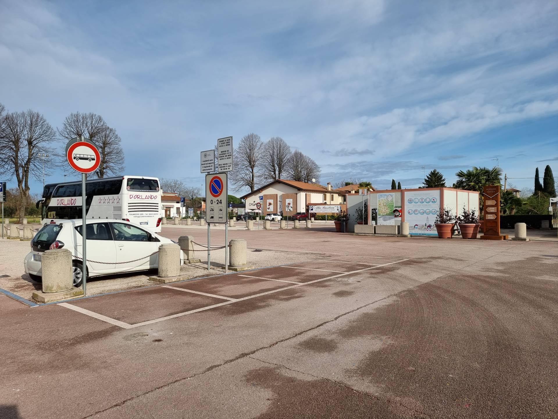
Photo 1 - Parking/bus terminal at Via Iulia Augusta
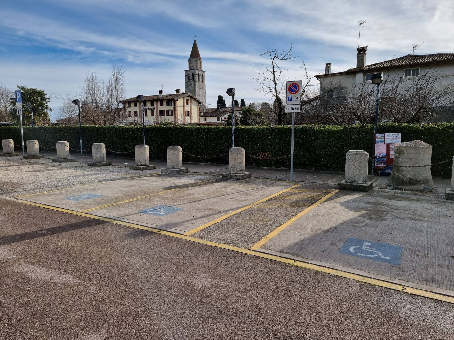
Photo 2 - Stalls for people with disabilities
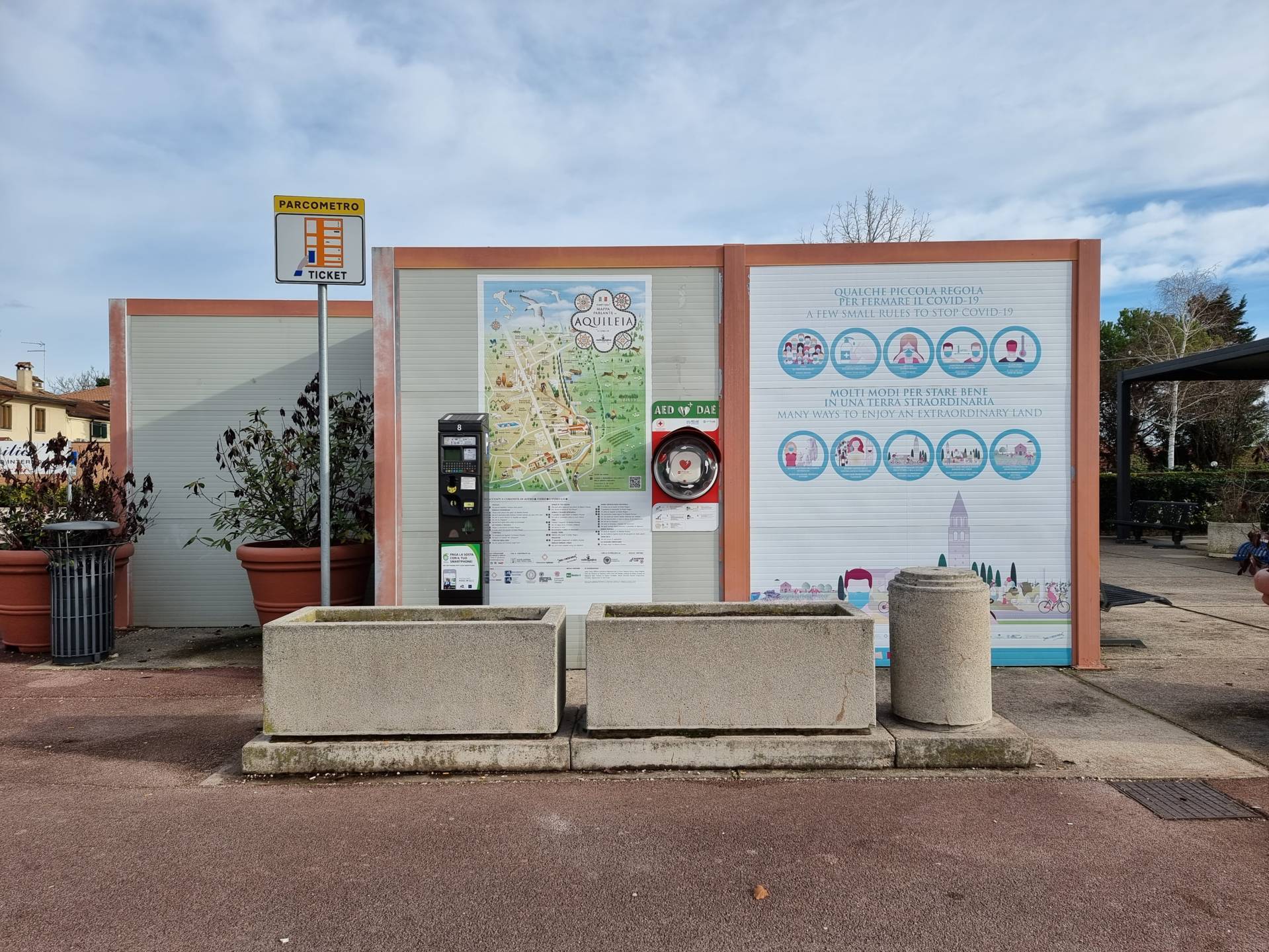
Photo 3 - Public toilet

Photo 4 - Public toilet

Photo 5 - Pedestrian crossing in front of the tourist office
Photo 6 - Route along the right-hand pavement
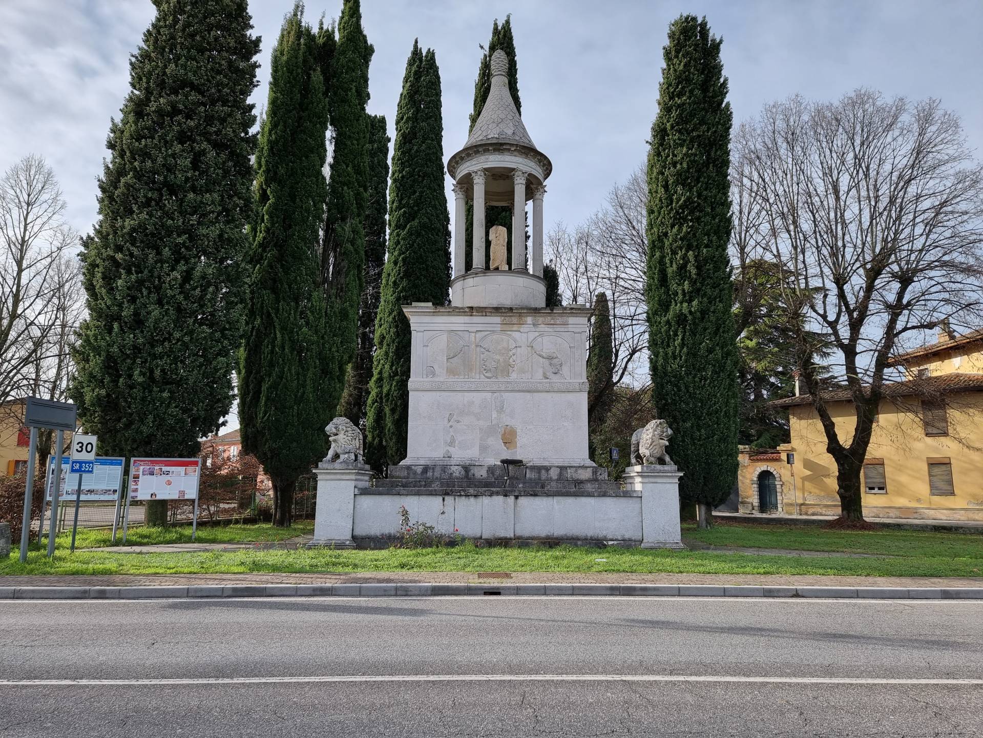
Photo 7 - Candia Mausoleum
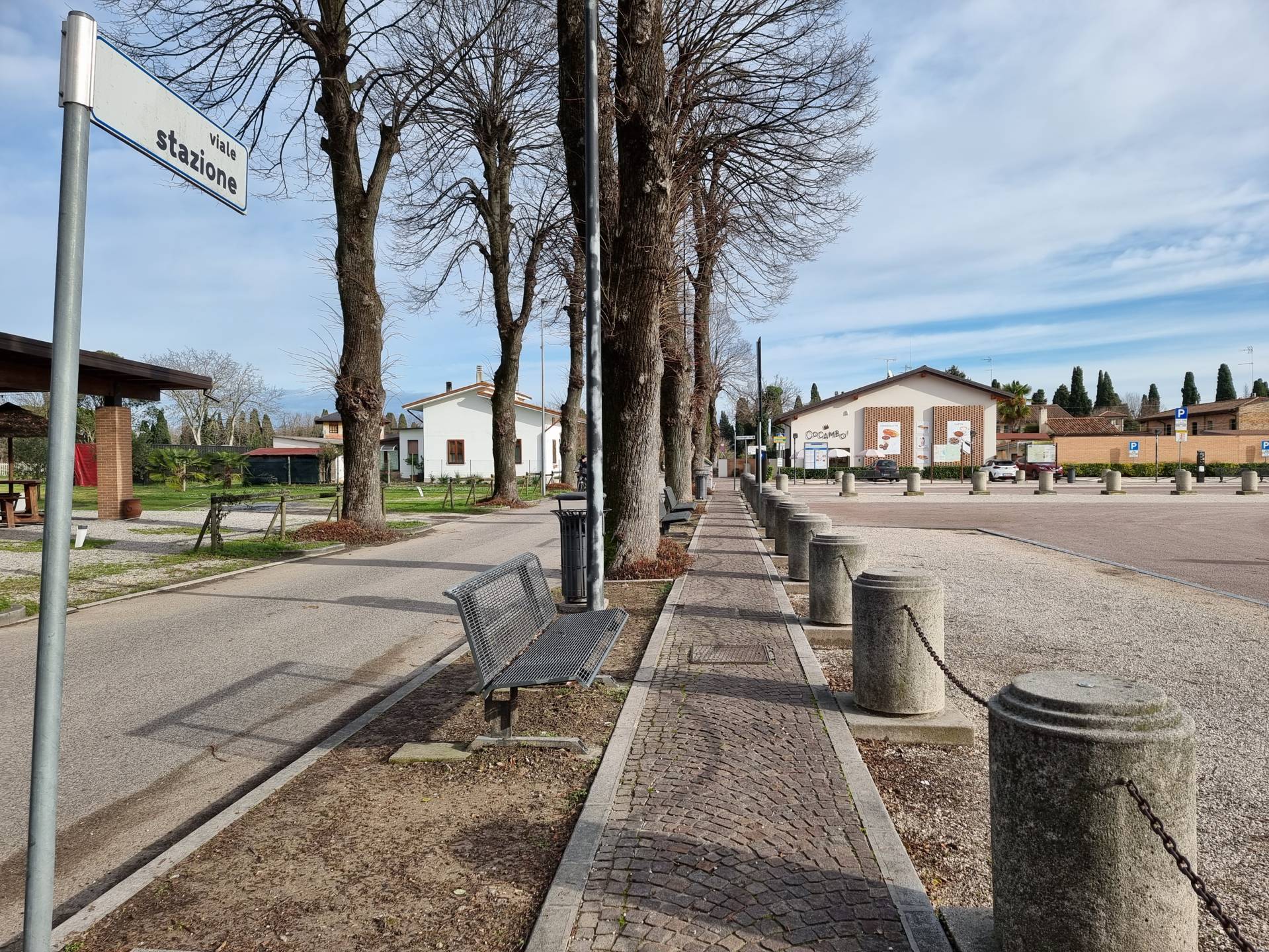
Photo 8 - Route on Viale Stazione
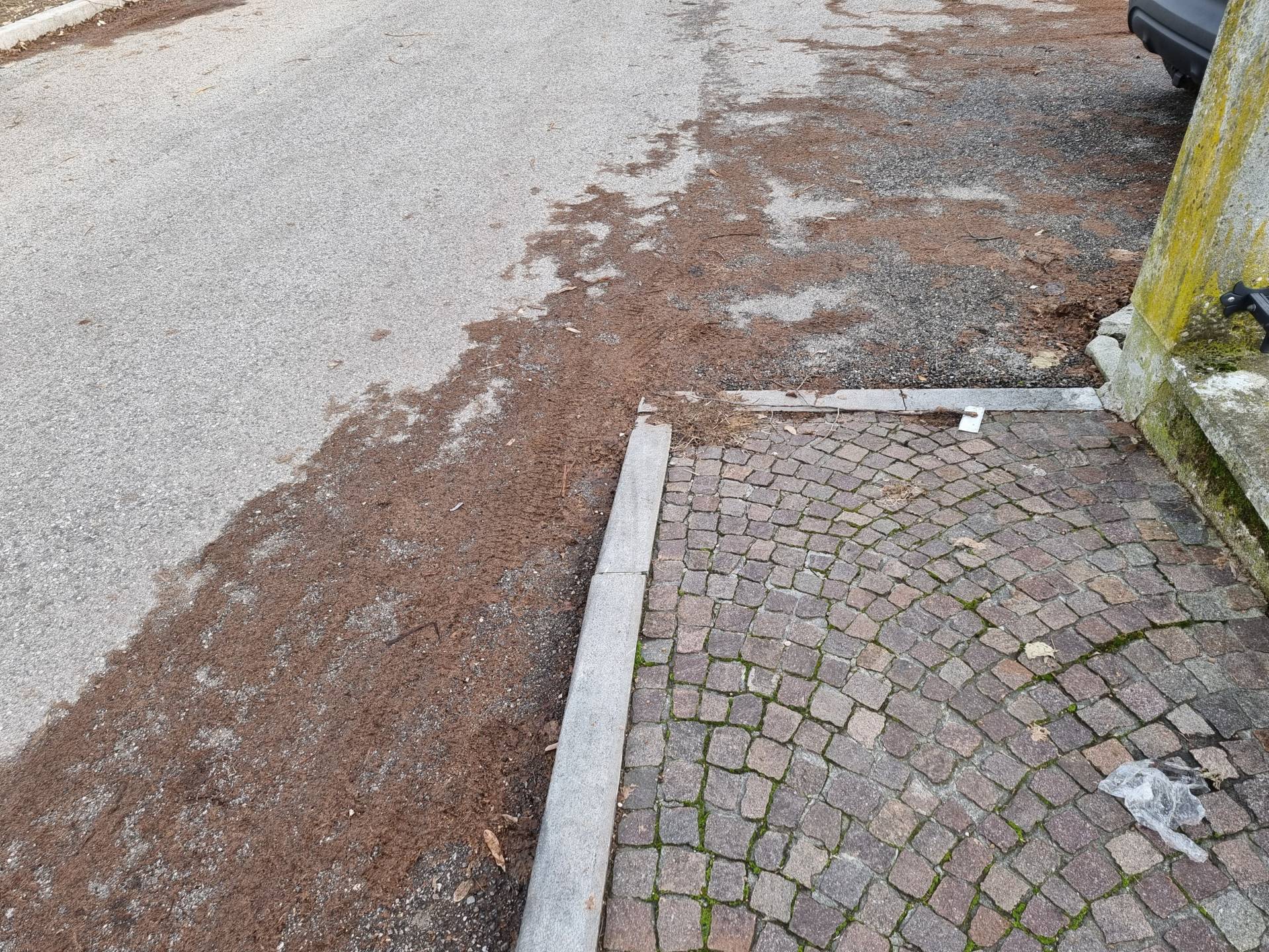
Photo 9 - Route on roadway
Beyond the Aquileia Mater totems (Photograph 10), the area is closed to vehicular traffic and only accessible to pedestrians and bicycles (Photograph 11). The route continues by turning left along the cycle track, with a regular asphalt surface, to reach the Roman Forum. Access to the Forum takes place on a sloping stretch of beaten gravel to reach the entrance gate (Photograph 12). There is a partly ruined information panel featuring a white background and black lettering (Photograph 13). The Forum can be visited from an elevated position with paths in earth and beaten gravel (Photograph 14).
Continuing the route towards Via Julia Augusta (Photograph 15) and crossing the street, it is possible to reach the Decumanus. Continue along the 1.25-metre wide porphyry pavement to the pedestrian path, with white stripes and a partially uneven asphalt surface (Photograph 16). Access is provided for an initial section by a metal footbridge that stops with five steps at the descent to the Decumanus (Photographs 17 and 18).
To reach the river port it is necessary to return to the cycle path and then turn onto Via Gemina.
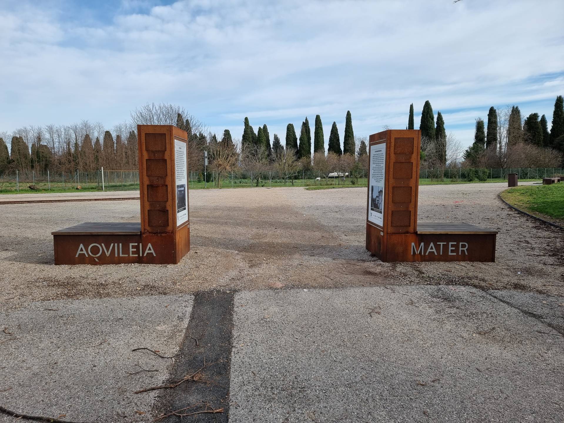
Photo 10 - Route with information totems

Photo 11 - Route along the bike path

Photo 12 - Porto Fluviale Entrance
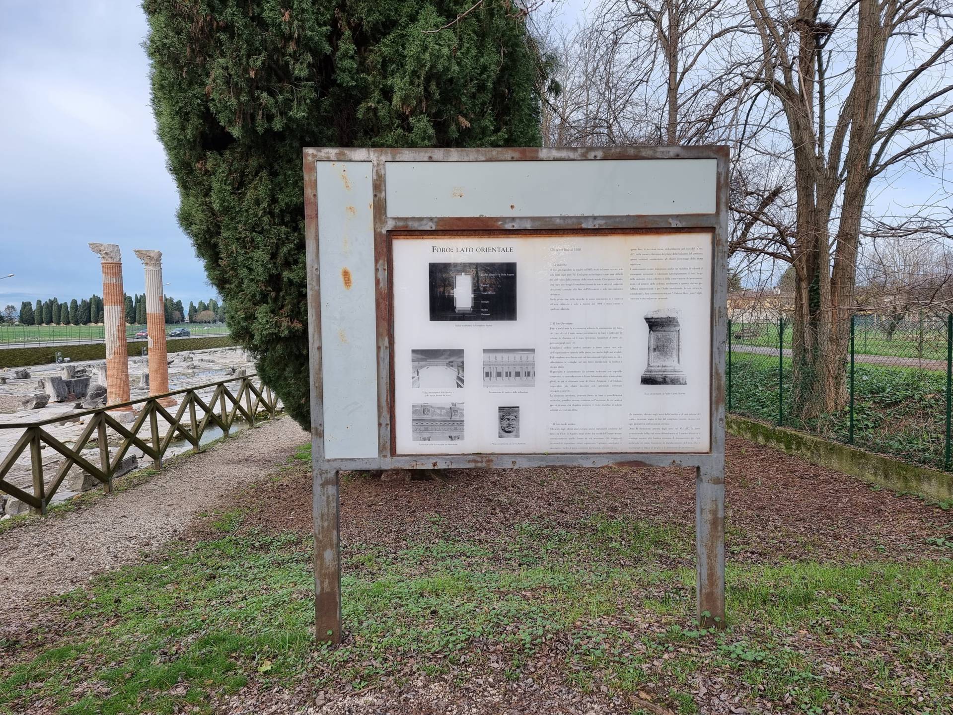
Photo 13 - Information panel
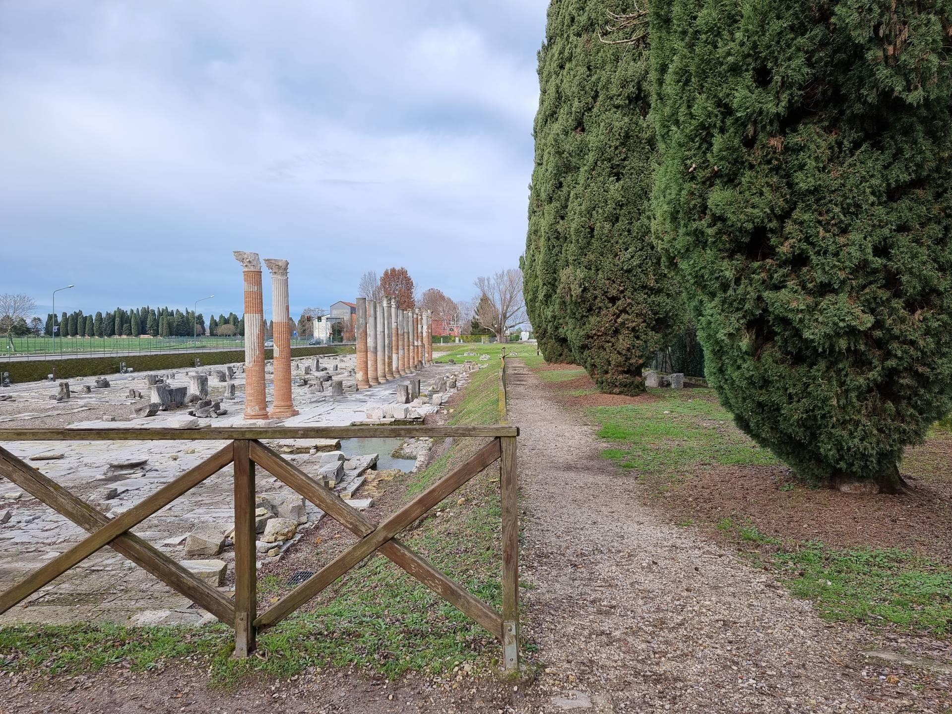
Photo 14 - Porto Fluviale
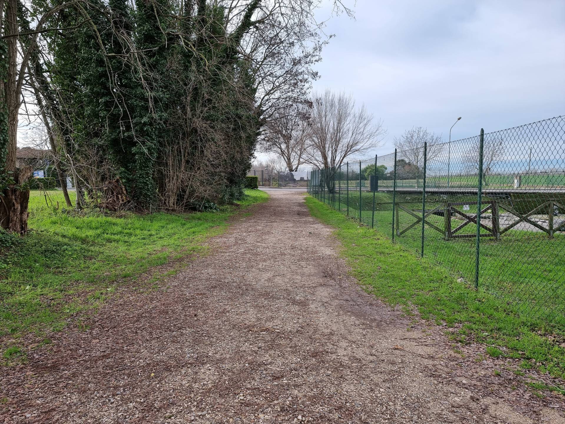
Photo 15 - Route on beaten gravel
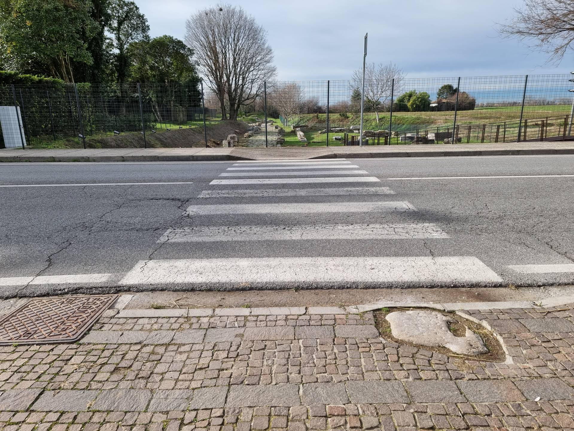
Photo 16 - Crossing at the Decumanus

Photo 17 - Decumanus walkway end view
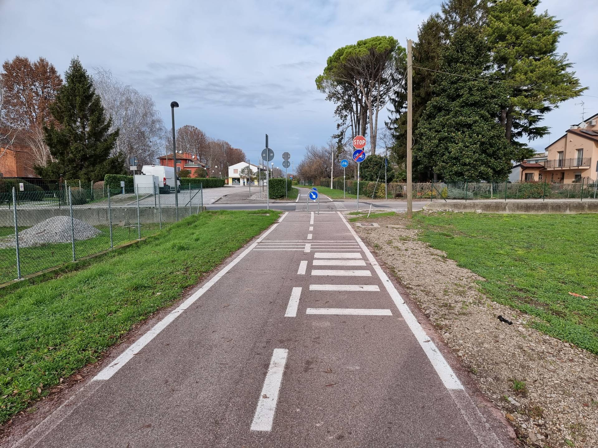
Photo 18 - Asphalt pathway
Via Gemina has a porphyry pavement which is reduced in size in places due to the installation of light poles, but still leaves a minimum clearance width of 90 centimetres (Photograph 19). Some short ramps are present to allow access to the driveways. The paving in the last section becomes stone and then porphyry again, with the presence of benches at the entrance to the Porto Fluviale port area (Photograph 20). In front of the entrance, there are five parking spaces reserved for people with disability (Photograph 21). The entrance to the Port is very well interconnected with the pavement around it. The access opening is 290 centimetres in width and the bottom consists of shallow gravel, the material of which the entire subsequent section of the Via Sacra is composed (Photograph 22). Atong the route, there are information panels of good legibility, white background and black lettering (Photograph 23). The area is partially protected by wooden fences (Photograph 24).
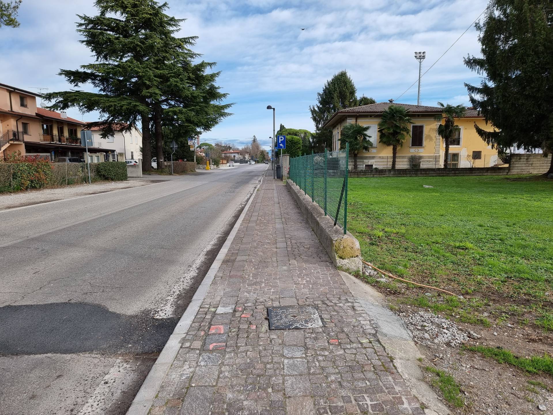
Photo 19 - Via Gemina
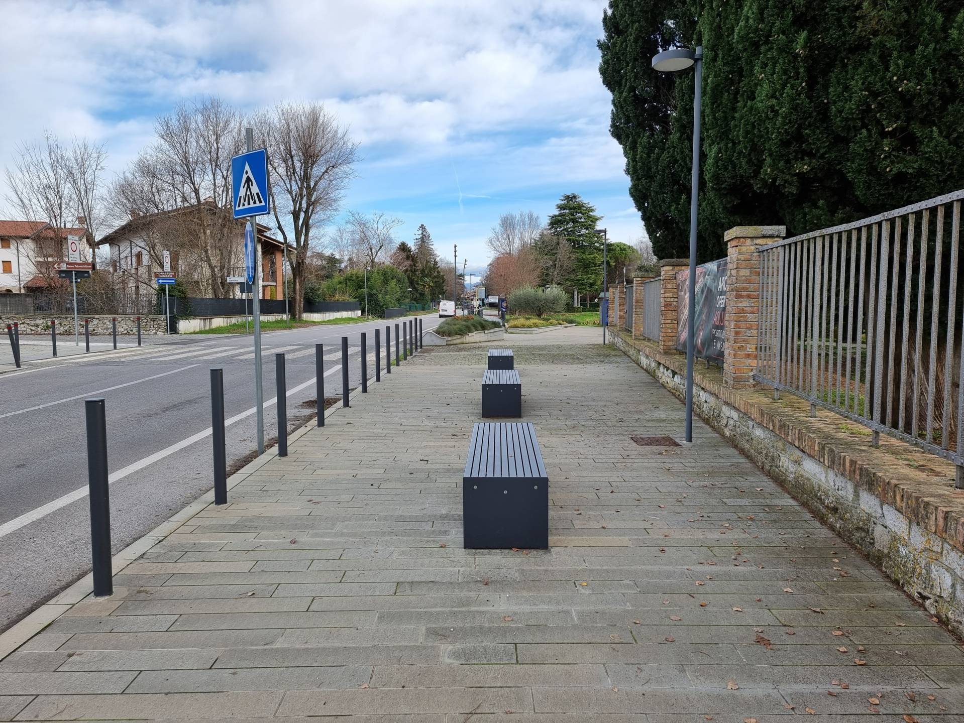
Photo 20 - Area in front of the entrance with benches
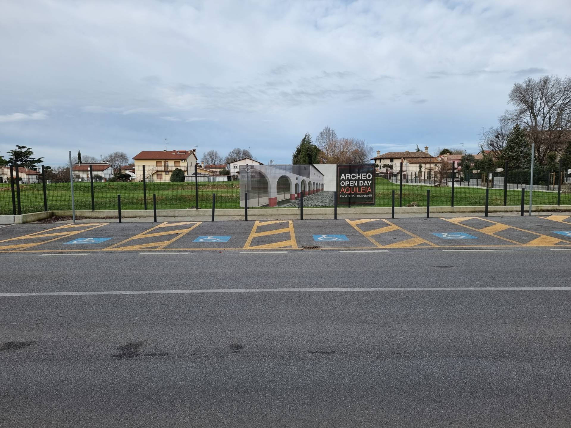
Photo 21 - Stalls at the entrance

Photo 22 - Stalls at the entrance

Photo 23 - Information panels
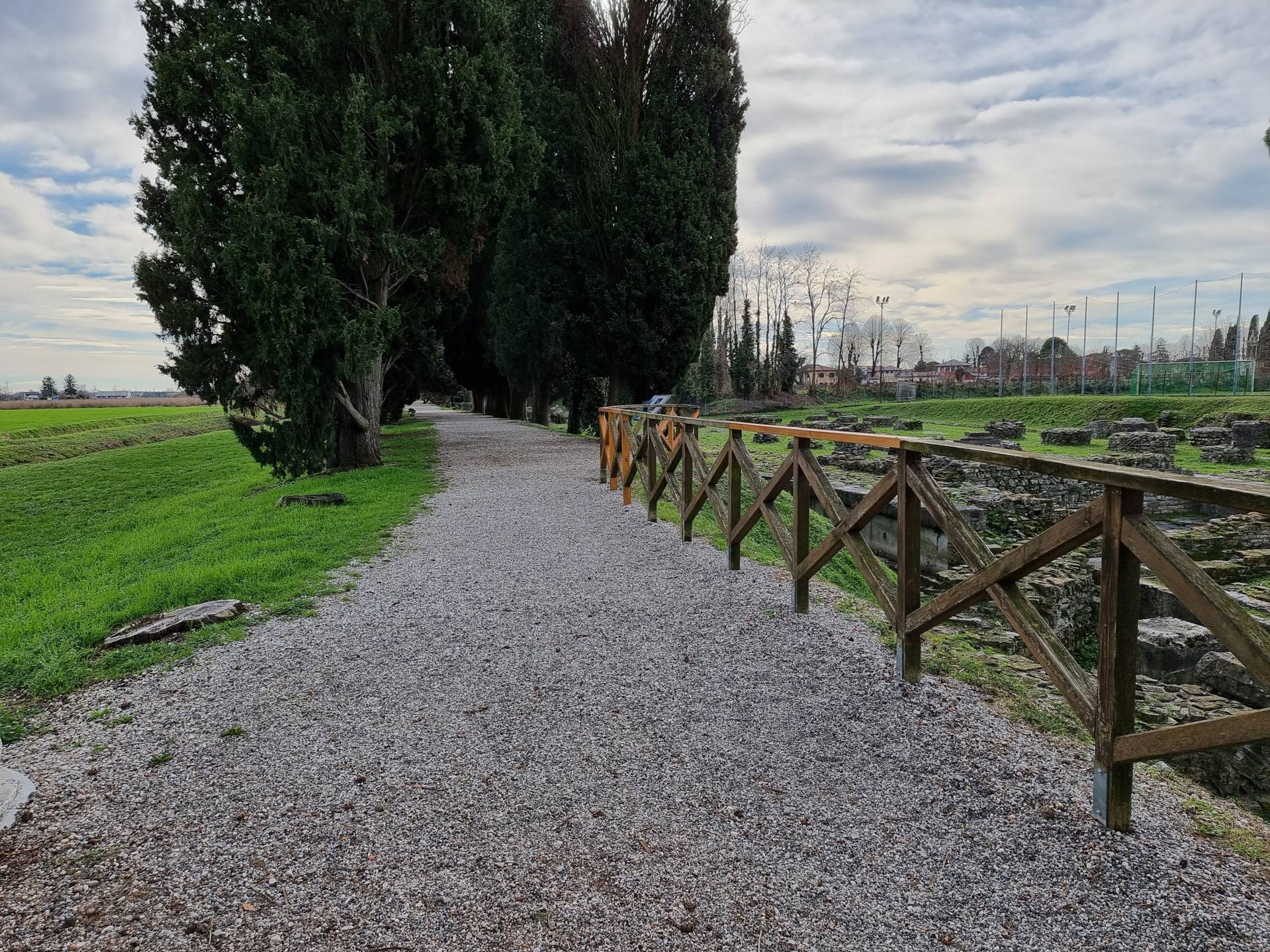
Photo 24 - Fences along the itinerary
The route then leaves Via Sacra (Photograph 25), turning right and crossing the cycle track, riding along a gravel-bottomed section (Photograph 26) to reach the Fondo Cossare Roman buildings and the Tito Macro Domus (Photographs 27 and 28). There are some slight inclines and uneven ground here. In the direction of the Patriarchal Basilica complex, continue along the grassy ground and gravel path, which can become deep in places (Photograph 29).
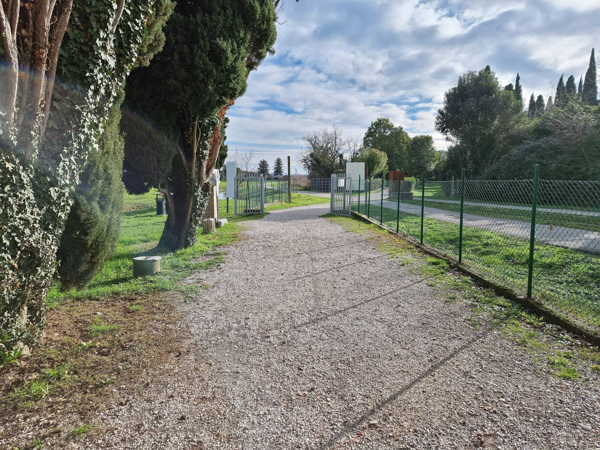
Photo 25 - Via Sacra
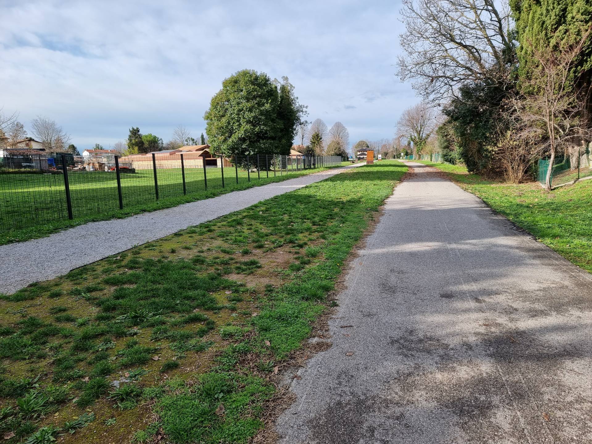
Photo 26 - Turn on the bike path
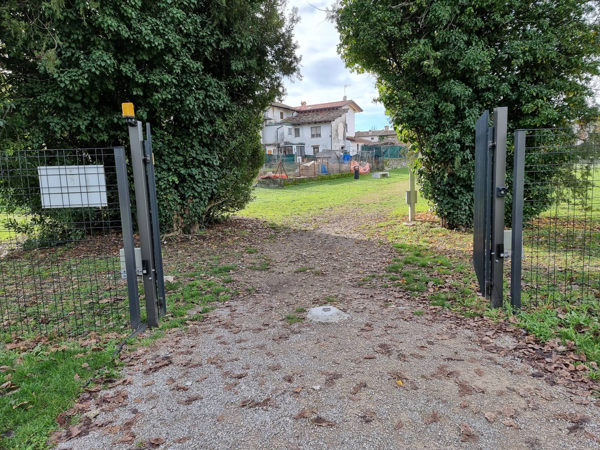
Photo 27 - Entrance to the area
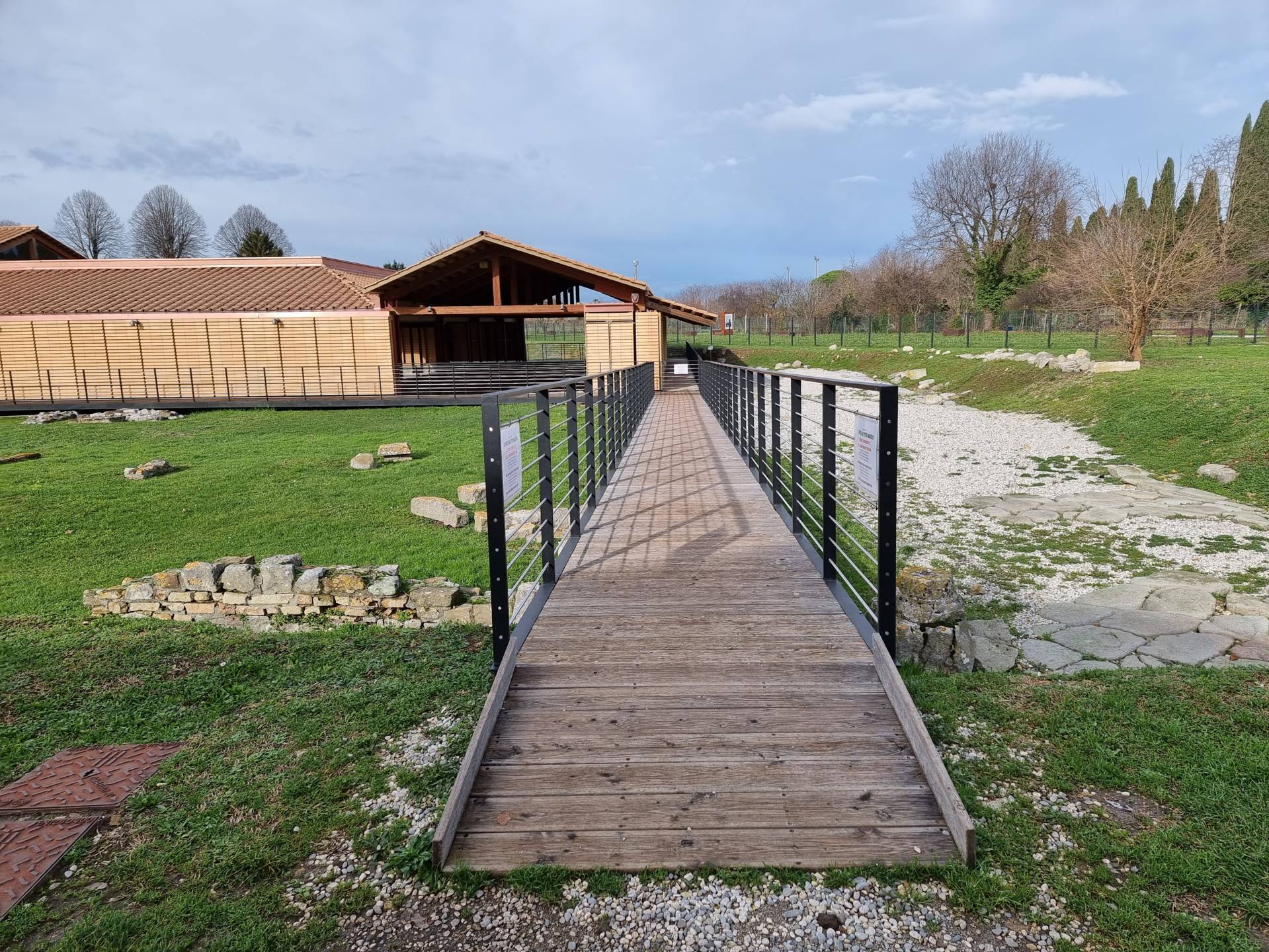
Photo 28 - Domus Tito Macro

Photo 29 - Gravel path in deep sections
The paving around Piazza Capitolo is connected with a threshold gap measuring 4 centimetres (Photograph 30). There are protruding manholes and uneven stone paving with joints greater than 1 centimetre (Photograph 31). At Piazza Capitolo there is a parking space reserved for people with disability. The ramp leading to the square, where the Santa Maria Assunta Basilica is located, has a 10% gradient (Photograph 32). The paving is also made of stone with the presence of significant joints that may create difficulties for people with mobility disabilities.
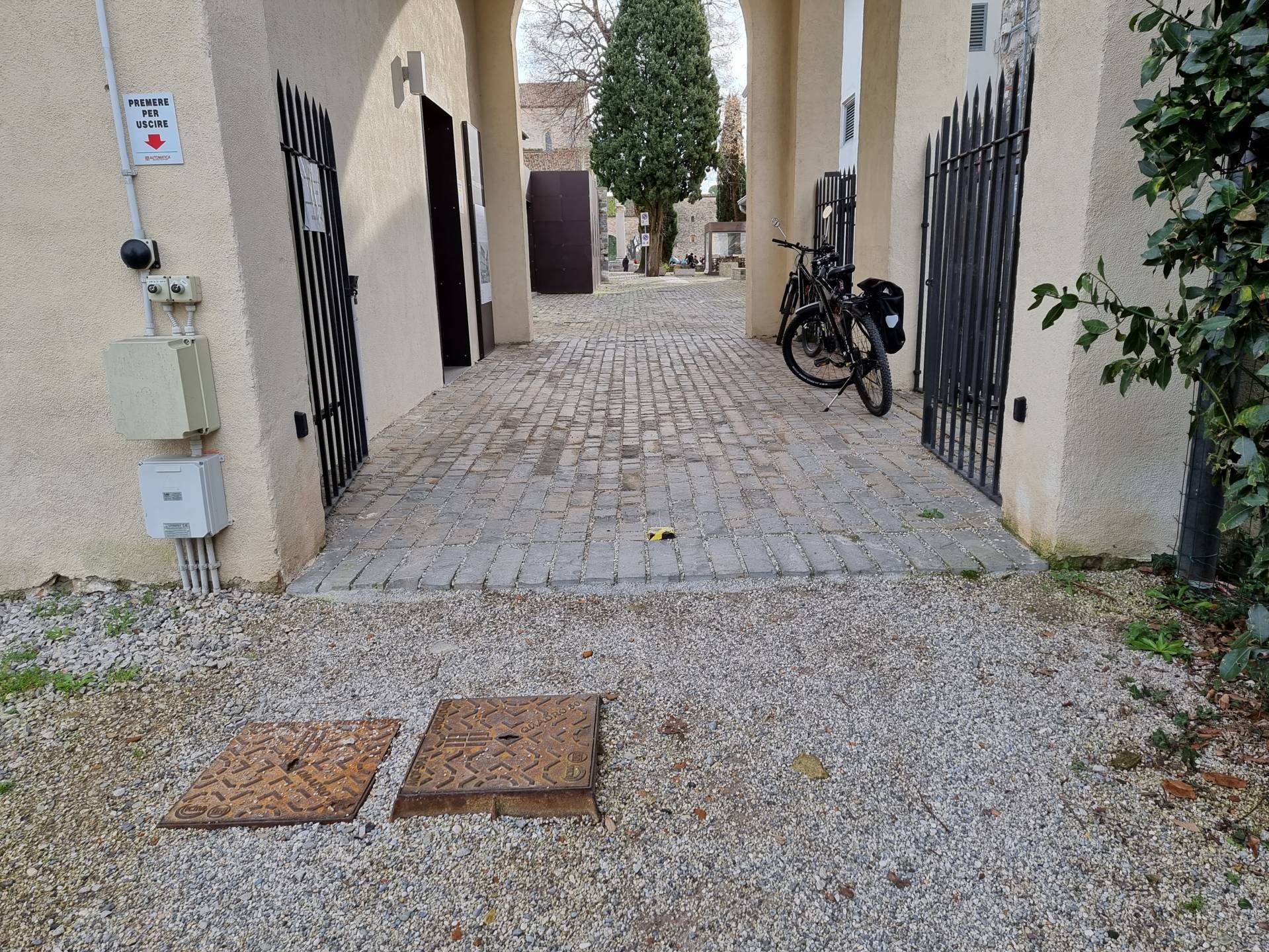
Photo 30 - Route to Piazza Capitolo
Photo 31 - Pathway in Piazza Capitolo made of uneven stone
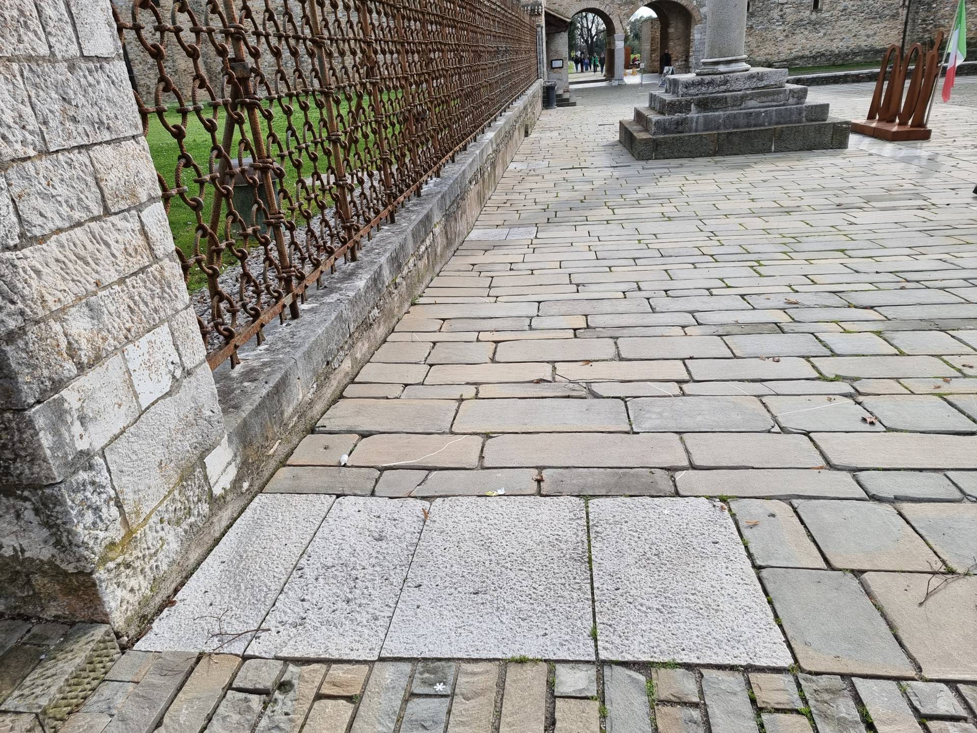
Photo 32 - Ramp in Piazza Capitolo
From Piazza Capitolo continue towards Via Patriarca Popone in the direction of Via Julia Augusta (Photograph 33). At the beginning of Via Patriarca Popone, there is a parking space for people with disability. The route continues along the street with porphyry pavements on both sides, regular and homogeneous, which are very wide (Photograph 34). The route proceeds by turning right onto Via Julia Augusta (Photograph 35), with regular and homogeneous porphyry pavement, and then it returns to the starting point.

Photo 33 - Via Patriarca Popone

Photo 34 - Route along the right kerbside

Photo 35 - Route on via Julia Augusta
2.8
/3
ENTRANCE
.jpg)
Rampa
.jpg)
Ingresso
Entrance typology
TYPE:
MainACCESSIBLE:
YesTIPO:
PrincipaleHeight difference (> 2.5 cm)
PRESENT:
YesDISLEVEL:
-
TYPE:
RampUNIVOCAL CODE:
RA1RAMP:
WIDTH (CM):
210LENGTH (CM):
550SLOPE:
SLOPE (°):
5SLOPE (%):
8.75CORRIMANO:
PRESENT:
YesSIDE KERB:
YesNON-SLIP FINISH:
YesCOLOUR CONTRAST:
NoTACTILE-PLANTAR PATHS:
No
Threshold (< 2.5 cm)
PRESENT:
YesHEIGHT:
2.5Entrance door
TYPE:
Single leafOPENING:
InsideAUTOMATED OPENING:
NoNET DOOR CLEARANCE:
Single or sliding doorMEASURE (CM):
85DOOR AND BACK DOOR COPLANARITY (NOT ASSESSED HEIGHT DIFFERENCE UP TO 2.5 CM):
YesZERBINI/CARPETS:
PRESENTS:
NoINTERCOM/BELL:
PRESENT:
NoGlass doors: window decals to indicate their presence
PRESENTS:
NoBATHROOM
.jpg)
WC
Present
Type
Plan
NUMBER:
0Anti-bathing
PRESENT:
YesWIDTH (CM):
175LENGTH (CM):
205EXCLUSIVE TOILET ACCESS:
YesANTI-BATHROOM DOOR:
PRESENT:
NoACCESSIBLE WASHBASIN ANTI-BATHROOM:
PRESENT:
NoACCESSIBLE TOILET DOOR
PRESENT:
YesDOOR TYPE:
SlidingHANDLE:
EmbeddedNET DOOR CLEARANCE:
Single or sliding doorMEASURE (CM):
77Compartment WC accessibile
WIDTH (CM):
180LENGTH (CM):
140SMOOTH ROTATION:
YesCOLOUR CONTRAST FLOORS/WALLS:
YesFLOOR COLOUR:
BeigeWALL COLOUR:
GreyEMERGENCY BELL:
NoMENSOLA:
NoCOAT HOOK:
YesGROUND CLEARANCE (CM):
180WC BOWL
TYPE TOILET BOWL:
SuspendedWITH FRONT HOLE:
YesHEIGHT FROM GROUND WITHOUT AXLE COVER (CM):
50DISTANCE FROM REAR WALL (CM):
75BACK SUPPORT:
NoAXLE CLEARANCE:
Left sideCM:
93FRONTAL APPROACH ONLY:
NoHANDLION:
YesTYPE OF HANDLE:
Fixed, TipperFIXED HANDLE SIDE:
RightHEIGHT RIGHT SIDE (CM):
70VERTICAL:
NoFOLDING HANDLE SIDE:
LeftHEIGHT LEFT SIDE (CM):
55FLUSH BUTTON:
AccessibleDOCCINO:
NoACCESSIBLE WASHBASIN TOILET
PRESENT:
YesTYPOLOGY WASHBASIN:
SuspendedGROUND CLEARANCE (CM):
85FRONT CLEARANCE (CM):
110TYPE OF TAP:
PhotocellulaMIRROR:
YesMIRROR TYPOLOGY:
FixedMIRROR HEIGHT FROM GROUND (CM):
86SOAP HOLDERS:
YesSOAP DISH HEIGHT (CM):
100PAPER HOLDER/DRYER:
YesPAPER HOLDER HEIGHT (CM):
105HANDLION:
NoShower
PRESENT:
NoTactile map showing the layout of sanitary facilities
PRESENTS:
NoCourtesy aids on request (shower chair, toilet seat, ...)
PRESENTS:
NoSecurity in the event of an emergency: doors with a mechanism that allows them to be opened from the outside even when locked from the inside
PRESENTS:
YesSafety in an emergency: emergency light
PRESENTS:
Yes2.8
/3
ENTRANCE
Rampa
Ingresso
Entrance typology
TYPE:
MainACCESSIBLE:
YesTIPO:
PrincipaleHeight difference (> 2.5 cm)
PRESENT:
YesDISLEVEL:
-
TYPE:
RampUNIVOCAL CODE:
RA1RAMP:
WIDTH (CM):
210LENGTH (CM):
550SLOPE:
SLOPE (°):
5SLOPE (%):
8.75CORRIMANO:
PRESENT:
YesSIDE KERB:
YesNON-SLIP FINISH:
YesCOLOUR CONTRAST:
NoTACTILE-PLANTAR PATHS:
No
Threshold (< 2.5 cm)
PRESENT:
YesHEIGHT:
2.5Entrance door
TYPE:
Single leafOPENING:
InsideAUTOMATED OPENING:
NoNET DOOR CLEARANCE:
Single or sliding doorMEASURE (CM):
85DOOR AND BACK DOOR COPLANARITY (NOT ASSESSED HEIGHT DIFFERENCE UP TO 2.5 CM):
YesZERBINI/CARPETS:
PRESENTS:
NoINTERCOM/BELL:
PRESENT:
NoGlass doors: window decals to indicate their presence
PRESENTS:
NoBATHROOM
WC
Present
Type
Plan
NUMBER:
0Anti-bathing
PRESENT:
YesWIDTH (CM):
175LENGTH (CM):
205EXCLUSIVE TOILET ACCESS:
YesANTI-BATHROOM DOOR:
PRESENT:
NoACCESSIBLE WASHBASIN ANTI-BATHROOM:
PRESENT:
NoACCESSIBLE TOILET DOOR
PRESENT:
YesDOOR TYPE:
SlidingHANDLE:
EmbeddedNET DOOR CLEARANCE:
Single or sliding doorMEASURE (CM):
77Compartment WC accessibile
WIDTH (CM):
180LENGTH (CM):
140SMOOTH ROTATION:
YesCOLOUR CONTRAST FLOORS/WALLS:
YesFLOOR COLOUR:
BeigeWALL COLOUR:
GreyEMERGENCY BELL:
NoMENSOLA:
NoCOAT HOOK:
YesGROUND CLEARANCE (CM):
180WC BOWL
TYPE TOILET BOWL:
SuspendedWITH FRONT HOLE:
YesHEIGHT FROM GROUND WITHOUT AXLE COVER (CM):
50DISTANCE FROM REAR WALL (CM):
75BACK SUPPORT:
NoAXLE CLEARANCE:
Left sideCM:
93FRONTAL APPROACH ONLY:
NoHANDLION:
YesTYPE OF HANDLE:
Fixed, TipperFIXED HANDLE SIDE:
RightHEIGHT RIGHT SIDE (CM):
70VERTICAL:
NoFOLDING HANDLE SIDE:
LeftHEIGHT LEFT SIDE (CM):
55FLUSH BUTTON:
AccessibleDOCCINO:
NoACCESSIBLE WASHBASIN TOILET
PRESENT:
YesTYPOLOGY WASHBASIN:
SuspendedGROUND CLEARANCE (CM):
85FRONT CLEARANCE (CM):
110TYPE OF TAP:
PhotocellulaMIRROR:
YesMIRROR TYPOLOGY:
FixedMIRROR HEIGHT FROM GROUND (CM):
86SOAP HOLDERS:
YesSOAP DISH HEIGHT (CM):
100PAPER HOLDER/DRYER:
YesPAPER HOLDER HEIGHT (CM):
105HANDLION:
NoShower
PRESENT:
NoTactile map showing the layout of sanitary facilities
PRESENTS:
NoCourtesy aids on request (shower chair, toilet seat, ...)
PRESENTS:
NoSecurity in the event of an emergency: doors with a mechanism that allows them to be opened from the outside even when locked from the inside
PRESENTS:
YesSafety in an emergency: emergency light
PRESENTS:
Yes1.5
/3
ATM COUNTER
.jpg)
Sportello bancomat
Type sportello bancomat
TYPE:
OutdoorTIPO:
EsternoUser workstation
TYPE:
On pavementShelter
PRESENT:
YesTYPE:
CanopyWheelchair approach
TYPE:
PossibleAverage device height
GROUND CLEARANCE (CM):
150Facilities
TYPE:
Audio channelGeneral note
1.5
/3
ATM COUNTER
Sportello bancomat
Type sportello bancomat
TYPE:
OutdoorTIPO:
EsternoUser workstation
TYPE:
On pavementShelter
PRESENT:
YesTYPE:
CanopyWheelchair approach
TYPE:
PossibleAverage device height
GROUND CLEARANCE (CM):
150Facilities
TYPE:
Audio channelGeneral note
2.8
/3
ENTRANCE
.jpg)
Ingresso
Entrance typology
TYPE:
MainACCESSIBLE:
YesTIPO:
PrincipaleHeight difference (> 2.5 cm)
PRESENT:
NoThreshold (< 2.5 cm)
PRESENT:
YesHEIGHT:
2Entrance door
TYPE:
With two doors or with two opening elementsOPENING:
InsideAUTOMATED OPENING:
NoNET DOOR CLEARANCE:
With two doors or with two opening elementsOVERALL BORE (CM):
118MAIN DOOR (CM):
84DOOR AND BACK DOOR COPLANARITY (NOT ASSESSED HEIGHT DIFFERENCE UP TO 2.5 CM):
YesZERBINI/CARPETS:
PRESENTS:
NoINTERCOM/BELL:
PRESENT:
NoGlass doors: window decals to indicate their presence
PRESENTS:
NoCOMPARTMENT
.jpg)
Interno con tavoli e sedie
.jpg)
Bancone
Compartment name
TYPE:
Generic, of the structureIDENTIFIER:
V1Door
ACCESS:
NoneDimensions
ROTATION DIAMETER 140 CM:
YesPREVAILING CLEAR WIDTH:
> 75 cmPaving
TYPE:
MoreOTHER TYPOLOGY:
SownColour contrast floors/walls
TYPE:
YesFLOOR COLOUR:
SownWALL COLOUR:
GreySignage
TACTILE-PLANTAR PATHS:
NoTOUCH MAP:
NoINFORMATION SIGNAGE:
NoFurniture
COUNTER:
-
HEIGHT:
UniqueGROUND CLEARANCE (CM):
113EMPTY UNDER:
No
TABLE:
-
TYPE OF SUPPORT:
Centre pivotTYPE OF PLAN:
Rectangular/SquareWIDTH (CM):
60LENGTH (CM):
70GROUND CLEARANCE (CM):
74GROUND CLEARANCE (CM):
70TOP WITH ROUNDED EDGES:
No
CHAIR:
-
Backrest
FIXED TO THE GROUND:
No
ENTRANCE - SALA ROMANA
.jpg)
Ingresso
Entrance typology
TYPE:
MainACCESSIBLE:
YesTIPO:
PrincipaleHeight difference (> 2.5 cm)
PRESENT:
NoThreshold (< 2.5 cm)
PRESENT:
YesHEIGHT:
2Entrance door
TYPE:
With two doors or with two opening elementsOPENING:
OutdoorAUTOMATED OPENING:
NoNET DOOR CLEARANCE:
With two doors or with two opening elementsOVERALL BORE (CM):
200MAIN DOOR (CM):
100DOOR AND BACK DOOR COPLANARITY (NOT ASSESSED HEIGHT DIFFERENCE UP TO 2.5 CM):
YesZERBINI/CARPETS:
PRESENTS:
YesTYPE:
Protruding doormatTYPE:
CompactINTERCOM/BELL:
PRESENT:
NoGlass doors: window decals to indicate their presence
PRESENTS:
NoCONNECTION PATHWAYWAY - INGRESSO SALA ROMANA/WC
.jpg)
Percorso
Connection
ITINERARY IDENTIFIER:
C1DA:
Generic, of the structureA:
WC accessible common areaType of route
Internal itinerary characteristics
DIMENSIONS:
PREVAILING CLEAR WIDTH:
> 75 cmNARROWING (CM):
125PAVING:
TYPE:
TilesCOLOUR CONTRAST FLOORS/WALLS:
FLOOR COLOUR:
Beige mixedWALL COLOUR:
WhiteSIGNAGE:
TACTILE-PLANTAR PATHS:
NoTOUCH MAP:
NoINFORMATION SIGNAGE:
NoHEIGHT DIFFERENCE (> 2.5 CM):
PRESENT:
NoGlass doors: window decals to indicate their presence
PRESENTS:
NoCommon parts: no furniture with bodies protruding from the base up to a height of 210 cm
PRESENTS:
YesPresence of tactile information map of available routes and services
PRESENTS:
NoSafety in case of emergency in common areas: presence of acoustic alarm
PRESENTS:
NoSafety in case of emergency in common areas: presence of luminous alarm
PRESENTS:
NoEmergency safety in common areas: emergency light, visual escape route signs, evacuation route map
PRESENTS:
YesBATHROOM - SALA ROMANA
.jpg)
WC
Present
Type
Plan
NUMBER:
0Anti-bathing
PRESENT:
YesWIDTH (CM):
134LENGTH (CM):
275EXCLUSIVE TOILET ACCESS:
NoANTI-BATHROOM DOOR:
PRESENT:
YesDOOR TYPE:
With two doors or with two opening elementsOPENING:
InsideNET DOOR CLEARANCE:
With two doors or with two opening elementsOVERALL BORE (CM):
114MAIN DOOR (CM):
72ACCESSIBLE WASHBASIN ANTI-BATHROOM:
PRESENT:
YesTYPOLOGY WASHBASIN:
SuspendedGROUND CLEARANCE (CM):
81FRONT CLEARANCE (CM):
143TYPE OF TAP:
MoreOTHER TYPOLOGY:
ButtonMIRROR:
NoSOAP HOLDERS:
YesSOAP DISH HEIGHT (CM):
110PAPER HOLDER/DRYER:
YesPAPER HOLDER HEIGHT (CM):
115HANDLION:
NoACCESSIBLE TOILET DOOR
PRESENT:
YesDOOR TYPE:
Single leafOPENING:
OutdoorNET DOOR CLEARANCE:
Single or sliding doorMEASURE (CM):
90Compartment WC accessibile
WIDTH (CM):
180LENGTH (CM):
182SMOOTH ROTATION:
NoTOILET-WASHBASIN DISTANCE (CM):
103USEFUL MEASURES FOR ROTATION:
110x160COLOUR CONTRAST FLOORS/WALLS:
NoFLOOR COLOUR:
GreyWALL COLOUR:
GreyEMERGENCY BELL:
NoMENSOLA:
NoCOAT HOOK:
NoWC BOWL
TYPE TOILET BOWL:
On the groundWITH FRONT HOLE:
NoHEIGHT FROM GROUND WITHOUT AXLE COVER (CM):
51DISTANCE FROM REAR WALL (CM):
69BACK SUPPORT:
YesTYPE OF SUPPORT:
External boxAXLE CLEARANCE:
Left sideCM:
125FRONTAL APPROACH ONLY:
NoHANDLION:
YesTYPE OF HANDLE:
FixedFIXED HANDLE SIDE:
Right, LeftHEIGHT RIGHT SIDE (CM):
80VERTICAL:
NoVERTICAL:
YesFLUSH BUTTON:
AccessibleDOCCINO:
NoACCESSIBLE WASHBASIN TOILET
PRESENT:
YesTYPOLOGY WASHBASIN:
SuspendedGROUND CLEARANCE (CM):
80FRONT CLEARANCE (CM):
120TYPE OF TAP:
Long lever mixerMIRROR:
NoSOAP HOLDERS:
NoPAPER HOLDER/DRYER:
YesPAPER HOLDER HEIGHT (CM):
130HANDLION:
NoShower
PRESENT:
NoTactile map showing the layout of sanitary facilities
PRESENTS:
NoCourtesy aids on request (shower chair, toilet seat, ...)
PRESENTS:
NoSecurity in the event of an emergency: doors with a mechanism that allows them to be opened from the outside even when locked from the inside
PRESENTS:
YesSafety in an emergency: emergency light
PRESENTS:
YesGeneral note
OUTDOOR AREA
.jpg)
Area esterna su pedana coperta
Destination of the area
AREA TYPOLOGY:
ConsumptionType
Access to the area
TYPE:
From the main door already describedHeight difference (> 2.5 cm)
PRESENT:
YesDISLEVEL:
-
TYPE:
RampUNIVOCAL CODE:
RA1RAMP:
WIDTH (CM):
100LENGTH (CM):
120SLOPE:
SLOPE (°):
8.3SLOPE (%):
14.59CORRIMANO:
PRESENT:
NoSIDE KERB:
NoNON-SLIP FINISH:
YesCOLOUR CONTRAST:
NoTACTILE-PLANTAR PATHS:
No
Paving
TYPE:
Wood/metal platformDimensions
ROTATION DIAMETER 140 CM:
NoPREVAILING CLEAR WIDTH:
> 75 cmNARROWING (CM):
70Furniture
TABLE:
-
TYPE OF SUPPORT:
Corner legsTYPE OF PLAN:
Rectangular/SquareWIDTH (CM):
70LENGTH (CM):
80GROUND CLEARANCE (CM):
75GROUND CLEARANCE (CM):
73TOP WITH ROUNDED EDGES:
No
CHAIR:
-
Backrest, Armrests
FIXED TO THE GROUND:
No
2.8
/3
ENTRANCE - PRINCIPALE
.jpg)
Ingresso
Entrance typology
TYPE:
MainACCESSIBLE:
YesTIPO:
PrincipaleHeight difference (> 2.5 cm)
PRESENT:
NoThreshold (< 2.5 cm)
PRESENT:
No/LevelEntrance door
TYPE:
SlidingAUTOMATED OPENING:
YesNET DOOR CLEARANCE:
Single or sliding doorMEASURE (CM):
150DOOR AND BACK DOOR COPLANARITY (NOT ASSESSED HEIGHT DIFFERENCE UP TO 2.5 CM):
YesZERBINI/CARPETS:
PRESENTS:
NoINTERCOM/BELL:
PRESENT:
NoGlass doors: window decals to indicate their presence
PRESENTS:
YesCOMPARTMENT - BAR
.jpg)
Bancone
.jpg)
Tavoli e sedie
Compartment name
TYPE:
Generic, of the structureIDENTIFIER:
V1Door
ACCESS:
NoneDimensions
ROTATION DIAMETER 140 CM:
YesPREVAILING CLEAR WIDTH:
> 75 cmPaving
TYPE:
WoodColour contrast floors/walls
TYPE:
YesFLOOR COLOUR:
WoodWALL COLOUR:
WhiteSignage
TACTILE-PLANTAR PATHS:
NoTOUCH MAP:
NoINFORMATION SIGNAGE:
NoFurniture
COUNTER:
-
HEIGHT:
UniqueGROUND CLEARANCE (CM):
115EMPTY UNDER:
No
TABLE:
-
TYPE OF SUPPORT:
Centre pivotTYPE OF PLAN:
Rectangular/SquareWIDTH (CM):
60LENGTH (CM):
120GROUND CLEARANCE (CM):
78GROUND CLEARANCE (CM):
74TOP WITH ROUNDED EDGES:
No
CHAIR:
-
Backrest
FIXED TO THE GROUND:
No
CONNECTION PATHWAYWAY - BAR/LABORATORIO DIDATTICO
.jpg)
Ascensore
.jpg)
Scala
Connection
ITINERARY IDENTIFIER:
C1DA:
Generic, of the structureA:
Educational play area/workshopType of route
Internal itinerary characteristics
DIMENSIONS:
PREVAILING CLEAR WIDTH:
> 75 cmPAVING:
TYPE:
WoodCOLOUR CONTRAST FLOORS/WALLS:
FLOOR COLOUR:
WoodWALL COLOUR:
WhiteSIGNAGE:
TACTILE-PLANTAR PATHS:
NoTOUCH MAP:
NoINFORMATION SIGNAGE:
NoHEIGHT DIFFERENCE (> 2.5 CM):
PRESENT:
YesDISLEVEL:
-
TYPE:
Elevator/elevator platform with closed compartmentUNIVOCAL CODE:
AS1ELEVATOR/ELEVATOR PLATFORM WITH CLOSED COMPARTMENT:
DOOR TYPE:
a doorNET DOOR CLEARANCE (CM):
90SPACE IN FRONT OF DOOR 140X140 MIN:
YesCABIN SIZE:
DOOR SIDE (CM):
100BLIND SIDE (CM):
130EXTERNAL BUTTON PANEL:
AVERAGE HEIGHT (CM):
100BRAILLE:
YesRELIEF :
YesCOLOUR CONTRAST:
YesINTERNAL BUTTON PANEL:
AVERAGE HEIGHT (CM):
110BRAILLE:
YesRELIEF :
YesCOLOUR CONTRAST:
YesBUZZER:
NoEMERGENCY CAMERA:
No -
TYPE:
Long staircaseUNIVOCAL CODE:
SL1LONG STAIRCASE (HIGHER THAN ONE FLOOR):
WIDTH (CM):
90CORRIMANO:
PRESENT:
YesTYPE:
One sideCOLOUR CONTRAST:
NoSTEP:
TYPE:
Non-slipTACTILE-PLANTAR PATHS:
No
Glass doors: window decals to indicate their presence
PRESENTS:
NoCommon parts: no furniture with bodies protruding from the base up to a height of 210 cm
PRESENTS:
NoPresence of tactile information map of available routes and services
PRESENTS:
NoSafety in case of emergency in common areas: presence of acoustic alarm
PRESENTS:
NoSafety in case of emergency in common areas: presence of luminous alarm
PRESENTS:
NoEmergency safety in common areas: emergency light, visual escape route signs, evacuation route map
PRESENTS:
NoCOMPARTMENT - LABORATORIO DIDATTICO
.jpg)
Laboratorio
Compartment name
TYPE:
Educational play area/workshopIDENTIFIER:
V2Door
ACCESS:
NoneDimensions
ROTATION DIAMETER 140 CM:
YesPREVAILING CLEAR WIDTH:
> 75 cmPaving
TYPE:
WoodColour contrast floors/walls
TYPE:
YesFLOOR COLOUR:
WoodWALL COLOUR:
WhiteSignage
TACTILE-PLANTAR PATHS:
NoTOUCH MAP:
NoINFORMATION SIGNAGE:
NoBATHROOM
.jpg)
WC
Present
Type
Plan
NUMBER:
0Anti-bathing
PRESENT:
YesWIDTH (CM):
118LENGTH (CM):
285EXCLUSIVE TOILET ACCESS:
NoANTI-BATHROOM DOOR:
PRESENT:
YesDOOR TYPE:
SlidingHANDLE:
EmbeddedNET DOOR CLEARANCE:
Single or sliding doorMEASURE (CM):
80ACCESSIBLE WASHBASIN ANTI-BATHROOM:
PRESENT:
YesTYPOLOGY WASHBASIN:
SuspendedGROUND CLEARANCE (CM):
90FRONT CLEARANCE (CM):
288TYPE OF TAP:
PhotocellulaMIRROR:
YesMIRROR TYPOLOGY:
FixedMIRROR HEIGHT FROM GROUND (CM):
120SOAP HOLDERS:
YesSOAP DISH HEIGHT (CM):
115PAPER HOLDER/DRYER:
YesPAPER HOLDER HEIGHT (CM):
128HANDLION:
NoACCESSIBLE TOILET DOOR
PRESENT:
YesDOOR TYPE:
SlidingHANDLE:
EmbeddedNET DOOR CLEARANCE:
Single or sliding doorMEASURE (CM):
80Compartment WC accessibile
WIDTH (CM):
170LENGTH (CM):
182SMOOTH ROTATION:
YesCOLOUR CONTRAST FLOORS/WALLS:
YesFLOOR COLOUR:
WoodWALL COLOUR:
GreyEMERGENCY BELL:
YesGROUND CLEARANCE (CM):
105PROXIMITY TOILET BOWL:
YesMENSOLA:
NoCOAT HOOK:
NoWC BOWL
TYPE TOILET BOWL:
SuspendedWITH FRONT HOLE:
NoHEIGHT FROM GROUND WITHOUT AXLE COVER (CM):
47DISTANCE FROM REAR WALL (CM):
53BACK SUPPORT:
YesTYPE OF SUPPORT:
Rear wallAXLE CLEARANCE:
Right-hand sideCM:
100FRONTAL APPROACH ONLY:
NoHANDLION:
YesTYPE OF HANDLE:
FixedFIXED HANDLE SIDE:
RightVERTICAL:
YesFLUSH BUTTON:
AccessibleDOCCINO:
NoACCESSIBLE WASHBASIN TOILET
PRESENT:
YesTYPOLOGY WASHBASIN:
SuspendedGROUND CLEARANCE (CM):
90FRONT CLEARANCE (CM):
123TYPE OF TAP:
PhotocellulaMIRROR:
YesMIRROR TYPOLOGY:
FixedMIRROR HEIGHT FROM GROUND (CM):
120SOAP HOLDERS:
YesSOAP DISH HEIGHT (CM):
105PAPER HOLDER/DRYER:
YesPAPER HOLDER HEIGHT (CM):
130HANDLION:
NoShower
PRESENT:
NoTactile map showing the layout of sanitary facilities
PRESENTS:
NoCourtesy aids on request (shower chair, toilet seat, ...)
PRESENTS:
NoSecurity in the event of an emergency: doors with a mechanism that allows them to be opened from the outside even when locked from the inside
PRESENTS:
YesSafety in an emergency: emergency light
PRESENTS:
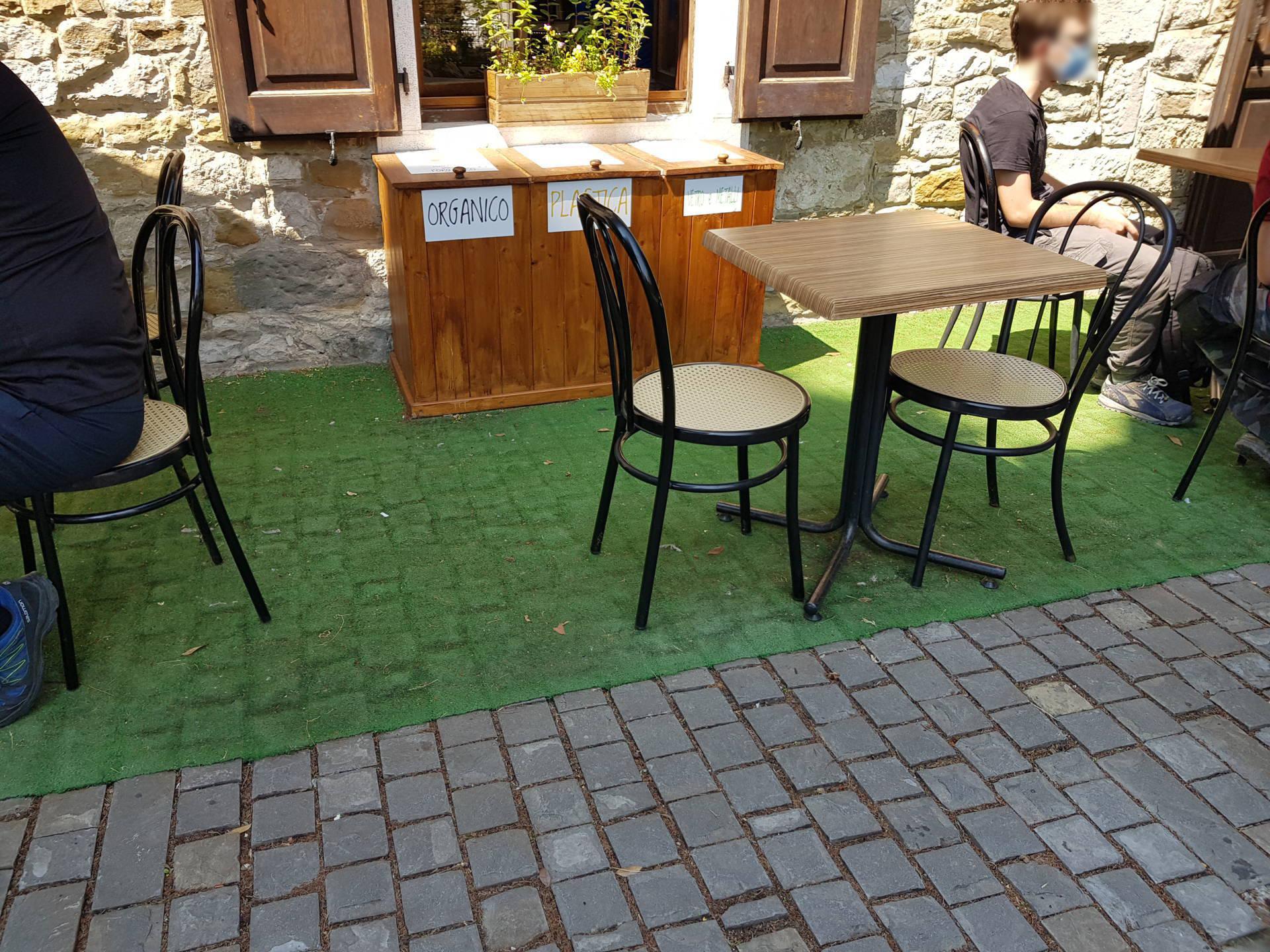
YesOUTDOOR AREA
.jpg)
Tavoli e sedie
Destination of the area
AREA TYPOLOGY:
ConsumptionType
Access to the area
TYPE:
From the main door already describedHeight difference (> 2.5 cm)
PRESENT:
NoPaving
TYPE:
TilesDimensions
ROTATION DIAMETER 140 CM:
YesPREVAILING CLEAR WIDTH:
> 75 cmFurniture
TABLE:
-
TYPE OF SUPPORT:
Centre pivotTYPE OF PLAN:
Rectangular/SquareWIDTH (CM):
60LENGTH (CM):
120GROUND CLEARANCE (CM):
77GROUND CLEARANCE (CM):
72TOP WITH ROUNDED EDGES:
No
CHAIR:
-
Backrest
FIXED TO THE GROUND:
No
ENTRANCE - LABORATORIO
.jpg)
Ingresso
Entrance typology
TYPE:
SecondaryACCESSIBLE:
YesTIPO:
SecondarioLOCATION IN RELATION TO THE MAIN:
In the private courtyard.Height difference (> 2.5 cm)
PRESENT:
NoThreshold (< 2.5 cm)
PRESENT:
YesHEIGHT:
2Entrance door
TYPE:
Single leafOPENING:
InsideHANDLE SIDE RAIL (CM):
YesAUTOMATED OPENING:
NoNET DOOR CLEARANCE:
Single or sliding doorMEASURE (CM):
115DOOR AND BACK DOOR COPLANARITY (NOT ASSESSED HEIGHT DIFFERENCE UP TO 2.5 CM):
YesZERBINI/CARPETS:
PRESENTS:
YesTYPE:
Protruding doormatTYPE:
CompactINTERCOM/BELL:
PRESENT:
NoGlass doors: window decals to indicate their presence
PRESENTS:
NoGeneral note
COMPARTMENT - LABORATORIO
.jpg)
Interno
Compartment name
TYPE:
Educational play area/workshopIDENTIFIER:
V3Door
ACCESS:
NoneDimensions
ROTATION DIAMETER 140 CM:
YesPREVAILING CLEAR WIDTH:
> 75 cmPaving
TYPE:
WoodColour contrast floors/walls
TYPE:
YesFLOOR COLOUR:
WoodWALL COLOUR:
GreySignage
TACTILE-PLANTAR PATHS:
NoTOUCH MAP:
NoINFORMATION SIGNAGE:
NoFurniture
TABLE/BUFFET:
-
HEIGHT:
UniqueGROUND CLEARANCE (CM):
95
2.8
/3
ENTRANCE
.jpg)
Ingresso
Entrance typology
TYPE:
MainACCESSIBLE:
YesTIPO:
PrincipaleHeight difference (> 2.5 cm)
PRESENT:
NoThreshold (< 2.5 cm)
PRESENT:
YesHEIGHT:
2Entrance door
TYPE:
With two doors or with two opening elementsOPENING:
InsideAUTOMATED OPENING:
NoNET DOOR CLEARANCE:
With two doors or with two opening elementsOVERALL BORE (CM):
116MAIN DOOR (CM):
56DOOR AND BACK DOOR COPLANARITY (NOT ASSESSED HEIGHT DIFFERENCE UP TO 2.5 CM):
YesZERBINI/CARPETS:
PRESENTS:
NoINTERCOM/BELL:
PRESENT:
NoGlass doors: window decals to indicate their presence
PRESENTS:
YesCOMPARTMENT
.jpg)
Bancone
.jpg)
Tavoli e sedie
Compartment name
TYPE:
Generic, of the structureIDENTIFIER:
V1Door
ACCESS:
NoneDimensions
WIDTH (CM):
830LENGTH (CM):
600ROTATION DIAMETER 140 CM:
YesPREVAILING CLEAR WIDTH:
> 75 cmNARROWING (CM):
66Paving
TYPE:
TilesColour contrast floors/walls
TYPE:
YesFLOOR COLOUR:
GreyWALL COLOUR:
BrownSignage
TACTILE-PLANTAR PATHS:
NoTOUCH MAP:
NoINFORMATION SIGNAGE:
NoFurniture
COUNTER:
-
HEIGHT:
UniqueGROUND CLEARANCE (CM):
105EMPTY UNDER:
No
TABLE:
-
TYPE OF SUPPORT:
Centre pivotTYPE OF PLAN:
Rectangular/SquareWIDTH (CM):
60LENGTH (CM):
60GROUND CLEARANCE (CM):
78GROUND CLEARANCE (CM):
73TOP WITH ROUNDED EDGES:
No
CHAIR:
-
Backrest
FIXED TO THE GROUND:
No
BATHROOM
.jpg)
WC
Present
Type
Plan
NUMBER:
0Anti-bathing
PRESENT:
YesWIDTH (CM):
137LENGTH (CM):
145EXCLUSIVE TOILET ACCESS:
NoANTI-BATHROOM DOOR:
PRESENT:
YesDOOR TYPE:
Single leafOPENING:
InsideNET DOOR CLEARANCE:
Single or sliding doorMEASURE (CM):
82ACCESSIBLE WASHBASIN ANTI-BATHROOM:
PRESENT:
NoACCESSIBLE TOILET DOOR
PRESENT:
YesDOOR TYPE:
Single leafOPENING:
InsideNET DOOR CLEARANCE:
Single or sliding doorMEASURE (CM):
80Compartment WC accessibile
WIDTH (CM):
182LENGTH (CM):
251SMOOTH ROTATION:
YesCOLOUR CONTRAST FLOORS/WALLS:
NoFLOOR COLOUR:
WhiteWALL COLOUR:
WhiteEMERGENCY BELL:
YesGROUND CLEARANCE (CM):
84PROXIMITY TOILET BOWL:
YesMENSOLA:
NoCOAT HOOK:
YesGROUND CLEARANCE (CM):
170WC BOWL
TYPE TOILET BOWL:
On the groundWITH FRONT HOLE:
NoHEIGHT FROM GROUND WITHOUT AXLE COVER (CM):
40DISTANCE FROM REAR WALL (CM):
58BACK SUPPORT:
YesTYPE OF SUPPORT:
External boxAXLE CLEARANCE:
Right-hand sideCM:
120FRONTAL APPROACH ONLY:
NoHANDLION:
YesTYPE OF HANDLE:
FixedFIXED HANDLE SIDE:
LeftHEIGHT LEFT SIDE (CM):
88VERTICAL:
NoFLUSH BUTTON:
AccessibleDOCCINO:
NoACCESSIBLE WASHBASIN TOILET
PRESENT:
YesTYPOLOGY WASHBASIN:
SuspendedGROUND CLEARANCE (CM):
80FRONT CLEARANCE (CM):
135TYPE OF TAP:
Small mixerMIRROR:
YesMIRROR TYPOLOGY:
FixedMIRROR HEIGHT FROM GROUND (CM):
110SOAP HOLDERS:
YesSOAP DISH HEIGHT (CM):
90PAPER HOLDER/DRYER:
YesPAPER HOLDER HEIGHT (CM):
114HANDLION:
YesShower
PRESENT:
NoTactile map showing the layout of sanitary facilities
PRESENTS:
NoCourtesy aids on request (shower chair, toilet seat, ...)
PRESENTS:
NoSecurity in the event of an emergency: doors with a mechanism that allows them to be opened from the outside even when locked from the inside
PRESENTS:
YesSafety in an emergency: emergency light
PRESENTS:
YesGeneral note
OUTDOOR AREA
Tavoli e sedie
Destination of the area
AREA TYPOLOGY:
ConsumptionType
Access to the area
TYPE:
From the main door already describedHeight difference (> 2.5 cm)
PRESENT:
NoPaving
TYPE:
Rough concrete/porphyry blocks, cobblestonesDimensions
ROTATION DIAMETER 140 CM:
YesPREVAILING CLEAR WIDTH:
> 75 cmFurniture
TABLE:
-
TYPE OF SUPPORT:
Centre pivotTYPE OF PLAN:
Rectangular/SquareWIDTH (CM):
60LENGTH (CM):
60GROUND CLEARANCE (CM):
76GROUND CLEARANCE (CM):
71TOP WITH ROUNDED EDGES:
Yes
CHAIR:
-
Backrest
FIXED TO THE GROUND:
No
2.5
/3
ENTRANCE
.jpg)
Ingresso
.jpg)
Rampa e gradini
Entrance typology
TYPE:
MainACCESSIBLE:
YesTIPO:
PrincipaleHeight difference (> 2.5 cm)
PRESENT:
YesDISLEVEL:
-
TYPE:
Short staircase/stepUNIVOCAL CODE:
SB1SHORT STAIRCASE (LESS THAN ONE FLOOR):
WIDTH (CM):
320NUMBER OF STEPS:
3HEIGHT OF INDIVIDUAL RISER (CM):
17CORRIMANO:
PRESENT:
NoINTERMEDIATE LANDING:
NoTACTILE-PLANTAR PATHS:
No -
TYPE:
RampUNIVOCAL CODE:
RA1RAMP:
WIDTH (CM):
125LENGTH (CM):
295SLOPE:
SLOPE (°):
8SLOPE (%):
14.05CORRIMANO:
PRESENT:
NoSIDE KERB:
NoNON-SLIP FINISH:
YesCOLOUR CONTRAST:
NoTACTILE-PLANTAR PATHS:
No
Threshold (< 2.5 cm)
PRESENT:
No/LevelEntrance door
TYPE:
With two doors or with two opening elementsOPENING:
InsideAUTOMATED OPENING:
NoNET DOOR CLEARANCE:
With two doors or with two opening elementsOVERALL BORE (CM):
277MAIN DOOR (CM):
138DOOR AND BACK DOOR COPLANARITY (NOT ASSESSED HEIGHT DIFFERENCE UP TO 2.5 CM):
YesZERBINI/CARPETS:
PRESENTS:
YesTYPE:
Satin doormatTYPE:
CompactINTERCOM/BELL:
PRESENT:
NoCOMPARTMENT - AULA CON MOSAICO
.jpg)
Passerella in vetro
Compartment name
TYPE:
Generic, of the structureIDENTIFIER:
V1Door
ACCESS:
NoneDimensions
ROTATION DIAMETER 140 CM:
YesPaving
TYPE:
MoreOTHER TYPOLOGY:
GlassColour contrast floors/walls
TYPE:
NoFLOOR COLOUR:
GlassWALL COLOUR:
Glass/steelSignage
TACTILE-PLANTAR PATHS:
NoTOUCH MAP:
NoINFORMATION SIGNAGE:
NoGeneral note
CONNECTION PATHWAYWAY - AULA/PRESBITERIO
.jpg)
Rampa RA2
.jpg)
Rampa RA3
Connection
ITINERARY IDENTIFIER:
C1DA:
Generic, of the structureA:
Generic, of the structureType of route
Internal itinerary characteristics
DIMENSIONS:
PREVAILING CLEAR WIDTH:
> 75 cmPAVING:
TYPE:
MoreOTHER TYPOLOGY:
GlassCOLOUR CONTRAST FLOORS/WALLS:
FLOOR COLOUR:
GlassWALL COLOUR:
Glass/steelSIGNAGE:
TACTILE-PLANTAR PATHS:
NoTOUCH MAP:
NoINFORMATION SIGNAGE:
NoHEIGHT DIFFERENCE (> 2.5 CM):
PRESENT:
YesDISLEVEL:
-
TYPE:
RampUNIVOCAL CODE:
RA2RAMP:
WIDTH (CM):
113LENGTH (CM):
195SLOPE:
SLOPE (°):
7SLOPE (%):
12.28CORRIMANO:
PRESENT:
YesSIDE KERB:
NoNON-SLIP FINISH:
YesCOLOUR CONTRAST:
NoTACTILE-PLANTAR PATHS:
No -
TYPE:
RampUNIVOCAL CODE:
RA3RAMP:
WIDTH (CM):
117LENGTH (CM):
100SLOPE:
SLOPE (°):
13SLOPE (%):
23.09CORRIMANO:
PRESENT:
NoSIDE KERB:
NoNON-SLIP FINISH:
YesCOLOUR CONTRAST:
NoTACTILE-PLANTAR PATHS:
No
Common parts: no furniture with bodies protruding from the base up to a height of 210 cm
PRESENTS:
NoPresence of tactile information map of available routes and services
PRESENTS:
YesSafety in case of emergency in common areas: presence of acoustic alarm
PRESENTS:
NoSafety in case of emergency in common areas: presence of luminous alarm
PRESENTS:
NoEmergency safety in common areas: emergency light, visual escape route signs, evacuation route map
PRESENTS:
NoCOMPARTMENT - CRIPTA DEGLI AFFRESCHI
.jpg)
Segnaletica
.jpg)
Scala di ingresso
.jpg)
Scala di uscita
Compartment name
TYPE:
Generic, of the structureIDENTIFIER:
V2Door
ACCESS:
NoneDimensions
ROTATION DIAMETER 140 CM:
YesPaving
TYPE:
MoreOTHER TYPOLOGY:
StoneColour contrast floors/walls
TYPE:
NoFLOOR COLOUR:
GreyWALL COLOUR:
GreySignage
TACTILE-PLANTAR PATHS:
NoTOUCH MAP:
NoINFORMATION SIGNAGE:
YesNOTES:
Present outside and inside and integrated with audio information.General note
CONNECTION PATHWAYWAY - CRIPTA DEGLI AFFRESCHI/CRIPTA DEGLI SCAVI
.jpg)
Pavimentazione
.jpg)
Rampa
Connection
ITINERARY IDENTIFIER:
C2DA:
Generic, of the structureA:
Generic, of the structureType of route
Internal itinerary characteristics
DIMENSIONS:
PREVAILING CLEAR WIDTH:
> 75 cmPAVING:
TYPE:
Tiles, WoodCOLOUR CONTRAST FLOORS/WALLS:
FLOOR COLOUR:
Red/BeigeWALL COLOUR:
Grey/beigeSIGNAGE:
TACTILE-PLANTAR PATHS:
NoTOUCH MAP:
NoINFORMATION SIGNAGE:
NoHEIGHT DIFFERENCE (> 2.5 CM):
PRESENT:
YesDISLEVEL:
-
TYPE:
RampUNIVOCAL CODE:
RA4RAMP:
WIDTH (CM):
100LENGTH (CM):
800SLOPE:
SLOPE (°):
8SLOPE (%):
14.05CORRIMANO:
PRESENT:
YesSIDE KERB:
NoNON-SLIP FINISH:
YesCOLOUR CONTRAST:
NoTACTILE-PLANTAR PATHS:
No
Common parts: no furniture with bodies protruding from the base up to a height of 210 cm
PRESENTS:
NoPresence of tactile information map of available routes and services
PRESENTS:
YesSafety in case of emergency in common areas: presence of acoustic alarm
PRESENTS:
NoSafety in case of emergency in common areas: presence of luminous alarm
PRESENTS:
NoEmergency safety in common areas: emergency light, visual escape route signs, evacuation route map
PRESENTS:
NoCOMPARTMENT - CRIPTA DEGLI SCAVI
.jpg)
Passerella in vetro
.jpg)
Didascalia su passamano metallico
Compartment name
TYPE:
Generic, of the structureIDENTIFIER:
V3Door
ACCESS:
NoneDimensions
ROTATION DIAMETER 140 CM:
YesPaving
TYPE:
MoreOTHER TYPOLOGY:
GlassColour contrast floors/walls
TYPE:
YesFLOOR COLOUR:
GlassWALL COLOUR:
Glass/steelSignage
TACTILE-PLANTAR PATHS:
NoTOUCH MAP:
NoINFORMATION SIGNAGE:
YesNOTES:
Contrasting colour captions are present on the metal handrails.2.5
/3
ENTRANCE
Ingresso
Rampa e gradini
Entrance typology
TYPE:
MainACCESSIBLE:
YesTIPO:
PrincipaleHeight difference (> 2.5 cm)
PRESENT:
YesDISLEVEL:
-
TYPE:
Short staircase/stepUNIVOCAL CODE:
SB1SHORT STAIRCASE (LESS THAN ONE FLOOR):
WIDTH (CM):
320NUMBER OF STEPS:
3HEIGHT OF INDIVIDUAL RISER (CM):
17CORRIMANO:
PRESENT:
NoINTERMEDIATE LANDING:
NoTACTILE-PLANTAR PATHS:
No -
TYPE:
RampUNIVOCAL CODE:
RA1RAMP:
WIDTH (CM):
125LENGTH (CM):
295SLOPE:
SLOPE (°):
8SLOPE (%):
14.05CORRIMANO:
PRESENT:
NoSIDE KERB:
NoNON-SLIP FINISH:
YesCOLOUR CONTRAST:
NoTACTILE-PLANTAR PATHS:
No
Threshold (< 2.5 cm)
PRESENT:
No/LevelEntrance door
TYPE:
With two doors or with two opening elementsOPENING:
InsideAUTOMATED OPENING:
NoNET DOOR CLEARANCE:
With two doors or with two opening elementsOVERALL BORE (CM):
277MAIN DOOR (CM):
138DOOR AND BACK DOOR COPLANARITY (NOT ASSESSED HEIGHT DIFFERENCE UP TO 2.5 CM):
YesZERBINI/CARPETS:
PRESENTS:
YesTYPE:
Satin doormatTYPE:
CompactINTERCOM/BELL:
PRESENT:
NoCOMPARTMENT - AULA CON MOSAICO
Passerella in vetro
Compartment name
TYPE:
Generic, of the structureIDENTIFIER:
V1Door
ACCESS:
NoneDimensions
ROTATION DIAMETER 140 CM:
YesPaving
TYPE:
MoreOTHER TYPOLOGY:
GlassColour contrast floors/walls
TYPE:
NoFLOOR COLOUR:
GlassWALL COLOUR:
Glass/steelSignage
TACTILE-PLANTAR PATHS:
NoTOUCH MAP:
NoINFORMATION SIGNAGE:
NoGeneral note
CONNECTION PATHWAYWAY - AULA/PRESBITERIO
Rampa RA2
Rampa RA3
Connection
ITINERARY IDENTIFIER:
C1DA:
Generic, of the structureA:
Generic, of the structureType of route
Internal itinerary characteristics
DIMENSIONS:
PREVAILING CLEAR WIDTH:
> 75 cmPAVING:
TYPE:
MoreOTHER TYPOLOGY:
GlassCOLOUR CONTRAST FLOORS/WALLS:
FLOOR COLOUR:
GlassWALL COLOUR:
Glass/steelSIGNAGE:
TACTILE-PLANTAR PATHS:
NoTOUCH MAP:
NoINFORMATION SIGNAGE:
NoHEIGHT DIFFERENCE (> 2.5 CM):
PRESENT:
YesDISLEVEL:
-
TYPE:
RampUNIVOCAL CODE:
RA2RAMP:
WIDTH (CM):
113LENGTH (CM):
195SLOPE:
SLOPE (°):
7SLOPE (%):
12.28CORRIMANO:
PRESENT:
YesSIDE KERB:
NoNON-SLIP FINISH:
YesCOLOUR CONTRAST:
NoTACTILE-PLANTAR PATHS:
No -
TYPE:
RampUNIVOCAL CODE:
RA3RAMP:
WIDTH (CM):
117LENGTH (CM):
100SLOPE:
SLOPE (°):
13SLOPE (%):
23.09CORRIMANO:
PRESENT:
NoSIDE KERB:
NoNON-SLIP FINISH:
YesCOLOUR CONTRAST:
NoTACTILE-PLANTAR PATHS:
No
Common parts: no furniture with bodies protruding from the base up to a height of 210 cm
PRESENTS:
NoPresence of tactile information map of available routes and services
PRESENTS:
YesSafety in case of emergency in common areas: presence of acoustic alarm
PRESENTS:
NoSafety in case of emergency in common areas: presence of luminous alarm
PRESENTS:
NoEmergency safety in common areas: emergency light, visual escape route signs, evacuation route map
PRESENTS:
NoCOMPARTMENT - CRIPTA DEGLI AFFRESCHI
Segnaletica
Scala di ingresso
Scala di uscita
Compartment name
TYPE:
Generic, of the structureIDENTIFIER:
V2Door
ACCESS:
NoneDimensions
ROTATION DIAMETER 140 CM:
YesPaving
TYPE:
MoreOTHER TYPOLOGY:
StoneColour contrast floors/walls
TYPE:
NoFLOOR COLOUR:
GreyWALL COLOUR:
GreySignage
TACTILE-PLANTAR PATHS:
NoTOUCH MAP:
NoINFORMATION SIGNAGE:
YesNOTES:
Present outside and inside and integrated with audio information.General note
CONNECTION PATHWAYWAY - CRIPTA DEGLI AFFRESCHI/CRIPTA DEGLI SCAVI
Pavimentazione
Rampa
Connection
ITINERARY IDENTIFIER:
C2DA:
Generic, of the structureA:
Generic, of the structureType of route
Internal itinerary characteristics
DIMENSIONS:
PREVAILING CLEAR WIDTH:
> 75 cmPAVING:
TYPE:
Tiles, WoodCOLOUR CONTRAST FLOORS/WALLS:
FLOOR COLOUR:
Red/BeigeWALL COLOUR:
Grey/beigeSIGNAGE:
TACTILE-PLANTAR PATHS:
NoTOUCH MAP:
NoINFORMATION SIGNAGE:
NoHEIGHT DIFFERENCE (> 2.5 CM):
PRESENT:
YesDISLEVEL:
-
TYPE:
RampUNIVOCAL CODE:
RA4RAMP:
WIDTH (CM):
100LENGTH (CM):
800SLOPE:
SLOPE (°):
8SLOPE (%):
14.05CORRIMANO:
PRESENT:
YesSIDE KERB:
NoNON-SLIP FINISH:
YesCOLOUR CONTRAST:
NoTACTILE-PLANTAR PATHS:
No
Common parts: no furniture with bodies protruding from the base up to a height of 210 cm
PRESENTS:
NoPresence of tactile information map of available routes and services
PRESENTS:
YesSafety in case of emergency in common areas: presence of acoustic alarm
PRESENTS:
NoSafety in case of emergency in common areas: presence of luminous alarm
PRESENTS:
NoEmergency safety in common areas: emergency light, visual escape route signs, evacuation route map
PRESENTS:
NoCOMPARTMENT - CRIPTA DEGLI SCAVI
Passerella in vetro
Didascalia su passamano metallico
Compartment name
TYPE:
Generic, of the structureIDENTIFIER:
V3Door
ACCESS:
NoneDimensions
ROTATION DIAMETER 140 CM:
YesPaving
TYPE:
MoreOTHER TYPOLOGY:
GlassColour contrast floors/walls
TYPE:
YesFLOOR COLOUR:
GlassWALL COLOUR:
Glass/steelSignage
TACTILE-PLANTAR PATHS:
NoTOUCH MAP:
NoINFORMATION SIGNAGE:
YesNOTES:
Contrasting colour captions are present on the metal handrails.2.7
/3
ENTRANCE - PRINCIPALE
.jpg)
Scala
Entrance typology
TYPE:
MainACCESSIBLE:
NoTIPO:
PrincipaleHeight difference (> 2.5 cm)
PRESENT:
YesDISLEVEL:
-
TYPE:
Short staircase/stepUNIVOCAL CODE:
SB1SHORT STAIRCASE (LESS THAN ONE FLOOR):
WIDTH (CM):
145NUMBER OF STEPS:
3HEIGHT OF INDIVIDUAL RISER (CM):
17CORRIMANO:
PRESENT:
YesTYPE:
Two sidesCOLOUR CONTRAST:
YesSTEP:
TYPE:
Non-slipINTERMEDIATE LANDING:
NoTACTILE-PLANTAR PATHS:
No
Threshold (< 2.5 cm)
PRESENT:
No/LevelEntrance door
TYPE:
Single leafOPENING:
InsideAUTOMATED OPENING:
NoNET DOOR CLEARANCE:
Single or sliding doorMEASURE (CM):
95DOOR AND BACK DOOR COPLANARITY (NOT ASSESSED HEIGHT DIFFERENCE UP TO 2.5 CM):
YesZERBINI/CARPETS:
PRESENTS:
NoINTERCOM/BELL:
PRESENT:
NoGlass doors: window decals to indicate their presence
PRESENTS:
NoENTRANCE - SECONDARIO
.jpg)
Rampa
.jpg)
Ingresso secondario
Entrance typology
TYPE:
SecondaryACCESSIBLE:
YesTIPO:
SecondarioLOCATION IN RELATION TO THE MAIN:
On the left side.Height difference (> 2.5 cm)
PRESENT:
YesDISLEVEL:
-
TYPE:
RampUNIVOCAL CODE:
RA1RAMP:
WIDTH (CM):
210LENGTH (CM):
550SLOPE:
SLOPE (°):
5SLOPE (%):
8.75CORRIMANO:
PRESENT:
YesSIDE KERB:
YesNON-SLIP FINISH:
YesCOLOUR CONTRAST:
NoTACTILE-PLANTAR PATHS:
No
Threshold (< 2.5 cm)
PRESENT:
YesHEIGHT:
2Entrance door
TYPE:
SlidingAUTOMATED OPENING:
NoNET DOOR CLEARANCE:
Single or sliding doorMEASURE (CM):
135DOOR AND BACK DOOR COPLANARITY (NOT ASSESSED HEIGHT DIFFERENCE UP TO 2.5 CM):
YesZERBINI/CARPETS:
PRESENTS:
NoINTERCOM/BELL:
PRESENT:
YesHEIGHT (CM):
100LOCATION:
On the right side of the door.Glass doors: window decals to indicate their presence
PRESENTS:
NoCOMPARTMENT
Compartment name
TYPE:
Generic, of the structureIDENTIFIER:
V1Door
ACCESS:
NoneDimensions
ROTATION DIAMETER 140 CM:
YesPREVAILING CLEAR WIDTH:
> 75 cmPaving
TYPE:
TilesColour contrast floors/walls
TYPE:
YesFLOOR COLOUR:
GreyWALL COLOUR:
BeigeSignage
TACTILE-PLANTAR PATHS:
NoTOUCH MAP:
NoINFORMATION SIGNAGE:
NoFurniture
COUNTER:
-
HEIGHT:
DoubleMINIMUM HEIGHT FROM THE GROUND (CM):
96MAXIMUM HEIGHT FROM THE GROUND (CM):
116EMPTY UNDER:
No
CHAIR:
-
NOTES:
BenchFIXED TO THE GROUND:
No
2.7
/3
ENTRANCE - PRINCIPALE
Scala
Entrance typology
TYPE:
MainACCESSIBLE:
NoTIPO:
PrincipaleHeight difference (> 2.5 cm)
PRESENT:
YesDISLEVEL:
-
TYPE:
Short staircase/stepUNIVOCAL CODE:
SB1SHORT STAIRCASE (LESS THAN ONE FLOOR):
WIDTH (CM):
145NUMBER OF STEPS:
3HEIGHT OF INDIVIDUAL RISER (CM):
17CORRIMANO:
PRESENT:
YesTYPE:
Two sidesCOLOUR CONTRAST:
YesSTEP:
TYPE:
Non-slipINTERMEDIATE LANDING:
NoTACTILE-PLANTAR PATHS:
No
Threshold (< 2.5 cm)
PRESENT:
No/LevelEntrance door
TYPE:
Single leafOPENING:
InsideAUTOMATED OPENING:
NoNET DOOR CLEARANCE:
Single or sliding doorMEASURE (CM):
95DOOR AND BACK DOOR COPLANARITY (NOT ASSESSED HEIGHT DIFFERENCE UP TO 2.5 CM):
YesZERBINI/CARPETS:
PRESENTS:
NoINTERCOM/BELL:
PRESENT:
NoGlass doors: window decals to indicate their presence
PRESENTS:
NoENTRANCE - SECONDARIO
Rampa
Ingresso secondario
Entrance typology
TYPE:
SecondaryACCESSIBLE:
YesTIPO:
SecondarioLOCATION IN RELATION TO THE MAIN:
On the left side.Height difference (> 2.5 cm)
PRESENT:
YesDISLEVEL:
-
TYPE:
RampUNIVOCAL CODE:
RA1RAMP:
WIDTH (CM):
210LENGTH (CM):
550SLOPE:
SLOPE (°):
5SLOPE (%):
8.75CORRIMANO:
PRESENT:
YesSIDE KERB:
YesNON-SLIP FINISH:
YesCOLOUR CONTRAST:
NoTACTILE-PLANTAR PATHS:
No
Threshold (< 2.5 cm)
PRESENT:
YesHEIGHT:
2Entrance door
TYPE:
SlidingAUTOMATED OPENING:
NoNET DOOR CLEARANCE:
Single or sliding doorMEASURE (CM):
135DOOR AND BACK DOOR COPLANARITY (NOT ASSESSED HEIGHT DIFFERENCE UP TO 2.5 CM):
YesZERBINI/CARPETS:
PRESENTS:
NoINTERCOM/BELL:
PRESENT:
YesHEIGHT (CM):
100LOCATION:
On the right side of the door.Glass doors: window decals to indicate their presence
PRESENTS:
NoCOMPARTMENT
Compartment name
TYPE:
Generic, of the structureIDENTIFIER:
V1Door
ACCESS:
NoneDimensions
ROTATION DIAMETER 140 CM:
YesPREVAILING CLEAR WIDTH:
> 75 cmPaving
TYPE:
TilesColour contrast floors/walls
TYPE:
YesFLOOR COLOUR:
GreyWALL COLOUR:
BeigeSignage
TACTILE-PLANTAR PATHS:
NoTOUCH MAP:
NoINFORMATION SIGNAGE:
NoFurniture
COUNTER:
-
HEIGHT:
DoubleMINIMUM HEIGHT FROM THE GROUND (CM):
96MAXIMUM HEIGHT FROM THE GROUND (CM):
116EMPTY UNDER:
No
CHAIR:
-
NOTES:
BenchFIXED TO THE GROUND:
No
2.9
/3
ENTRANCE - PRINCIPALE
.jpg)
Ingresso principale
Entrance typology
TYPE:
MainACCESSIBLE:
YesTIPO:
PrincipaleHeight difference (> 2.5 cm)
PRESENT:
NoThreshold (< 2.5 cm)
PRESENT:
YesHEIGHT:
2Entrance door
TYPE:
Single leafOPENING:
InsideAUTOMATED OPENING:
NoNET DOOR CLEARANCE:
Single or sliding doorMEASURE (CM):
89DOOR AND BACK DOOR COPLANARITY (NOT ASSESSED HEIGHT DIFFERENCE UP TO 2.5 CM):
YesZERBINI/CARPETS:
PRESENTS:
YesTYPE:
Satin doormatTYPE:
CompactINTERCOM/BELL:
PRESENT:
NoGlass doors: window decals to indicate their presence
PRESENTS:
NoENTRANCE - SECONDARIO
Entrance typology
TYPE:
SecondaryACCESSIBLE:
YesTIPO:
SecondarioLOCATION IN RELATION TO THE MAIN:
Next to the main one.Height difference (> 2.5 cm)
PRESENT:
NoThreshold (< 2.5 cm)
PRESENT:
YesHEIGHT:
2Entrance door
TYPE:
Single leafOPENING:
InsideAUTOMATED OPENING:
NoNET DOOR CLEARANCE:
Single or sliding doorMEASURE (CM):
89DOOR AND BACK DOOR COPLANARITY (NOT ASSESSED HEIGHT DIFFERENCE UP TO 2.5 CM):
YesZERBINI/CARPETS:
PRESENTS:
YesTYPE:
Satin doormatTYPE:
CompactINTERCOM/BELL:
PRESENT:
NoGlass doors: window decals to indicate their presence
PRESENTS:
NoCOMPARTMENT
Compartment name
TYPE:
Generic, of the structureIDENTIFIER:
V1Door
ACCESS:
NoneDimensions
ROTATION DIAMETER 140 CM:
YesPREVAILING CLEAR WIDTH:
> 75 cmPaving
TYPE:
TilesColour contrast floors/walls
TYPE:
YesFLOOR COLOUR:
GreyWALL COLOUR:
PinkSignage
TACTILE-PLANTAR PATHS:
NoTOUCH MAP:
NoINFORMATION SIGNAGE:
NoOUTDOOR AREA
Destination of the area
AREA TYPOLOGY:
ConsumptionType
Access to the area
TYPE:
From external pathwayHeight difference (> 2.5 cm)
PRESENT:
NoPaving
TYPE:
Concrete/porphyry coplanar blocksDimensions
ROTATION DIAMETER 140 CM:
NoPREVAILING CLEAR WIDTH:
> 75 cmFurniture
CHAIR:
-
Backrest, Armrests
FIXED TO THE GROUND:
No
General note
2.8
/3
ENTRANCE - PRINCIPALE
.jpg)
Ingresso
.jpg)
Porta
Entrance typology
TYPE:
MainACCESSIBLE:
NoTIPO:
PrincipaleHeight difference (> 2.5 cm)
PRESENT:
YesDISLEVEL:
-
TYPE:
Short staircase/stepUNIVOCAL CODE:
SB1SHORT STAIRCASE (LESS THAN ONE FLOOR):
WIDTH (CM):
200NUMBER OF STEPS:
1HEIGHT OF INDIVIDUAL RISER (CM):
4CORRIMANO:
PRESENT:
NoINTERMEDIATE LANDING:
NoTACTILE-PLANTAR PATHS:
No
Threshold (< 2.5 cm)
PRESENT:
No/LevelEntrance door
TYPE:
Single leafOPENING:
OutdoorAUTOMATED OPENING:
NoTYPE:
RectangularWIDTH (CM):
155LENGTH (CM):
400NOTE EXTERNAL DOOR:
Gap without a door.NET DOOR CLEARANCE:
Single or sliding doorMEASURE (CM):
90DOOR AND BACK DOOR COPLANARITY (NOT ASSESSED HEIGHT DIFFERENCE UP TO 2.5 CM):
YesZERBINI/CARPETS:
PRESENTS:
NoINTERCOM/BELL:
PRESENT:
NoGlass doors: window decals to indicate their presence
PRESENTS:
YesCOMPARTMENT
.jpg)
Espositori e totem
.jpg)
Bancone
Compartment name
TYPE:
Generic, of the structureIDENTIFIER:
V1Door
ACCESS:
NoneDimensions
ROTATION DIAMETER 140 CM:
YesPREVAILING CLEAR WIDTH:
> 75 cmPaving
TYPE:
TilesColour contrast floors/walls
TYPE:
YesFLOOR COLOUR:
BeigeWALL COLOUR:
WhiteSignage
TACTILE-PLANTAR PATHS:
NoTOUCH MAP:
NoINFORMATION SIGNAGE:
NoFurniture
COUNTER:
-
HEIGHT:
UniqueGROUND CLEARANCE (CM):
110EMPTY UNDER:
No
EXHIBITOR:
-
HEIGHT:
Dispenser/ShelfMINIMUM HEIGHT FROM THE GROUND (CM):
10MAXIMUM HEIGHT FROM THE GROUND (CM):
195
General note
0.5
/3
PARKING FOR PUBLIC USE
.jpg)
Stallo di parcheggio
Public car park features
TYPE:
Outdoor uncoveredSTALL:
-
NUMBER OF STALLS:
1TYPE:
In lineWIDTH (CM):
200LENGTH (CM):
500SIGNAGE:
HorizontalPAVING:
Rough concrete/porphyry blocks, cobblestones, erba, legno
Connection with the footpath
HEIGHT DIFFERENCE (> 2.5 CM):
PRESENT:
No0.5
/3
PARKING FOR PUBLIC USE
Stallo di parcheggio
Public car park features
TYPE:
Outdoor uncoveredSTALL:
-
NUMBER OF STALLS:
1TYPE:
In lineWIDTH (CM):
200LENGTH (CM):
500SIGNAGE:
HorizontalPAVING:
Rough concrete/porphyry blocks, cobblestones, erba, legno
Connection with the footpath
HEIGHT DIFFERENCE (> 2.5 CM):
PRESENT:
No3
/3
PARKING FOR PUBLIC USE
.jpg)
Stalli di parcheggio
Public car park features
TYPE:
Outdoor uncoveredSTALL:
-
NUMBER OF STALLS:
5TYPE:
in combWIDTH (CM):
325LENGTH (CM):
487SIGNAGE:
HorizontalPAVING:
Concrete/Asphalt or coplanar stone
Connection with the footpath
HEIGHT DIFFERENCE (> 2.5 CM):
PRESENT:
No3
/3
PARKING FOR PUBLIC USE
Stalli di parcheggio
Public car park features
TYPE:
Outdoor uncoveredSTALL:
-
NUMBER OF STALLS:
5TYPE:
in combWIDTH (CM):
325LENGTH (CM):
487SIGNAGE:
HorizontalPAVING:
Concrete/Asphalt or coplanar stone
Connection with the footpath
HEIGHT DIFFERENCE (> 2.5 CM):
PRESENT:
No1.5
/3
PARKING FOR PUBLIC USE
.jpg)
Stalli di parcheggio
Public car park features
TYPE:
Outdoor uncoveredSTALL:
-
NUMBER OF STALLS:
5TYPE:
in combWIDTH (CM):
275LENGTH (CM):
450SIGNAGE:
Horizontal, VerticalPAVING:
Concrete/Asphalt or coplanar stone
Connection with the footpath
HEIGHT DIFFERENCE (> 2.5 CM):
PRESENT:
NoGeneral note
1.5
/3
PARKING FOR PUBLIC USE
Stalli di parcheggio
Public car park features
TYPE:
Outdoor uncoveredSTALL:
-
NUMBER OF STALLS:
5TYPE:
in combWIDTH (CM):
275LENGTH (CM):
450SIGNAGE:
Horizontal, VerticalPAVING:
Concrete/Asphalt or coplanar stone
Connection with the footpath
HEIGHT DIFFERENCE (> 2.5 CM):
PRESENT:
NoGeneral note
2.5
/3
PARKING FOR PUBLIC USE
.jpg)
Stallo di parcheggio
Public car park features
TYPE:
Outdoor uncoveredSTALL:
-
NUMBER OF STALLS:
1TYPE:
In lineWIDTH (CM):
230LENGTH (CM):
600SIGNAGE:
Horizontal, VerticalPAVING:
Concrete/porphyry coplanar blocks
Connection with the footpath
HEIGHT DIFFERENCE (> 2.5 CM):
PRESENT:
NoGeneral note
2.5
/3
PARKING FOR PUBLIC USE
Stallo di parcheggio
Public car park features
TYPE:
Outdoor uncoveredSTALL:
-
NUMBER OF STALLS:
1TYPE:
In lineWIDTH (CM):
230LENGTH (CM):
600SIGNAGE:
Horizontal, VerticalPAVING:
Concrete/porphyry coplanar blocks
Connection with the footpath
HEIGHT DIFFERENCE (> 2.5 CM):
PRESENT:
NoGeneral note
2.5
/3
ENTRANCE
.jpg)
Ingresso
Entrance typology
TYPE:
MainACCESSIBLE:
NoTIPO:
PrincipaleHeight difference (> 2.5 cm)
PRESENT:
YesDISLEVEL:
-
TYPE:
Short staircase/stepUNIVOCAL CODE:
SB1SHORT STAIRCASE (LESS THAN ONE FLOOR):
WIDTH (CM):
85NUMBER OF STEPS:
1HEIGHT OF INDIVIDUAL RISER (CM):
4CORRIMANO:
PRESENT:
NoINTERMEDIATE LANDING:
NoTACTILE-PLANTAR PATHS:
No
Threshold (< 2.5 cm)
PRESENT:
No/LevelEntrance door
TYPE:
Single leafOPENING:
InsideAUTOMATED OPENING:
NoNET DOOR CLEARANCE:
Single or sliding doorMEASURE (CM):
100DOOR AND BACK DOOR COPLANARITY (NOT ASSESSED HEIGHT DIFFERENCE UP TO 2.5 CM):
NoZERBINI/CARPETS:
PRESENTS:
YesTYPE:
Protruding doormatTYPE:
CompactINTERCOM/BELL:
PRESENT:
NoGlass doors: window decals to indicate their presence
PRESENTS:
NoCOMPARTMENT
Compartment name
TYPE:
Generic, of the structureIDENTIFIER:
V1Door
ACCESS:
NoneDimensions
ROTATION DIAMETER 140 CM:
YesPREVAILING CLEAR WIDTH:
> 75 cmPaving
TYPE:
TilesColour contrast floors/walls
TYPE:
YesFLOOR COLOUR:
GreyWALL COLOUR:
WhiteSignage
TACTILE-PLANTAR PATHS:
NoTOUCH MAP:
NoINFORMATION SIGNAGE:
NoFurniture
COUNTER:
-
HEIGHT:
UniqueGROUND CLEARANCE (CM):
90EMPTY UNDER:
No
General note
OUTDOOR AREA
Destination of the area
AREA TYPOLOGY:
ConsumptionType
Access to the area
TYPE:
From external pathwayHeight difference (> 2.5 cm)
PRESENT:
NoPaving
TYPE:
Rough concrete/porphyry blocks, cobblestonesDimensions
ROTATION DIAMETER 140 CM:
YesPREVAILING CLEAR WIDTH:
> 75 cmFurniture
TABLE:
-
TYPE OF SUPPORT:
Corner legsTYPE OF PLAN:
Rectangular/SquareWIDTH (CM):
80LENGTH (CM):
180GROUND CLEARANCE (CM):
75GROUND CLEARANCE (CM):
72TOP WITH ROUNDED EDGES:
No
CHAIR:
-
Backrest
FIXED TO THE GROUND:
No -
NOTES:
BenchesFIXED TO THE GROUND:
No