Barcis - Tour Itinerary

Mountain
GENERAL INFORMATION
LAST INSPECTION DATE
18/08/2022
PLANNED ITINERARY
Barcis - Tour Itinerary
LENGTH
1700 meters
DEPARTURE
Parking along the shore of Lake Barcis, near SR251 - locality RIbe
The itinerary unfolds in an urban area without tactile foot markers.
The tour can take place at any time of the year.
The starting point is from the car park along the shore of the Lake of Barcis to the left of Regional Road SR251 (Photographs 1-2). Two parking spaces, not adjacent to each other, are located here, reserved for people with disability (Photographs 3-4). Both have modular concrete element paving and an adjacent packed earth itinerary leading to the lay-by area.
The rest area, also with a packed earth surface, is located on the lakeshore, shaded by trees and equipped with wooden benches and tables (Photograph 5). For wheelchair users, this type of seating and table is not the optimal choice due to the impossibility of sitting at the head of the table, except with some difficulty (due to the presence of the table's footrest). The rest area also features a covered section under an almost semi-circular stone canopy closed on two sides. The area also serves as a starting point for bicycle and walking itineraries, which are signposted with wooden information panels (Photograph 6). The panel located in the rest area is inclined in relation to the vertical plane with a base 100 centimetres above the ground, complete with a map and indications of the various itineraries of interest. The panel is partly ruined with poor legibility.
At the exit of the car park, it is necessary to travel an uphill section on asphalt of approximately 10 metres (Photograph 7), which has a slope of 10%. By crossing the parking area for buses, you reach the porphyry cube pavement measuring 2.45 metres in width, of which 1.07 metres is clear of the encumbrance of the trees. The pavement is raised from the road surface by 9 centimetres and joined to the road surface by a short ramp and a threshold measuring 3.5 centimetres.
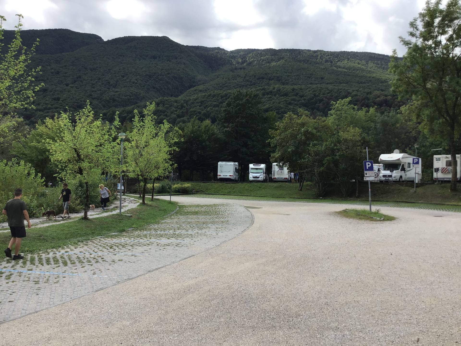
Photo 1 - view of the car park
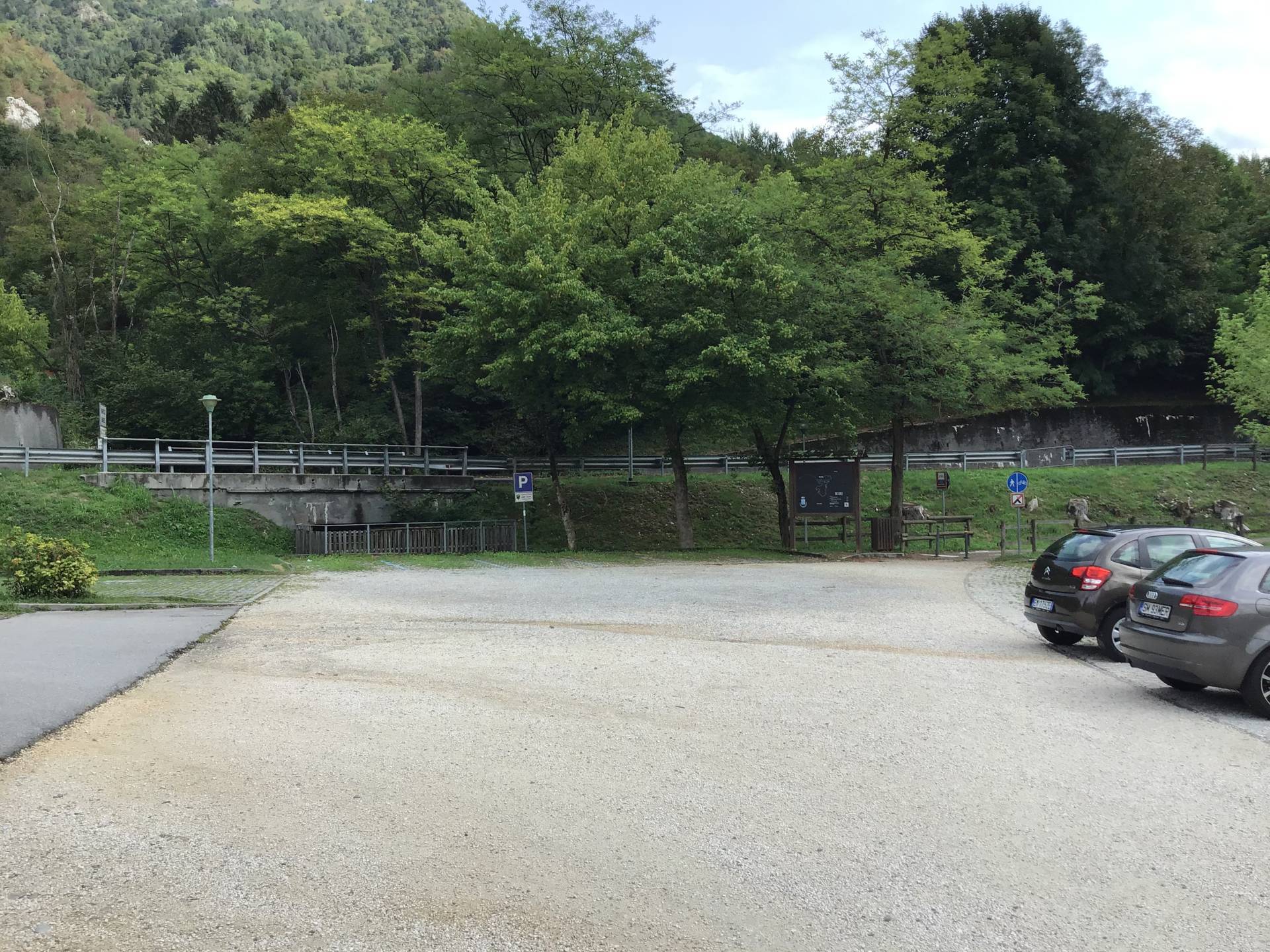
Photo 2 - view of the car park

Photo 3 - stall reserved for people with disabilities

Photo 4 - stall reserved for people with disabilities
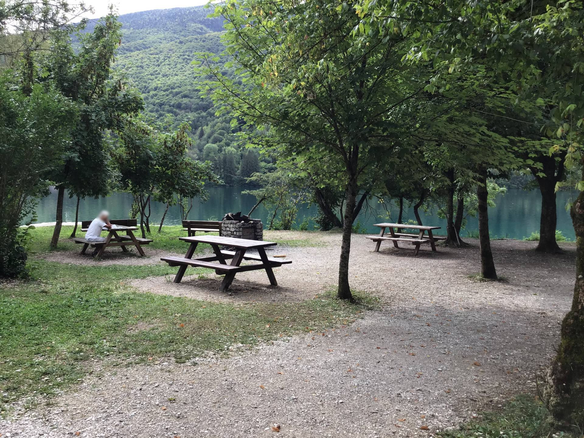
Photo 5 - parking area
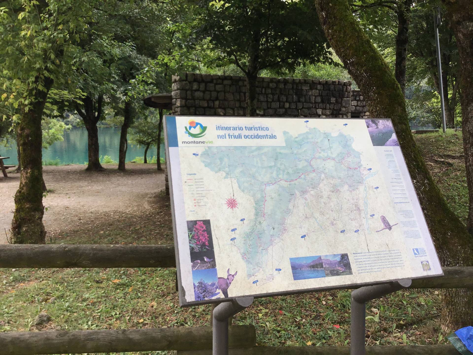
Photo 6 - information panel
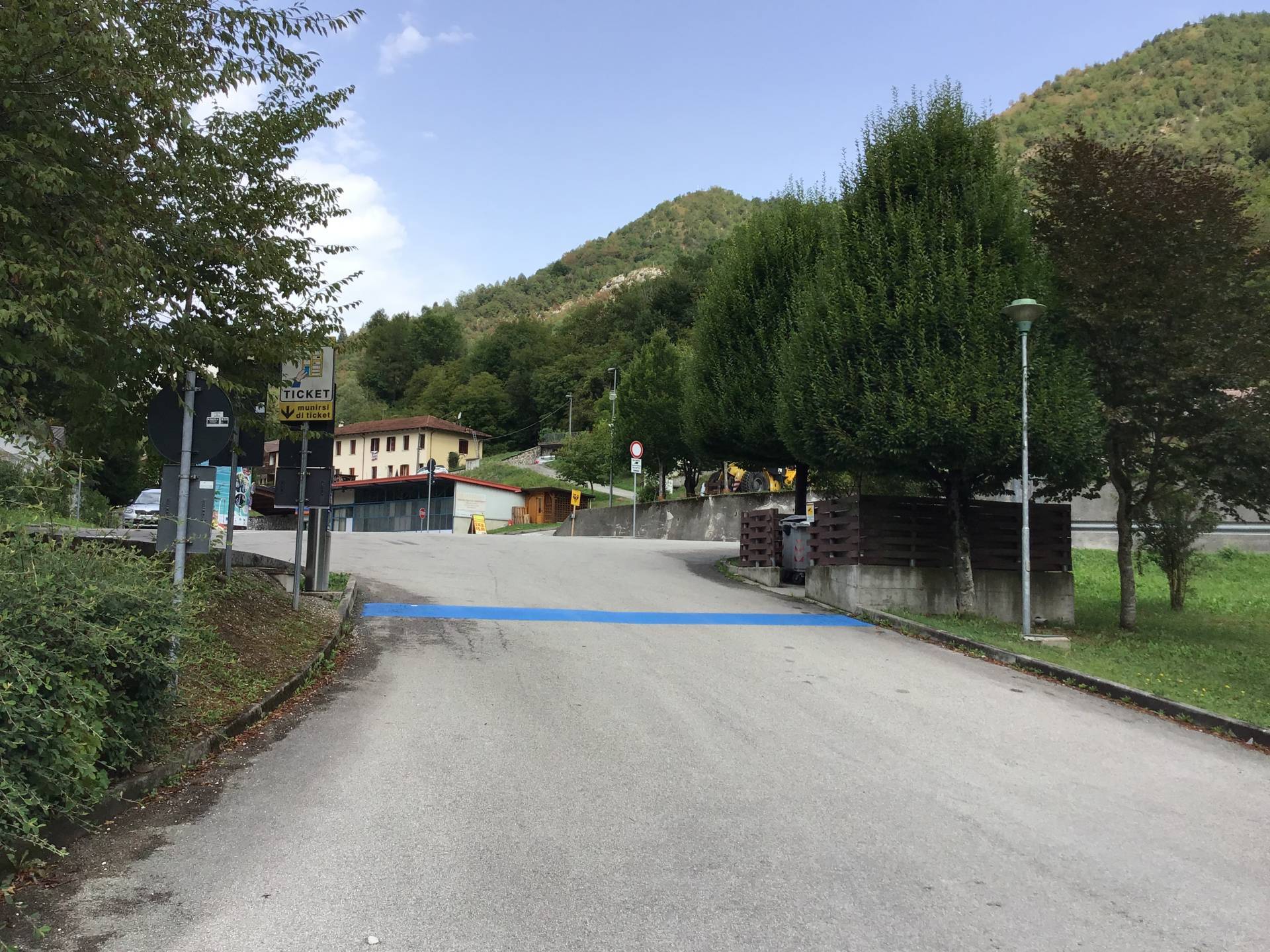
Photo 7 - Parking lot exit ramp
A large information board regarding Barcis is located at the beginning of the pavement, illustrating the main events of the site (Photographs 8-9). A short ramp is located after a few metres, which allows both a descent to the parking area leading to the cemetery, and to continue straight ahead by crossing the road.
In order to descend to the parking area (Photograph 10), it is necessary to walk along an approximately 9 metre-long section of paved road with a 10% slope. In the parking area, there is a parking space reserved for people with disability (Photograph 10).
Continuing straight ahead, however, the street is traversed, on a zebra crossing, at the junction. The itinerary on the pavement then resumes with a 1-centimetre threshold. Please note that a number of benches without backrests and armrests are located along this itinerary, allowing for a rest and a view of the lake.

Photo 8 - information panel

Photo 9 - left porphyry pavement
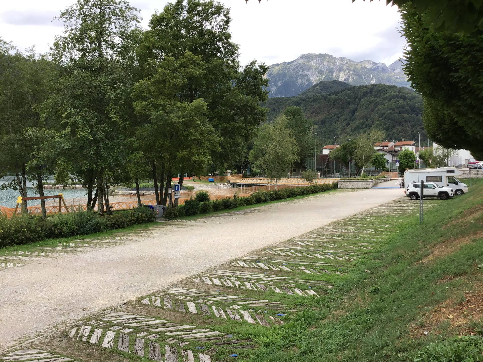
Photo 10 - parking area
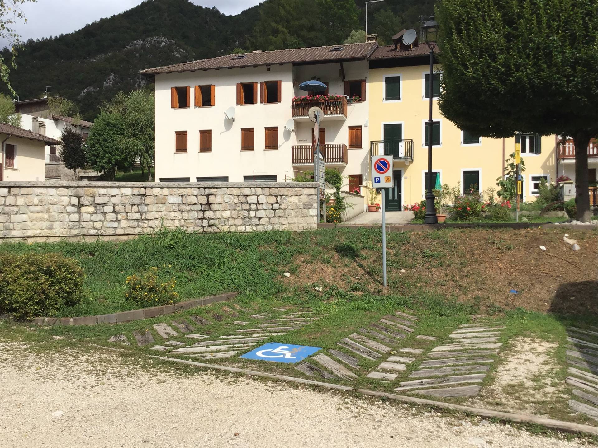
Photo 11 - stall reserved for people with disabilities
The crossing (Photograph 12) is identified with white horizontal stripes on a paved surface and connected to the porphyry pavement by two short downhill and uphill ramps. The pavement continues along Via Vittorio Veneto (Regional Road SR251) (Photograph 13) with the same characteristics as described previously (width, narrowing due to the presence of trees and benches, an even surface). Atong the itinerary, there is an information panel (beige surface and black lettering) that is very ruined and of poor legibility, with figurative representations of the elements of interest. The panel is inclined with respect to the vertical plane to favour better legibility (Photograph 18), however, it is not easily legible because it is installed in the opposite direction (towards the parking area and not towards the itinerary).
Photo 12 - pedestrian crossing

Photo 13 - porphyry pavement

Photo 14 - information panel
To the left of this stretch of pavement is another car park (Photograph 15), as mentioned above. A dedicated space is available for people with disability. There is also a pedestrian crossing on Via Vittorio Veneto, but this is not accessible as it is not levelled with the road surface (height difference of 8/10 centimetres). Please be advised that the short pavement on the right side of Via Vittorio Veneto (towards Via San Francesco) exhibits an uneven cobblestone surface.
The pavement continues with a crossing connected to the partly uneven road level, again on a porphyry surface and marked with the two different colours of porphyry (natural and white) until it reaches the car park of the Mountain Community of Western Friuli building (Photograph 16).
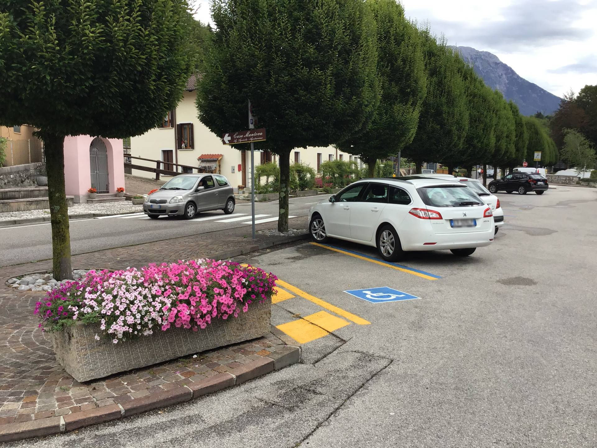
Photo 15 - parking view
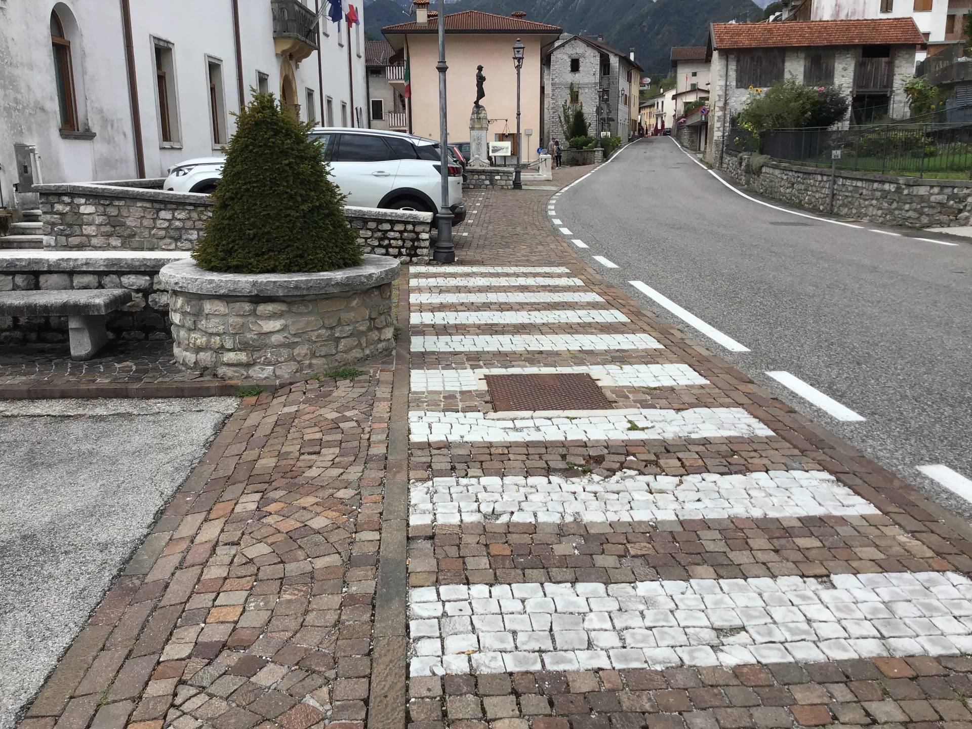
Photo 16 - pedestrian crossing on porphyry
The entrance to the headquarters of the Western Friuli Mountain Community building is inaccessible to people with mobility difficulties because there is a step measuring 15 centimetres (Photograph 17). Near the entrance, there is a parking space reserved for people with disability (Photograph 18). After narrowing down to 94 centimetres, the pavement becomes increasingly wider and continues until it reaches the pedestrian area in Via Fabio Filzi parallel to Via Vittorio Veneto (Photograph 19). Transit along Via Vittorio Veneto is not recommended because from this point onwards there is no pavement (Photograph 20) and it is necessary to continue for several stretches along the roadway.
The pedestrian area in Via Fabio Filzi has a width of 3.00 metres and a porphyry surface. It has a rainwater drainage grid in the initial part, in a direction perpendicular to the direction of travel, and in the final part a section approximately 45 metres in length with a slope of between 6% and 10%.
Continuing towards the Town Hall, the pavement narrows almost to the point of exhaustion, requiring the user to walk along the side of the road for a certain distance.
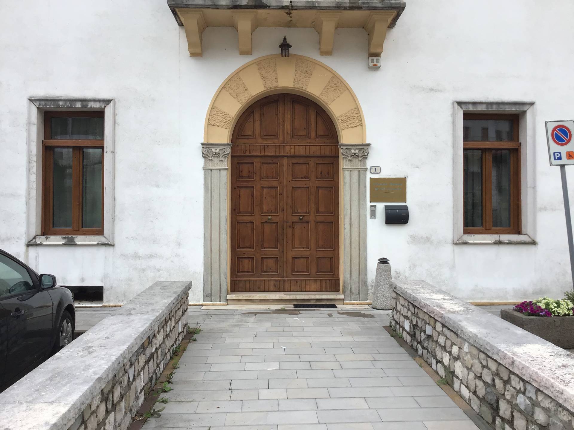
Photo 17 - Entrance headquarters Comunità Montana del Friuli Occidentale
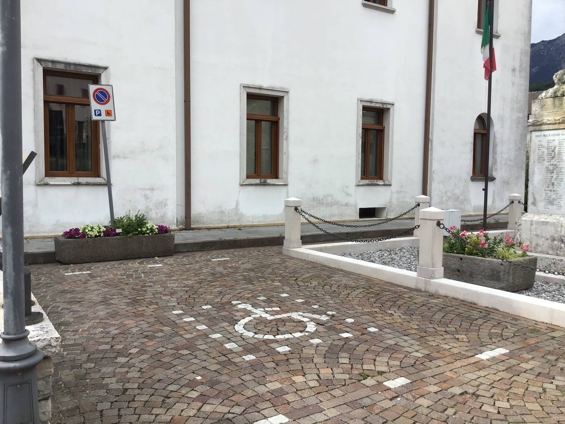
Photo 18 - stall reserved for people with disabilities

Photo 19 - pavement narrowing
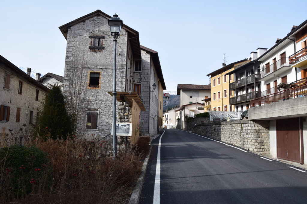
Photo 20 - absence of pavement
The Town Hall (Photograph 21) on the right-hand side of Via Vittorio Emanuele is accessible via three steps or a ramp in rectangular slabs of piasentina stone with a slope of 5%, width of 1.25 metres and length of 8 metres. The ramp does not have handrails or wheel stops. The pedestrian crossing (Photograph 22) of Via Vittorio Veneto (Regional Road SR251) is safe, level, with horizontal markings and connected to the road surface. The small square in front of the Town Hall is paved with light-coloured stone slabs with geometresc patterns and dark red stone.
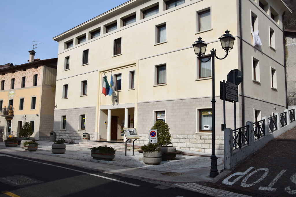
Photo 21 - town hall
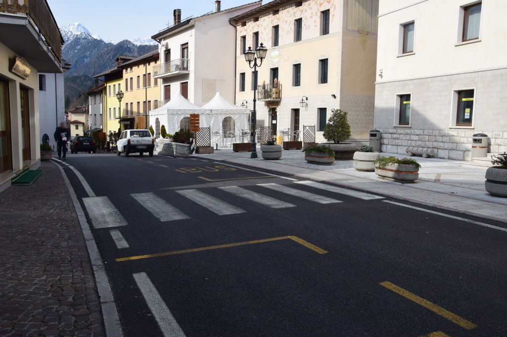
Photo 22 - pedestrian crossing
Continuing along the itinerary, however, inaccessible sections of the pavement are encountered because of the presence of obstacles (planters) and the layout of the building, which make it impossible to pass, except on the roadway. Continuing from Piazza Vittorio Emanuele II onwards, there is a 7% downhill section. Atong this section of the itinerary, there are shops (Photograph 23), access to which is, however, impeded for people with mobility disabilities, because they are elevated 30/40 centimetres above the level of the pavement and can only be accessed via steps of an average height of 15/20 centimetres. A little further on from the Town Hall square is a small square paved (Photograph 24) with porphyry cubes, which is level, with three semi-circular seats made of piasentina stone on cobblestone bases: it is an arena consisting of three tiers of steps and a tree in the centre, which includes an information board. It should be noted that there is a 30 km/h speed limit on this stretch of road, which, at least in part, should help to slow down vehicle traffic, although, in reality, this is not always the case.
Photo 22 - commercial activities
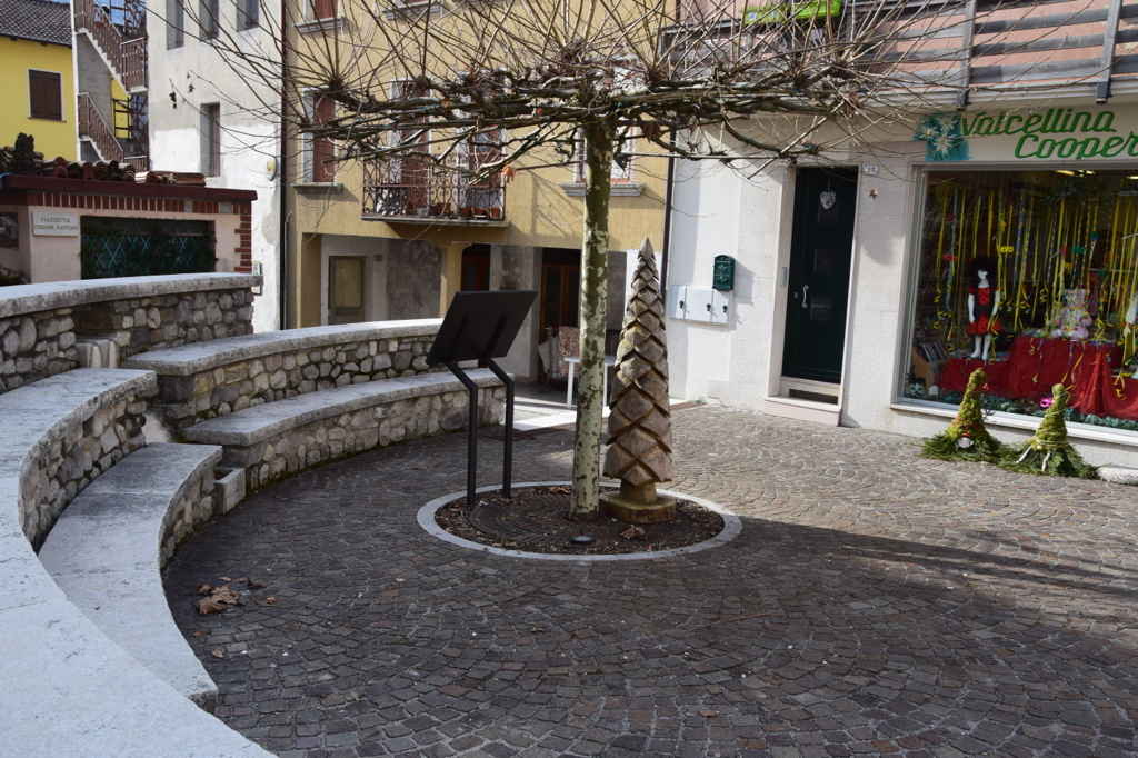
Photo 23 - paved square
Next, there is the pedestrian crossing of Cortile Nazario Sauro, which leads to the open space in front of the side entrance of the Church dedicated to Saint John the Baptist. The crossing is on the same level as the pavement on the side facing the Church, while the side facing the businesses presents a difference in height of between 2 and 6 centimetres (Photograph 24). The entrance to the Church is accessed by a pavement measuring 1.70 metres in width made of slabs of piasentina stone with a uniform surface, bordered from the roadway by steel posts and steel cable (Photograph 25). The first entrance visitors face is the side entrance, which can be reached via a short ramp with a width of 1.70 metres, a length of 1 metre and an upward slope of 20%.
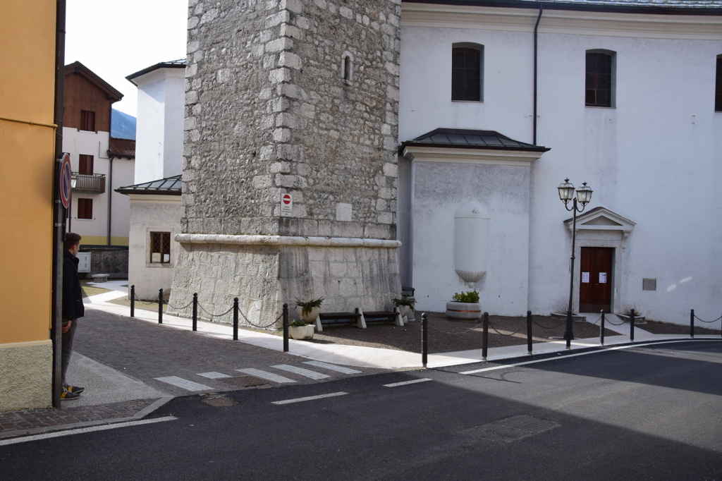
Photo 24 - pedestrian crossing

Photo 25 - side entrance to the church
In front of the secondary entrance to the Church, however, visitors are forced to get off the pavement and continue along the unsafe road, until they reach the wide open space in front of the main entrance to the Church dedicated to Saint John the Baptist. This entrance is inaccessible due to the presence of a staircase consisting of eight semi-circular steps (Photograph 26). A car park is located in front of the entrance on the other side of the street, with a parking space reserved for people with disability (Photograph 27). The pedestrian crossing at the car park is paved (white stripes), with a fairly regular and uniform surface but a downhill cross slope of 5%.

Photo 26 - Main access
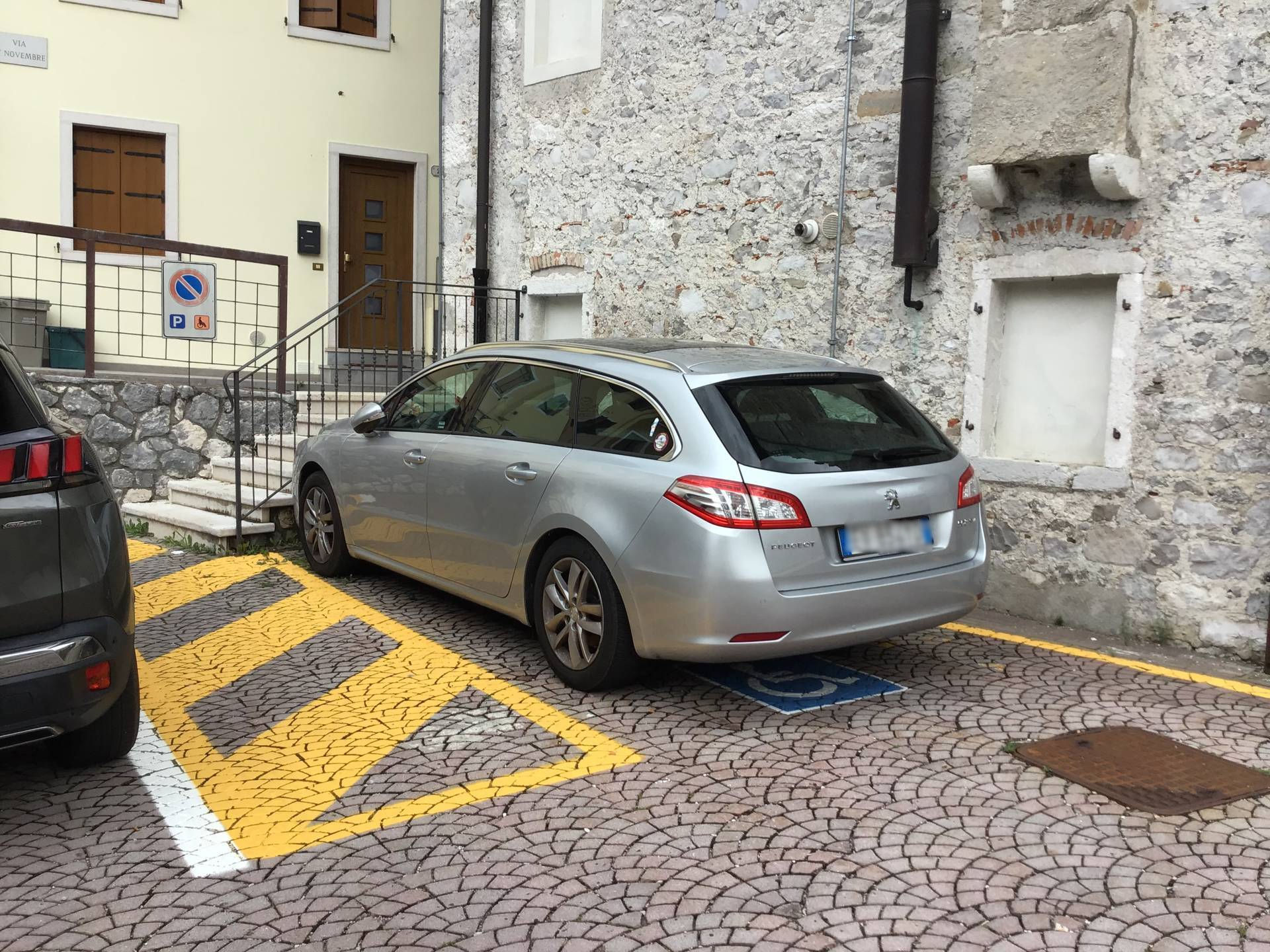
Photo 27 - stall reserved for people with disabilities
At this point, the route continues straight on SR251 or by turning left along Via Piave. Turning left, we reach Via Piave; the ground is even, paved in porphyry, and downhill with an average slope of 8%. The pavement is actually not accessible to persons with disabilities because it includes several steps downwards and is obstructed by planters and other elements serving the businesses in the area (this also results in difficulties in accessing these commercial activities). This means travelling on a section of roadway (which is surfaced with porphyry cubes). Beyond Cortile XI Febbraio, on the left, continue on Via Piave, towards Road Lungolago, always downhill, on a road surface of porphyry and without a pavement (Photographs 28-29-30). A metal grating for stormwater drainage is located at one point (Photograph 31).

Photo 28 - Road Lungolago
Photo 29 - Road Lungolago
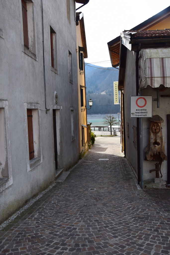
Photo 30 - Road Lungolago

Photo 31 Drainage gutter
The second section of Via Piave, after a long descent, is almost level, with a fairly regular porphyry cube ground, with white decorative geometresc patterns (Photograph 32). On the right-hand side, there is an area with trees and white concrete benches without backrests and armrests (Photographs 33-34) and shortly afterwards a car park and children's play area (Photograph 34). Access to the play area is difficult due to the presence of grass. The itinerary at this point continues along Via Piave on a paved road surface (Photograph 35), or alternatively along the pedestrian area on the lakeside, along Road Lungolago (Photograph 36).

Photo 32 - view of the square

Photo 33 - view of the square

Photo 34 - view of the square with seating
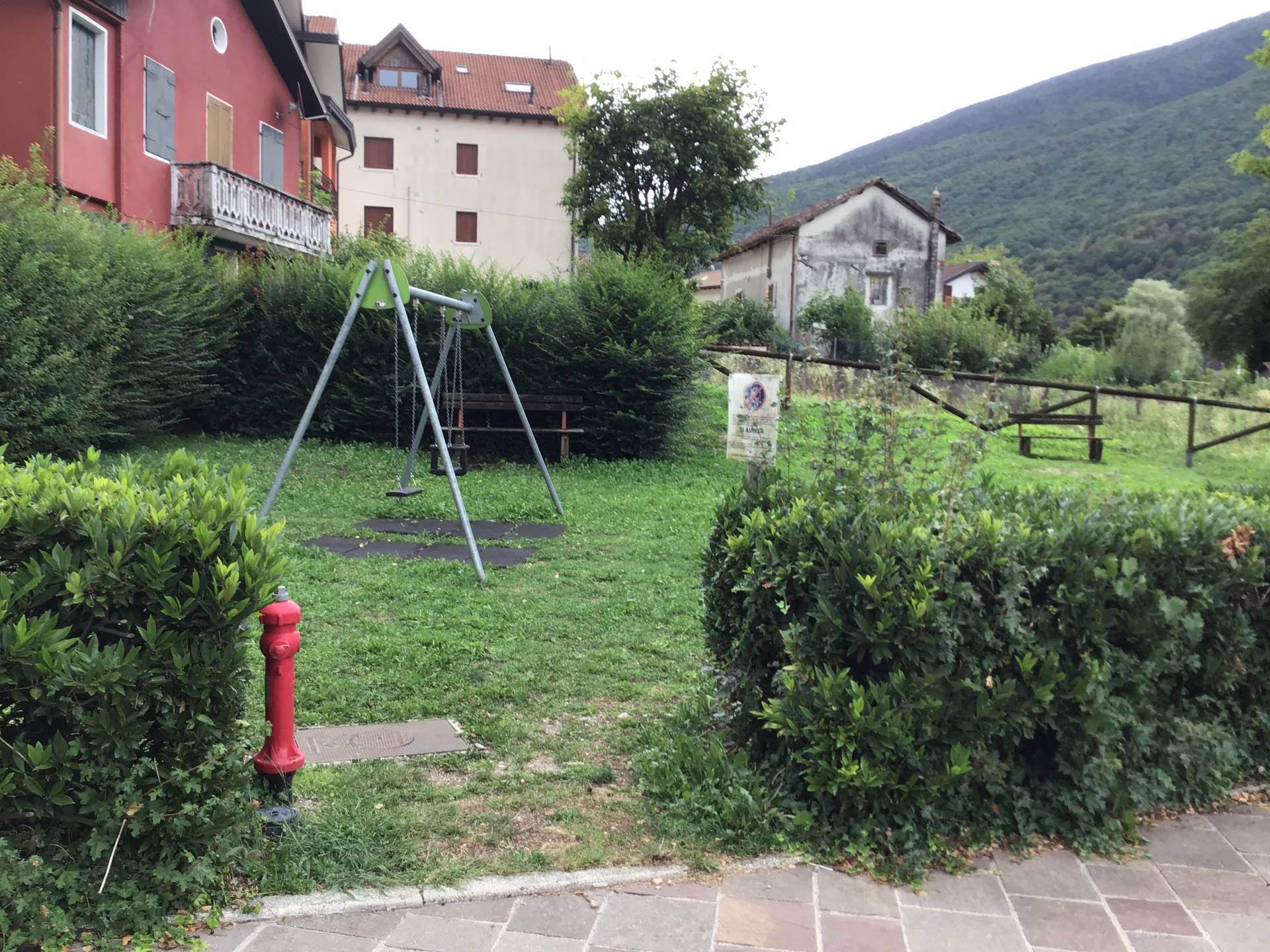
Photo 35 - play area

Photo 36 - Via Piave
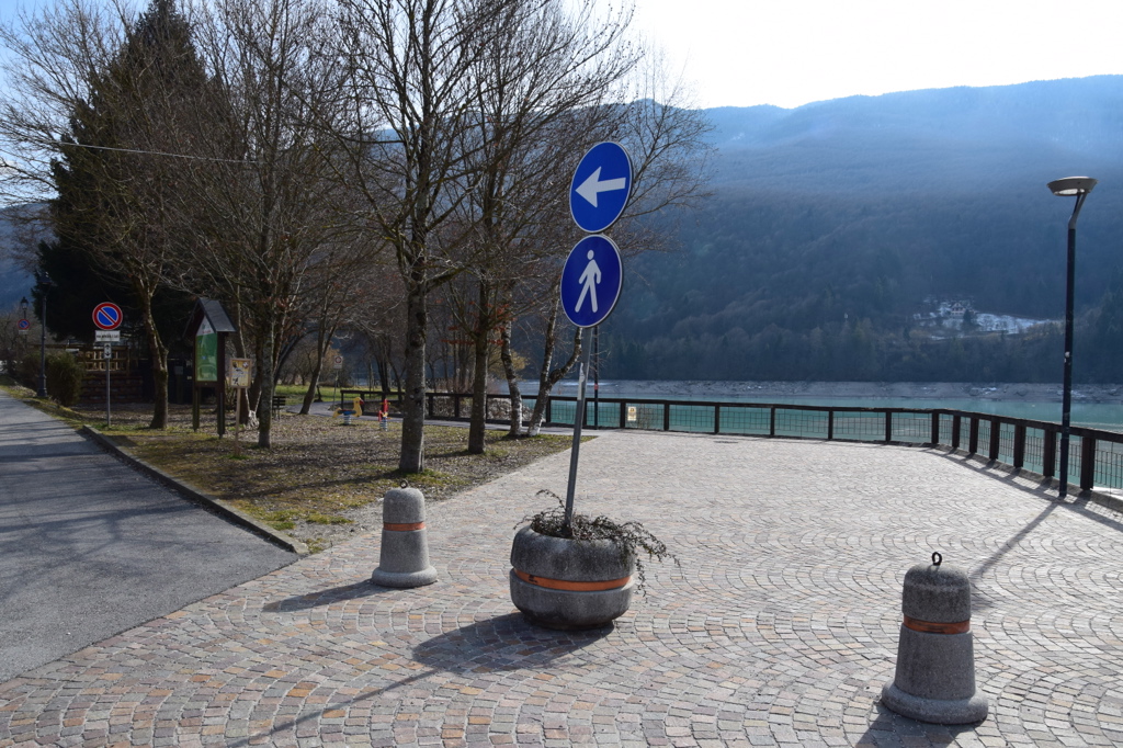
Photo 37 - strada Lungolago
Returning along Regional Road SR 251, past the car park on the right (as described previously) and the café on the left, the porphyry cube pavement at street level is interrupted and it is necessary to continue on a road with a high slope (Photograph 38). After about ten metres, continue -Piazzetta Umberto I- on the pavement on the left side, which is irregular in width due to the pre-existing buildings (Photograph 39). The surface is uniform, made of porphyry cubes, and has a slope of 5%. This slope is considered to be high considering the length of the itinerary. From street number 2 onwards, the width of the pavement is considered to be wide (approximately 1.50 metres). The pedestrian crossing (Photograph 40) here is not accessible due to the absence of connecting ramps with the street level. The pavement as described previously has a connecting ramp at the street level immediately before the pedestrian crossing. In this way, with a pavement height difference equal to 12 centimetres from street level, the crossing does not meet the requirements of accessibility. On the other side of the road is a paved strip, at the same level as the road, which is wide and with a fairly even surface that allows the automatic teller machine to be reached. This strip subsequently narrows to the point of stopping.
Returning to the left side of the road, the porphyry cube pavement continues with the same characteristics until it reaches Hotel Celis (Photograph 41). Here the path without barriers is interrupted. From this point onwards, on both sides, it is necessary to continue on the roadway, paying close attention to vehicle traffic (Photograph 42).

Photo 38 - roadway with high gradient
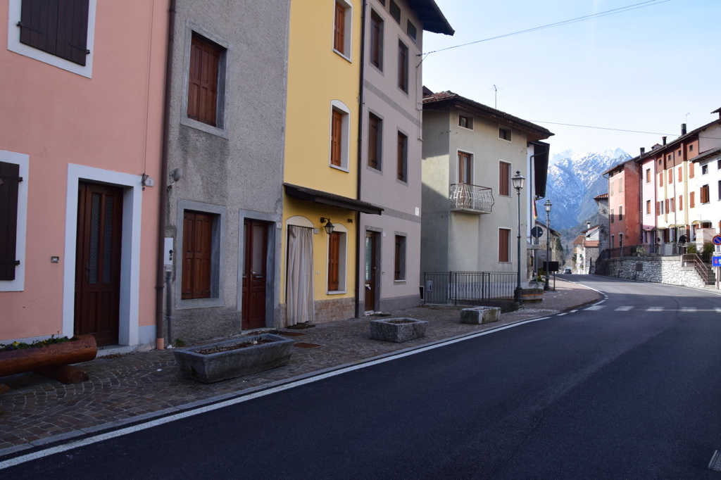
Photo 39 - left-hand pavement
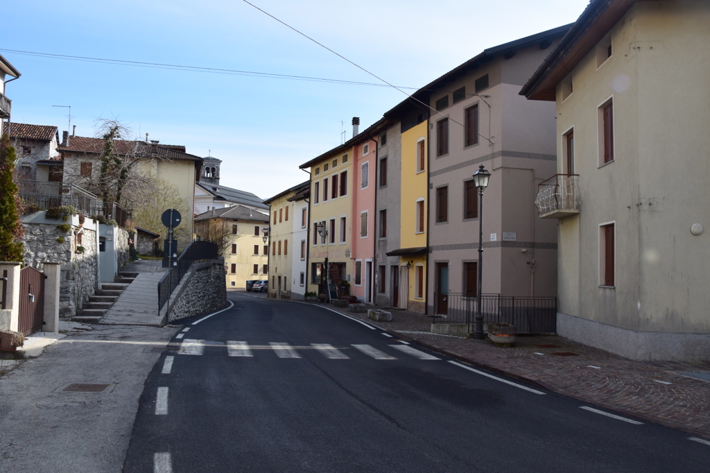
Photo 40 - Pedestrian Crossing on SR 251

Photo 41 - pavement near the hotel

Photo 42 - continuation on roadway
Shortly after Hotel Celis, on Via Dante, there is a pedestrian crossing (Photograph 43), white stripes on a paved surface, with a regular surface with level connections to the pedestrian itineraries. On the left-hand side of the road, the crossing is located in the vicinity of the roadside lay-bys. Between the lay-bys and the carriageway, there is a buffer strip that is useful for pedestrians, but without protection. This strip, at first wide, subsequently narrows down to approximately 60-70 centimetres. On the right-hand side, on the other hand, the pedestrian crossing is located at the beginning of the short connecting ramp between the road surface and the pavement, made of concrete, with a width of 70 centimetres, and a uniform surface, except for the ramp (and therefore the relative ascent onto the pavement), which has a rough and irregular surface. The pavement on the right-hand side has some protections from the roadway at the accesses to the houses (steps) or pedestrian crossings: these are elements consisting of tubular steel posts approximately 1.20 metres in height and the same width, painted in red and white stripes, which are barely visible (Photograph 44). The next pedestrian crossing is in the same condition as the previous one: white stripes, regular and uniform surface asphalt and ends on the right-hand side at the descent ramp from the concrete pavement, regular and uniform surface. The pavement on the right-hand side, therefore, stops at this point, while on the left-hand side, the strip of asphalt protecting the parking spaces ends about twenty metres later. Therefore, it is necessary to proceed on the road for about twenty metres until reaching the left turn towards Road Lungolago, at the itinerary for pedestrians and cyclists that runs along the lakeshore. In this section, there is a bump in the road surface approximately 20 centimetres wide and 2 centimetres deep, all along the road, which makes it difficult to pass (Photograph 45).

Photo 43 - pedestrian crossing

Photo 44 - tubular posts on right pavement
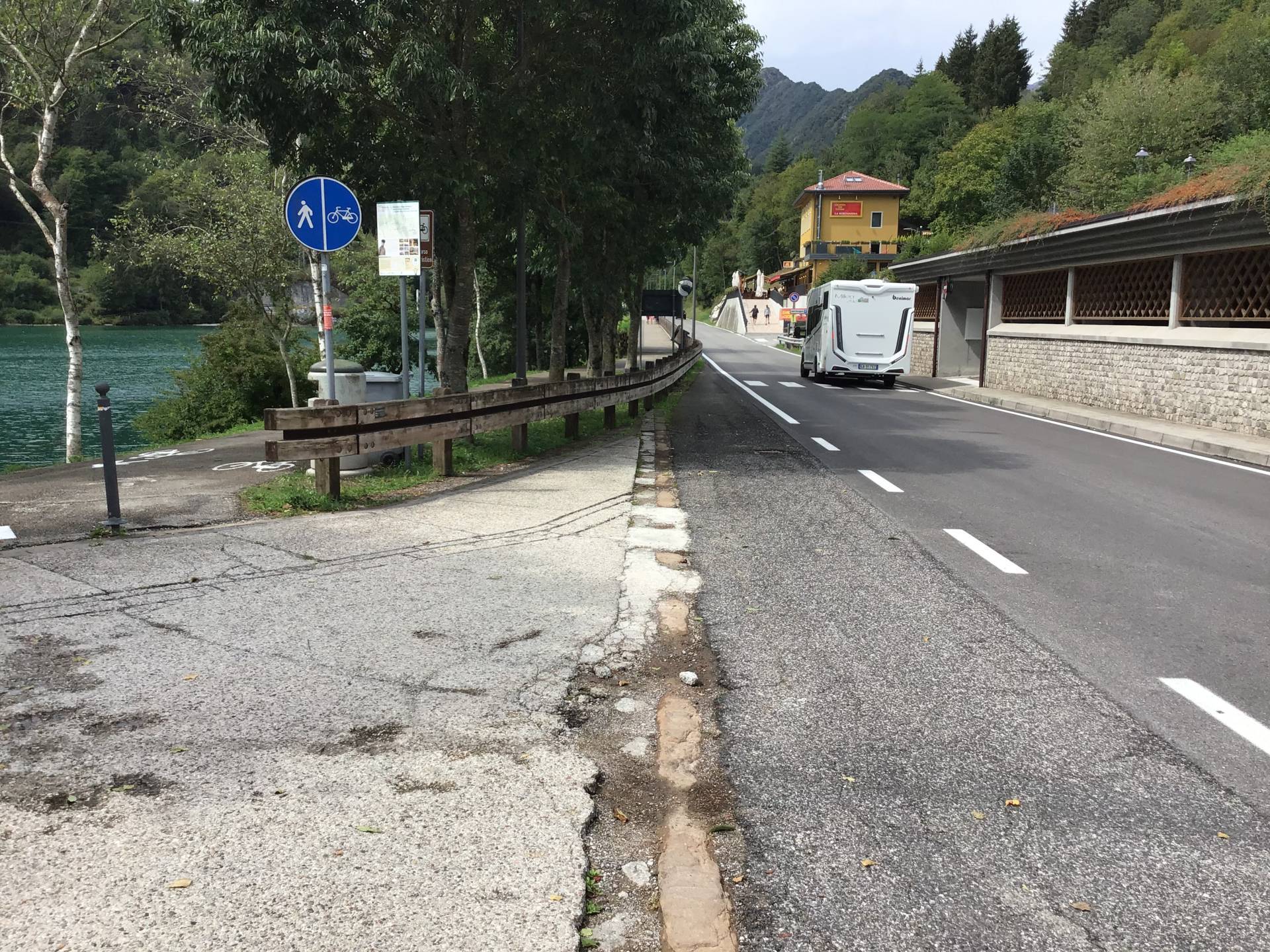
Photo 45 - cycle-pedestrian itinerary
The Lakeside Road follows the shore of the Lake and features, towards the west, a broad width of approximately 3.00 metres, a regular and even surface in asphalt and then in wooden planking arranged perpendicular to the direction of travel, protected from the roadway by a stretch of trees and guard-rails in steel and wood, and towards the lake by the shore of the lake itself or by a wooden parapet. It is reserved exclusively for both pedestrians and cyclists alike (Photograph 46). Information panels are located along the route, with an average height of 1.20 metres, dimensions of approximately 60x80 centimetres, a clear background with black lettering of good legibility, complete with an expanded map with the specifications of the main points of interest along the route (Photograph 58).

Photo 46 - cycle-pedestrian itinerary
To the east the surface is paved, very wide, going downhill. On the left side of the path, there is a concrete pavement, which is raised above the road surface by 13 cm and not connected to it, and whose path is also obstructed by the presence of concrete benches (Photograph 47). On the left, the path along the lakeshore is protected by a concrete kerb on which a wooden and steel parapet is mounted. On the right, close to the parapet, there is a delimitation to mark the presence of the pavement, consisting of two strips of level kerb markers: this delimitation is barely noticeable from a visual point of view, maintaining the same pavement characteristics as the roadway. The route continues with a steep downhill slope of 11% for about fifteen metres, then continues on level ground (Photographs 48-49) An information board is located just before the steep descent (like the one described previously in the initial section of the route) which provides information on the main events taking place in Barcis during the year. Subsequently, the asphalt paving is interrupted and turns into porphyry cubes; the transition is made by a short concrete connecting ramp that overcomes the 15 centimetres difference in height. At the same time, the pavement on the left becomes much wider, made of stone blocks, at the level of the porphyry cube pavement. The pavement crosses a green area with seats and trees, while the porphyry cube path continues flanked by the large curved concrete seat as described previously (Photograph 50). Both routes then converge in the small square formed by the crossing of Via Piave. A large circular stone staircase, like an arena, is located here, with three central steps and two side staircases consisting of approximately twenty steps. The staircase on the right has black-painted tubular steel handrails (Photograph 51). To the right is a stage with a spherical structure, possibly supporting a roof in case of bad weather, also made of dark grey tubular steel.
Photo 47 - Concrete benches

Photo 48 - Ramp with high slope
Photo 49 - Itinerary to the Square

Photo 50 - Concrete bench
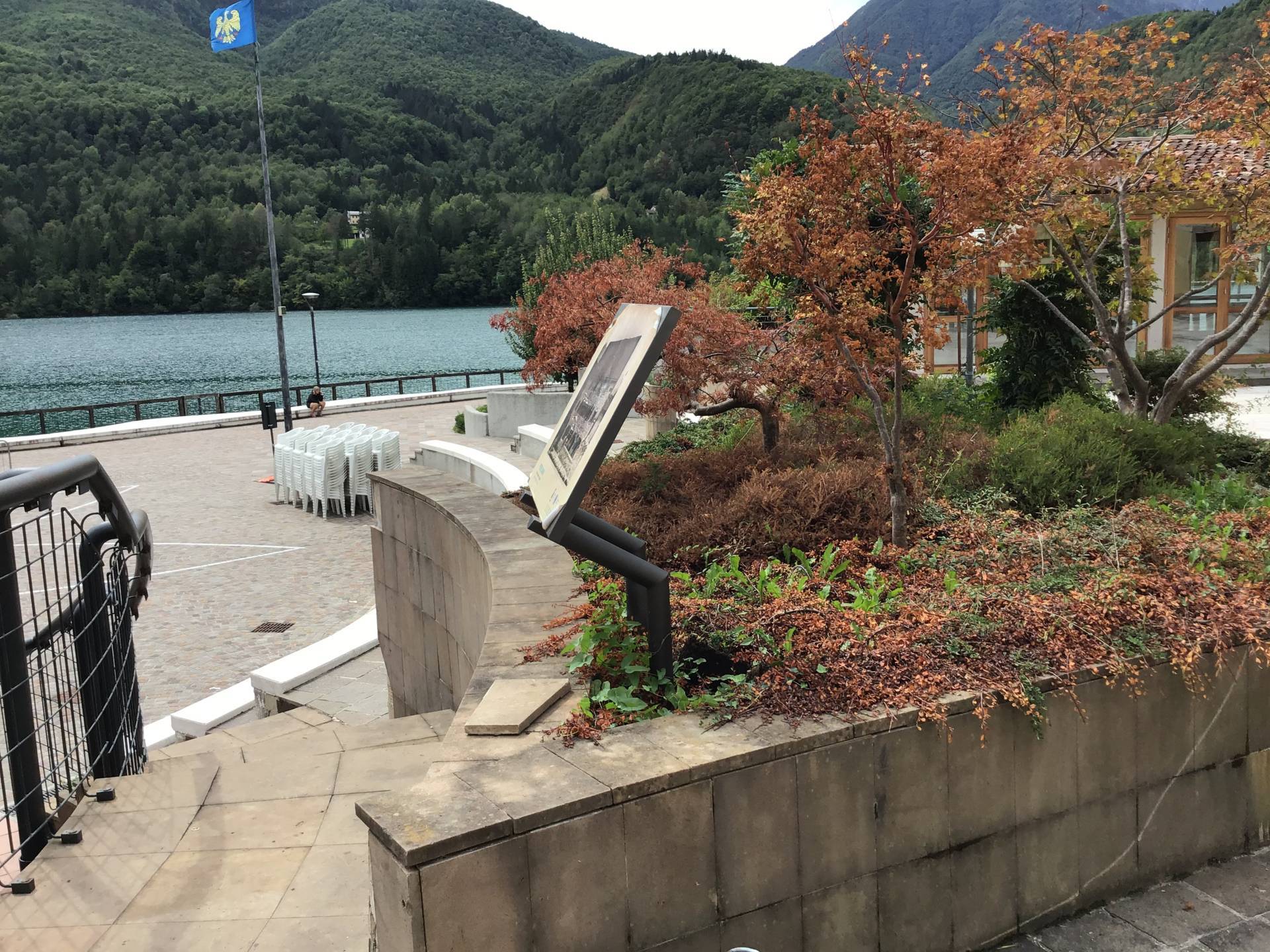
Photo 51 - square staircase with tubular
At the top of the steps, there is a square and Mocenigo Centi Palace, the former residence of the Counts Mocenigo, now the site of the tourist office (Photograph 52) and the library. Information panels with indications of features of interest are also present here, with a light background written in black, inclined from the vertical (as described previously). The tourist office is difficult to access considering the 7 centimetres high entrance threshold (Photograph 53). The itinerary to access it includes crossing the area in front of the building. The paving is first in porphyry cubes and later in stone slabs, quite regular and uniform, while the portico of Palazzo Mocenigo Conti is paved in stone blocks with a slightly irregular surface due to wear.

Photo 52 - Palazzo Mocenigo Centi
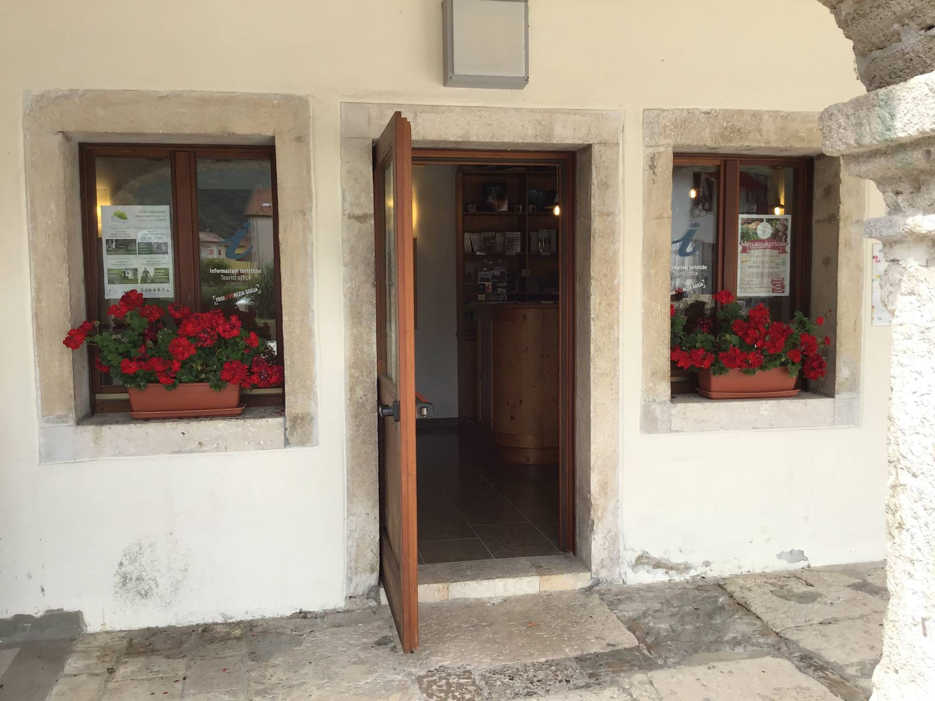
Photo 53 - tourist office
This square can also be reached from the road parallel to Via Piave that starts from Via Roma - Largo Deputato Paron Celli. This route is paved with porphyry cubes, a regular and even surface, and it has a steep downhill slope for about twenty metres (Photographs 54-55). At the end of the descent is a stormwater drainage channel and then the level section of the square.

Photo 54 - itinerary with gutter

Photo 55 - porphyry itinerary
Returning to the main route from the square, Lungolago Road is now exclusively for pedestrians and features a wide, level surface with various types of surfaces. First in porphyry cubes (Photograph 56), then in concrete and lastly in wood-like plastic planking installed perpendicular to the direction of travel, with a width of 1.80 metres (Photographs 57-58). On the right side, towards the lake, there is a steel and wood parapet on a concrete curb that stops after a few metres, while on the left side, there is a strip lined with trees. The itinerary is equipped with lighting poles. Further on, a wooden pontoon overlooking the lake is located on the right (Photograph 59), which is floored with wooden planking arranged perpendicularly to the direction of travel, 1.20 metres in width, and fitted with a wooden parapet on both sides (Photograph 60). Shortly afterwards there is a large platform (approximately 4.00 x 9.00 metres), also with wooden floorboards, but without a parapet (Photographs 61-62). At the time of the inspection, access to the premises was closed for restoration work.
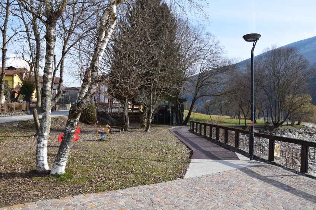
Photo 56 - porphyry itinerary

Photo 57 - itinerary on plastic planking

Photo 58 - itinerary on plastic planking
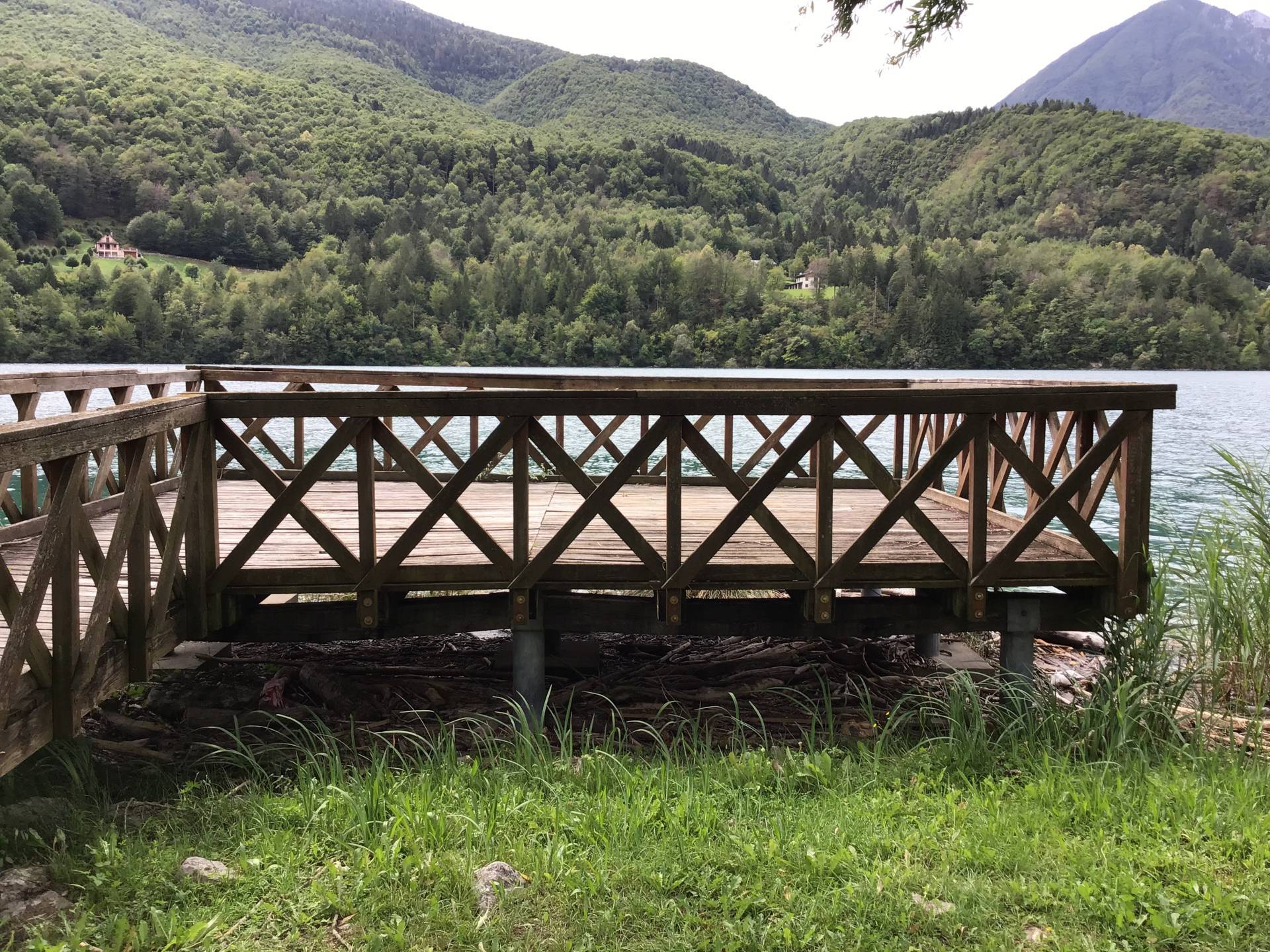
Photo 59 - wooden jetty

Photo 60 - jetty not accessible
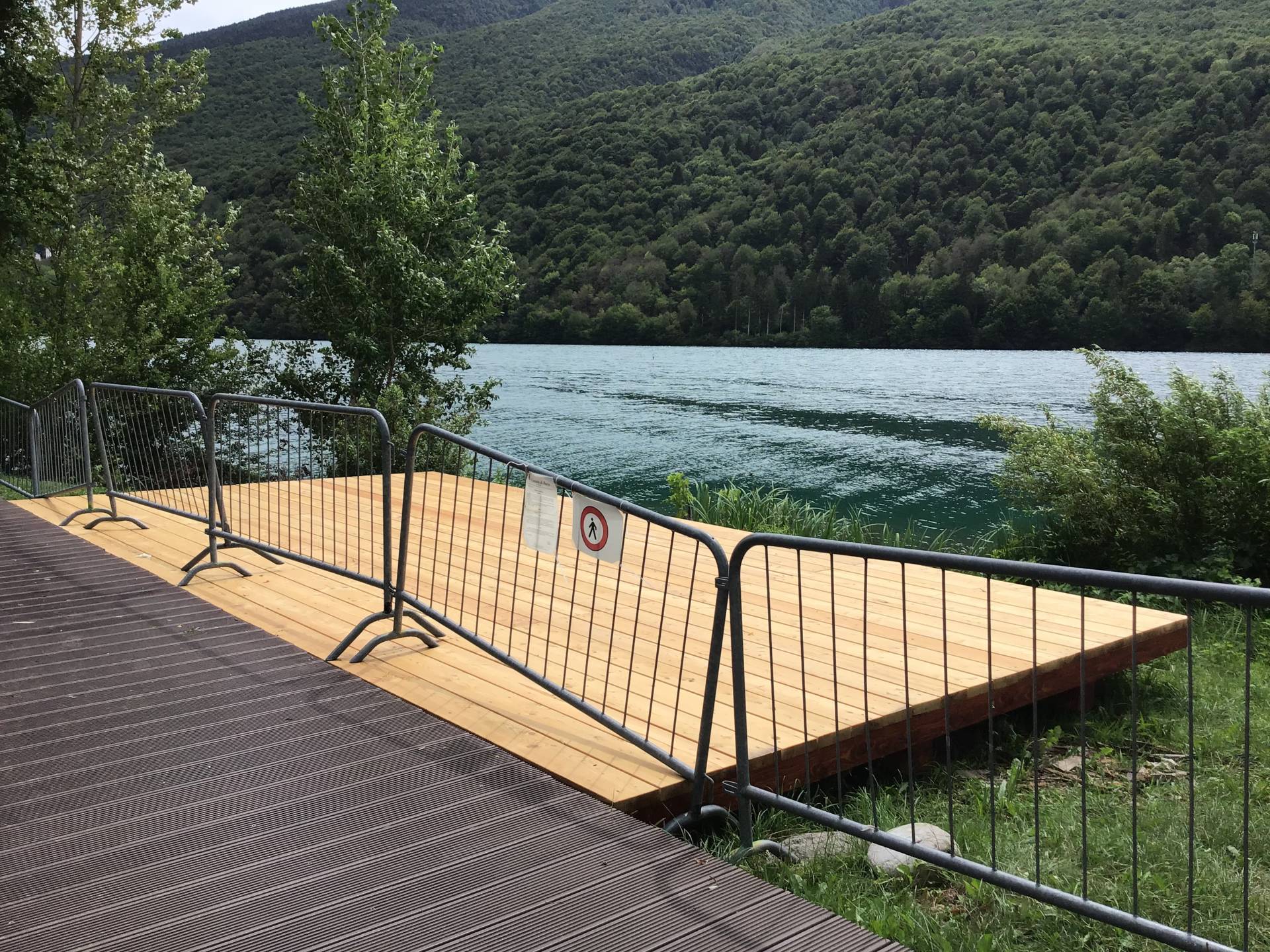
Photo 61 - Wooden footboard
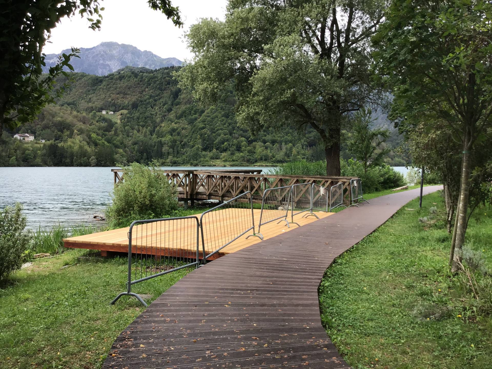
Photo 62 - Wooden footboard
Moving forward, there is a small bridge (Photographs 63-64-65-66) with a downhill slope of 15% for about ten metres, then uphill with the same slope for about 7 metres and finally a stretch of about ten metres with a slope of 9%.
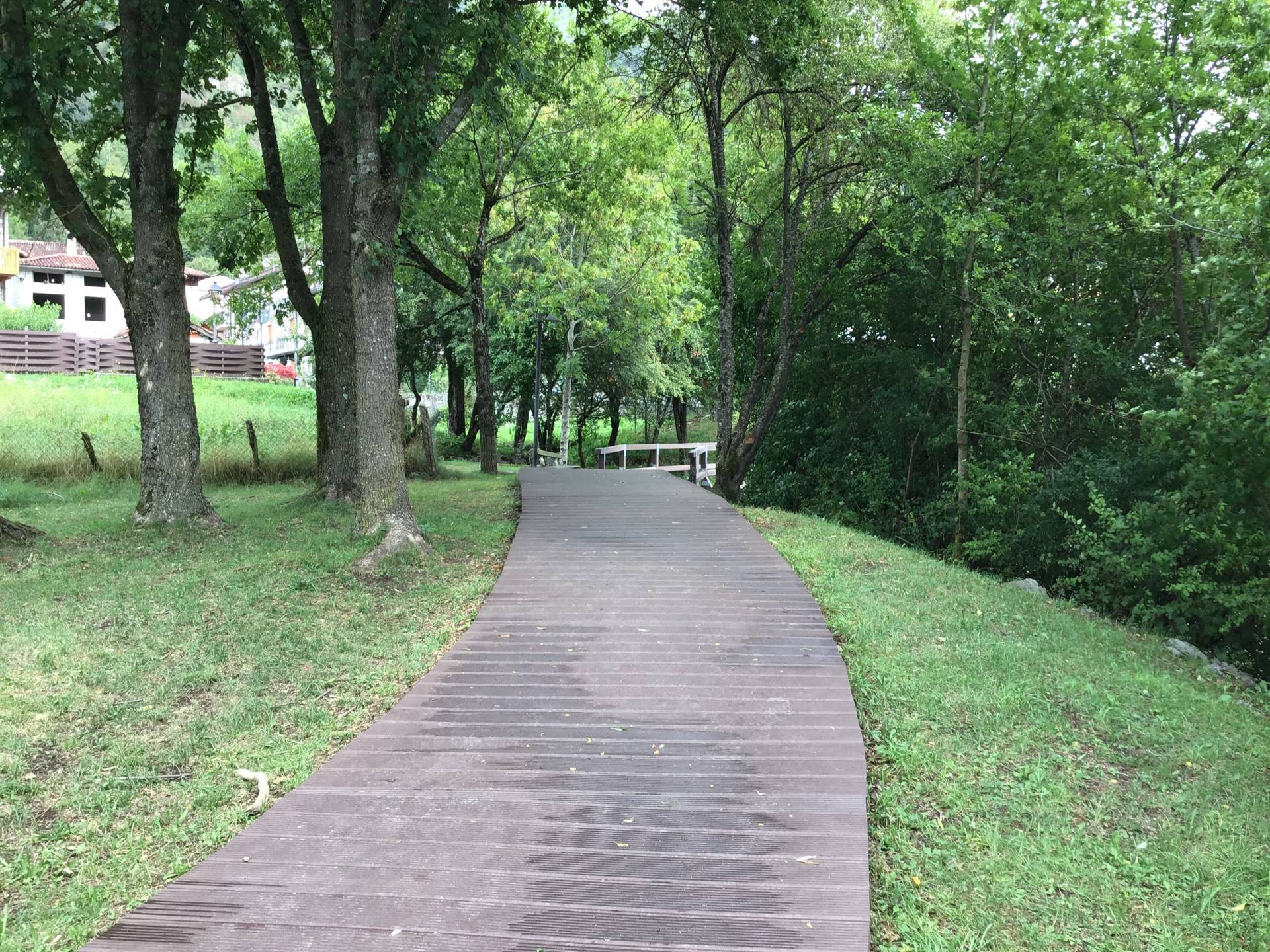
Photo 63 - Pathway on plastic material planking
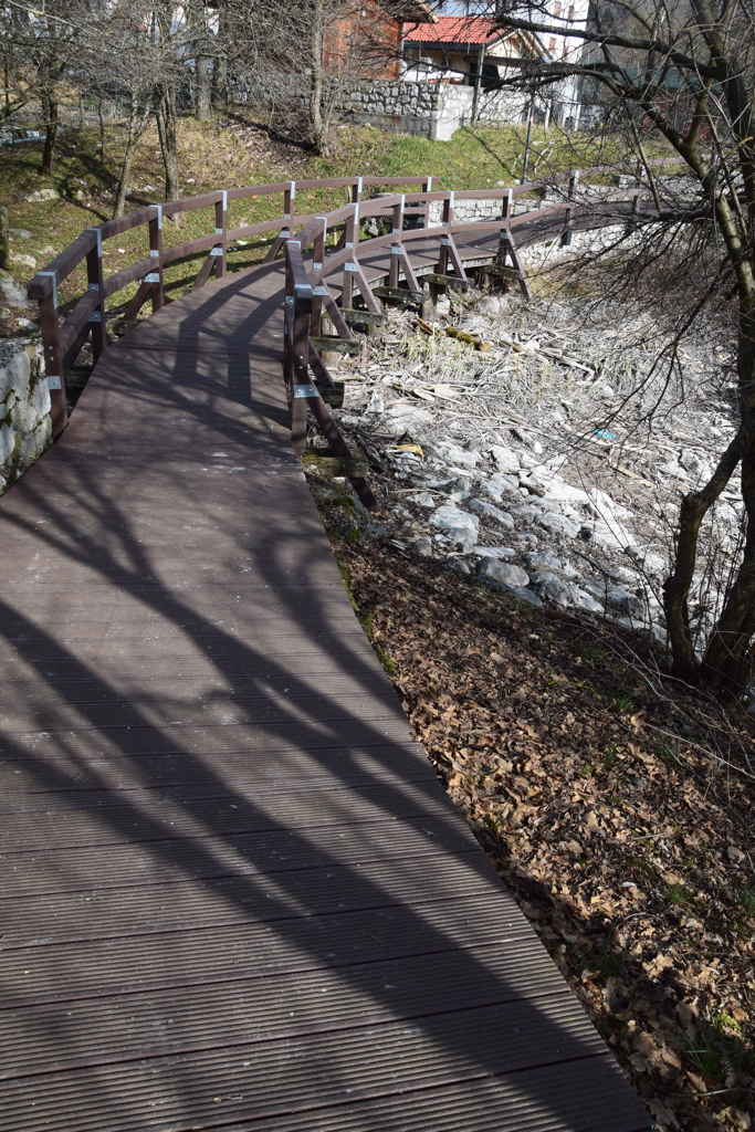
Photo 64 - downhill itinerary

Photo 65 - downhill itinerary

Photo 66 - uphill itinerary
The itinerary continues with the same characteristics as described previously, until it re-joins the paved part of Via Piave, with a ramp of approximately 10.00 metres in length and a slope of 13% (Photograph 67). The itinerary continues on the road, with no pavement, and is level. On the left, behind the playing fields, there is a parking area (Photograph 68). Subsequently, there is an itinerary exclusively for pedestrians, which is wide (over 3.00 metres) on the right-hand side of the road, protected on the right-hand side by a wooden fence and on the left-hand side by a steel railing. The itinerary is paved with wooden planking and at the time of the inspection, access was prohibited due to work being completed (Photographs 69-70). Further along, the itinerary is interrupted by a series of stone steps, making it inaccessible (Photograph 71). Turning back, the visitor is then forced to continue along the paved road until reaching the initial parking area; alternatively, from the steps described previously, additional steps lead to the itinerary along the lake shore below ( which is also connected by other steps) (Photograph 72), which reaches the large parking and rest area as described at the beginning. This itinerary is paved like the previous one (planking), 1.80 metres in width with a wooden fence on the right side and wooden benches on the left side, but it is inaccessible due to the presence of the stairs (Photograph 73).
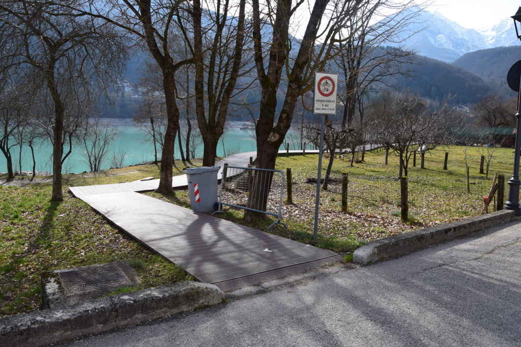
Photo 67 - Route to the intersection with Piave Street
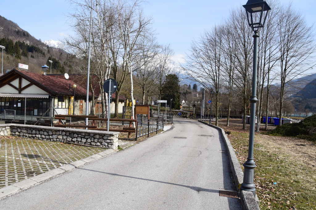
Photo 68 - asphalt itinerary
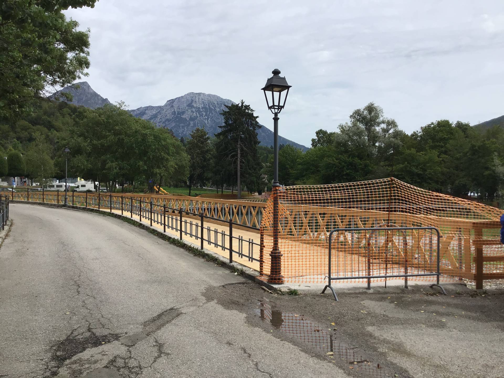
Photo 69 - wooden bridge

Photo 70 - itinerary on wooden planking
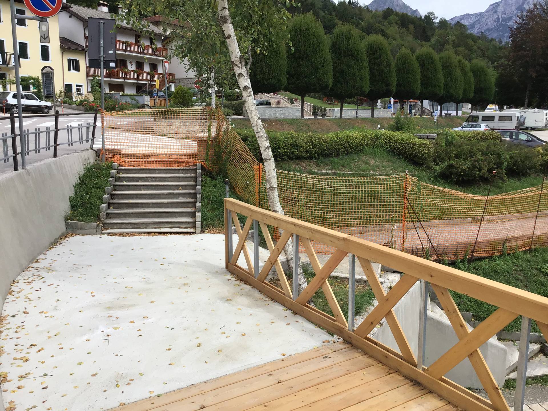
Photo 71 - staircase

Photo 72 - lungolago itinerary on wooden planking
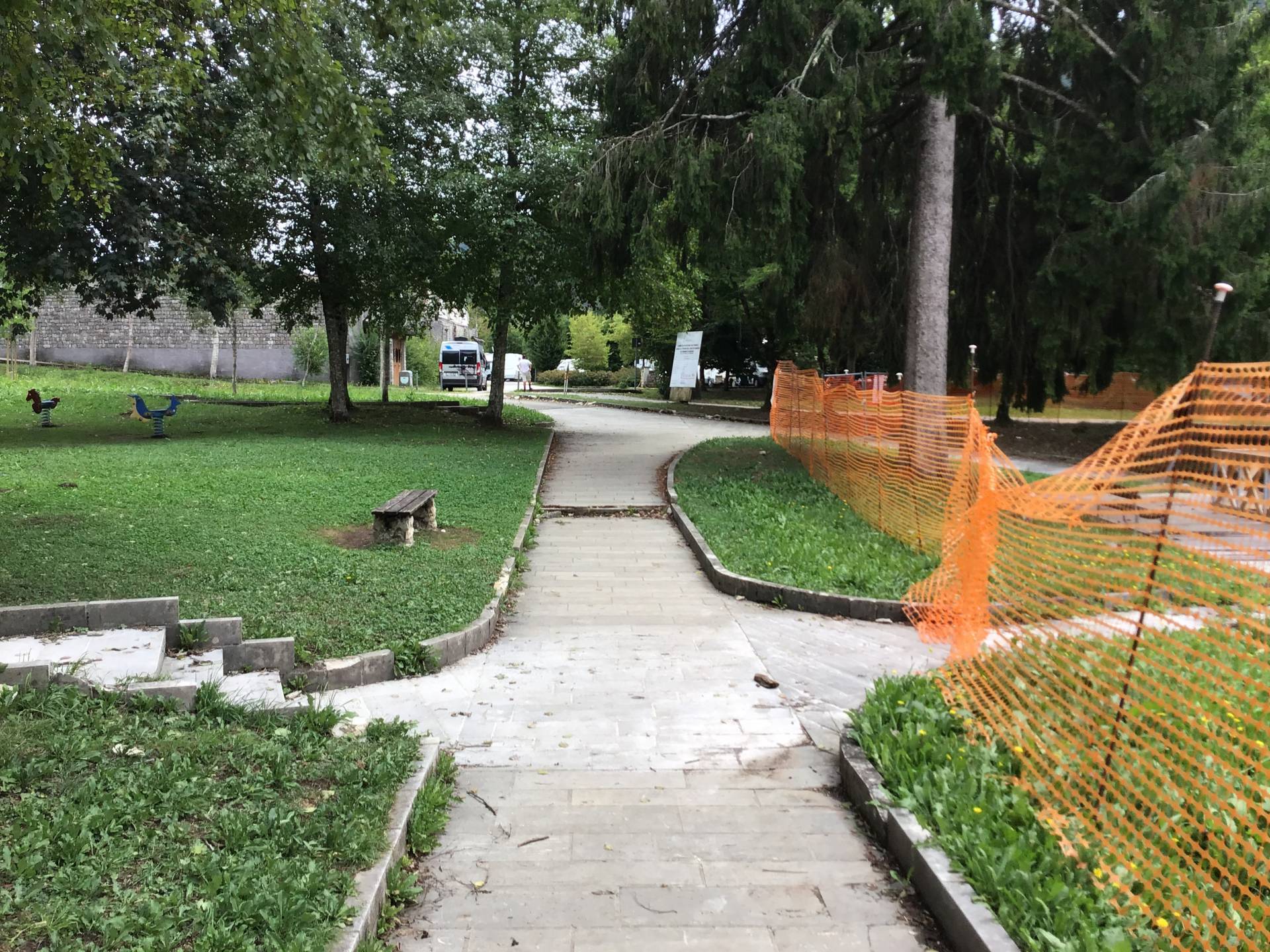
Photo 73 - stone itinerary with benches
Continuing the itinerary along the lake, visitors return to the initial parking area using an area with coarse gravel and packed earth paving, mostly on level ground (Photographs 88-89-90).

Photo 74 - itinerary on coarse gravel
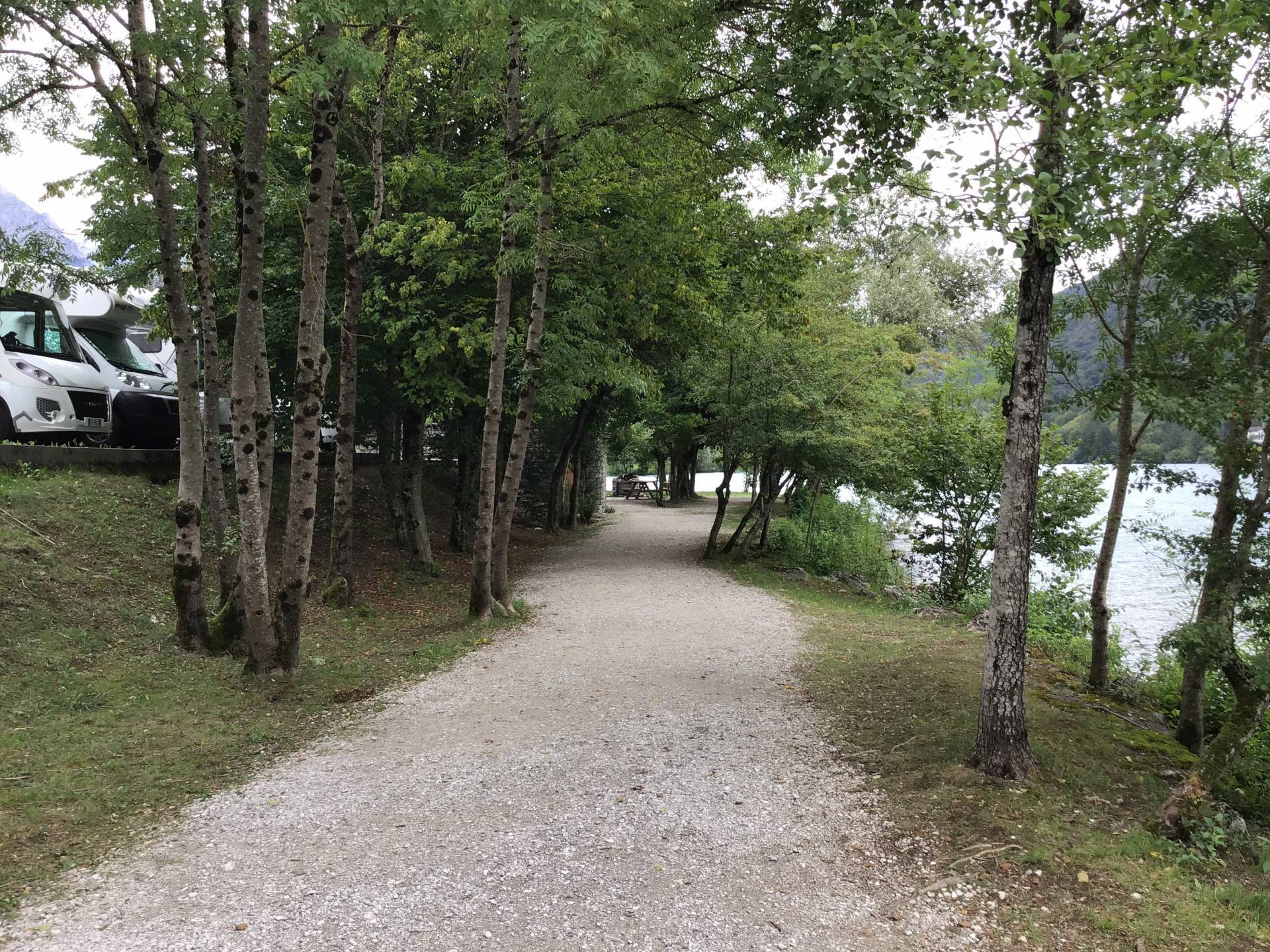
Photo 75 - itinerary on coarse gravel

Photo 76 - final stretch towards the car park
1.9
/3
ENTRANCE
%20(FILEminimizer).jpeg)
Ingresso
Entrance typology
TYPE:
MainACCESSIBLE:
NoTIPO:
PrincipaleHeight difference (> 2.5 cm)
PRESENT:
YesDISLEVEL:
-
TYPE:
Short staircase/stepUNIVOCAL CODE:
SB1SHORT STAIRCASE (LESS THAN ONE FLOOR):
WIDTH (CM):
93NUMBER OF STEPS:
1HEIGHT OF INDIVIDUAL RISER (CM):
13CORRIMANO:
PRESENT:
NoINTERMEDIATE LANDING:
NoTACTILE-PLANTAR PATHS:
No
Threshold (< 2.5 cm)
PRESENT:
No/LevelEntrance door
TYPE:
Single leafOPENING:
InsideAUTOMATED OPENING:
NoNET DOOR CLEARANCE:
Single or sliding doorMEASURE (CM):
93DOOR AND BACK DOOR COPLANARITY (NOT ASSESSED HEIGHT DIFFERENCE UP TO 2.5 CM):
NoZERBINI/CARPETS:
PRESENTS:
NoINTERCOM/BELL:
PRESENT:
NoGlass doors: window decals to indicate their presence
PRESENTS:
NoGeneral note
COMPARTMENT
Compartment name
TYPE:
Generic, of the structureIDENTIFIER:
V1Door
ACCESS:
NoneDimensions
ROTATION DIAMETER 140 CM:
NoPREVAILING CLEAR WIDTH:
> 75 cmPaving
TYPE:
TilesColour contrast floors/walls
TYPE:
NoFLOOR COLOUR:
BeigeWALL COLOUR:
ClearSignage
TACTILE-PLANTAR PATHS:
NoTOUCH MAP:
NoINFORMATION SIGNAGE:
NoFurniture
COUNTER:
-
HEIGHT:
UniqueGROUND CLEARANCE (CM):
120EMPTY UNDER:
No
1.9
/3
ENTRANCE
%20(FILEminimizer)_MOD%20(FILEminimizer).jpg)
Ingresso
Entrance typology
TYPE:
MainACCESSIBLE:
NoTIPO:
PrincipaleHeight difference (> 2.5 cm)
PRESENT:
YesDISLEVEL:
-
TYPE:
Short staircase/stepUNIVOCAL CODE:
SB1SHORT STAIRCASE (LESS THAN ONE FLOOR):
NUMBER OF STEPS:
1HEIGHT OF INDIVIDUAL RISER (CM):
13CORRIMANO:
PRESENT:
NoINTERMEDIATE LANDING:
NoTACTILE-PLANTAR PATHS:
No
Threshold (< 2.5 cm)
PRESENT:
YesHEIGHT:
2.5Entrance door
TYPE:
Single leafOPENING:
InsideAUTOMATED OPENING:
NoNET DOOR CLEARANCE:
Single or sliding doorMEASURE (CM):
80DOOR AND BACK DOOR COPLANARITY (NOT ASSESSED HEIGHT DIFFERENCE UP TO 2.5 CM):
NoZERBINI/CARPETS:
PRESENTS:
NoINTERCOM/BELL:
PRESENT:
NoGlass doors: window decals to indicate their presence
PRESENTS:
NoGeneral note
COMPARTMENT
Compartment name
TYPE:
Generic, of the structureIDENTIFIER:
V1Door
ACCESS:
NoneDimensions
ROTATION DIAMETER 140 CM:
YesPREVAILING CLEAR WIDTH:
> 75 cmPaving
TYPE:
TilesColour contrast floors/walls
TYPE:
YesFLOOR COLOUR:
GreyWALL COLOUR:
MixedSignage
TACTILE-PLANTAR PATHS:
NoTOUCH MAP:
NoINFORMATION SIGNAGE:
No-
/3
ATM COUNTER
%20(FILEminimizer).jpeg)
Sportello bancomat
ATM counter Type
TYPE:
OutdoorTIPO:
EsternoUser workstation
TYPE:
On a private area with a slopeDISLEVEL:
-
TYPE:
Short staircase/stepUNIVOCAL CODE:
SB1SHORT STAIRCASE (LESS THAN ONE FLOOR):
WIDTH (CM):
280NUMBER OF STEPS:
2HEIGHT OF INDIVIDUAL RISER (CM):
18CORRIMANO:
PRESENT:
NoSTEP:
TYPE:
Colour contrastINTERMEDIATE LANDING:
NoTACTILE-PLANTAR PATHS:
No
Shelter
PRESENT:
YesTYPE:
CanopyWheelchair approach
TYPE:
ImpossibleAverage device height
GROUND CLEARANCE (CM):
130Facilities
TYPE:
Touch screen, Audio channel2.5
/3
ENTRANCE
_MOD%20(FILEminimizer).jpg)
Ingresso
Entrance typology
TYPE:
MainACCESSIBLE:
YesTIPO:
PrincipaleHeight difference (> 2.5 cm)
PRESENT:
NoThreshold (< 2.5 cm)
PRESENT:
YesHEIGHT:
2.5Entrance door
TYPE:
Single leafOPENING:
InsideAUTOMATED OPENING:
NoNET DOOR CLEARANCE:
Single or sliding doorMEASURE (CM):
70DOOR AND BACK DOOR COPLANARITY (NOT ASSESSED HEIGHT DIFFERENCE UP TO 2.5 CM):
YesZERBINI/CARPETS:
PRESENTS:
YesTYPE:
Satin doormatTYPE:
CompactINTERCOM/BELL:
PRESENT:
NoGlass doors: window decals to indicate their presence
PRESENTS:
NoCOMPARTMENT
Compartment name
TYPE:
Generic, of the structureIDENTIFIER:
V1Door
ACCESS:
NoneDimensions
ROTATION DIAMETER 140 CM:
YesPREVAILING CLEAR WIDTH:
> 75 cmPaving
TYPE:
MoreOTHER TYPOLOGY:
StoneColour contrast floors/walls
TYPE:
YesFLOOR COLOUR:
Pink GreyWALL COLOUR:
Pink MixedSignage
TACTILE-PLANTAR PATHS:
NoTOUCH MAP:
NoINFORMATION SIGNAGE:
NoFurniture
COUNTER:
-
HEIGHT:
UniqueGROUND CLEARANCE (CM):
110EMPTY UNDER:
No
TABLE:
-
TYPE OF SUPPORT:
Centre pivotTYPE OF PLAN:
Rectangular/SquareWIDTH (CM):
50LENGTH (CM):
50GROUND CLEARANCE (CM):
77GROUND CLEARANCE (CM):
75TOP WITH ROUNDED EDGES:
No
CHAIR:
-
Backrest
FIXED TO THE GROUND:
No
OUTDOOR AREA
Destination of the area
AREA TYPOLOGY:
ConsumptionType
Access to the area
TYPE:
From the main door already describedHeight difference (> 2.5 cm)
PRESENT:
NoPaving
TYPE:
Concrete/porphyry coplanar blocksDimensions
ROTATION DIAMETER 140 CM:
NoPREVAILING CLEAR WIDTH:
> 75 cmFurniture
TABLE:
-
TYPE OF SUPPORT:
Centre pivotTYPE OF PLAN:
Round/OvalDIAMETER (CM):
60GROUND CLEARANCE (CM):
75GROUND CLEARANCE (CM):
72TOP WITH ROUNDED EDGES:
No
CHAIR:
-
Backrest, Armrests
FIXED TO THE GROUND:
No
General note
1.2
/3
ENTRANCE - PRINCIPALE
%20(FILEminimizer).jpeg)
Ingresso
Entrance typology
TYPE:
MainACCESSIBLE:
NoTIPO:
PrincipaleHeight difference (> 2.5 cm)
PRESENT:
YesDISLEVEL:
-
TYPE:
Long staircaseUNIVOCAL CODE:
SL1LONG STAIRCASE (HIGHER THAN ONE FLOOR):
WIDTH (CM):
200CORRIMANO:
PRESENT:
YesTYPE:
One sideCOLOUR CONTRAST:
NoSTEP:
TYPE:
Irregular footstepsNOTES:
Semicircular staircase.TACTILE-PLANTAR PATHS:
No
Threshold (< 2.5 cm)
PRESENT:
YesHEIGHT:
2.5Entrance door
TYPE:
With two doors or with two opening elementsOPENING:
InsideAUTOMATED OPENING:
NoNET DOOR CLEARANCE:
With two doors or with two opening elementsOVERALL BORE (CM):
150MAIN DOOR (CM):
75DOOR AND BACK DOOR COPLANARITY (NOT ASSESSED HEIGHT DIFFERENCE UP TO 2.5 CM):
NoZERBINI/CARPETS:
PRESENTS:
NoINTERCOM/BELL:
PRESENT:
NoGlass doors: window decals to indicate their presence
PRESENTS:
NoENTRANCE - SECONDARIO
.jpeg)
Ingresso
Entrance typology
TYPE:
SecondaryACCESSIBLE:
YesTIPO:
SecondarioLOCATION IN RELATION TO THE MAIN:
Side.Height difference (> 2.5 cm)
PRESENT:
YesDISLEVEL:
-
TYPE:
RampUNIVOCAL CODE:
RA1RAMP:
WIDTH (CM):
170LENGTH (CM):
105SLOPE:
SLOPE (°):
11.31SLOPE (%):
20CORRIMANO:
PRESENT:
NoSIDE KERB:
NoNON-SLIP FINISH:
NoCOLOUR CONTRAST:
NoTACTILE-PLANTAR PATHS:
No
Threshold (< 2.5 cm)
PRESENT:
YesHEIGHT:
2.5Entrance door
TYPE:
With two doors or with two opening elementsOPENING:
InsideAUTOMATED OPENING:
NoNET DOOR CLEARANCE:
With two doors or with two opening elementsOVERALL BORE (CM):
160MAIN DOOR (CM):
80DOOR AND BACK DOOR COPLANARITY (NOT ASSESSED HEIGHT DIFFERENCE UP TO 2.5 CM):
NoZERBINI/CARPETS:
PRESENTS:
NoINTERCOM/BELL:
PRESENT:
NoGlass doors: window decals to indicate their presence
PRESENTS:
No1.6
/3
ENTRANCE
%20(FILEminimizer).jpeg)
Ingresso
Entrance typology
TYPE:
MainACCESSIBLE:
NoTIPO:
PrincipaleHeight difference (> 2.5 cm)
PRESENT:
YesDISLEVEL:
-
TYPE:
Short staircase/stepUNIVOCAL CODE:
SB1SHORT STAIRCASE (LESS THAN ONE FLOOR):
WIDTH (CM):
80NUMBER OF STEPS:
2HEIGHT OF INDIVIDUAL RISER (CM):
16CORRIMANO:
PRESENT:
NoSTEP:
TYPE:
Non-slip, Colour contrastNOTES:
Red non-slip coated treads, white stone risers.INTERMEDIATE LANDING:
NoTACTILE-PLANTAR PATHS:
No
Threshold (< 2.5 cm)
PRESENT:
No/LevelEntrance door
TYPE:
Single leafOPENING:
InsideAUTOMATED OPENING:
NoNET DOOR CLEARANCE:
Single or sliding doorMEASURE (CM):
80DOOR AND BACK DOOR COPLANARITY (NOT ASSESSED HEIGHT DIFFERENCE UP TO 2.5 CM):
NoZERBINI/CARPETS:
PRESENTS:
NoINTERCOM/BELL:
PRESENT:
NoGlass doors: window decals to indicate their presence
PRESENTS:
NoCOMPARTMENT
.jpeg)
Bancone
Compartment name
TYPE:
Generic, of the structureIDENTIFIER:
V1Door
ACCESS:
NoneDimensions
ROTATION DIAMETER 140 CM:
NoPREVAILING CLEAR WIDTH:
> 75 cmPaving
TYPE:
MoreOTHER TYPOLOGY:
Sown alla VenetianColour contrast floors/walls
TYPE:
YesFLOOR COLOUR:
MixedWALL COLOUR:
WhiteSignage
TACTILE-PLANTAR PATHS:
NoTOUCH MAP:
NoINFORMATION SIGNAGE:
NoFurniture
COUNTER:
-
HEIGHT:
UniqueGROUND CLEARANCE (CM):
91EMPTY UNDER:
No
2.4
/3
ENTRANCE - PRINCIPALE
%20(FILEminimizer).jpeg)
Ingresso
Entrance typology
TYPE:
MainACCESSIBLE:
NoTIPO:
PrincipaleHeight difference (> 2.5 cm)
PRESENT:
YesDISLEVEL:
-
TYPE:
Short staircase/stepUNIVOCAL CODE:
SB2SHORT STAIRCASE (LESS THAN ONE FLOOR):
WIDTH (CM):
150NUMBER OF STEPS:
1HEIGHT OF INDIVIDUAL RISER (CM):
5CORRIMANO:
PRESENT:
NoINTERMEDIATE LANDING:
NoTACTILE-PLANTAR PATHS:
No
Threshold (< 2.5 cm)
PRESENT:
YesHEIGHT:
2.5Entrance door
TYPE:
Single leafOPENING:
InsideAUTOMATED OPENING:
NoNET DOOR CLEARANCE:
Single or sliding doorMEASURE (CM):
90DOOR AND BACK DOOR COPLANARITY (NOT ASSESSED HEIGHT DIFFERENCE UP TO 2.5 CM):
NoZERBINI/CARPETS:
PRESENTS:
NoINTERCOM/BELL:
PRESENT:
NoGlass doors: window decals to indicate their presence
PRESENTS:
NoCOMPARTMENT
Compartment name
TYPE:
Generic, of the structureIDENTIFIER:
V1Door
ACCESS:
NoneDimensions
ROTATION DIAMETER 140 CM:
YesPREVAILING CLEAR WIDTH:
> 75 cmPaving
TYPE:
TilesColour contrast floors/walls
TYPE:
NoFLOOR COLOUR:
BrownWALL COLOUR:
BrownSignage
TACTILE-PLANTAR PATHS:
NoTOUCH MAP:
NoINFORMATION SIGNAGE:
NoFurniture
COUNTER:
-
HEIGHT:
UniqueGROUND CLEARANCE (CM):
124EMPTY UNDER:
No
TABLE:
-
TYPE OF SUPPORT:
Centre pivotTYPE OF PLAN:
Rectangular/SquareWIDTH (CM):
107LENGTH (CM):
66GROUND CLEARANCE (CM):
78GROUND CLEARANCE (CM):
76TOP WITH ROUNDED EDGES:
No
BATHROOM
Present
Type
Plan
NUMBER:
0Anti-bathing
PRESENT:
YesWIDTH (CM):
133LENGTH (CM):
173EXCLUSIVE TOILET ACCESS:
YesANTI-BATHROOM DOOR:
PRESENT:
YesDOOR TYPE:
Single leafOPENING:
OutdoorNET DOOR CLEARANCE:
Single or sliding doorMEASURE (CM):
80ACCESSIBLE WASHBASIN ANTI-BATHROOM:
PRESENT:
YesTYPOLOGY WASHBASIN:
SuspendedGROUND CLEARANCE (CM):
80FRONT CLEARANCE (CM):
125TYPE OF TAP:
Small mixerMIRROR:
YesMIRROR TYPOLOGY:
FixedMIRROR HEIGHT FROM GROUND (CM):
200SOAP HOLDERS:
YesSOAP DISH HEIGHT (CM):
80PAPER HOLDER/DRYER:
YesPAPER HOLDER HEIGHT (CM):
130HANDLION:
NoACCESSIBLE TOILET DOOR
PRESENT:
YesDOOR TYPE:
Single leafOPENING:
OutdoorNET DOOR CLEARANCE:
Single or sliding doorMEASURE (CM):
81Compartment WC accessibile
WIDTH (CM):
110LENGTH (CM):
170SMOOTH ROTATION:
NoCOLOUR CONTRAST FLOORS/WALLS:
YesFLOOR COLOUR:
BrownWALL COLOUR:
PinkEMERGENCY BELL:
NoMENSOLA:
NoCOAT HOOK:
NoWC BOWL
WITH FRONT HOLE:
NoHEIGHT FROM GROUND WITHOUT AXLE COVER (CM):
40DISTANCE FROM REAR WALL (CM):
60BACK SUPPORT:
YesTYPE OF SUPPORT:
External boxAXLE CLEARANCE:
Right-hand sideCM:
132FRONTAL APPROACH ONLY:
NoHANDLION:
YesTYPE OF HANDLE:
TipperFOLDING HANDLE SIDE:
LeftHEIGHT LEFT SIDE (CM):
70FLUSH BUTTON:
AccessibleDOCCINO:
NoACCESSIBLE WASHBASIN TOILET
PRESENT:
NoShower
PRESENT:
NoTactile map showing the layout of sanitary facilities
PRESENTS:
NoCourtesy aids on request (shower chair, toilet seat, ...)
PRESENTS:
NoSecurity in the event of an emergency: doors with a mechanism that allows them to be opened from the outside even when locked from the inside
PRESENTS:
YesSafety in an emergency: emergency light
PRESENTS:
NoENTRANCE - PER AREA ESTERNA
Entrance typology
TYPE:
SecondaryACCESSIBLE:
YesTIPO:
SecondarioLOCATION IN RELATION TO THE MAIN:
Side, exclusive for access to the outdoor area.Height difference (> 2.5 cm)
PRESENT:
NoThreshold (< 2.5 cm)
PRESENT:
No/LevelEntrance door
TYPE:
Single leafOPENING:
InsideAUTOMATED OPENING:
NoNET DOOR CLEARANCE:
Single or sliding doorMEASURE (CM):
80DOOR AND BACK DOOR COPLANARITY (NOT ASSESSED HEIGHT DIFFERENCE UP TO 2.5 CM):
YesZERBINI/CARPETS:
PRESENTS:
NoINTERCOM/BELL:
PRESENT:
NoGlass doors: window decals to indicate their presence
PRESENTS:
NoOUTDOOR AREA
Destination of the area
AREA TYPOLOGY:
ConsumptionType
Access to the area
TYPE:
From secondary doorHeight difference (> 2.5 cm)
PRESENT:
NoPaving
TYPE:
TilesDimensions
ROTATION DIAMETER 140 CM:
NoPREVAILING CLEAR WIDTH:
> 75 cm1.9
/3
ENTRANCE
%20(FILEminimizer).jpeg)
Ingresso
Entrance typology
TYPE:
MainACCESSIBLE:
NoTIPO:
PrincipaleHeight difference (> 2.5 cm)
PRESENT:
YesDISLEVEL:
-
TYPE:
Short staircase/stepUNIVOCAL CODE:
SB1SHORT STAIRCASE (LESS THAN ONE FLOOR):
WIDTH (CM):
100NUMBER OF STEPS:
1HEIGHT OF INDIVIDUAL RISER (CM):
10CORRIMANO:
PRESENT:
NoINTERMEDIATE LANDING:
NoTACTILE-PLANTAR PATHS:
No
Threshold (< 2.5 cm)
PRESENT:
No/LevelEntrance door
TYPE:
Single leafOPENING:
InsideAUTOMATED OPENING:
NoNET DOOR CLEARANCE:
Single or sliding doorMEASURE (CM):
100DOOR AND BACK DOOR COPLANARITY (NOT ASSESSED HEIGHT DIFFERENCE UP TO 2.5 CM):
NoZERBINI/CARPETS:
PRESENTS:
NoINTERCOM/BELL:
PRESENT:
NoGlass doors: window decals to indicate their presence
PRESENTS:
NoCOMPARTMENT
%20(FILEminimizer)_MOD%20(FILEminimizer).jpg)
Bancone
Compartment name
TYPE:
Generic, of the structureIDENTIFIER:
V1Door
ACCESS:
NoneDimensions
ROTATION DIAMETER 140 CM:
YesPREVAILING CLEAR WIDTH:
> 75 cmPaving
TYPE:
TilesColour contrast floors/walls
TYPE:
YesFLOOR COLOUR:
GreyWALL COLOUR:
YellowSignage
TACTILE-PLANTAR PATHS:
NoTOUCH MAP:
NoINFORMATION SIGNAGE:
NoFurniture
COUNTER:
-
HEIGHT:
UniqueGROUND CLEARANCE (CM):
120EMPTY UNDER:
No
2.7
/3
ENTRANCE
.jpeg)
Ingresso
Entrance typology
TYPE:
MainACCESSIBLE:
YesTIPO:
PrincipaleHeight difference (> 2.5 cm)
PRESENT:
NoThreshold (< 2.5 cm)
PRESENT:
YesEntrance door
TYPE:
With two doors or with two opening elementsOPENING:
InsideAUTOMATED OPENING:
NoNET DOOR CLEARANCE:
Single or sliding doorMEASURE (CM):
76DOOR AND BACK DOOR COPLANARITY (NOT ASSESSED HEIGHT DIFFERENCE UP TO 2.5 CM):
YesZERBINI/CARPETS:
PRESENTS:
YesTYPE:
Satin doormatTYPE:
CompactINTERCOM/BELL:
PRESENT:
NoGlass doors: window decals to indicate their presence
PRESENTS:
YesCOMPARTMENT
%20(FILEminimizer)_MOD%20(FILEminimizer).jpg)
Bancone
Compartment name
TYPE:
Generic, of the structureIDENTIFIER:
V1Door
ACCESS:
NoneDimensions
ROTATION DIAMETER 140 CM:
YesPREVAILING CLEAR WIDTH:
> 75 cmPaving
TYPE:
TilesColour contrast floors/walls
TYPE:
NoFLOOR COLOUR:
BeigeWALL COLOUR:
BeigeSignage
TACTILE-PLANTAR PATHS:
NoTOUCH MAP:
NoINFORMATION SIGNAGE:
NoFurniture
COUNTER:
-
HEIGHT:
UniqueGROUND CLEARANCE (CM):
94EMPTY UNDER:
No
OUTDOOR AREA
Destination of the area
AREA TYPOLOGY:
ConsumptionType
Access to the area
TYPE:
From the main door already describedHeight difference (> 2.5 cm)
PRESENT:
NoPaving
TYPE:
Concrete/porphyry coplanar blocksDimensions
ROTATION DIAMETER 140 CM:
YesPREVAILING CLEAR WIDTH:
> 75 cmFurniture
TABLE:
-
TYPE OF SUPPORT:
Corner legsTYPE OF PLAN:
Rectangular/SquareWIDTH (CM):
60LENGTH (CM):
120GROUND CLEARANCE (CM):
78GROUND CLEARANCE (CM):
75TOP WITH ROUNDED EDGES:
No
CHAIR:
-
FIXED TO THE GROUND:
No
General note
2.1
/3
ENTRANCE
%20(FILEminimizer).jpeg)
Ingresso
Entrance typology
TYPE:
MainACCESSIBLE:
NoTIPO:
PrincipaleHeight difference (> 2.5 cm)
PRESENT:
YesDISLEVEL:
-
TYPE:
Short staircase/stepUNIVOCAL CODE:
SB1SHORT STAIRCASE (LESS THAN ONE FLOOR):
WIDTH (CM):
75NUMBER OF STEPS:
1HEIGHT OF INDIVIDUAL RISER (CM):
12CORRIMANO:
PRESENT:
NoINTERMEDIATE LANDING:
NoTACTILE-PLANTAR PATHS:
No
Threshold (< 2.5 cm)
PRESENT:
No/LevelEntrance door
TYPE:
Single leafOPENING:
InsideAUTOMATED OPENING:
NoNET DOOR CLEARANCE:
Single or sliding doorMEASURE (CM):
75DOOR AND BACK DOOR COPLANARITY (NOT ASSESSED HEIGHT DIFFERENCE UP TO 2.5 CM):
NoZERBINI/CARPETS:
PRESENTS:
NoINTERCOM/BELL:
PRESENT:
NoGlass doors: window decals to indicate their presence
PRESENTS:
NoCOMPARTMENT
_MOD%20(FILEminimizer).jpg)
Interno
Compartment name
TYPE:
Generic, of the structureIDENTIFIER:
V1Door
ACCESS:
NoneDimensions
ROTATION DIAMETER 140 CM:
YesPREVAILING CLEAR WIDTH:
> 75 cmPaving
TYPE:
MoreOTHER TYPOLOGY:
Venetian sownColour contrast floors/walls
TYPE:
YesFLOOR COLOUR:
BrownWALL COLOUR:
White/WoodSignage
TACTILE-PLANTAR PATHS:
NoTOUCH MAP:
NoINFORMATION SIGNAGE:
NoFurniture
COUNTER:
-
HEIGHT:
UniqueGROUND CLEARANCE (CM):
115EMPTY UNDER:
No
TABLE:
-
TYPE OF SUPPORT:
Corner legsTYPE OF PLAN:
Rectangular/SquareWIDTH (CM):
70LENGTH (CM):
70GROUND CLEARANCE (CM):
79GROUND CLEARANCE (CM):
70TOP WITH ROUNDED EDGES:
No
CHAIR:
-
Backrest
FIXED TO THE GROUND:
No
BATHROOM
%20(FILEminimizer).jpeg)
WC
Present
Type
Plan
NUMBER:
0VICINITY TO:
MoreOTHER TYPOLOGY:
EntranceAnti-bathing
PRESENT:
NoACCESSIBLE TOILET DOOR
PRESENT:
YesDOOR TYPE:
SlidingHANDLE:
EmbeddedNET DOOR CLEARANCE:
Single or sliding doorMEASURE (CM):
80Compartment WC accessibile
WIDTH (CM):
145LENGTH (CM):
180SMOOTH ROTATION:
YesCOLOUR CONTRAST FLOORS/WALLS:
NoFLOOR COLOUR:
Light BlueeWALL COLOUR:
Light BlueeEMERGENCY BELL:
NoMENSOLA:
NoCOAT HOOK:
NoWC BOWL
TYPE TOILET BOWL:
SuspendedWITH FRONT HOLE:
YesHEIGHT FROM GROUND WITHOUT AXLE COVER (CM):
40DISTANCE FROM REAR WALL (CM):
20BACK SUPPORT:
YesTYPE OF SUPPORT:
External boxAXLE CLEARANCE:
Right-hand sideCM:
100FRONTAL APPROACH ONLY:
NoHANDLION:
YesTYPE OF HANDLE:
TipperFOLDING HANDLE SIDE:
LeftHEIGHT LEFT SIDE (CM):
80FLUSH BUTTON:
AccessibleDOCCINO:
NoACCESSIBLE WASHBASIN TOILET
PRESENT:
YesTYPOLOGY WASHBASIN:
SuspendedGROUND CLEARANCE (CM):
80FRONT CLEARANCE (CM):
60TYPE OF TAP:
Small mixerMIRROR:
YesMIRROR TYPOLOGY:
FixedMIRROR HEIGHT FROM GROUND (CM):
120SOAP HOLDERS:
YesSOAP DISH HEIGHT (CM):
110PAPER HOLDER/DRYER:
YesPAPER HOLDER HEIGHT (CM):
130HANDLION:
NoShower
PRESENT:
NoTactile map showing the layout of sanitary facilities
PRESENTS:
NoCourtesy aids on request (shower chair, toilet seat, ...)
PRESENTS:
NoSecurity in the event of an emergency: doors with a mechanism that allows them to be opened from the outside even when locked from the inside
PRESENTS:
NoSafety in an emergency: emergency light
PRESENTS:
NoOUTDOOR AREA
.jpeg)
Tavolo e sedie
Destination of the area
AREA TYPOLOGY:
ConsumptionType
Access to the area
TYPE:
From the main door already describedHeight difference (> 2.5 cm)
PRESENT:
NoPaving
TYPE:
Concrete/porphyry coplanar blocksDimensions
ROTATION DIAMETER 140 CM:
NoPREVAILING CLEAR WIDTH:
> 75 cmFurniture
TABLE:
-
TYPE OF SUPPORT:
Corner legsTYPE OF PLAN:
Rectangular/SquareWIDTH (CM):
70LENGTH (CM):
70GROUND CLEARANCE (CM):
72GROUND CLEARANCE (CM):
68TOP WITH ROUNDED EDGES:
No
CHAIR:
-
Backrest, Armrests
FIXED TO THE GROUND:
No
1.2
/3
PARKING FOR PUBLIC USE
%20(FILEminimizer).jpeg)
Stallo di parcheggio
Public car park features
TYPE:
Outdoor uncoveredSTALL:
-
NUMBER OF STALLS:
1TYPE:
in combWIDTH (CM):
360LENGTH (CM):
460SIGNAGE:
Horizontal, VerticalPAVING:
Gravel profonda, prato-pratico, cls con fori larghi, sabbia
Connection with the footpath
HEIGHT DIFFERENCE (> 2.5 CM):
PRESENT:
No2.5
/3
PARKING FOR PUBLIC USE
.jpeg)
Stallo di parcheggio
Public car park features
TYPE:
Outdoor uncoveredSTALL:
-
NUMBER OF STALLS:
1TYPE:
in combWIDTH (CM):
450LENGTH (CM):
500SIGNAGE:
Horizontal, VerticalPAVING:
Concrete/porphyry coplanar blocks
Connection with the footpath
HEIGHT DIFFERENCE (> 2.5 CM):
PRESENT:
No2.5
/3
PARKING FOR PUBLIC USE
%20(FILEminimizer).jpeg)
Stallo di parcheggio
Public car park features
TYPE:
Outdoor uncoveredSTALL:
-
NUMBER OF STALLS:
1TYPE:
in combWIDTH (CM):
330LENGTH (CM):
500SIGNAGE:
Horizontal, VerticalPAVING:
Concrete/porphyry coplanar blocks
Connection with the footpath
HEIGHT DIFFERENCE (> 2.5 CM):
PRESENT:
No2.5
/3
PARKING FOR PUBLIC USE
.jpeg)
Stallo di parcheggio
Public car park features
TYPE:
Outdoor uncoveredSTALL:
-
NUMBER OF STALLS:
1TYPE:
in combWIDTH (CM):
325LENGTH (CM):
500SIGNAGE:
Horizontal, VerticalPAVING:
Concrete/porphyry coplanar blocks
Connection with the footpath
HEIGHT DIFFERENCE (> 2.5 CM):
PRESENT:
No1.5
/3
PARKING FOR PUBLIC USE
%20(FILEminimizer)_MOD%20(FILEminimizer).jpg)
Stallo di parcheggio
Public car park features
TYPE:
Outdoor uncoveredSTALL:
-
NUMBER OF STALLS:
1TYPE:
in combWIDTH (CM):
380LENGTH (CM):
450SIGNAGE:
Horizontal, VerticalPAVING:
Concrete/porphyry coplanar blocks
Connection with the footpath
HEIGHT DIFFERENCE (> 2.5 CM):
PRESENT:
No2.8
/3
PARKING FOR PUBLIC USE
%20(FILEminimizer)MOD%20(FILEminimizer).jpg)
Stallo di parcheggio
Public car park features
TYPE:
Outdoor uncoveredSTALL:
-
NUMBER OF STALLS:
1TYPE:
HerringboneWIDTH (CM):
320LENGTH (CM):
500SIGNAGE:
Horizontal, VerticalPAVING:
Concrete/Asphalt or coplanar stone
Connection with the footpath
HEIGHT DIFFERENCE (> 2.5 CM):
PRESENT:
YesDISLEVEL:
-
TYPE:
Short staircase/stepUNIVOCAL CODE:
SB1SHORT STAIRCASE (LESS THAN ONE FLOOR):
WIDTH (CM):
150NUMBER OF STEPS:
1HEIGHT OF INDIVIDUAL RISER (CM):
4CORRIMANO:
PRESENT:
NoINTERMEDIATE LANDING:
NoTACTILE-PLANTAR PATHS:
No
1.7
/3
ENTRANCE
%20(FILEminimizer)_MOD%20(FILEminimizer).jpg)
Ingresso
Entrance typology
TYPE:
MainACCESSIBLE:
NoTIPO:
PrincipaleHeight difference (> 2.5 cm)
PRESENT:
YesDISLEVEL:
-
TYPE:
Short staircase/stepUNIVOCAL CODE:
SB1SHORT STAIRCASE (LESS THAN ONE FLOOR):
NUMBER OF STEPS:
2HEIGHT OF INDIVIDUAL RISER (CM):
15CORRIMANO:
PRESENT:
NoSTEP:
TYPE:
Non-slip, Colour contrastNOTES:
Green-colored non-slip coated treads, presence of yellow-black stripes and non-slip stickers.INTERMEDIATE LANDING:
NoTACTILE-PLANTAR PATHS:
No
Threshold (< 2.5 cm)
PRESENT:
No/LevelEntrance door
TYPE:
Single leafOPENING:
InsideAUTOMATED OPENING:
NoNET DOOR CLEARANCE:
Single or sliding doorMEASURE (CM):
80DOOR AND BACK DOOR COPLANARITY (NOT ASSESSED HEIGHT DIFFERENCE UP TO 2.5 CM):
NoZERBINI/CARPETS:
PRESENTS:
NoINTERCOM/BELL:
PRESENT:
NoGlass doors: window decals to indicate their presence
PRESENTS:
NoCOMPARTMENT
%20(FILEminimizer)_MOD%20(FILEminimizer).jpg)
Interno
Compartment name
TYPE:
Generic, of the structureIDENTIFIER:
V1Door
ACCESS:
NoneDimensions
ROTATION DIAMETER 140 CM:
YesPREVAILING CLEAR WIDTH:
> 75 cmPaving
TYPE:
TilesColour contrast floors/walls
TYPE:
YesFLOOR COLOUR:
BrownWALL COLOUR:
Beige/MixedSignage
TACTILE-PLANTAR PATHS:
NoTOUCH MAP:
NoINFORMATION SIGNAGE:
NoOUTDOOR AREA
_MOD(2)%20(FILEminimizer).jpg)
Tavolini e sedie
Destination of the area
AREA TYPOLOGY:
ConsumptionType
Access to the area
TYPE:
From the main door already describedHeight difference (> 2.5 cm)
PRESENT:
NoPaving
TYPE:
Concrete/porphyry coplanar blocksDimensions
ROTATION DIAMETER 140 CM:
YesPREVAILING CLEAR WIDTH:
> 75 cmFurniture
TABLE:
-
TYPE OF SUPPORT:
Corner legsTYPE OF PLAN:
Rectangular/SquareWIDTH (CM):
80LENGTH (CM):
80GROUND CLEARANCE (CM):
75GROUND CLEARANCE (CM):
70TOP WITH ROUNDED EDGES:
No
CHAIR:
-
Backrest, Armrests
FIXED TO THE GROUND:
No