Muggia - Tour itinerary

Sea
GENERAL INFORMATION
LAST INSPECTION DATE
29/11/2022
PLANNED ITINERARY
Muggia - Tour Itinerary
LENGTH
1500 meters
DEPARTURE
Caliterna car park - via Battisti
The tour can take place at any time of the year.
The itinerary can be divided into the north and south zones of Muggia. The northern zone is described below. Departure from the Caliterna car park - Via Cesare Battisti. The car park is subject to payment and has approximately seventy parking spaces. There is a parking space reserved for people with disability present, which faces the sea. It has an even and uniform surface made of smooth concrete slabs. There are two additional parking spaces reserved for people with disability in front of Piazza della Repubblica. After leaving the vehicle, it is possible to descend approximately 70 centimetres towards the sea by means of a short flight of 4 steps or with a ramp with a width of 1.3 metres, a length of approximately 20 metres (approximately 9 metres of ramp, 1 metre flat and another 9 metres of ramp) and a slope of approximately 4% (Photographs 1-2). The background is regular and uniform, made of light pink concrete and it features a broad width. This “square“ by the sea has various types of paving: porphyry cubes, stone slabs, concrete slabs, wooden planking, etc. The surface is uniform, although it has some irregularities due to natural ground subsidence. There are some wooden seats (on a concrete base) facing the sea and a wooded area (Photograph 3). The area is also equipped with information signposts (Photograph 4). Towards the sea, there are no protective elements to prevent falling into the sea, and the proximity to the quay is signalled by a change in the paving: there is a transition from concrete slabs to an area of wooden planking and with a zig-zag kerb to a rough-finish concrete (gritstone type).
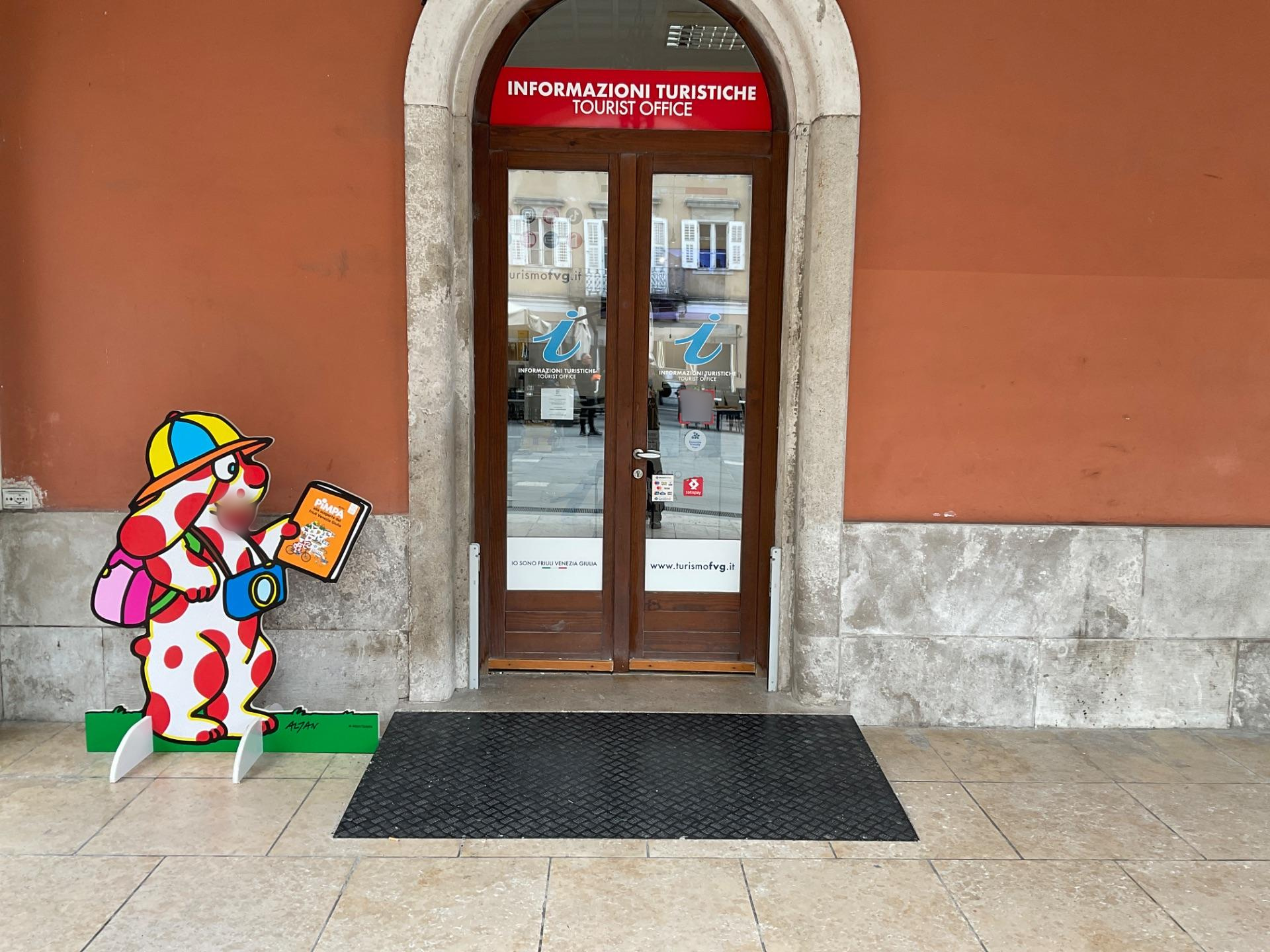
The Infopoint, temporarily relocated to Piazza Marconi at the Municipality's URP office, is located at the square by the sea (Photograph 5).

Photo 1 -ACCESS RAMP TO THE SEASIDE SQUARE
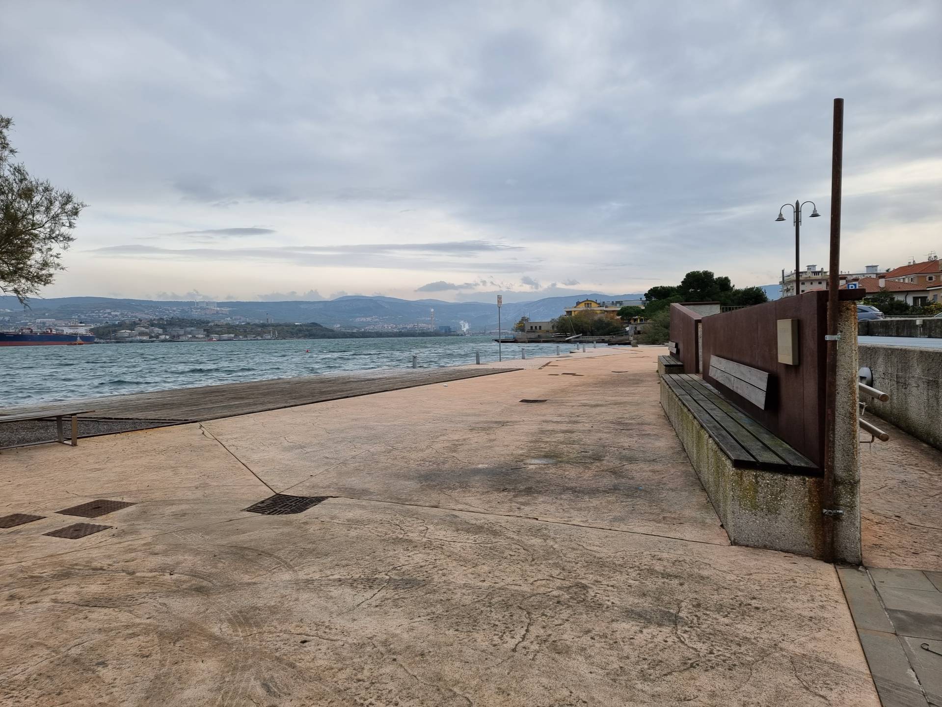
Photo 2 - seafront square with seating
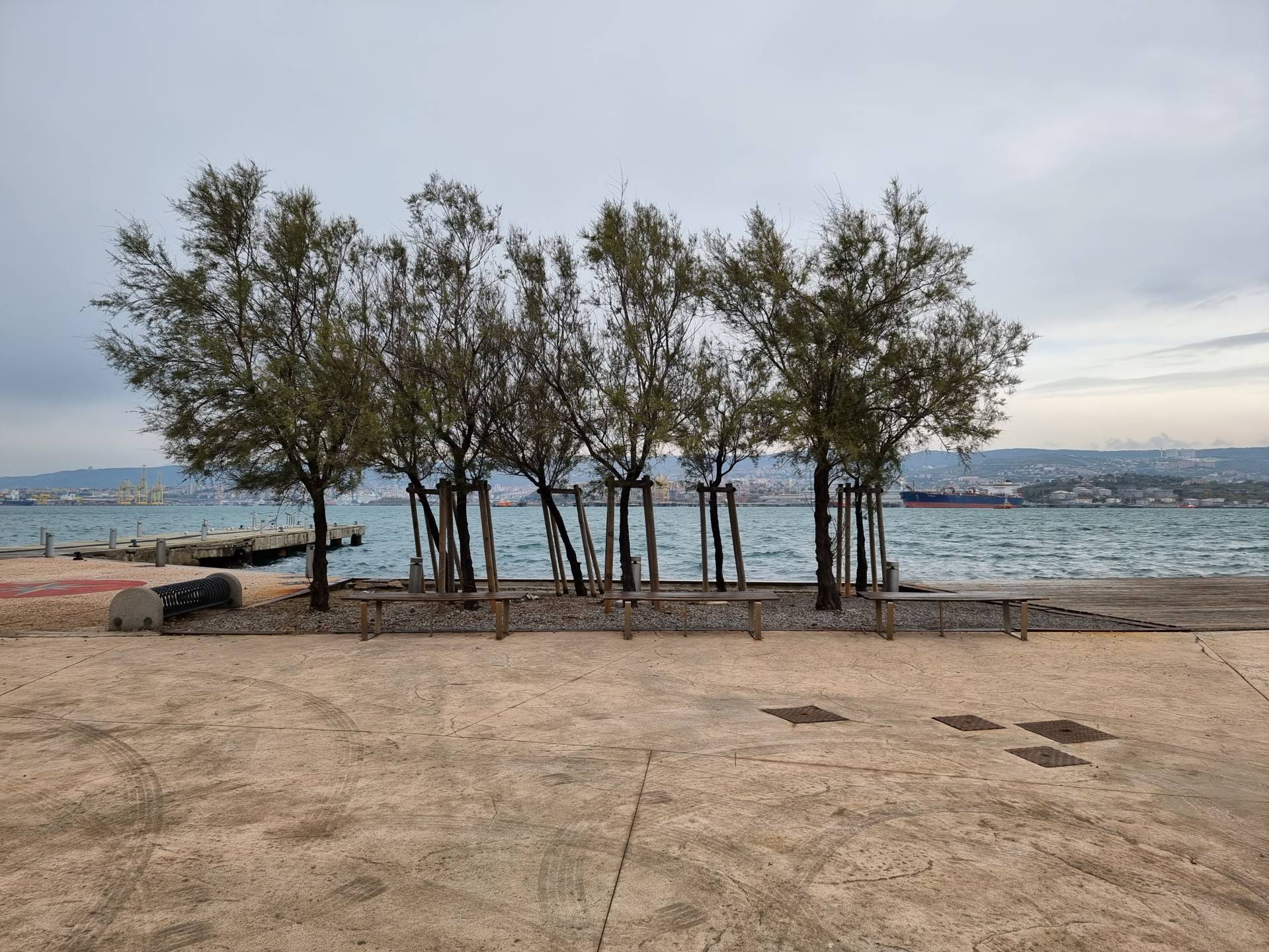
Photo 3 - tree-lined area on the square

Photo 4 - Information panels
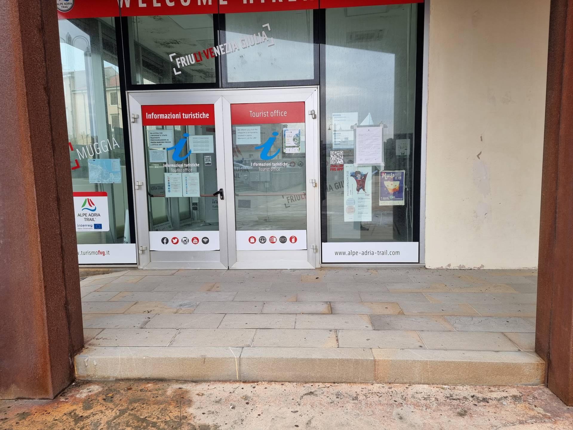
Foto 5 - Infopoint
Ascending to the level of the car parking area, the itinerary continues by crossing Via Cesare Battisti. The crossing is level, with white stripes on a paved, fairly even surface (Photograph 6). On the side of the car park, there is a wide, (greater than 1.20 metres) and pink-coloured grit pavement. LOGES modules are located at the ramps connecting the pavement (raised 12 centimetres above the road) with the road surface for the pedestrian crossing. Between the kerb of the pavement and the road surface, there is a difference in height of 2 centimetres. On the other side of the street, towards Piazza Repubblica, there is a wide pavement in granular material alternating with bands of porphyry cubes. The pavement is however regular. The road surface is connected to the pavement level by a short connecting ramp and has a difference in height of 2 centimetres between the road and the pavement. To the right of the crossing, there are two parking spaces reserved for people with disability. There are two parking spaces reserved for people with disability at the Theatre. The entrances to the buildings are raised above the pavement level and to reach the same level there is a connecting ramp approximately 11 metres long with a 5% slope (Photograph 7). There is a flat itinerary to the right of the crossing leading to the centre of Muggia, which is also provided with vertical signposts.
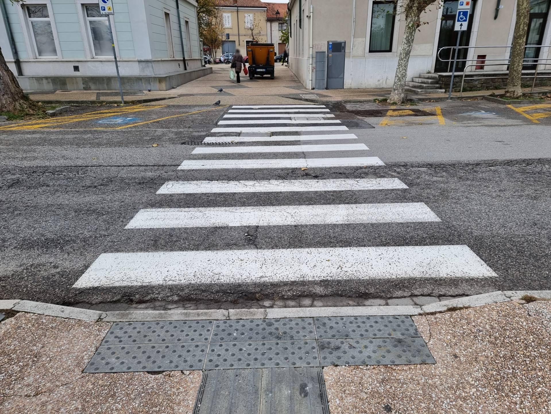
Photo 5 - Pedestrian crossing
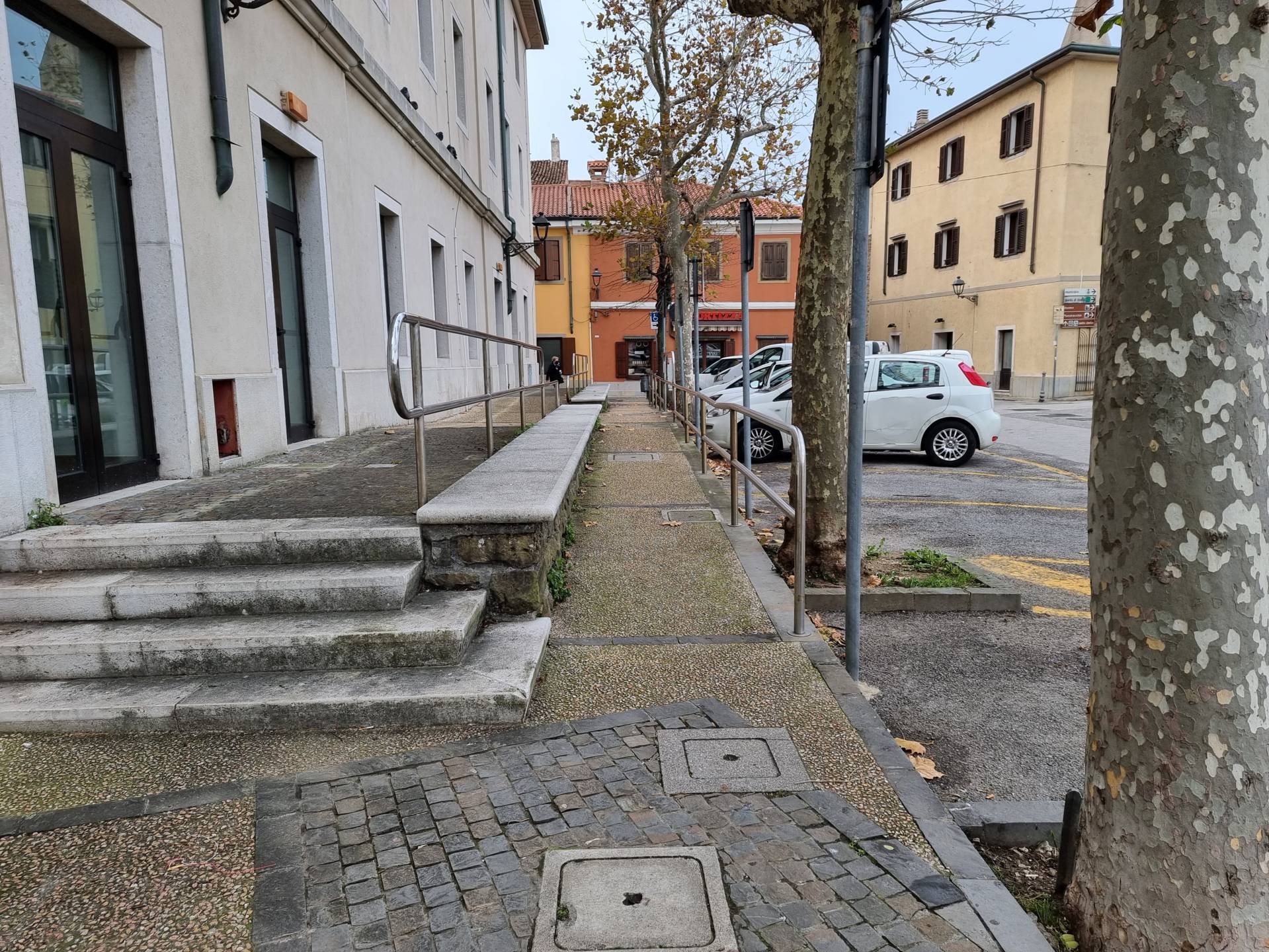
Photo 6 - Pathway with ramps
Continue along the pavement of Via Cesare Battisti, to the right of the pedestrian crossing towards Via Atessandro Manzoni until reaching the pedestrian area in the centre of Muggia. The pedestrian area is characterised by a first zone in which there are two narrow pavements at the edge of the road ( asphalt) raised about ten centimetres above the road, without a connecting ramp (Photograph 7). An even stone slab pavement is built after the stone arch, with some irregularities created by the conformation of the terrain (Photograph 8). From this point, the itinerary continues straight along Via Dante Alighieri. The entire pedestrian area (Via Dante Alighieri and Calle Verdi) features numerous business venues, most of which are inside historical buildings and are difficult to access for wheelchair users due to the presence of steps at the entrance or some uphill stretches (Photographs 9-10). Several wheelchair-accessible itineraries are signposted with vertical signage with a white background and blue symbols. In Piazza Santa Lucia, turn right and continue the itinerary downwards on Calle Verdi.
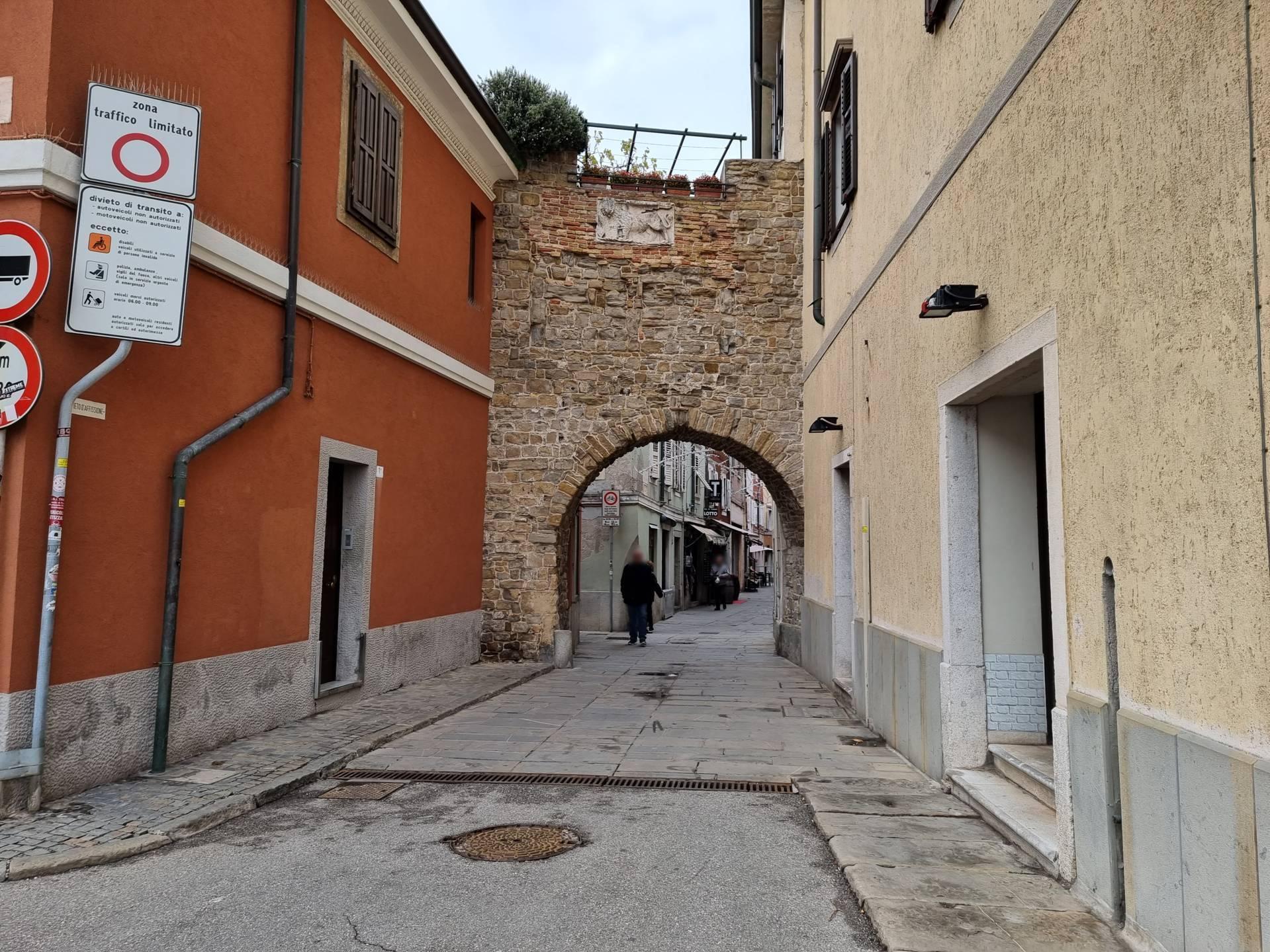
Photo 7 - Route before the arch
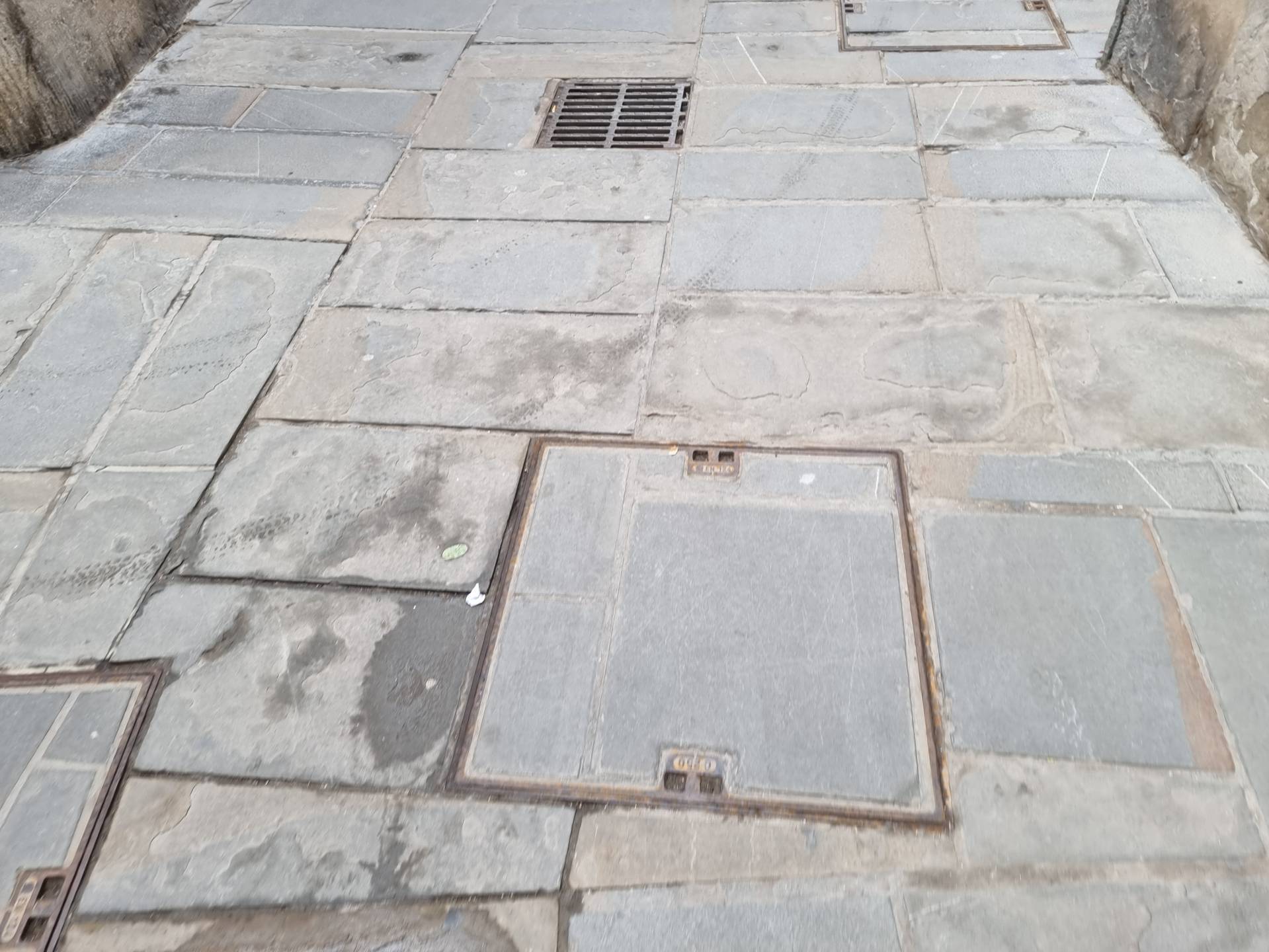
Photo 8 - Stone paving
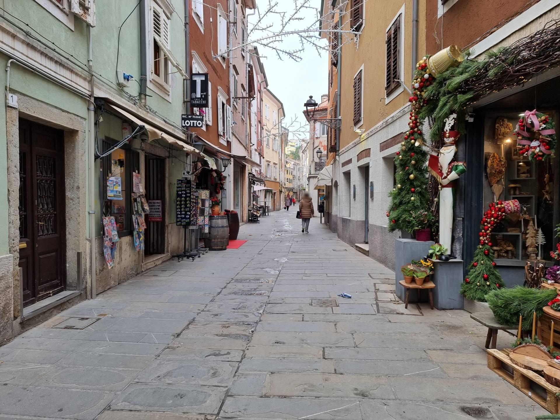
Photo 9 - Route on Via Dante Alighieri
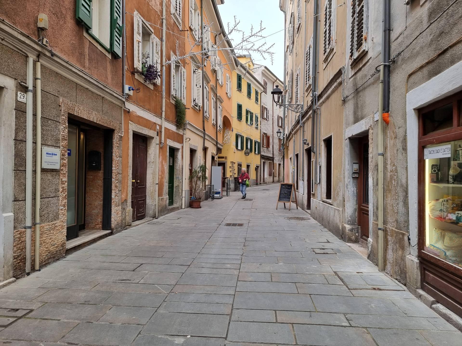
Photo 10 - Route on Via Dante Alighieri
The itinerary continues uphill until it reaches Piazza Santa Lucia (Photographs 11-12). Continue turning right and continuing the itinerary on Calle Verdi, downhill with a slope varying from 2% to 5% for stretches of more than 10 metres (Photographs 13-14). The paving is in stone slabs, uniform surface except for the absence of a few joints, and no pavements.
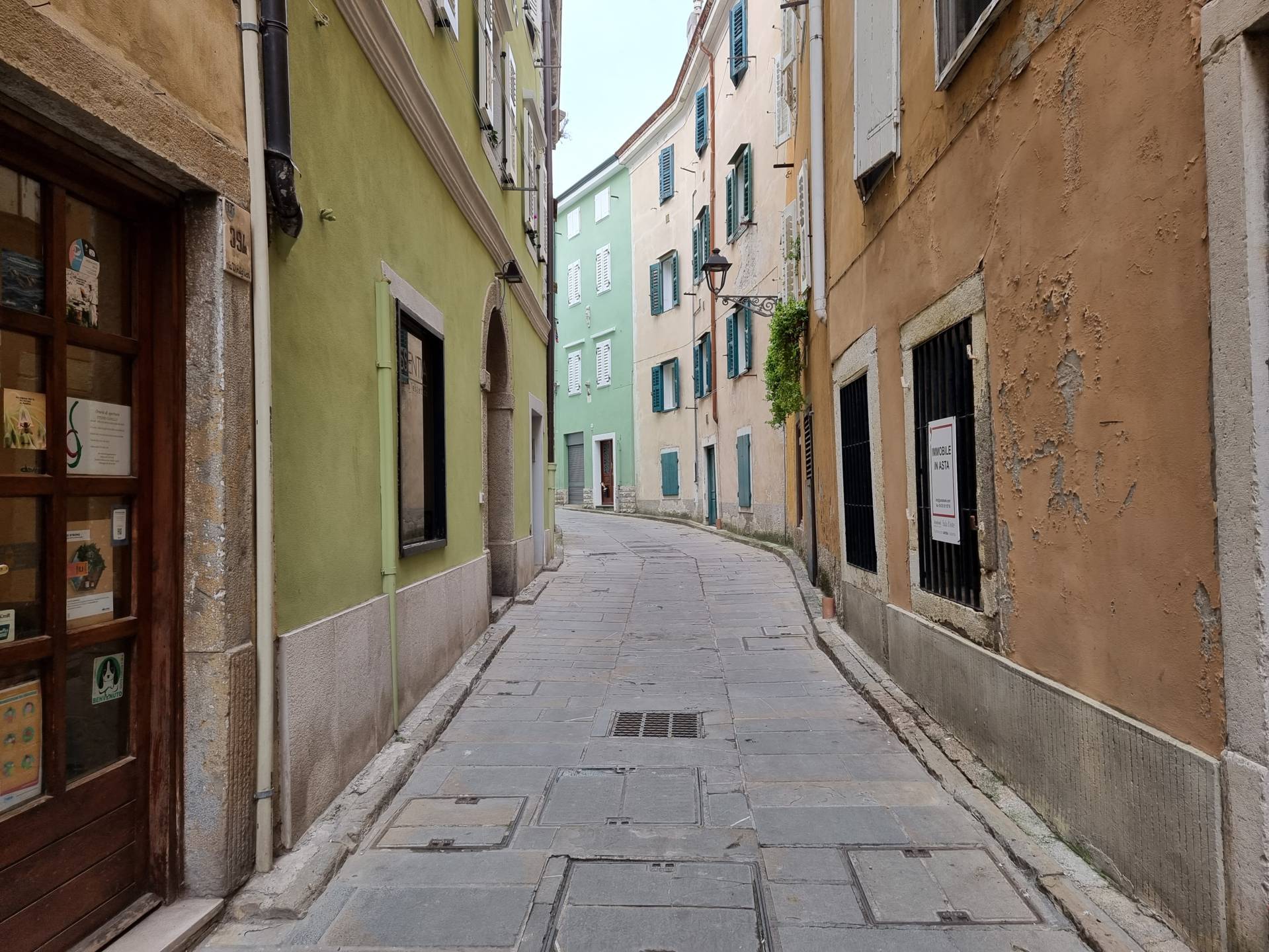
Photo 11 - Uphill route.
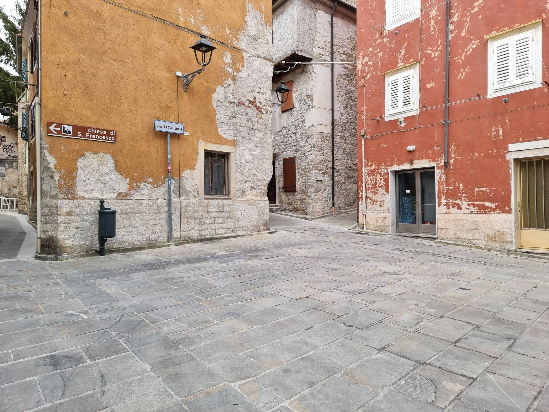
Photo 12 - Piazza Santa Lucia
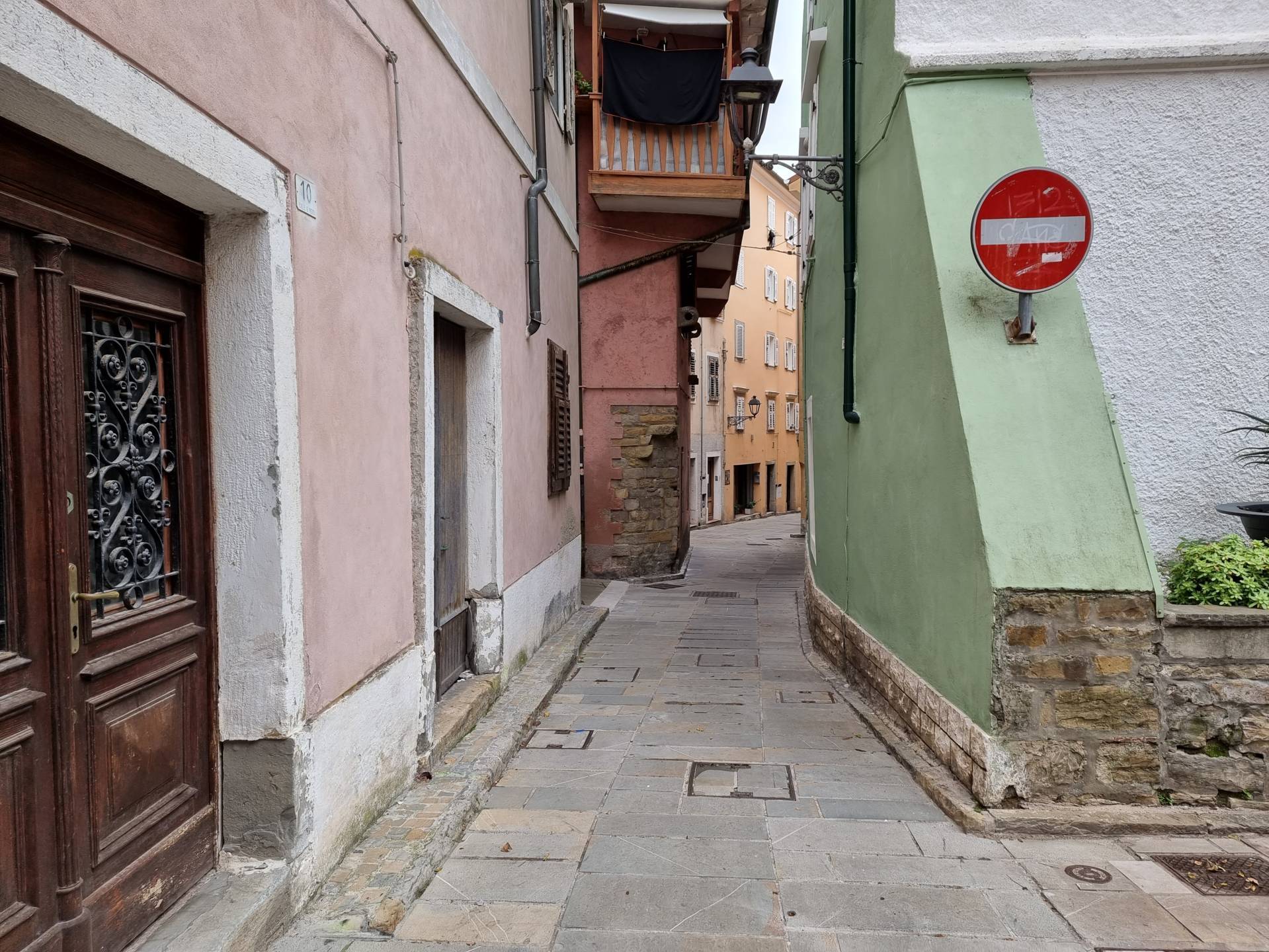
Photo 13 - Downhill route on Calle Verdi
Photo 14 - Path downhill to Piazza Marconi
Piazza Marconi (Photographs 15-16) is paved as described previously, with a uniform surface of stone slabs - for pedestrians; it is a large square that houses the Town Hall and the Duomo (Church of Saint John and Saint Paul), as well as various businesses.

Photo 15 - View of Piazza Marconi
Photo 16 - Town Hall in Piazza Marconi
From Piazza Marconi continue by turning right towards Corso Puccini (Photograph 17) to reach Riva De Amicis (Photograph 18). The paving of Calle Puccini - a pedestrian area - exhibits the same characteristics as described previously. Riva De Amicis, by contrast, features a pavement of broad width on the right-hand side, while there is a quay on the left-hand side overlooking the sea, the passage of which is possible but with some narrowing because of the presence of poles (Photograph 19). Moreover, as there is no protection towards the sea, safety conditions are generally very low. In both cases, the pavements are at the same level as the road and are therefore protected from the latter by a series of steel posts. The pavements in Via De Amicis are made of stone slabs, with a regular and uniform surface (Photograph 20).

Photo 17 - Route along Corso Puccini
Photo 18 - Pedestrian crossing on Riva De Amicis.
Photo 19 - Quay by the sea on Riva De Amicis
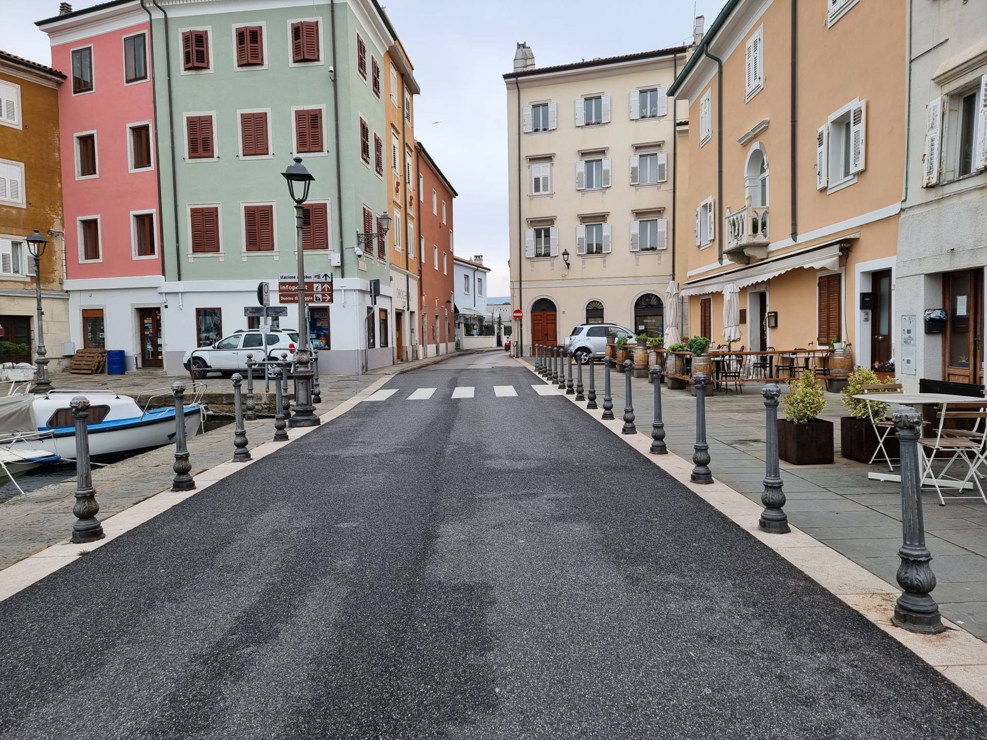
Photo 20 - Route along Riva De Amicis
Two pedestrian crossings are located at Corso Puccini and further on towards the square in front of the Municipal fish market (on the left): the surface is paved, regular and uniform surface, and there are no differences in level with the pavement, so the crossing is level. The crossing is marked by white stripes on a paved surface. The pedestrian crossing in the fish market area is level (Photograph 21), the stone-paved pedestrian area is reached, and after approximately ten metres the pavement begins, raised above the road surface and connected by a short ramp.

Photo 21 - crossing towards the municipal fish market
After a short distance, at the height of Calle Bacchiocco (near Piazza Galilei - which is also a pedestrian area) the pavement on the right-hand side is interrupted (Photograph 22) and it is necessary to cross the road (the pedestrian crossing is located at the Municipal fish market). The pavement on the left-hand side of Via Manzoni (the next street after Riva de Amicis) is approximately 70 centimetres in width (average width due to the shape of the street and the buildings), raised 15 centimetres above street level, and has a fairly regular paved surface, except for the section near the first driveway, where the uneven surface and the high transversal slope make it very difficult for wheelchair users to pass. The surface is stone, level, regular and uniform and directly connected to the adjacent pedestrian area. The pavement on the right-hand side of Via Manzoni is paved, with a fairly regular surface, but it is not completely accessible, as it is 15 centimetres higher than the road surface and not connected to it (except at the height of the Caliterna car park), and has an average width of 60-70 centimetres, starting from the height of the previously described driveway access on the left-hand side. At the height of the bend, the pavement on the right-hand side widens, while on the left-hand side, it is interrupted at the height of the entrance to the Caliterna car park, with a short connecting ramp to the ( asphalt) road surface. There is no pedestrian crossing signposted by stripes and the following pavement has a connecting ramp inside the parking area (after crossing the water drainage channel, a somewhat uneven stone cube surface for about ten metres and having overcome an obstacle due to the presence of a light pole together with a signpost) (Photographs 23-24).
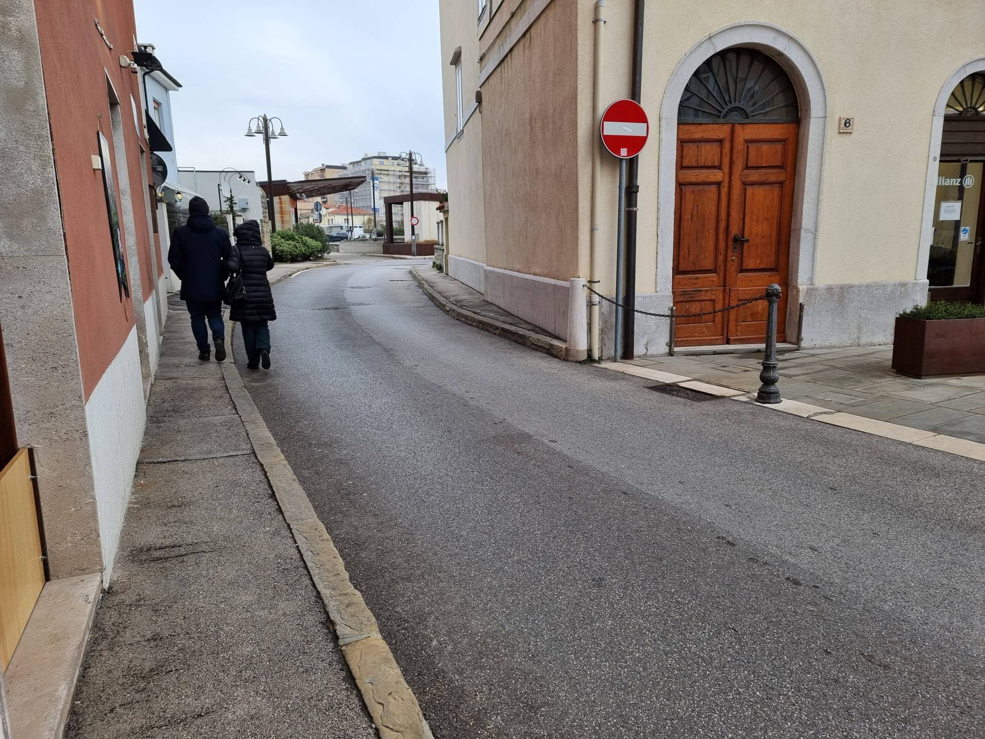
Photo 22 - itinerary on left pavement

Photo 23 - crossing near the car park exit
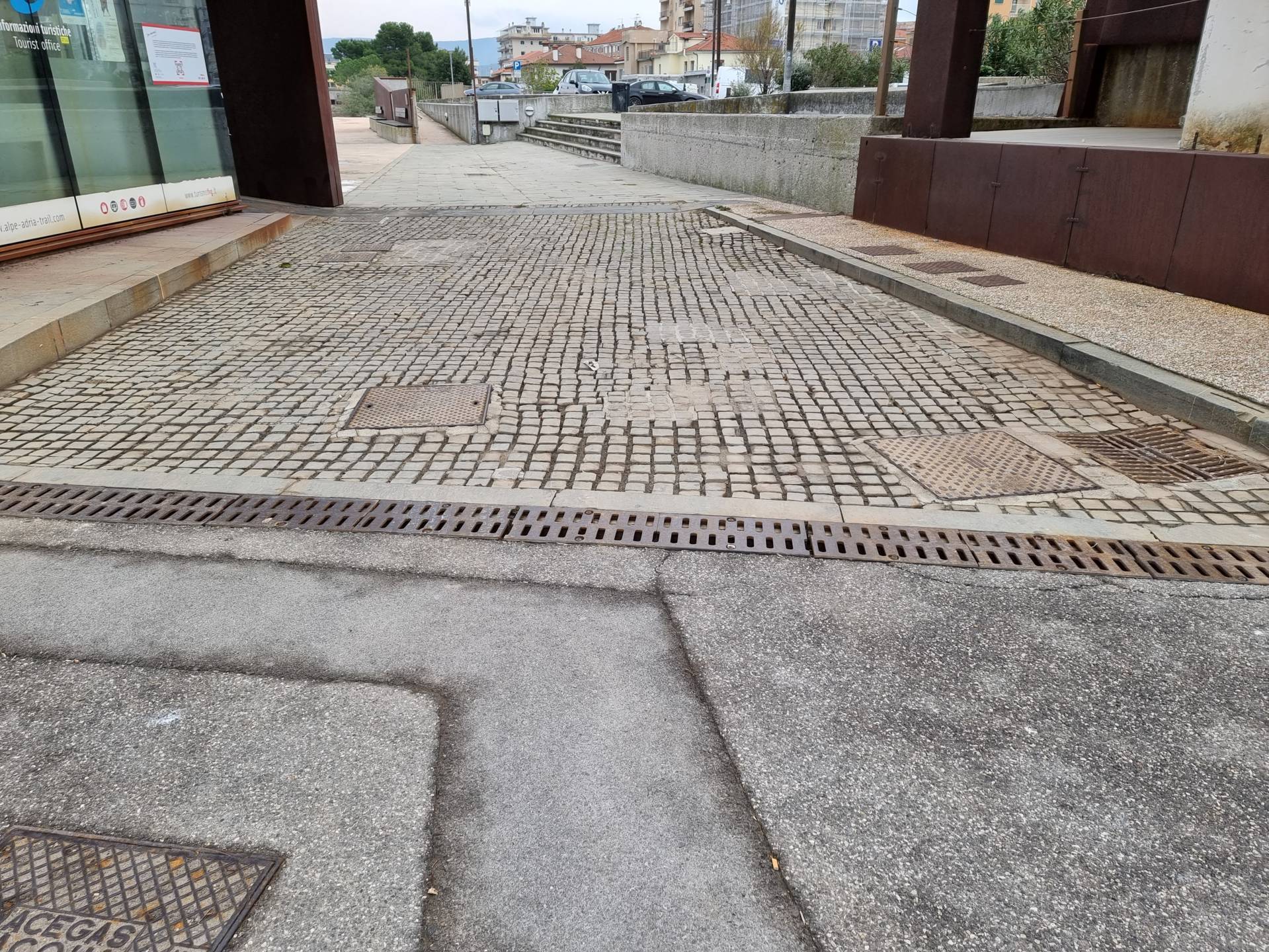
Photo 24 - Stone cube bottom with drainage gutter
Continuing towards Via Battisti, the pavement on the right side continues with the same characteristics described previously, while the pavement on the left side has a regular and uniform surface in granular material, a width of more than 90 centimetres and is raised above the road surface by an average height of 15 centimetres (Photograph 25). A pedestrian crossing (Photograph 26) is located approximately 20 metres after the bend. It is level, paved with white stripes, connected with short ramps on both sides and signposted by LOGES modules on the left. On the right-hand side, there is a difference in height measuring 3 centimetres, which makes it difficult to climb up to the pavement, while on the left-hand side, there is a difference in height of approximately 2 centimetres with the road surface and the water drainage channel not connected to the road surface, which makes it somewhat difficult to cross. This crossing is necessary because immediately afterwards, on the right-hand side, the pavement breaks at Calle Squero Vecchio, with a difference in height of 15 centimetres. The pavement that follows, which is not connected, has an initial width of 60 centimetres, and the paved surface is particularly disconnected (Photograph 27).
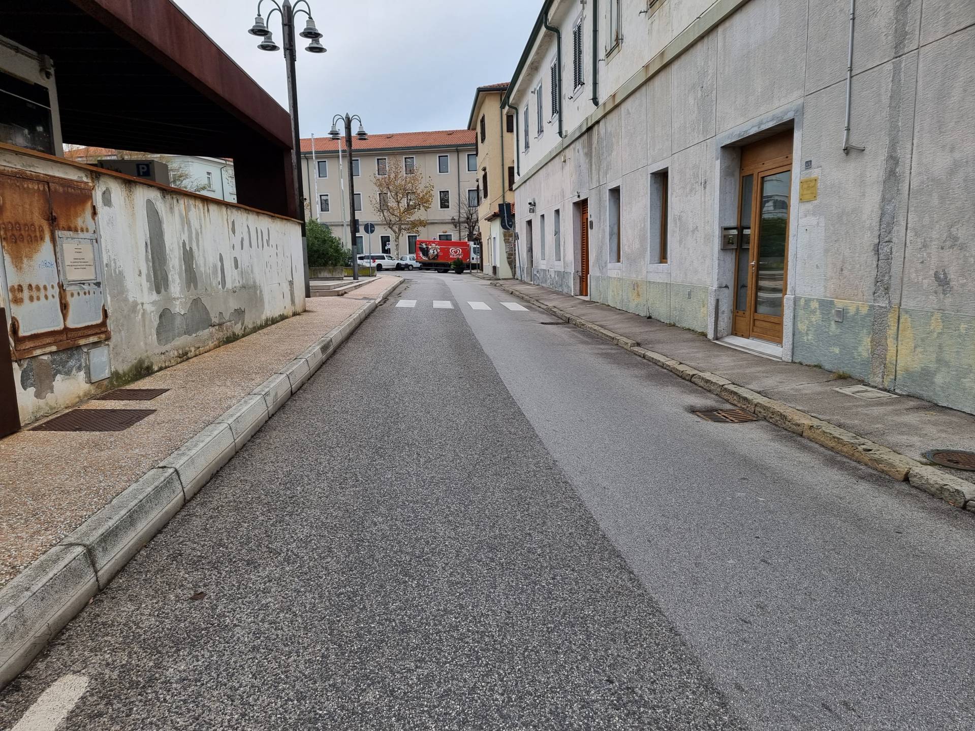
Photo 25 - path on grit pavement

Photo 26 - Pedestrian Crossing with Loges
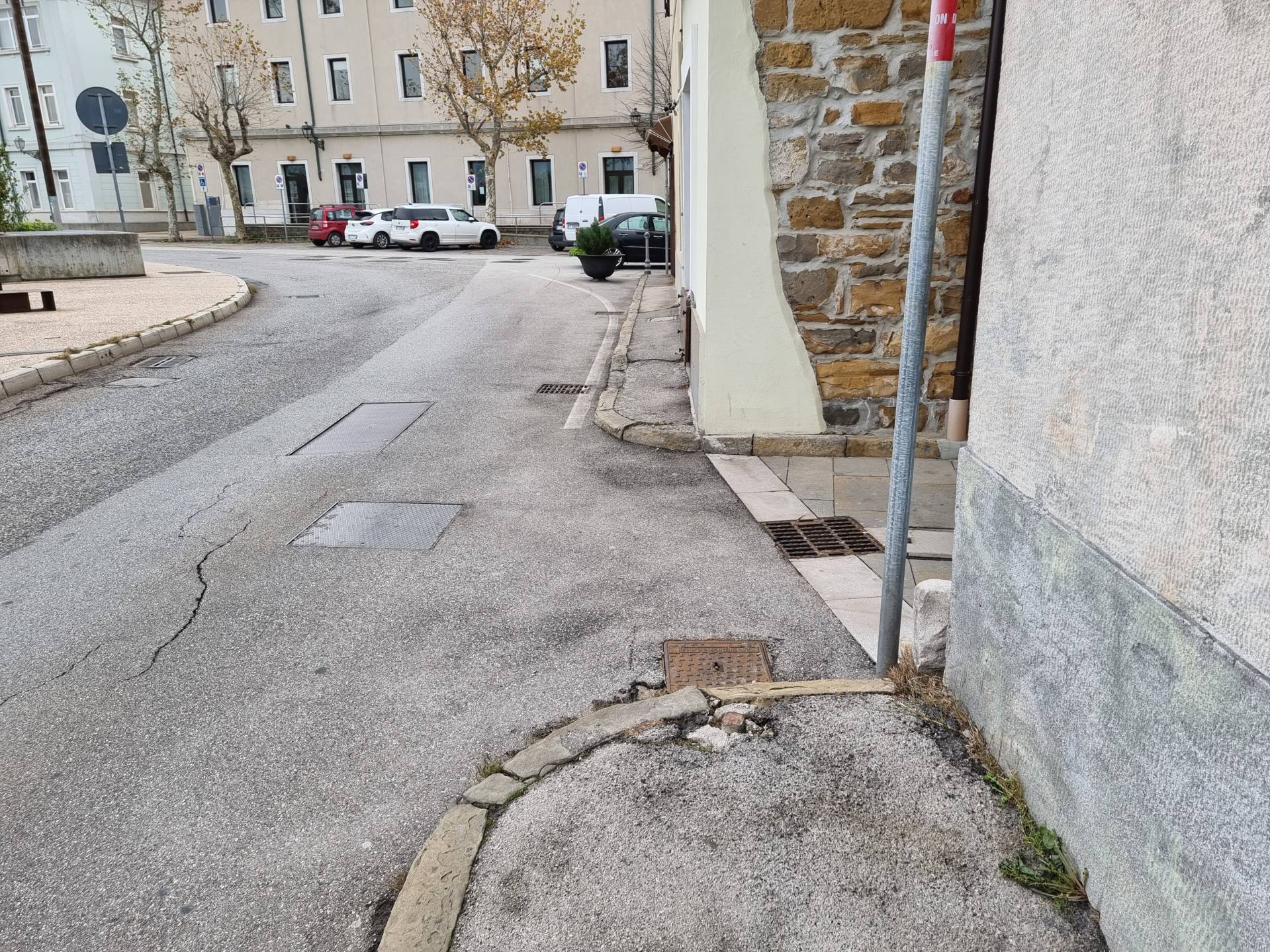
Photo 27 -Right kerb interruption without crossing
The itinerary continues towards the southern area of Muggia. From Via Cesare Battisti or Piazza della Repubblica, continue to the junction on the left with Calle Ferra Bombizza (Photograph 28). This is a pedestrian area and the paving exhibits the characteristics described previously: uniform surface and regular stone. Shortly afterwards, turn right onto Calle Oberdan (characteristics as described previously) (Photograph 29) and continue to the Museum of Muggia and the Territory. Continue to the junction with Calle Graziadio and here turn left along Calle Giacomo Puccini. This area is also a pedestrian zone and the paving has the same characteristics as described previously.
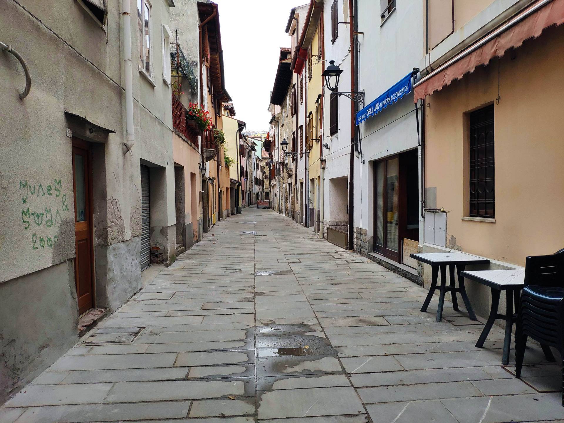
Photo 28 - Route on Calle Ferra Bombizza

Photo 29 - Turn right toward Calle Oberdan
Immediately afterwards, at the Church, turn left again and take Calle Giuseppe Parini (the pavement described previously, with a constant downhill slope of 3%) (Photographs 30-31) until it reaches Piazza della Repubblica. The final section of Calle Parini towards Piazza della Repubblica presents some critical issues caused by the presence of an uneven porphyry cube base (some cubes missing and soil deformation) and a drainage channel, preceded by a ramp 3 metres in width and 1.50 metres in length, 18% slope (Photograph 32). The corresponding pavement starts with an average height difference of 15 centimetres, then continues on the porphyry cube path until it reaches the pavement of Via Roma.

Photo 30 - Initial section Calle Giuseppe Parini

Photo 31 - Route along Calle Giuseppe Parini
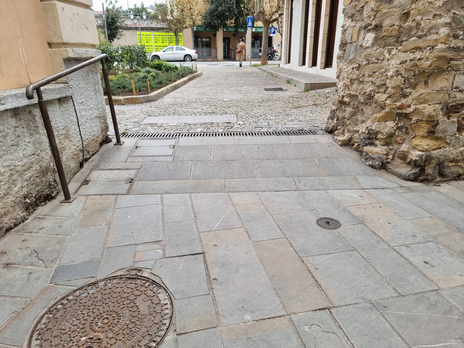
Photo 32 - Access ramp toward Piazza della Repubblica
Piazza della Repubblica (Photographs 33-34) is a large square paved with geometresc patterns in stone and asphalt, with seating and trees. There are some business activities present. Parking spaces for about fifteen vehicles are located at the edge of the square, two of which are reserved for people with disability. The surface is paved and the position of the parking spaces is close to the short access ramp to the square.

Photo 33 - View of Piazza della Repubblica
Photo 34 - View of Piazza della Repubblica
The itinerary continues along Via Roma - Provincial Road SP 14 - the pavement on the right-hand side is wide and raised above the road surface by approximately 15 centimetres, paved in stones of two different sizes: slabs and cubes (Photograph 35). The almost central strip of stone slabs measures 1.00 metre, an even, level ground. Trees are facing the street. Continue along Via Roma to the Museum of Modern Art (Photograph 36) and again to the crossroads on the right of Calle Puccini. Atong this section of the itinerary, there are three pedestrian crossings with the same characteristics: level, on an asphalt surface, white stripes, presence of connecting ramps with the pavement level. The only critical point noted is the presence of the rainwater gutter, made of porphyry cubes, which makes it difficult for a wheelchair to pass (Photograph 37). On Via Roma, at the Library, there is a parking space for people with disability.

Photo 35 - Route on via Roma
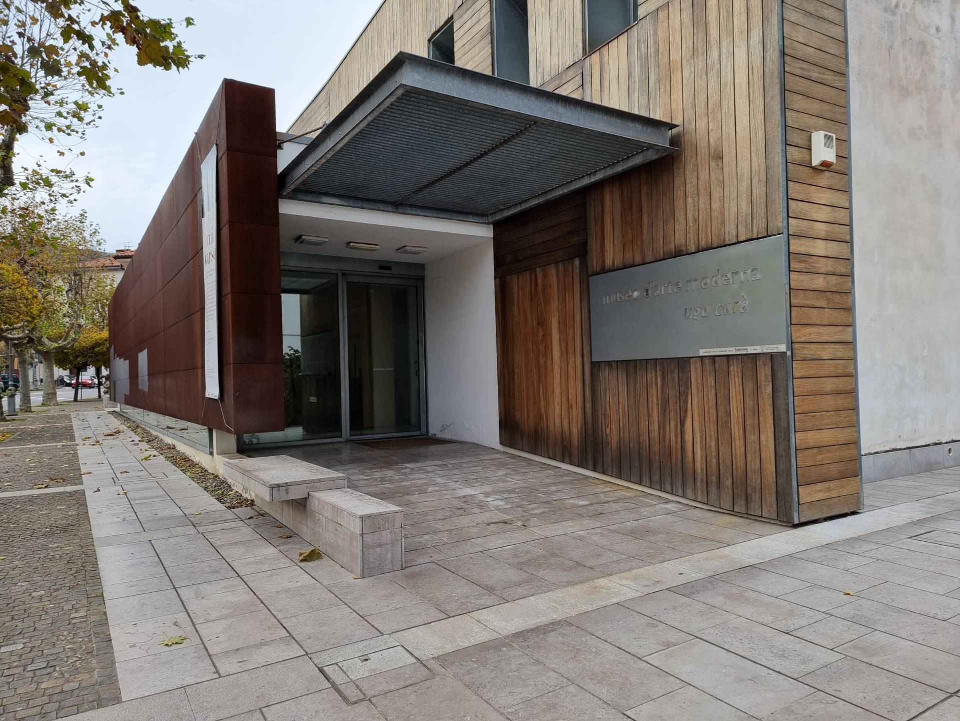
Photo 36 - Museum of Modern Art

Photo 37 - Pedestrian crossing on Via Roma
The final section of Via Roma towards Calle Puccini (Photograph 38) presents a narrowing of the stone pavement combined with the presence of a ramp (in stone slabs) 2 metres long downhill and curved, with a slope of 9%, which then continues for 12 metres with a slope of 3.5% (Photograph 39).
Calle Puccini - a pedestrian area and the final section of this circular itinerary in the south of Muggia - presents the same characteristics as described previously (Photograph 40). To reach the starting point, the route is followed in reverse.
Photo 38 - Final section of Via Roma

Photo 39 - Ramp access towards Calle Puccini
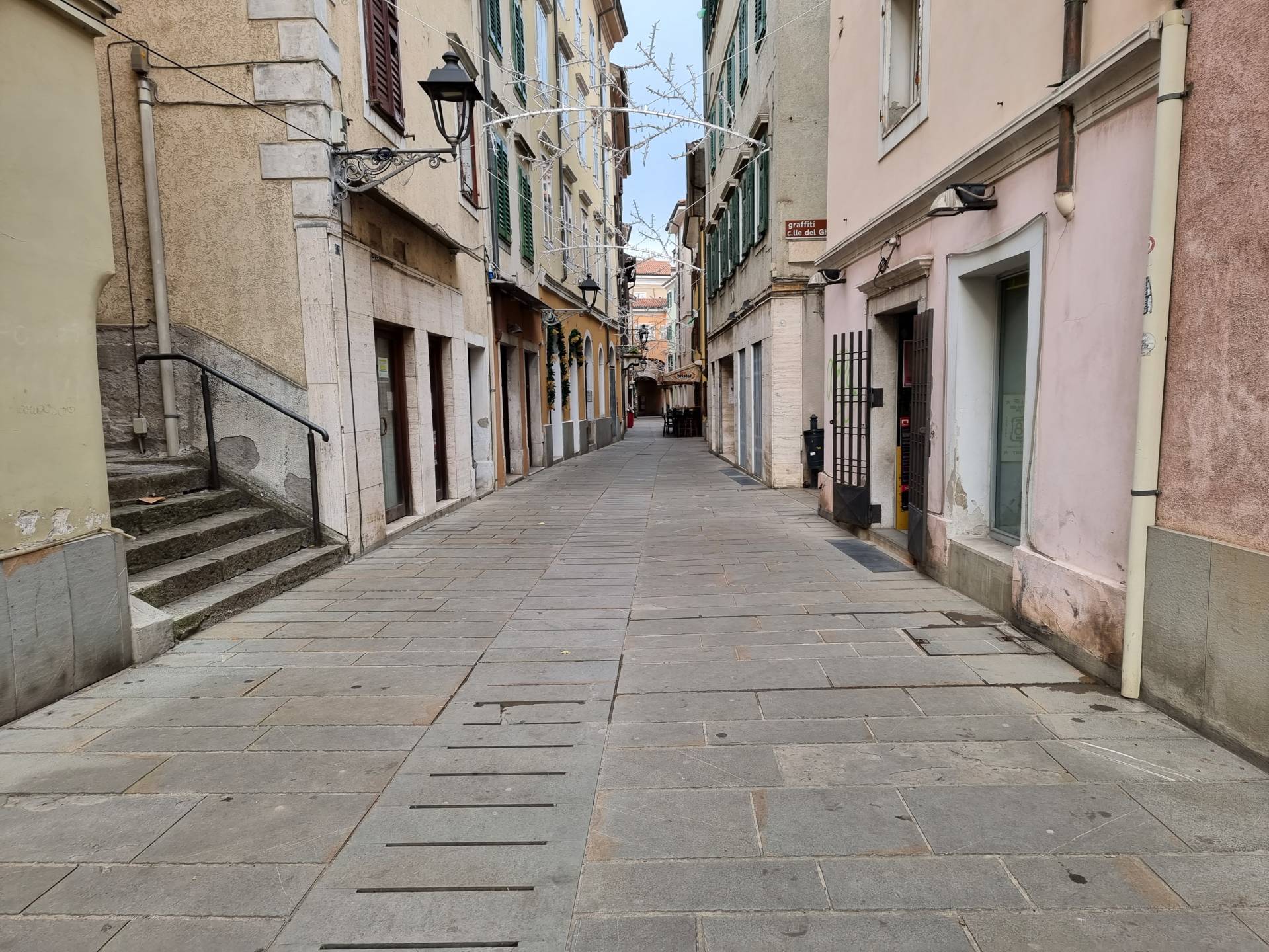
Photo 40 - Route on Calle Puccini
2.0
/3
ENTRANCE
_MOD%20(FILEminimizer).jpg)
Ingresso
Entrance typology
TYPE:
MainACCESSIBLE:
NoTIPO:
PrincipaleHeight difference (> 2.5 cm)
PRESENT:
YesDISLEVEL:
-
TYPE:
Short staircase/stepUNIVOCAL CODE:
SB1SHORT STAIRCASE (LESS THAN ONE FLOOR):
WIDTH (CM):
80NUMBER OF STEPS:
1HEIGHT OF INDIVIDUAL RISER (CM):
8CORRIMANO:
PRESENT:
NoINTERMEDIATE LANDING:
NoYES:
TACTILE-PLANTAR PATHS:
No
Threshold (< 2.5 cm)
PRESENT:
YesHEIGHT:
1Entrance door
TYPE:
Single leafOPENING:
InsideAUTOMATED OPENING:
NoNET DOOR CLEARANCE:
Single or sliding doorMEASURE (CM):
80DOOR AND BACK DOOR COPLANARITY (NOT ASSESSED HEIGHT DIFFERENCE UP TO 2.5 CM):
NoZERBINI/CARPETS:
PRESENTS:
NoINTERCOM/BELL:
PRESENT:
NoGlass doors: window decals to indicate their presence
PRESENTS:
YesCOMPARTMENT
Compartment name
TYPE:
Generic, of the structureIDENTIFIER:
V1Door
ACCESS:
NoneDimensions
ROTATION DIAMETER 140 CM:
YesLARGHEZZA LIBERA PREVALENTE:
> 75 cmPaving
TYPE:
TilesColour contrast floors/walls
TYPE:
NoFLOOR COLOUR:
BeigeWALL COLOUR:
WhiteSignage
YES:
TACTILE-PLANTAR PATHS:
NoYES:
TOUCH MAP:
NoYES:
INFORMATION SIGNAGE:
NoFurniture
COUNTER:
-
HEIGHT:
UniqueGROUND CLEARANCE (CM):
100EMPTY UNDER:
No
1.4
/3
ENTRANCE
.jpg)
Ingresso
Entrance typology
TYPE:
MainACCESSIBLE:
NoTIPO:
PrincipaleHeight difference (> 2.5 cm)
PRESENT:
YesDISLEVEL:
-
TYPE:
Short staircase/stepUNIVOCAL CODE:
SB2SHORT STAIRCASE/STEP (INFERIORE A UN PIANO):
WIDTH (CM):
100NUMBER OF STEPS:
1HEIGHT OF INDIVIDUAL RISER (CM):
17CORRIMANO:
PRESENT:
NoINTERMEDIATE LANDING:
NoYES:
TACTILE-PLANTAR PATHS:
No
Threshold (< 2.5 cm)
PRESENT:
No/LevelEntrance door
TYPE:
Single leafOPENING:
InsideAUTOMATED OPENING:
NoNET DOOR CLEARANCE:
Single or sliding doorMEASURE (CM):
100DOOR AND BACK DOOR COPLANARITY (NOT ASSESSED HEIGHT DIFFERENCE UP TO 2.5 CM):
NoZERBINI/CARPETS:
PRESENTS:
NoCITOFONO/CAMPANELLO:
PRESENT:
YesHEIGHT (CM):
90Glass doors: window decals to indicate their presence
PRESENTS:
NoATM COUNTER
.jpg)
Sportello bancomat
Atm typology
TYPE:
InsideTIPO:
InternoUser workstation
TYPE:
On a private area with a slopeDISLEVEL:
-
TYPE:
Short staircase/stepUNIVOCAL CODE:
SB1SHORT STAIRCASE/STEP (INFERIORE A UN PIANO):
WIDTH (CM):
80NUMBER OF STEPS:
1HEIGHT OF INDIVIDUAL RISER (CM):
12CORRIMANO:
PRESENT:
NoINTERMEDIATE LANDING:
NoYES:
TACTILE-PLANTAR PATHS:
No
Wheelchair approach
TYPE:
UncomfortableAverage device height
GROUND CLEARANCE (CM):
100Facilities
TYPE:
Anti-glare screen2.6
/3
ENTRANCE
.jpg)
Ingresso
Entrance type
ACCESSIBLE:
NoTYPE:
MainLevel difference (> 2.5 cm)
PRESENT:
YesLEVEL DIFFERENCE:
-
TYPE:
Short staircase/StepUNIQUE CODE:
SB1SHORT STAIRCASE/STEP (LESS THAN ONE FLOOR):
WIDTH (CM):
130NUMBER OF STEPS:
1HEIGHT OF SINGLE RISER (CM):
4.5HANDRAIL:
PRESENT:
NoINTERMEDIATE LANDING:
NoTACTILE-PLANTAR PATHS:
No
Threshold (< 2.5 cm)
PRESENT:
No/FlushEntrance door
TYPE:
Double door or with two opening elementsOPENING DIRECTION:
InsideAUTOMATED OPENING:
NoCLEAR DOOR LIGHT:
Double door or with two opening elementsOVERALL HOLE (CM):
130MAIN LEAF (CM):
65PLANARITY OF FRONT AND BACK DOOR (NOT EVALUATED LEVEL DIFFERENCE UP TO 2.5 CM):
NoDOORMATS/CARPETS:
PRESENT:
NoINTERCOM/BELL:
PRESENT:
YesHEIGHT (CM):
120LOCATION:
Door sideGlass doors: decals to signal their presence
RELEVANT:
SìPRESENT:
NoROOM
.jpg)
Bancone
.jpg)
Tavoli e sedie
Name of the room
TYPE:
Generic of the structureIDENTIFIER:
V1Door
ACCESS:
NoneDimensions
ROTATION DIAMETER 140 CM:
SìPREVALENT FREE WIDTH:
> 75 cmFlooring
TYPE:
TilesChromatic contrast floors/walls
TYPE:
YesFLOOR COLOR:
BrownWALL COLOR:
WhiteDifference in level (> 2.5 cm)
PRESENT:
NoSignage
TACTILE-PLANTAR PATHS:
NoTACTILE MAP:
NoINFORMATION SIGNAGE:
NoFurniture
COUNTER:
-
HEIGHT:
UniqueHEIGHT FROM THE GROUND (CM):
110EMPTY UNDERNEATH:
No
TABLE:
-
TYPE OF SUPPORT:
Central pinTYPE OF SURFACE:
Rectangular/SquareWIDTH (CM):
60LENGTH (CM):
60HEIGHT FROM THE GROUND (CM):
75FREE SPACE FROM THE GROUND (CM):
72SURFACE WITH BEVELED EDGES:
No
CHAIR:
-
Backrest
FIXED TO THE GROUND:
No
OUTDOOR AREA
Purpose of the area
AREA TYPE:
ConsumptionType
Access to the area
TYPE:
From main door already describedUnevenness (> 2.5 cm)
PRESENT:
NoPavement
TYPE:
Cement/Asphalt or flat stoneDimensions
ROTATION DIAMETER 140 CM:
SìPREVALENT FREE WIDTH:
> 75 cmFurnishings
TABLE:
-
TYPE OF SUPPORT:
Central pinTYPE OF SURFACE:
Rectangular/SquareWIDTH (CM):
70LENGTH (CM):
70HEIGHT FROM GROUND (CM):
72FREE SPACE FROM GROUND (CM):
70SURFACE WITH BEVELED EDGES:
No
CHAIR:
-
Backrest, Armrests
FIXED TO THE GROUND:
No
General note
2.7
/3
ENTRANCE
.jpg)
Ingresso
Entrance typology
TYPE:
MainACCESSIBLE:
NoTIPO:
PrincipaleHeight difference (> 2.5 cm)
PRESENT:
YesDISLEVEL:
-
TYPE:
Short staircase/stepUNIVOCAL CODE:
SB1SHORT STAIRCASE/STEP (INFERIORE A UN PIANO):
WIDTH (CM):
90NUMBER OF STEPS:
1HEIGHT OF INDIVIDUAL RISER (CM):
3CORRIMANO:
PRESENT:
NoINTERMEDIATE LANDING:
NoYES:
TACTILE-PLANTAR PATHS:
No
Threshold (< 2.5 cm)
PRESENT:
No/LevelEntrance door
TYPE:
Single leafOPENING:
InsideAUTOMATED OPENING:
NoNET DOOR CLEARANCE:
Single or sliding doorMEASURE (CM):
90DOOR AND BACK DOOR COPLANARITY (NOT ASSESSED HEIGHT DIFFERENCE UP TO 2.5 CM):
NoZERBINI/CARPETS:
PRESENTS:
NoCITOFONO/CAMPANELLO:
PRESENT:
NoGlass doors: window decals to indicate their presence
PRESENTS:
NoCOMPARTMENT
.jpg)
Bancone
.jpg)
Tavolo e sedie
Compartment name
TYPE:
Generic, of the structureIDENTIFIER:
V1Door
ACCESS:
NoneDimensions
ROTATION DIAMETER 140 CM:
YesPREVAILING CLEAR WIDTH:
> 75 cmPaving
TYPE:
TilesColour contrast floors/walls
TYPE:
YesFLOOR COLOUR:
Brown/GreyWALL COLOUR:
White/StoneSignage
YES:
TACTILE-PLANTAR PATHS:
NoYES:
TOUCH MAP:
NoYES:
INFORMATION SIGNAGE:
NoFurniture
COUNTER:
-
HEIGHT:
UniqueGROUND CLEARANCE (CM):
120EMPTY UNDER:
No
TABLE:
-
TYPE OF SUPPORT:
Corner legsTYPE OF PLAN:
Rectangular/SquareWIDTH (CM):
60LENGTH (CM):
60GROUND CLEARANCE (CM):
73GROUND CLEARANCE (CM):
71TOP WITH ROUNDED EDGES:
No
SEDIA:
-
Schienale
NOTES:
Stools also presentFIXED TO THE GROUND:
No
OUTDOOR AREA
.jpg)
Tavoli e sedie
Destination of the area
AREA TYPOLOGY:
ConsumptionType
YES:
On public groundAccess to the area
TYPE:
From external pathwayHeight difference (> 2.5 cm)
PRESENT:
NoPaving
TYPE:
Concrete/Asphalt or coplanar stoneDimensions
ROTATION DIAMETER 140 CM:
YesPREVAILING CLEAR WIDTH:
> 75 cmFurniture
TABLE:
-
TYPE OF SUPPORT:
Corner legsTYPE OF PLAN:
Rectangular/SquareWIDTH (CM):
60LENGTH (CM):
60GROUND CLEARANCE (CM):
74GROUND CLEARANCE (CM):
72TOP WITH ROUNDED EDGES:
No
SEDIA:
-
Schienale
FIXED TO THE GROUND:
No
General note
2.3
/3
ENTRANCE
.jpg)
Ingresso
Entrance typology
TYPE:
MainACCESSIBLE:
NoTIPO:
PrincipaleHeight difference (> 2.5 cm)
PRESENT:
YesDISLEVEL:
-
TYPE:
Short staircase/stepUNIVOCAL CODE:
SB1SHORT STAIRCASE/STEP (INFERIORE A UN PIANO):
WIDTH (CM):
80NUMBER OF STEPS:
1HEIGHT OF INDIVIDUAL RISER (CM):
8CORRIMANO:
PRESENT:
NoINTERMEDIATE LANDING:
NoYES:
TACTILE-PLANTAR PATHS:
No
Threshold (< 2.5 cm)
PRESENT:
No/LevelEntrance door
TYPE:
Single leafOPENING:
InsideAUTOMATED OPENING:
NoNET DOOR CLEARANCE:
Single or sliding doorMEASURE (CM):
80DOOR AND BACK DOOR COPLANARITY (NOT ASSESSED HEIGHT DIFFERENCE UP TO 2.5 CM):
NoZERBINI/CARPETS:
PRESENTS:
NoCITOFONO/CAMPANELLO:
PRESENT:
NoGlass doors: window decals to indicate their presence
PRESENTS:
NoCOMPARTMENT
.jpg)
Bancone
.jpg)
Tavolo e sedie
Compartment name
TYPE:
Generic, of the structureIDENTIFIER:
V1Door
ACCESS:
NoneDimensions
ROTATION DIAMETER 140 CM:
YesPREVAILING CLEAR WIDTH:
> 75 cmPaving
TYPE:
TilesColour contrast floors/walls
TYPE:
YesFLOOR COLOUR:
Beige/Various/Light greyWALL COLOUR:
WhiteSignage
YES:
TACTILE-PLANTAR PATHS:
NoYES:
TOUCH MAP:
NoYES:
INFORMATION SIGNAGE:
NoFurniture
COUNTER:
-
HEIGHT:
UniqueGROUND CLEARANCE (CM):
120EMPTY UNDER:
No
TABLE:
-
TYPE OF SUPPORT:
Corner legsTYPE OF PLAN:
Rectangular/SquareWIDTH (CM):
80LENGTH (CM):
40GROUND CLEARANCE (CM):
75GROUND CLEARANCE (CM):
72TOP WITH ROUNDED EDGES:
No
SEDIA:
-
Schienale
FIXED TO THE GROUND:
No
OUTDOOR AREA
Destination of the area
AREA TYPOLOGY:
ConsumptionType
YES:
On public groundOTHER TYPOLOGY:
Pedestrian areaAccess to the area
TYPE:
From external pathwayHeight difference (> 2.5 cm)
PRESENT:
NoPaving
TYPE:
Concrete/Asphalt or coplanar stoneDimensions
ROTATION DIAMETER 140 CM:
YesPREVAILING CLEAR WIDTH:
> 75 cmFurniture
TABLE:
-
TYPE OF SUPPORT:
Corner legsTYPE OF PLAN:
Rectangular/SquareWIDTH (CM):
40LENGTH (CM):
70GROUND CLEARANCE (CM):
75GROUND CLEARANCE (CM):
72TOP WITH ROUNDED EDGES:
No
SEDIA:
-
Schienale, Braccioli
FIXED TO THE GROUND:
No -
Schienale
NOTES:
StoolsFIXED TO THE GROUND:
No
2.0
/3
ENTRANCE
.jpg)
Ingresso
Entrance typology
TYPE:
MainACCESSIBLE:
NoTIPO:
PrincipaleHeight difference (> 2.5 cm)
PRESENT:
YesDISLEVEL:
-
TYPE:
Short staircase/stepUNIVOCAL CODE:
SB1SHORT STAIRCASE/STEP (INFERIORE A UN PIANO):
WIDTH (CM):
140NUMBER OF STEPS:
1HEIGHT OF INDIVIDUAL RISER (CM):
15CORRIMANO:
PRESENT:
NoINTERMEDIATE LANDING:
NoYES:
TACTILE-PLANTAR PATHS:
No
Threshold (< 2.5 cm)
PRESENT:
No/LevelEntrance door
TYPE:
With two doors or with two opening elementsOPENING:
InsideAUTOMATED OPENING:
NoNET DOOR CLEARANCE:
With two doors or with two opening elementsOVERALL BORE (CM):
140MAIN DOOR (CM):
70DOOR AND BACK DOOR COPLANARITY (NOT ASSESSED HEIGHT DIFFERENCE UP TO 2.5 CM):
NoZERBINI/CARPETS:
PRESENTS:
NoCITOFONO/CAMPANELLO:
PRESENT:
NoGlass doors: window decals to indicate their presence
PRESENTS:
NoCOMPARTMENT
Compartment name
TYPE:
Generic, of the structureIDENTIFIER:
V1Door
ACCESS:
NoneDimensions
ROTATION DIAMETER 140 CM:
YesPREVAILING CLEAR WIDTH:
> 75 cmPaving
TYPE:
TilesColour contrast floors/walls
TYPE:
YesFLOOR COLOUR:
Red BrickWALL COLOUR:
WhiteSignage
YES:
TACTILE-PLANTAR PATHS:
NoYES:
TOUCH MAP:
NoYES:
INFORMATION SIGNAGE:
NoFurniture
COUNTER:
-
HEIGHT:
UniqueGROUND CLEARANCE (CM):
100EMPTY UNDER:
No
General note
2.2
/3
ENTRANCE
.jpg)
Ingresso
Entrance typology
TYPE:
MainACCESSIBLE:
NoTIPO:
PrincipaleHeight difference (> 2.5 cm)
PRESENT:
YesDISLEVEL:
-
TYPE:
Short staircase/stepUNIVOCAL CODE:
SB1SHORT STAIRCASE/STEP (INFERIORE A UN PIANO):
WIDTH (CM):
80NUMBER OF STEPS:
1HEIGHT OF INDIVIDUAL RISER (CM):
3.5CORRIMANO:
PRESENT:
NoINTERMEDIATE LANDING:
NoTACTILE-PLANTAR PATHS:
No
Threshold (< 2.5 cm)
PRESENT:
No/LevelEntrance door
TYPE:
Single leafOPENING:
InsideAUTOMATED OPENING:
NoNET DOOR CLEARANCE:
Single or sliding doorMEASURE (CM):
80DOOR AND BACK DOOR COPLANARITY (NOT ASSESSED HEIGHT DIFFERENCE UP TO 2.5 CM):
NoZERBINI/CARPETS:
PRESENTS:
YesTYPE:
Satin doormatTYPE:
CompactCITOFONO/CAMPANELLO:
PRESENT:
NoGlass doors: window decals to indicate their presence
PRESENTS:
NoCOMPARTMENT
.jpg)
Bancone
Compartment name
TYPE:
Sale: shop and groceryIDENTIFIER:
V1Door
ACCESS:
NoneDimensions
ROTATION DIAMETER 140 CM:
YesPaving
TYPE:
TilesColour contrast floors/walls
TYPE:
YesFLOOR COLOUR:
Pink/brownWALL COLOUR:
White/WoodSignage
TACTILE-PLANTAR PATHS:
NoTOUCH MAP:
NoINFORMATION SIGNAGE:
NoFurniture
COUNTER:
-
HEIGHT:
UniqueGROUND CLEARANCE (CM):
120EMPTY UNDER:
No
2.6
/3
INGRESSO
Ingresso infopoint
Tipologia ingresso
ACCESSIBILE:
SìTIPO:
PrincipaleDislivello (> 2,5 cm)
PRESENTE:
SìDETTAGLI DISLIVELLO:
-
TIPO:
RampaRAMPA:
LARGHEZZA (CM):
197LUNGHEZZA (CM):
100PENDENZA:
7.7%CORRIMANO:
PRESENTE:
NoCORDOLO LATERALE BATTITACCO:
NoFINITURA ANTISCIVOLO:
SìCONTRASTO CROMATICO:
SìPERCORSI TATTILO-PLANTARI:
No
Soglia (< 2,5 cm)
PRESENTE:
No/A rasoPorta ingresso
TIPOLOGIA:
A due ante o con due elementi apribiliDETTAGLI A DUE ANTE O CON DUE ELEMENTI APRIBILI:
VERSO APERTURA:
InternoAPERTURA AUTOMATIZZATA:
NoLUCE NETTA PORTA:
A due ante o con due elementi apribiliFORO COMPLESSIVO (CM):
120ANTA PRINCIPALE (CM):
60COMPLANARITÀ ANTE E RETRO PORTA (NON VALUTATO DISLIVELLO FINO A 2,5 CM):
NoZERBINI/TAPPETI:
PRESENTI:
NoCITOFONO/CAMPANELLO:
PRESENTE:
NoPorte vetrate: vetrofanie per segnalare la presenza delle stesse
PRESENTI:
SìVANO
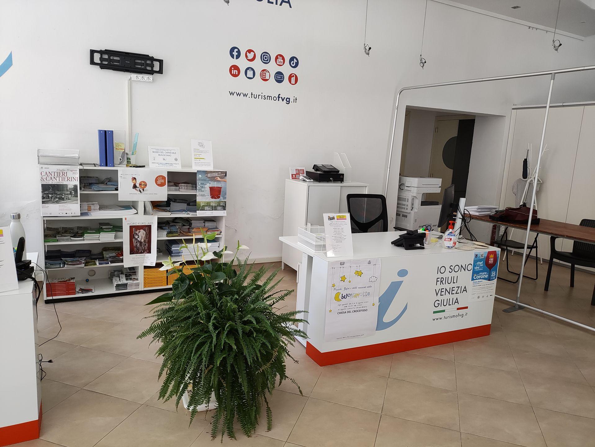
Bancone
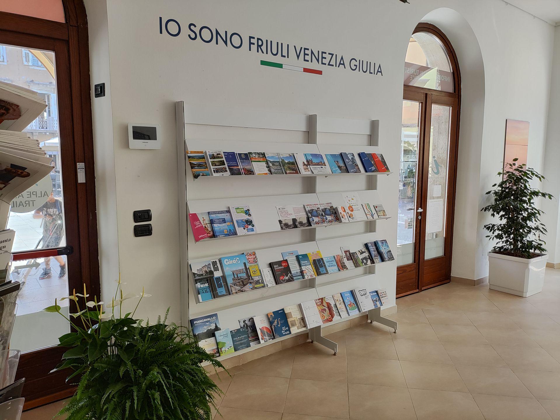
Espositori
Porta
ACCESSO:
NessunaDimensioni
ROTAZIONE DIAMETRO 140 CM:
SìLARGHEZZA LIBERA PREVALENTE:
> 75 cmPavimentazione
TIPO:
PiastrelleContrasto cromatico pavimenti/pareti
TIPO:
NoCOLORE PAVIMENTO:
BeigeCOLORE PARETI:
BiancoDislivello (> 2,5 cm)
PRESENTE:
NoSegnaletica
PERCORSI TATTILO-PLANTARI:
NoMAPPA TATTILE:
NoSEGNALETICA INFORMATIVA:
NoArredi
DETTAGLI BANCONE:
-
ALTEZZA (CM):
UnicaALTEZZA DA TERRA (CM):
75VUOTO SOTTO:
No
DETTAGLI ESPOSITORE:
-
ALTEZZA (CM):
Dispenser/ScaffaleALTEZZA MINIMA DA TERRA (CM):
70ALTEZZA MASSIMA DA TERRA (CM):
160
2.0
/3
ENTRANCE
.jpg)
Ingresso
Entrance typology
TYPE:
MainACCESSIBLE:
NoTIPO:
PrincipaleHeight difference (> 2.5 cm)
PRESENT:
YesDISLEVEL:
-
TYPE:
Short staircase/stepUNIVOCAL CODE:
SB1SHORT STAIRCASE/STEP (INFERIORE A UN PIANO):
WIDTH (CM):
115NUMBER OF STEPS:
1HEIGHT OF INDIVIDUAL RISER (CM):
10HANDRAIL:
PRESENT:
NoINTERMEDIATE LANDING:
NoTACTILE-PLANTAR PATHS:
No
Threshold (< 2.5 cm)
PRESENT:
YesHEIGHT:
2.5Entrance door
TYPE:
Single leafOPENING:
InsideAUTOMATED OPENING:
NoNET DOOR CLEARANCE:
Single or sliding doorMEASURE (CM):
100DOOR AND BACK DOOR COPLANARITY (NOT ASSESSED HEIGHT DIFFERENCE UP TO 2.5 CM):
NoZERBINI/CARPETS:
PRESENTS:
NoINTERCOM/BELL:
PRESENT:
NoGlass doors: window decals to indicate their presence
PRESENTS:
NoCOMPARTMENT
.jpg)
Bancone
.jpg)
Tavoli e sedie
Compartment name
TYPE:
Consumption: dining roomIDENTIFIER:
V1Door
ACCESS:
NoneDimensions
ROTATION DIAMETER 140 CM:
YesPREVAILING CLEAR WIDTH:
> 75 cmPaving
TYPE:
TilesColour contrast floors/walls
TYPE:
NoFLOOR COLOUR:
GreyWALL COLOUR:
PinkSignage
TACTILE-PLANTAR PATHS:
NoTOUCH MAP:
NoINFORMATION SIGNAGE:
NoFurniture
TABLE:
-
TYPE OF SUPPORT:
Centre pivotTYPE OF PLAN:
Rectangular/SquareWIDTH (CM):
60LENGTH (CM):
60GROUND CLEARANCE (CM):
77GROUND CLEARANCE (CM):
72TOP WITH ROUNDED EDGES:
No
SEDIA:
-
Backrest, Braccioli
FIXED TO THE GROUND:
No
Attri arredi
TYPE:
CounterHEIGHT:
UniqueGROUND CLEARANCE (CM):
115EMPTY UNDER:
No2.1
/3
ENTRANCE
.jpg)
Ingresso
Entrance typology
TYPE:
MainACCESSIBLE:
NoTIPO:
PrincipaleHeight difference (> 2.5 cm)
DISLEVEL:
-
SHORT STAIRCASE/STEP (INFERIORE A UN PIANO):
CORRIMANO:
PRESENT:
NoTYPE:
Short staircase/stepUNIVOCAL CODE:
SB1
PRESENT:
YesThreshold (< 2.5 cm)
PRESENT:
YesHEIGHT:
2.5Entrance door
TYPE:
Single leafOPENING:
InsideAUTOMATED OPENING:
NoNET DOOR CLEARANCE:
Single or sliding doorFORO COMPLESSIVO (CM):
130ANTA PRINCIPALE (CM):
80DOOR AND BACK DOOR COPLANARITY (NOT ASSESSED HEIGHT DIFFERENCE UP TO 2.5 CM):
NoZERBINI/CARPETS:
PRESENTS:
NoINTERCOM/BELL:
PRESENT:
NoGlass doors: window decals to indicate their presence
PRESENTS:
NoCOMPARTMENT
Compartment name
TYPE:
Consumption: dining roomIDENTIFIER:
V1Door
ACCESS:
NoneDimensions
ROTATION DIAMETER 140 CM:
YesPREVAILING CLEAR WIDTH:
> 75 cmPaving
TYPE:
TilesColour contrast floors/walls
TYPE:
NoFLOOR COLOUR:
GreyWALL COLOUR:
PinkSignage
TACTILE-PLANTAR PATHS:
NoTOUCH MAP:
NoINFORMATION SIGNAGE:
NoFurniture
BANCONE:
-
ALTEZZA (CM):
UnicaALTEZZA DA TERRA (CM):
112VUOTO SOTTO:
No
TABLE:
-
TYPE OF SUPPORT:
Centre pivotTYPE OF PLAN:
Rectangular/SquareWIDTH (CM):
80LENGTH (CM):
80GROUND CLEARANCE (CM):
72GROUND CLEARANCE (CM):
70TOP WITH ROUNDED EDGES:
Sì -
TIPOLOGIA SOSTEGNO:
Perno centraleTIPO DI PIANO:
Rettangolare/QuadratoLARGHEZZA (CM):
80LUNGHEZZA (CM):
80ALTEZZA DA TERRA (CM):
72SPAZIO LIBERO DA TERRA (CM):
70PIANO CON SPIGOLI SMUSSATI:
Sì
SEDIA:
-
Backrest, Armrests
FIXED TO THE GROUND:
No
General note
VANO
Porta
ACCESSO:
NessunaDimensioni
ROTAZIONE DIAMETRO 140 CM:
SìLARGHEZZA LIBERA PREVALENTE:
> 75 cmPavimentazione
TIPO:
LegnoContrasto cromatico pavimenti/pareti
TIPO:
SìCOLORE PAVIMENTO:
LegnoCOLORE PARETI:
BiancoSegnaletica
PERCORSI TATTILO-PLANTARI:
NoMAPPA TATTILE:
NoSEGNALETICA INFORMATIVA:
NoArredi
TAVOLO:
-
TIPOLOGIA SOSTEGNO:
Perno centraleTIPO DI PIANO:
Rettangolare/QuadratoLARGHEZZA (CM):
80LUNGHEZZA (CM):
80ALTEZZA DA TERRA (CM):
72SPAZIO LIBERO DA TERRA (CM):
70PIANO CON SPIGOLI SMUSSATI:
Sì
SEDIA:
-
Schienale
FISSA AL SUOLO:
No
BAGNO
Presente
AREA ESTERNA
.jpg)
Tavolo e sedie
Destinazione dell'area
TIPOLOGIA AREA:
ConsumazioneTipologia
ALTRA TIPOLOGIA:
Area pedonaleAccesso all'area
TIPOLOGIA:
Da percorso esternoDislivello (> 2,5 cm)
PRESENTE:
NoPavimentazione
TIPOLOGIA:
Cemento/Asfalto o pietra complanareDimensioni
ROTAZIONE DIAMETRO 140 CM:
SìLARGHEZZA LIBERA PREVALENTE:
> 75 cmArredi
TAVOLO:
-
TIPOLOGIA SOSTEGNO:
Gambe rientrantiTIPO DI PIANO:
Rettangolare/QuadratoLARGHEZZA (CM):
80LUNGHEZZA (CM):
80ALTEZZA DA TERRA (CM):
72SPAZIO LIBERO DA TERRA (CM):
70PIANO CON SPIGOLI SMUSSATI:
Sì -
TIPOLOGIA SOSTEGNO:
Gambe angoliTIPO DI PIANO:
Rettangolare/QuadratoLARGHEZZA (CM):
80LUNGHEZZA (CM):
80ALTEZZA DA TERRA (CM):
72SPAZIO LIBERO DA TERRA (CM):
70PIANO CON SPIGOLI SMUSSATI:
Sì
SEDIA:
-
Schienale
FISSA AL SUOLO:
No -
Schienale, Braccioli
FISSA AL SUOLO:
No
Nota generica
2.8
/3
ENTRANCE
.jpg)
Ingresso
Plan
Entrance typology
TYPE:
MainACCESSIBLE:
YesTIPO:
PrincipaleHeight difference (> 2.5 cm)
PRESENT:
NoThreshold (< 2.5 cm)
PRESENT:
YesHEIGHT:
2.5Entrance door
TYPE:
With two doors or with two opening elementsOPENING:
InsideAUTOMATED OPENING:
NoNET DOOR CLEARANCE:
With two doors or with two opening elementsOVERALL BORE (CM):
140MAIN DOOR (CM):
90DOOR AND BACK DOOR COPLANARITY (NOT ASSESSED HEIGHT DIFFERENCE UP TO 2.5 CM):
YesZERBINI/CARPETS:
PRESENTS:
NoINTERCOM/BELL:
PRESENT:
NoGlass doors: window decals to indicate their presence
PRESENTS:
NoCOMPARTMENT
Compartment name
TYPE:
Generic, of the structureIDENTIFIER:
V1Door
ACCESS:
NoneDimensions
ROTATION DIAMETER 140 CM:
YesPREVAILING CLEAR WIDTH:
> 75 cmPaving
TYPE:
TilesColour contrast floors/walls
TYPE:
YesFLOOR COLOUR:
BrownWALL COLOUR:
WhiteSignage
TACTILE-PLANTAR PATHS:
NoTOUCH MAP:
NoINFORMATION SIGNAGE:
NoFurniture
COUNTER:
-
HEIGHT:
UniqueGROUND CLEARANCE (CM):
120EMPTY UNDER:
No
TABLE:
-
TYPE OF SUPPORT:
Corner legsTYPE OF PLAN:
Rectangular/SquareWIDTH (CM):
80LENGTH (CM):
80GROUND CLEARANCE (CM):
72GROUND CLEARANCE (CM):
70TOP WITH ROUNDED EDGES:
No
SEDIA:
-
Backrest
FIXED TO THE GROUND:
No
3
/3
PARKING FOR PUBLIC USE
.jpg)
Stalli di parcheggio
Public car park features
TYPE:
Outdoor uncoveredSTALL:
-
NUMBER OF STALLS:
2TYPE:
HerringboneWIDTH (CM):
360LENGTH (CM):
500SIGNAGE:
Horizontal, VerticalPAVING:
Concrete/Asphalt or coplanar stone
Connection with the footpath
HEIGHT DIFFERENCE (> 2.5 CM):
PRESENT:
No3
/3
PARKING FOR PUBLIC USE
.jpg)
Stallo di parcheggio
Public car park features
TYPE:
Outdoor uncoveredSTALL:
-
NUMBER OF STALLS:
1TYPE:
in combWIDTH (CM):
330LENGTH (CM):
550SIGNAGE:
Horizontal, VerticalPAVING:
Concrete/Asphalt or coplanar stone
Connection with the footpath
HEIGHT DIFFERENCE (> 2.5 CM):
PRESENT:
No2.0
/3
PARKING FOR PUBLIC USE
.jpg)
Stallo di parcheggio
Public car park features
TYPE:
Outdoor uncoveredSTALL:
-
NUMBER OF STALLS:
1TYPE:
In lineWIDTH (CM):
290LENGTH (CM):
500SIGNAGE:
Horizontal, VerticalPAVING:
Concrete/Asphalt or coplanar stone
Connection with the footpath
HEIGHT DIFFERENCE (> 2.5 CM):
PRESENT:
No2.0
/3
PARKING FOR PUBLIC USE
.jpg)
Stalli di parcheggio
Public car park features
TYPE:
Outdoor uncoveredSTALL:
-
NUMBER OF STALLS:
2TYPE:
in combWIDTH (CM):
300LENGTH (CM):
450SIGNAGE:
Horizontal, VerticalPAVING:
Concrete/Asphalt or coplanar stone
Connection with the footpath
HEIGHT DIFFERENCE (> 2.5 CM):
PRESENT:
No2.5
/3
PARKING FOR PUBLIC USE
_MOD%20(FILEminimizer).jpg)
Stallo di parcheggio
Public car park features
TYPE:
Outdoor uncoveredSTALL:
-
NUMBER OF STALLS:
1TYPE:
In lineWIDTH (CM):
230LENGTH (CM):
600SIGNAGE:
Horizontal, VerticalPAVING:
Concrete/porphyry coplanar blocks
Connection with the footpath
HEIGHT DIFFERENCE (> 2.5 CM):
PRESENT:
No2.4
/3
ENTRANCE - PIAZZA MARCONI 6/A
.jpg)
Ingresso
Entrance typology
TYPE:
MainACCESSIBLE:
NoTIPO:
PrincipaleHeight difference (> 2.5 cm)
PRESENT:
YesDISLEVEL:
-
TYPE:
Short staircase/stepUNIVOCAL CODE:
SB1SHORT STAIRCASE/STEP (LESS THAN ONE FLOOR):
WIDTH (CM):
80NUMBER OF STEPS:
1HEIGHT OF INDIVIDUAL RISER (CM):
5CORRIMANO:
PRESENT:
NoINTERMEDIATE LANDING:
NoTACTILE-PLANTAR PATHS:
No
Threshold (< 2.5 cm)
PRESENT:
No/LevelEntrance door
TYPE:
Single leafOPENING:
InsideAUTOMATED OPENING:
NoNET DOOR CLEARANCE:
Single or sliding doorMEASURE (CM):
80DOOR AND BACK DOOR COPLANARITY (NOT ASSESSED HEIGHT DIFFERENCE UP TO 2.5 CM):
NoZERBINI/CARPETS:
PRESENTS:
YesTYPE:
Satin doormatTYPE:
CompactINTERCOM/BELL:
PRESENT:
NoGlass doors: window decals to indicate their presence
PRESENTS:
NoENTRANCE - VIA DANTE ALIGHIERI 22/A
.jpg)
Ingresso
Entrance typology
TYPE:
SecondaryACCESSIBLE:
NoTIPO:
SecondarioLOCATION IN RELATION TO THE MAIN:
Opposite side of the buildingSECONDARY ENTRANCE INDICATION:
Via Dante Atighieri 22/AHeight difference (> 2.5 cm)
PRESENT:
YesDISLEVEL:
-
TYPE:
Short staircase/stepUNIVOCAL CODE:
SB2SHORT STAIRCASE/STEP (LESS THAN ONE FLOOR):
WIDTH (CM):
80NUMBER OF STEPS:
1HEIGHT OF INDIVIDUAL RISER (CM):
10CORRIMANO:
PRESENT:
NoINTERMEDIATE LANDING:
NoTACTILE-PLANTAR PATHS:
No
Threshold (< 2.5 cm)
PRESENT:
No/LevelEntrance door
TYPE:
Single leafOPENING:
InsideAUTOMATED OPENING:
NoNET DOOR CLEARANCE:
Single or sliding doorMEASURE (CM):
80DOOR AND BACK DOOR COPLANARITY (NOT ASSESSED HEIGHT DIFFERENCE UP TO 2.5 CM):
NoZERBINI/CARPETS:
PRESENTS:
YesTYPE:
Satin doormatTYPE:
CompactINTERCOM/BELL:
PRESENT:
NoGlass doors: window decals to indicate their presence
PRESENTS:
NoGeneral note
COMPARTMENT
Compartment name
TYPE:
Generic, of the structureIDENTIFIER:
V1Door
ACCESS:
NoneDimensions
ROTATION DIAMETER 140 CM:
YesPREVAILING CLEAR WIDTH:
> 75 cmPaving
TYPE:
TilesColour contrast floors/walls
TYPE:
YesFLOOR COLOUR:
GreyWALL COLOUR:
WhiteSignage
TACTILE-PLANTAR PATHS:
NoTOUCH MAP:
NoINFORMATION SIGNAGE:
NoFurniture
COUNTER:
-
HEIGHT:
UniqueGROUND CLEARANCE (CM):
100EMPTY UNDER:
No
ESPOSITORE:
-
HEIGHT:
Dispenser/Shelf
General note
OUTDOOR AREA - PIAZZA MARCONI
Destination of the area
AREA TYPOLOGY:
MoreType
Access to the area
TYPE:
From external pathwayHeight difference (> 2.5 cm)
PRESENT:
NoPaving
TYPE:
Concrete/Asphalt or coplanar stoneDimensions
ROTATION DIAMETER 140 CM:
YesPREVAILING CLEAR WIDTH:
> 75 cmFurniture
ESPOSITORE:
-
HEIGHT:
Dispenser/Shelf
General note
3
/3
ENTRANCE
.jpg)
Ingresso
Entrance typology
TYPE:
MainACCESSIBLE:
YesTIPO:
PrincipaleHeight difference (> 2.5 cm)
PRESENT:
NoThreshold (< 2.5 cm)
PRESENT:
YesHEIGHT:
2.5Entrance door
TYPE:
Single leafOPENING:
InsideAUTOMATED OPENING:
NoNET DOOR CLEARANCE:
Single or sliding doorMEASURE (CM):
85DOOR AND BACK DOOR COPLANARITY (NOT ASSESSED HEIGHT DIFFERENCE UP TO 2.5 CM):
YesZERBINI/CARPETS:
PRESENTS:
NoINTERCOM/BELL:
PRESENT:
NoGlass doors: window decals to indicate their presence
PRESENTS:
NoCOMPARTMENT
Compartment name
TYPE:
Generic, of the structureIDENTIFIER:
V1Door
ACCESS:
NoneDimensions
ROTATION DIAMETER 140 CM:
YesPREVAILING CLEAR WIDTH:
> 75 cmPaving
TYPE:
TilesColour contrast floors/walls
TYPE:
YesFLOOR COLOUR:
Beige/BrownWALL COLOUR:
VariousousSignage
TACTILE-PLANTAR PATHS:
NoTOUCH MAP:
NoINFORMATION SIGNAGE:
NoFurniture
COUNTER:
-
HEIGHT:
UniqueGROUND CLEARANCE (CM):
90EMPTY UNDER:
No
General note
2.0
/3
ENTRANCE
.jpg)
Ingresso
Entrance typology
TYPE:
MainACCESSIBLE:
NoTIPO:
PrincipaleHeight difference (> 2.5 cm)
PRESENT:
YesDISLEVEL:
-
TYPE:
Short staircase/stepUNIVOCAL CODE:
SB1SHORT STAIRCASE (LESS THAN ONE FLOOR):
WIDTH (CM):
80NUMBER OF STEPS:
1HEIGHT OF INDIVIDUAL RISER (CM):
12CORRIMANO:
PRESENT:
NoINTERMEDIATE LANDING:
NoTACTILE-PLANTAR PATHS:
No
Threshold (< 2.5 cm)
PRESENT:
No/LevelEntrance door
TYPE:
Single leafOPENING:
InsideAUTOMATED OPENING:
NoNET DOOR CLEARANCE:
Single or sliding doorMEASURE (CM):
80DOOR AND BACK DOOR COPLANARITY (NOT ASSESSED HEIGHT DIFFERENCE UP TO 2.5 CM):
NoZERBINI/CARPETS:
PRESENTS:
NoINTERCOM/BELL:
PRESENT:
NoGlass doors: window decals to indicate their presence
PRESENTS:
NoCOMPARTMENT
Compartment name
TYPE:
Generic, of the structureIDENTIFIER:
V1Door
ACCESS:
NoneDimensions
ROTATION DIAMETER 140 CM:
YesPREVAILING CLEAR WIDTH:
> 75 cmPaving
TYPE:
TilesColour contrast floors/walls
TYPE:
NoFLOOR COLOUR:
Not detectedWALL COLOUR:
Not detectedSignage
TACTILE-PLANTAR PATHS:
NoTOUCH MAP:
NoINFORMATION SIGNAGE:
NoFurniture
COUNTER:
-
HEIGHT:
UniqueGROUND CLEARANCE (CM):
110EMPTY UNDER:
No
1.9
/3
ENTRANCE
.jpg)
Ingresso
Entrance typology
TYPE:
MainACCESSIBLE:
NoTIPO:
PrincipaleHeight difference (> 2.5 cm)
PRESENT:
YesDISLEVEL:
-
TYPE:
Short staircase/stepUNIVOCAL CODE:
SB1SHORT STAIRCASE (LESS THAN ONE FLOOR):
WIDTH (CM):
90NUMBER OF STEPS:
1HEIGHT OF INDIVIDUAL RISER (CM):
5CORRIMANO:
PRESENT:
NoINTERMEDIATE LANDING:
NoTACTILE-PLANTAR PATHS:
No
Threshold (< 2.5 cm)
PRESENT:
No/LevelEntrance door
TYPE:
Single leafOPENING:
InsideAUTOMATED OPENING:
NoNET DOOR CLEARANCE:
Single or sliding doorMEASURE (CM):
90DOOR AND BACK DOOR COPLANARITY (NOT ASSESSED HEIGHT DIFFERENCE UP TO 2.5 CM):
NoZERBINI/CARPETS:
PRESENTS:
YesTYPE:
Satin doormatTYPE:
CompactINTERCOM/BELL:
PRESENT:
NoGlass doors: window decals to indicate their presence
PRESENTS:
NoCOMPARTMENT - INGRESSO
.jpg)
Bancone
.jpg)
Tavoli e sedie
Compartment name
TYPE:
Generic, of the structureIDENTIFIER:
V1Door
ACCESS:
NoneDimensions
ROTATION DIAMETER 140 CM:
YesPREVAILING CLEAR WIDTH:
> 75 cmPaving
TYPE:
MoreOTHER TYPOLOGY:
Sown alla VenetianColour contrast floors/walls
TYPE:
YesFLOOR COLOUR:
MixedWALL COLOUR:
Wood/BlueeSignage
TACTILE-PLANTAR PATHS:
NoTOUCH MAP:
NoINFORMATION SIGNAGE:
NoFurniture
COUNTER:
-
HEIGHT:
UniqueGROUND CLEARANCE (CM):
110EMPTY UNDER:
No
TABLE:
-
TYPE OF SUPPORT:
Corner legsTYPE OF PLAN:
Rectangular/SquareWIDTH (CM):
80LENGTH (CM):
80GROUND CLEARANCE (CM):
75GROUND CLEARANCE (CM):
71TOP WITH ROUNDED EDGES:
No
CHAIR:
-
Backrest
FIXED TO THE GROUND:
No
COMPARTMENT - SALA
.jpg)
Rampa
.jpg)
Tavolo e sedie
Compartment name
TYPE:
Consumption: dining roomIDENTIFIER:
V1Door
ACCESS:
From internal common partsDOOR TYPE:
With two doors or with two opening elementsOPENING:
InsideNET DOOR CLEARANCE:
With two doors or with two opening elementsOVERALL BORE (CM):
90MAIN DOOR (CM):
60Dimensions
ROTATION DIAMETER 140 CM:
YesPREVAILING CLEAR WIDTH:
> 75 cmPaving
TYPE:
WoodColour contrast floors/walls
TYPE:
YesFLOOR COLOUR:
WoodWALL COLOUR:
WoodSignage
TACTILE-PLANTAR PATHS:
NoTOUCH MAP:
NoINFORMATION SIGNAGE:
NoFurniture
TABLE:
-
TYPE OF SUPPORT:
Corner legsTYPE OF PLAN:
Rectangular/SquareWIDTH (CM):
120LENGTH (CM):
120GROUND CLEARANCE (CM):
80GROUND CLEARANCE (CM):
75TOP WITH ROUNDED EDGES:
No
CHAIR:
-
Backrest
FIXED TO THE GROUND:
No
BATHROOM
Present
OUTDOOR AREA
Destination of the area
AREA TYPOLOGY:
ConsumptionType
Access to the area
TYPE:
From external pathwayHeight difference (> 2.5 cm)
PRESENT:
NoPaving
TYPE:
Concrete/Asphalt or coplanar stoneDimensions
ROTATION DIAMETER 140 CM:
YesPREVAILING CLEAR WIDTH:
> 75 cmFurniture
TABLE:
-
TYPE OF SUPPORT:
Corner legsTYPE OF PLAN:
Rectangular/SquareWIDTH (CM):
90LENGTH (CM):
90GROUND CLEARANCE (CM):
75GROUND CLEARANCE (CM):
70TOP WITH ROUNDED EDGES:
No
CHAIR:
-
Backrest
FIXED TO THE GROUND:
No
General note
1.9
/3
ENTRANCE
.jpg)
Ingresso
Entrance typology
TYPE:
MainACCESSIBLE:
NoTIPO:
PrincipaleHeight difference (> 2.5 cm)
PRESENT:
YesDISLEVEL:
-
TYPE:
Short staircase/stepUNIVOCAL CODE:
SB1SHORT STAIRCASE (LESS THAN ONE FLOOR):
WIDTH (CM):
90NUMBER OF STEPS:
1HEIGHT OF INDIVIDUAL RISER (CM):
9CORRIMANO:
PRESENT:
NoINTERMEDIATE LANDING:
NoTACTILE-PLANTAR PATHS:
No
Threshold (< 2.5 cm)
PRESENT:
No/LevelEntrance door
TYPE:
Single leafOPENING:
InsideAUTOMATED OPENING:
NoNET DOOR CLEARANCE:
Single or sliding doorMEASURE (CM):
90DOOR AND BACK DOOR COPLANARITY (NOT ASSESSED HEIGHT DIFFERENCE UP TO 2.5 CM):
NoZERBINI/CARPETS:
PRESENTS:
NoINTERCOM/BELL:
PRESENT:
NoGlass doors: window decals to indicate their presence
PRESENTS:
NoCOMPARTMENT
Compartment name
TYPE:
Consumption: dining roomIDENTIFIER:
V1Door
ACCESS:
NoneDimensions
ROTATION DIAMETER 140 CM:
YesPREVAILING CLEAR WIDTH:
> 75 cmPaving
TYPE:
TilesColour contrast floors/walls
TYPE:
YesFLOOR COLOUR:
BeigeWALL COLOUR:
White/WoodSignage
TACTILE-PLANTAR PATHS:
NoTOUCH MAP:
NoINFORMATION SIGNAGE:
NoFurniture
TABLE:
-
TYPE OF SUPPORT:
Corner legsTYPE OF PLAN:
Rectangular/SquareWIDTH (CM):
100LENGTH (CM):
100GROUND CLEARANCE (CM):
74GROUND CLEARANCE (CM):
72TOP WITH ROUNDED EDGES:
No
CHAIR:
-
Backrest
FIXED TO THE GROUND:
No
General note
BATHROOM
Present
OUTDOOR AREA
Destination of the area
AREA TYPOLOGY:
ConsumptionType
Access to the area
TYPE:
From external pathwayHeight difference (> 2.5 cm)
PRESENT:
NoPaving
TYPE:
Concrete/Asphalt or coplanar stoneDimensions
ROTATION DIAMETER 140 CM:
YesPREVAILING CLEAR WIDTH:
> 75 cmFurniture
TABLE:
-
TYPE OF SUPPORT:
Centre pivotTYPE OF PLAN:
Rectangular/SquareWIDTH (CM):
60LENGTH (CM):
60GROUND CLEARANCE (CM):
74GROUND CLEARANCE (CM):
72TOP WITH ROUNDED EDGES:
No
CHAIR:
-
Backrest
FIXED TO THE GROUND:
No -
Backrest, Armrests
FIXED TO THE GROUND:
No
General note
2.0
/3
ENTRANCE
.jpg)
Ingresso
Entrance typology
TYPE:
MainACCESSIBLE:
NoTIPO:
PrincipaleHeight difference (> 2.5 cm)
PRESENT:
YesDISLEVEL:
-
TYPE:
Short staircase/stepUNIVOCAL CODE:
SB1SHORT STAIRCASE (LESS THAN ONE FLOOR):
WIDTH (CM):
150NUMBER OF STEPS:
1HEIGHT OF INDIVIDUAL RISER (CM):
10CORRIMANO:
PRESENT:
NoINTERMEDIATE LANDING:
NoTACTILE-PLANTAR PATHS:
No
Threshold (< 2.5 cm)
PRESENT:
No/LevelEntrance door
TYPE:
With two doors or with two opening elementsOPENING:
InsideAUTOMATED OPENING:
NoNET DOOR CLEARANCE:
With two doors or with two opening elementsOVERALL BORE (CM):
150MAIN DOOR (CM):
75DOOR AND BACK DOOR COPLANARITY (NOT ASSESSED HEIGHT DIFFERENCE UP TO 2.5 CM):
NoZERBINI/CARPETS:
PRESENTS:
NoINTERCOM/BELL:
PRESENT:
NoGlass doors: window decals to indicate their presence
PRESENTS:
NoCOMPARTMENT
.jpg)
Bancone
Compartment name
TYPE:
Generic, of the structureIDENTIFIER:
V1Door
ACCESS:
NoneDimensions
ROTATION DIAMETER 140 CM:
YesPREVAILING CLEAR WIDTH:
> 75 cmPaving
TYPE:
TilesColour contrast floors/walls
TYPE:
YesFLOOR COLOUR:
GreyWALL COLOUR:
White/GreenSignage
TACTILE-PLANTAR PATHS:
NoTOUCH MAP:
NoINFORMATION SIGNAGE:
NoFurniture
COUNTER:
-
HEIGHT:
UniqueGROUND CLEARANCE (CM):
110EMPTY UNDER:
No