Marano Lagunare - Tour itinerary

Sea
GENERAL INFORMATION
LAST INSPECTION DATE
19/10/2022
PLANNED ITINERARY
Marano Lagunare - Tour Itinerary
LENGTH
1000 meters
DEPARTURE
Piazza Case Operaie car park
The tour can take place at any time of the year.
Departure from the car park in Piazza Case Operaie (Photograph 1). There is parking for around twenty vehicles, including a parking space reserved for people with disability. Even, uniform surface, made of porphyry. The pavement (Photograph 2), on one side of the square and then across the full width, is made of natural stone slabs and is broad in width. On the opposite side of the square, there is a tree line. From Piazza Case Operaie, it is also possible to reach Via delle Mura, paved in stone, with a uniform surface leading towards the area of the Town Hall and the Archaeological Museum of the Lagoon (Photograph 3).

Photo 1 - Piazza Case Operaie parking

Photo 2 - square pavement

Photo 3 - Route to via delle Mura
From the car park in Piazza Case Operaie continue along Via Giovanni Pascoli (a pedestrian area), the road is narrow and paved with porphyry (Photograph 4). Shortly afterwards there is a car park (behind the Church dedicated to Saint Martin) for about ten vehicles and a parking space reserved for people with disability (Photograph 5).

Photo 4 - via Giovanni Pascoli

Photo 5 - Parking behind the church of San Martino
Past the car park, the itinerary continues along Via Giovanni Pascoli and the paving continues as follows: porphyry main road and natural stone pavements in width (Photograph 6). The pavements are level with the road and are bordered by steel posts. The itinerary is level as far as Piazza Savorgnan where there is a car park (Photograph 7) which includes a parking space reserved for people with disability. To reach Piazza Loredan (Photographs 8 and 9), it is also possible to continue along the street parallel to Via Giovanni Pascoli, which is also a level pedestrian area and paved completely with slabs of piasentina stone, with a regular and uniform surface (Photograph 10).

Photo 6 - itinerary on porphyry

Photo 7 - Route to Piazza Savorgnan

Photo 8 - Piazza Loredan
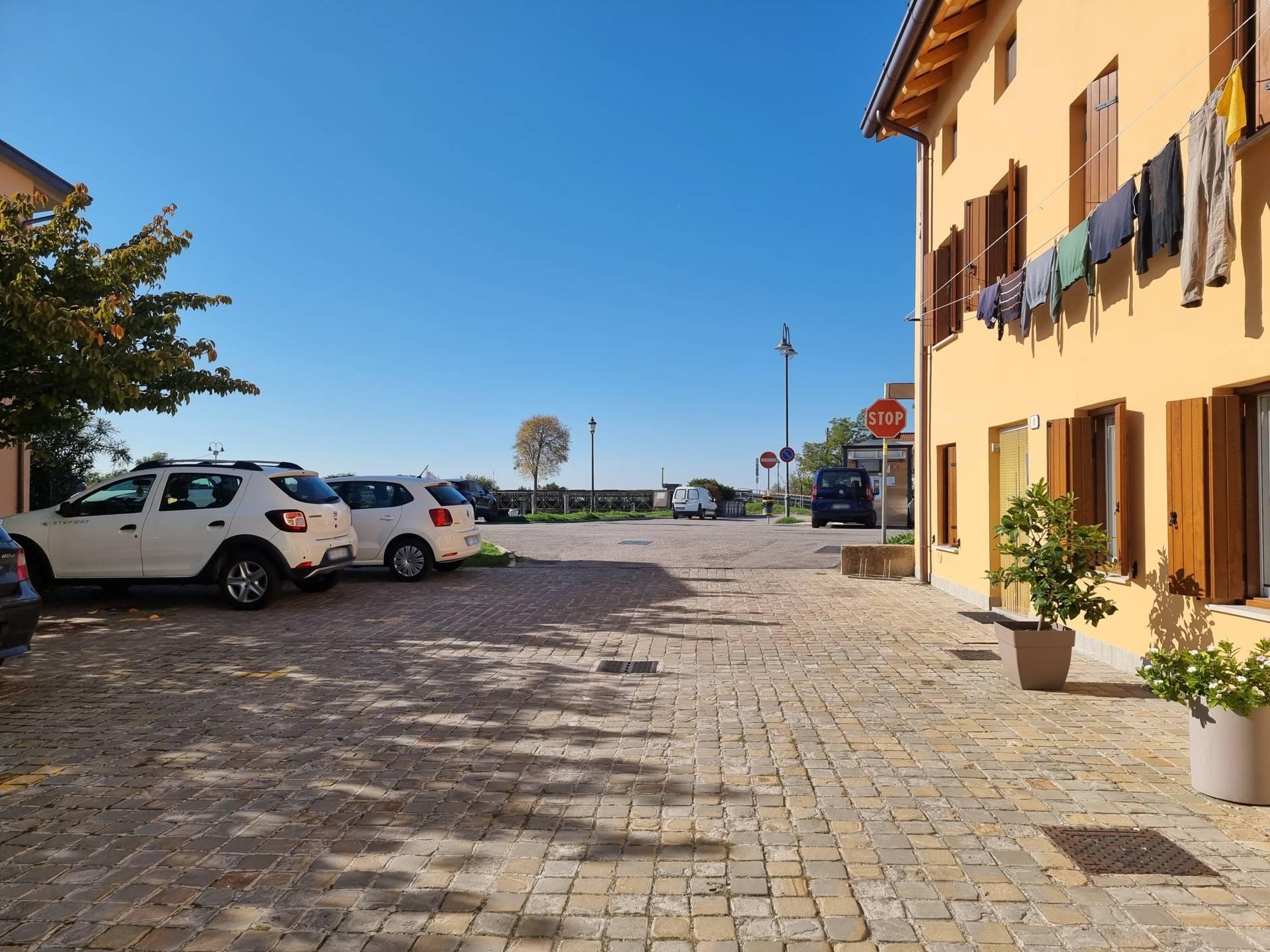
Photo 9 - Piazza Loredan
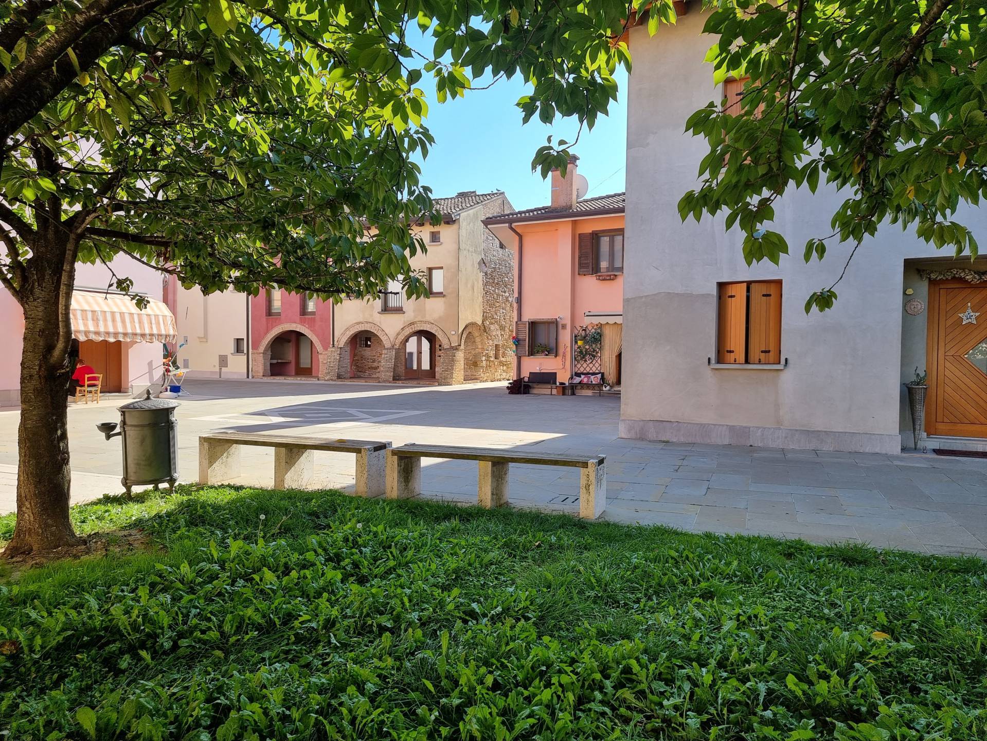
Photo 10 - stone itinerary
To continue the assigned itinerary, from Via Giovanni Pascoli it is necessary to cross a drain with 2.5 centimetres holes and continue for a short distance along Via Venezia (Photographs 11-12).

Photo 11 - storm drain on the route
Photo 12 - Route along via Venezia
After crossing Via Venezia, visitors arrive at Piazza dello Squero, a square mainly intended for parking on asphalt (Photograph 13). The itinerary involves crossing the bridge and then from the end of the pavement it is necessary to continue for a short distance along the road and take, on the left, the 10-metre-long paved ramp with an average slope of 8.5 per cent uphill (Photograph 14). This slope, combined with the length of the ramp, makes it difficult for wheelchair users to be able to use it independently (Photograph 15).
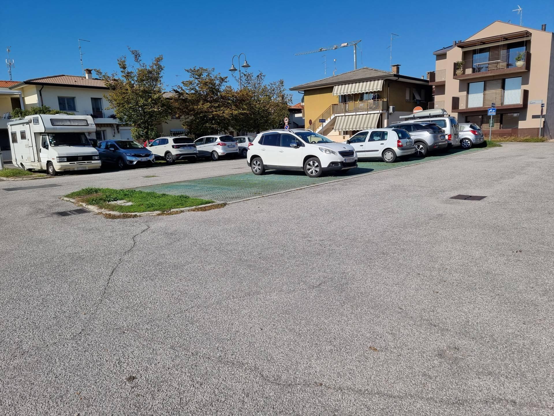
Photo 13 - Parking in Piazza dello Squero
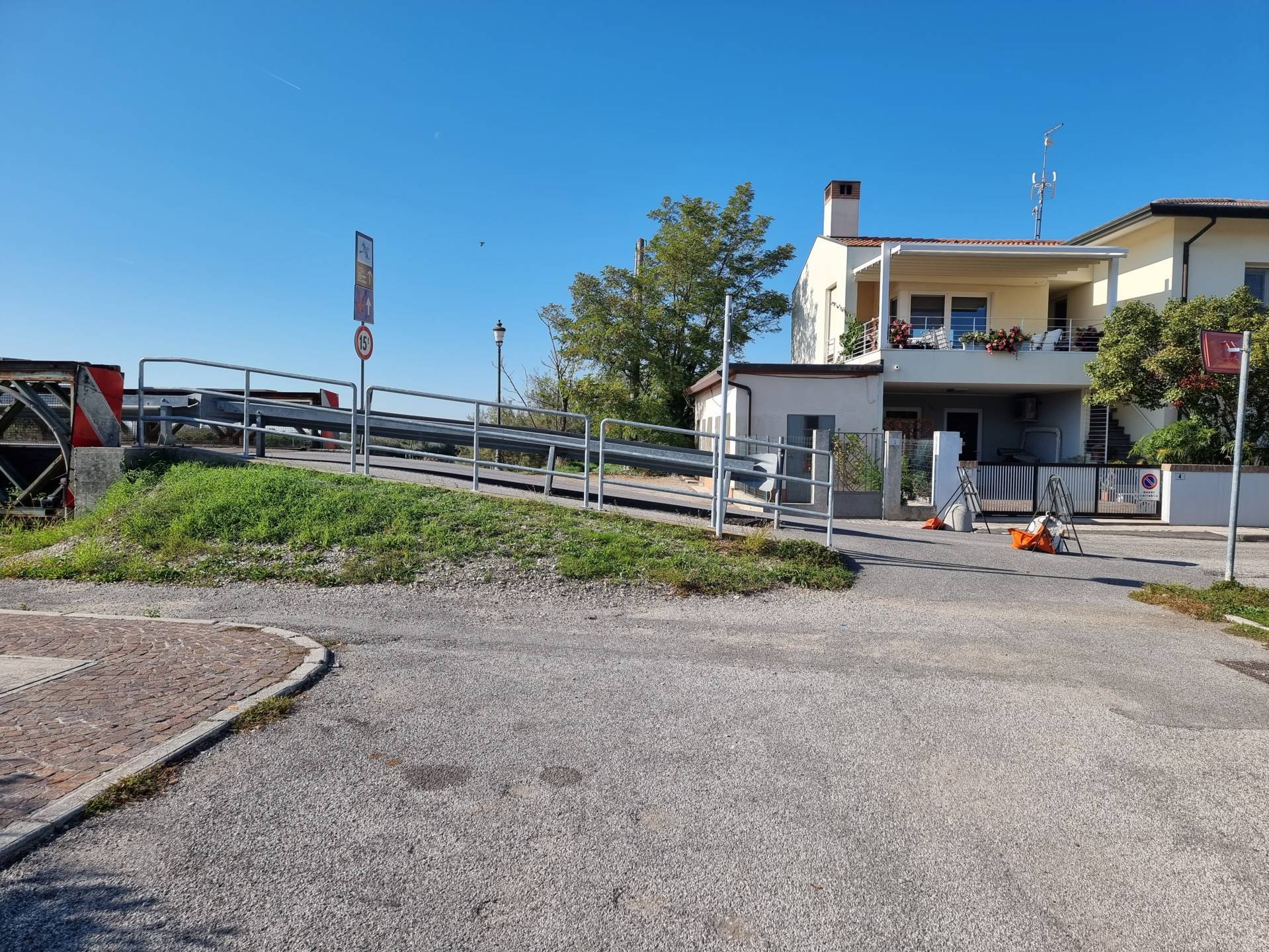
Photo 14 - view of the bridge ramp
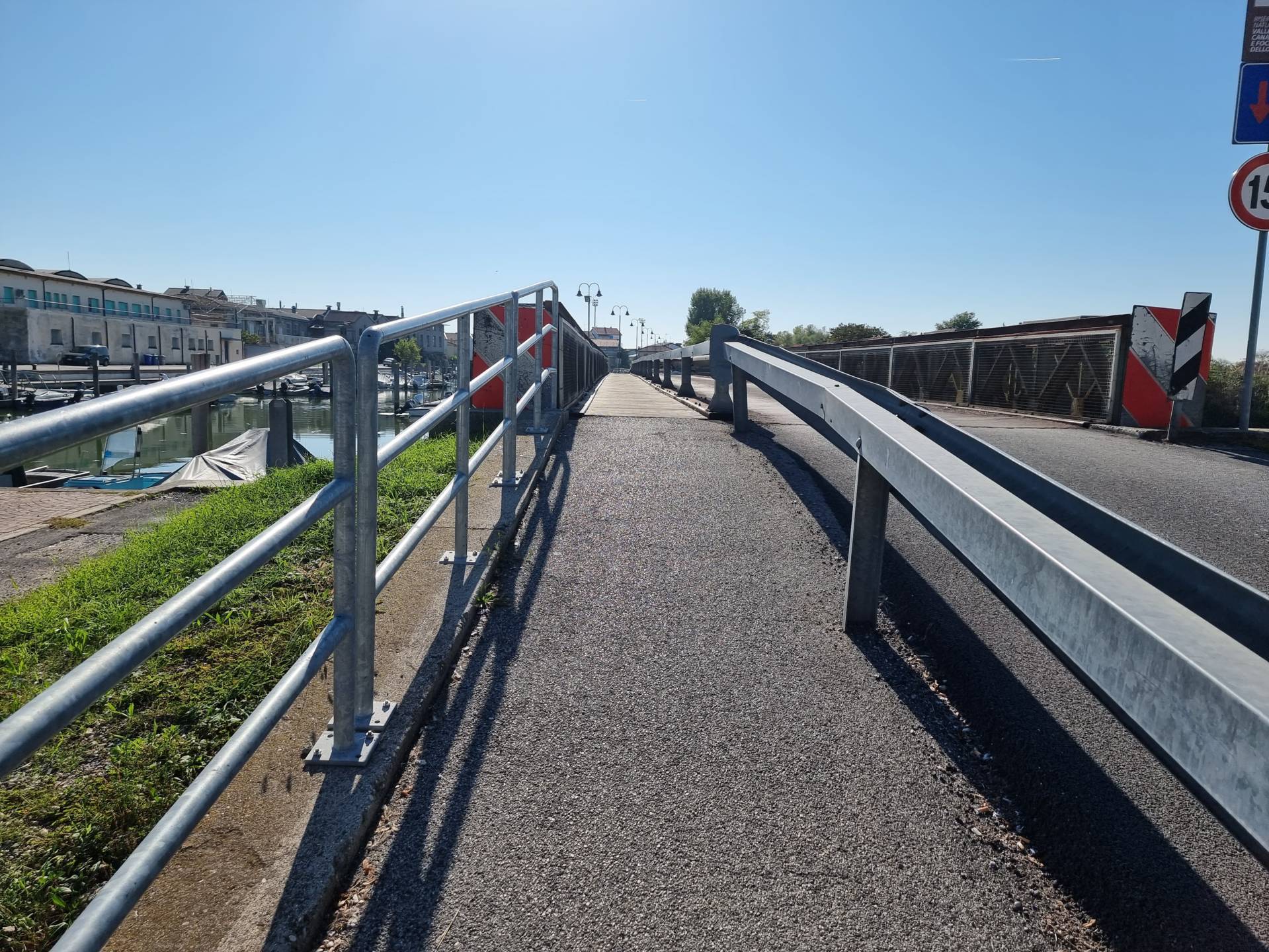
Photo 15 - bridge crossing
Then the bridge walkway is paved with wooden planks, the planks are arranged parallel to the direction of travel; the itinerary is separated from the asphalt road by a guardrail and is level. The bridge walkway (Photograph 16), which is 1.00 metre in width, has a somewhat uneven pavement due to the wooden planking with 1-centimetre joints. A paved downhill ramp is located beyond the flat bridge itinerary (Photograph 17). Then there is a wooden footbridge (boat jetty) that runs alongside the canal and continues along the paved itinerary, always protected by guardrails to the right of the jetty. The jetty (no protection against falling into the sea) has wooden boards arranged perpendicularly to the direction of travel and gaps of approximately 1 centimetre between one board and the next, so it is advisable to continue the itinerary on a parallel protected paved itinerary. Between the protected asphalt itinerary and the jetty is a wide concrete kerb with rounded corners. Visually, the boundary of the jetty is clearly defined from the kerb (Photograph 18).

Photo 16 - wooden flooring
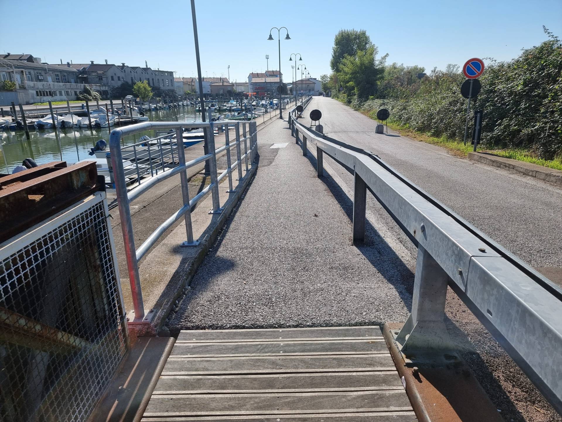
Photo 17 - asphalt paving

Photo 18 - separating kerb from jetty
Towards the end of the road, the wooden footbridge stops and the guardrail protecting the footpath also comes to an end (Photograph 19). The paved pedestrian path, which is now marked with white stripes on the ground, first becomes narrower and then wider near the entrance, on the opposite side, of the Valle Canal Novo Regional Nature Reserve (Photograph 20). This is where the wooden boardwalk also starts again. The pedestrian path, or rather the area of the roadway in Via delle Valli, is marked with white stripes on the ground and undergoes considerable changes in width due to the presence of obstacles and parking spaces. The boardwalk in this section is physically separated from the roadway by a reinforced concrete wall (Photograph 10).

Photo 19 - guard-rail interruption

Photo 20 - Valle Canal Novo Regional Nature Reserve

Photo 21 - route along the jetty
The Regional Nature Reserve of the Canal Novo Valley (Photograph 22) consists of a former fishing valley and some agricultural land covering approximately 121 hectares and features several buildings constructed in the traditional style of local “Casoni” (huts) with functions of services, refreshment, didactics and an observatory (Photograph 23). In addition to the ticket office, there is an educational lodge, aquarium, panoramic observatory, guest quarters, observatory (not accessible to wheelchair users) and a prehistoric area. Atmost all of the Reserve, albeit with some difficulties due to the sometimes uneven terrain, is accessible to people with disability. In the “casone“, where the ticket office and the Oasis restaurant are located, there is a toilet accessible to people with disability. The itineraries inside the park have variable widths and are paved with a mixture of washed gravel, gravel or packed earth and wooden boards. The signage inside the park consists of large wooden structures with black lettering on a white surface, indicating the main elements of interest (including bird life) and complete with maps, pictures and illustrations, with good legibility (Photograph 24).

Photo 22 -itineraries inside the park

Photo 23 - ENTRANCE TO THE STRUCTURE

Photo 24 - signage inside the park
The itinerary continues along Via delle Valli (Photograph 25), with no pavement on either side, the route continues along the main road to the junction with Via Saline. Via Saline has a pavement on the right side (Photograph 26), a regular surface in concrete modules, raised above the road level by 12 centimetres. To continue the itinerary on the pavement, it is necessary to step onto the pavement at the first driveway access after the crossroads, at street number 17. The pavement has some narrowing due to the presence of the entrance steps to the houses. At the crossroads with Via Toniolo, however, there is no lowering that would allow a pedestrian crossing, and even continuing along this street there is no lowering located for the junction, and the only way down is to overcome the height difference that measures 12 centimetres. The itinerary continues along Via Saline (Photograph 27). Since it is not possible to continue along the pavement on the right, the only valid way is to continue along the road, on asphalt until reaching the uphill ramp that crosses the bridge and descends towards Vecchia Pescheria (Photograph 28).
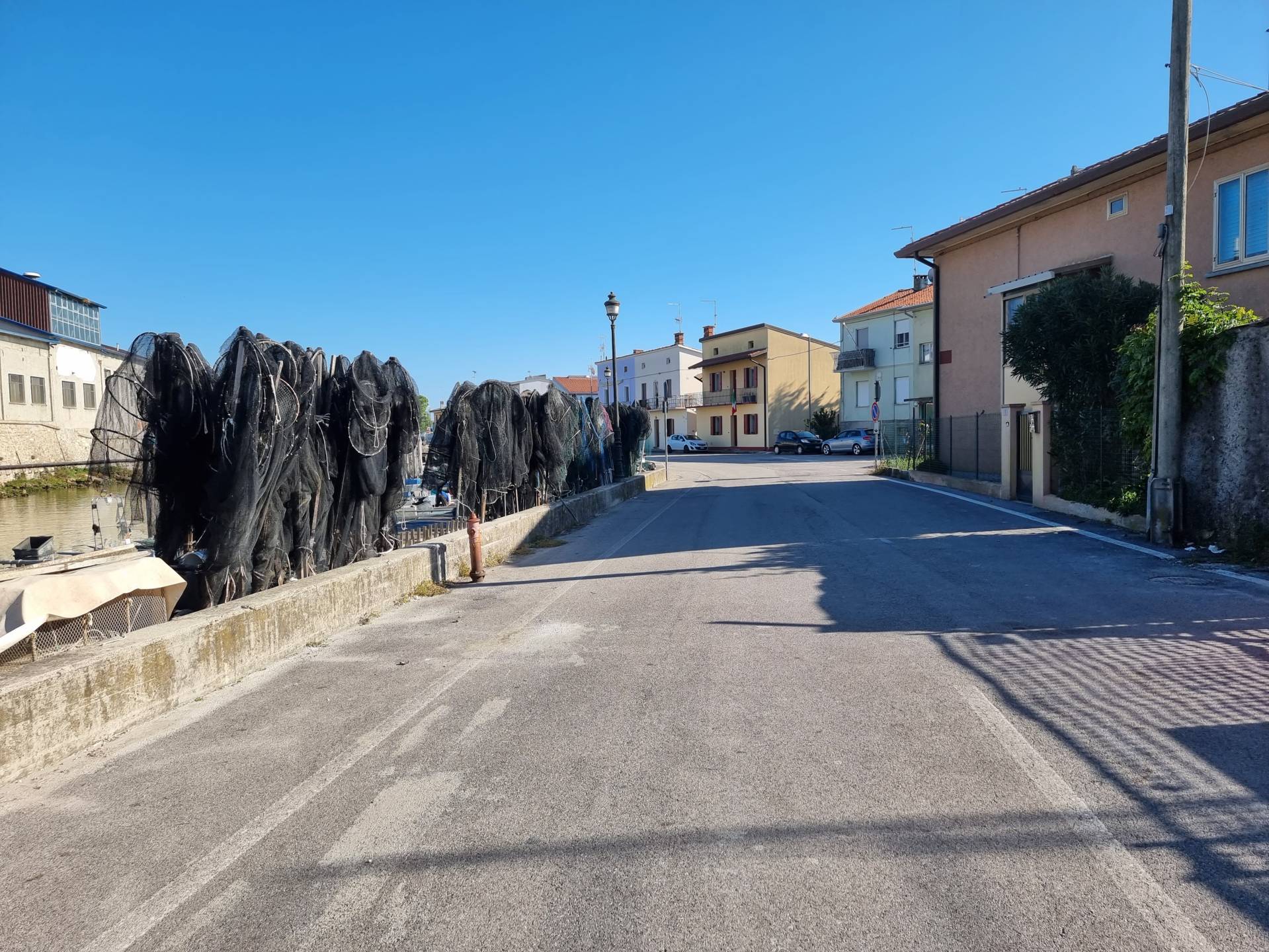
Photo 25 - Route on via delle Valli

Photo 26 - Route on via Saline with sidewalk on right side
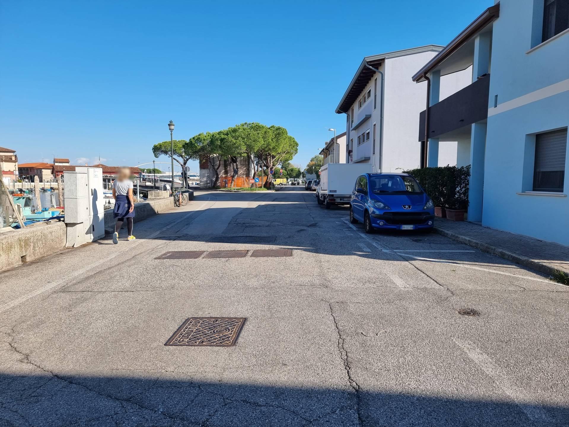
Photo 27 - Route on via Saline toward the bridge
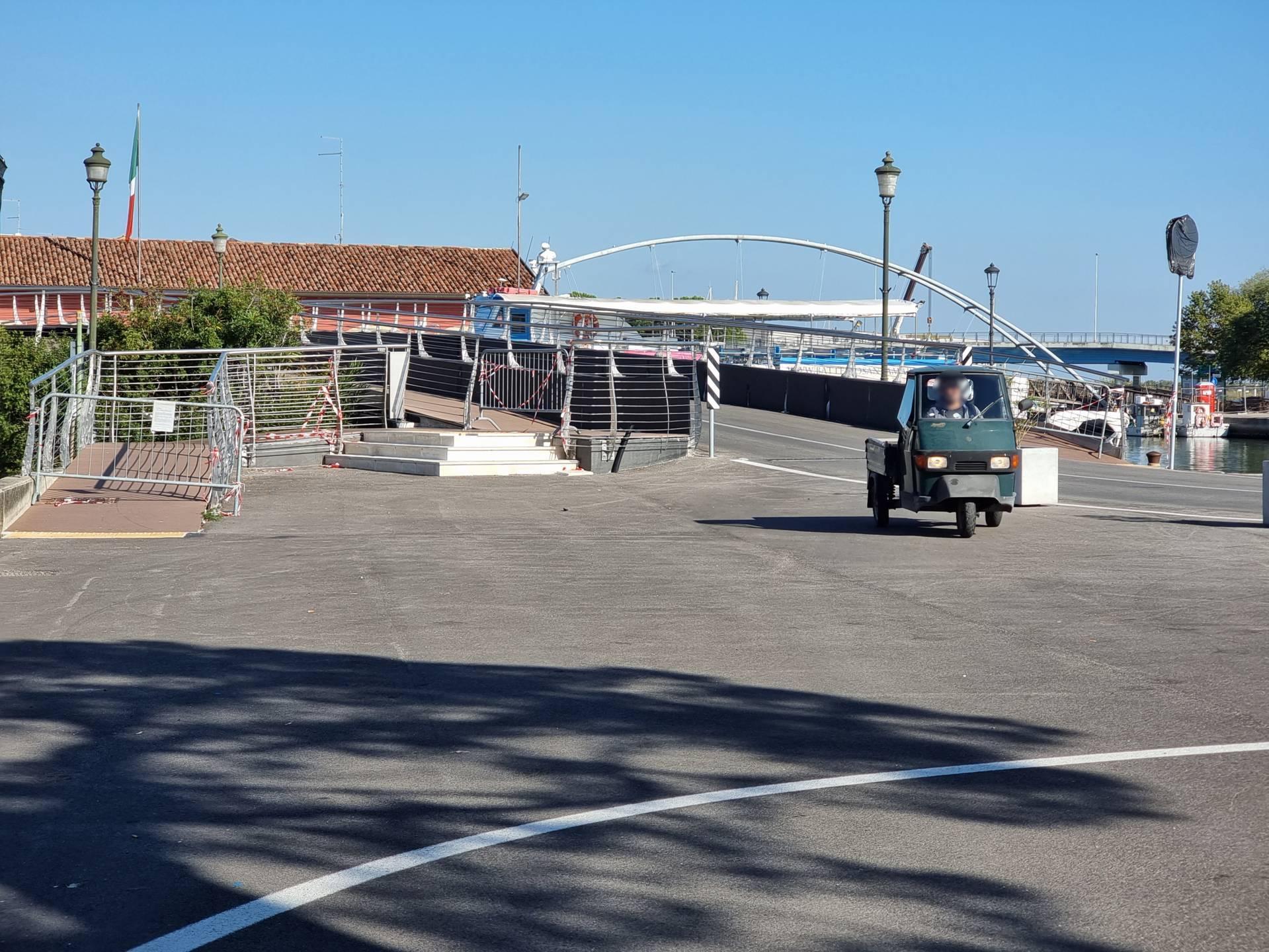
Photo 28 - route to the bridge
The bridge is equipped with connecting ramps to the roadway, LOGES markers and brown recycled plastic slats with a 5% slope (Photographs 29-30). Arriving at the Vecchia Pescheria (Old Fish Market), a large stone-paved square with a regular, uniform surface is located on the level (Photograph 31). At the end of the ramp descent, there is a parking space for people with disability.
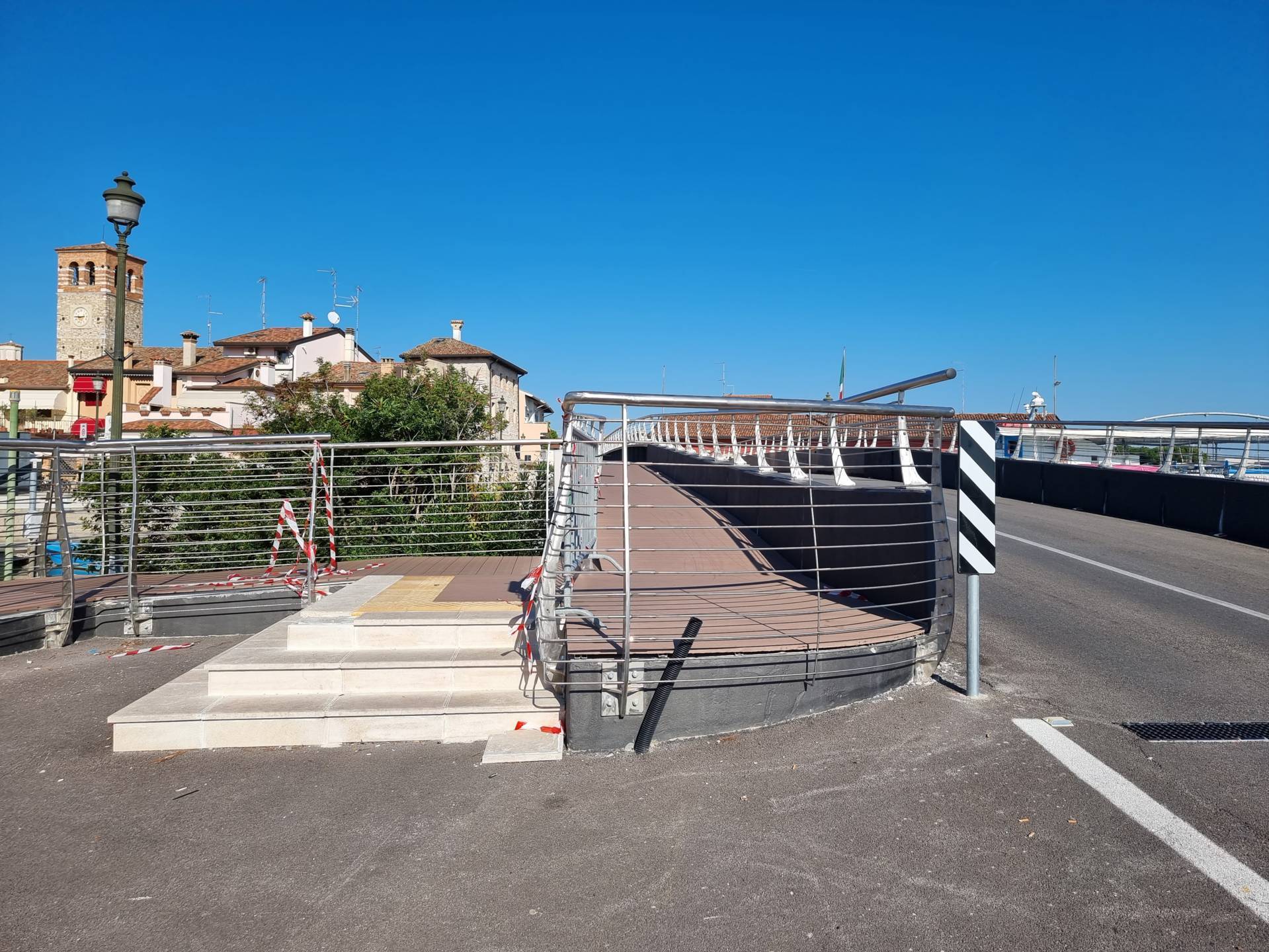
Photo 29 - view of the bridge

Photo 30 - itinerary along the bridge
Photo 31 - Vecchia Pescheria
Walk down the ramp on the right-hand side to reach the square in front of the old fish market (Photograph 32) or cross the street - Via Roma - on white paved strips (Photograph 33), on an even surface, and continue the itinerary along the pedestrian zone, Via Porto del Friuli (Photograph 34). From the ramp on the right side of the bridge, on the other hand, it is necessary to descend onto the road and continue until reaching the pedestrian area. For each point of interest, there is an information board with a pink-beige background and black lettering with the main historical information, complete with photographs and translated into English and German. The typeface is small but legibility is good.
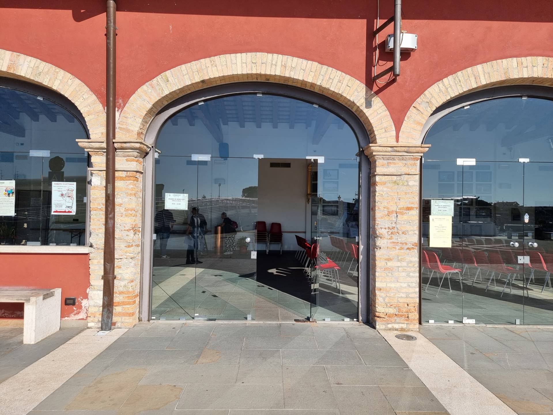
Photo 32 - Entrance of Vecchia Pescheria

Photo 33 - Pedestrian crossing on via Roma

Photo 34 - Via Porto del Friuli
Via Porto del Friuli (Photograph 35) represents the southern end of Marano's main pedestrian area: it is paved with porphyry cubes, in width, on a level, regular and smooth surface. Atong the sides are pavements made of light-coloured Aurisina-type stone blocks, at the same level as the road. Continue on to Piazza Vittorio Emanuele II and Piazza Provveditori, paved in stone slabs and with a regular and smooth surface except for a few irregularities due to the flaking of the stone slabs (Photograph 36). Here visitors can also admire Torre Millenaria (inaccessible due to the access staircase), the Contareno Well, the Banner Stand and the Ancient Guardhouse. The route continues northwards, remaining always wide, on a level, even surface in porphyry cubes with bands of light-coloured stone on the sides (Photograph 37), and it ends at the junction of Via Udine and Via Giuseppe Garibaldi, on asphalt, at the Town Hall and the Archaeological Museum of the Lagoon. Behind the museum, in Piazza Guidobaldo d'Urbino, there is a car park with a parking space reserved for people with disability. From the pedestrian zone by crossing the road to the north - via Garibaldi - where there are white stripes on asphalt, reach the Town Hall area (Photograph 38), while turning right, continue straight along the Museum building and then cross via Udine, to return to the starting point.
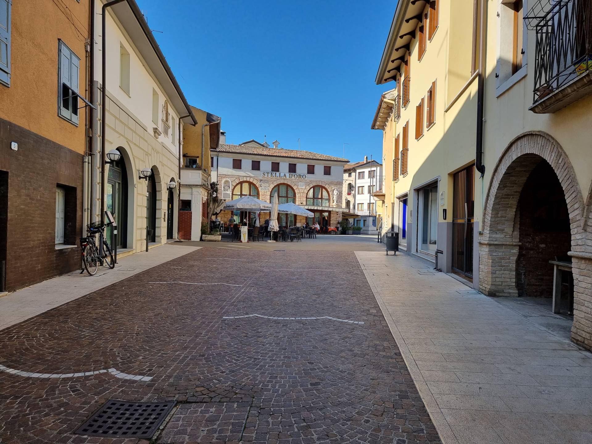
Photo 35 - Route along via Porto del Friuli toward Piazza Vittorio Emanuele II
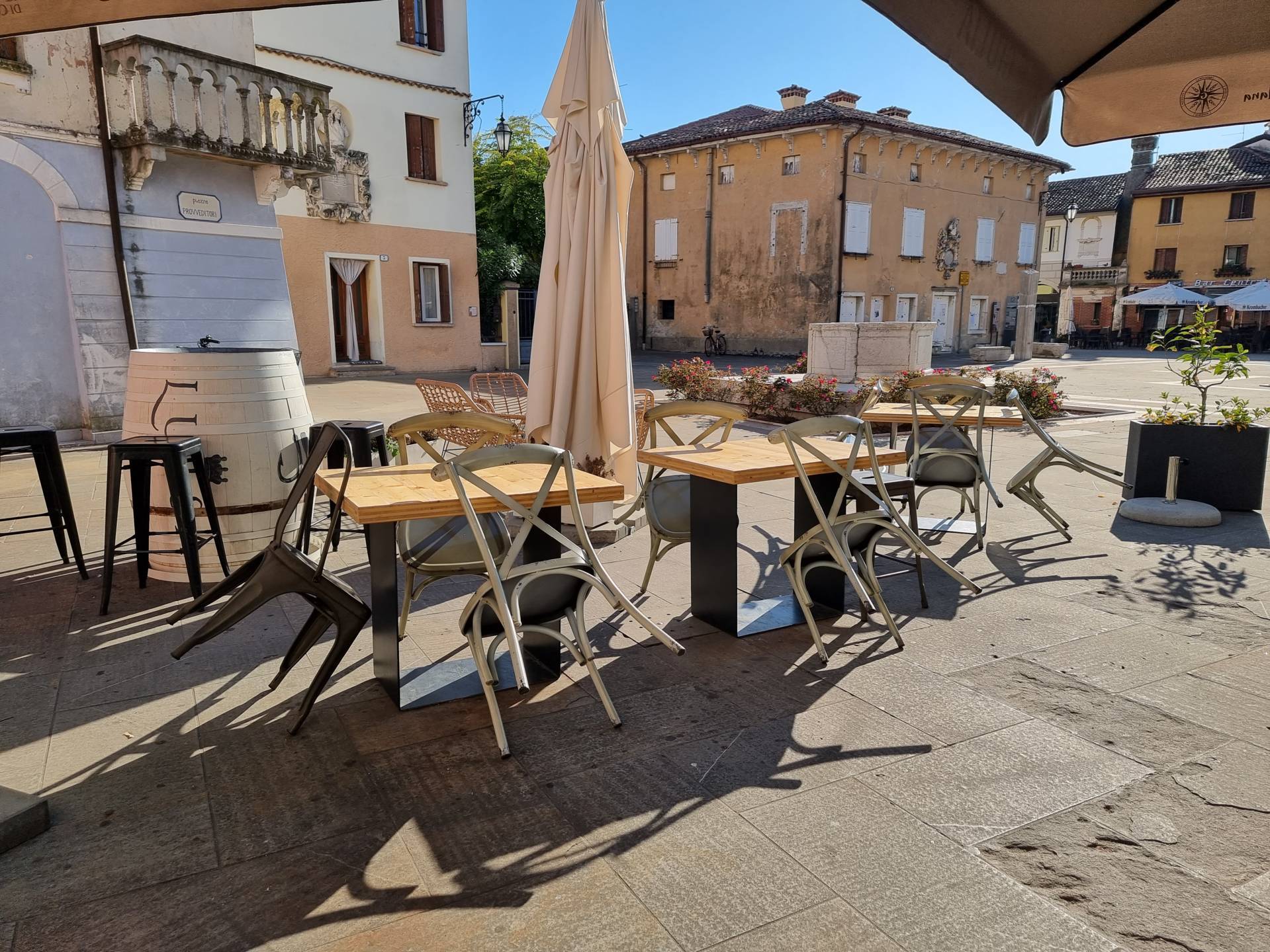
Photo 36 - Piazza Provveditori
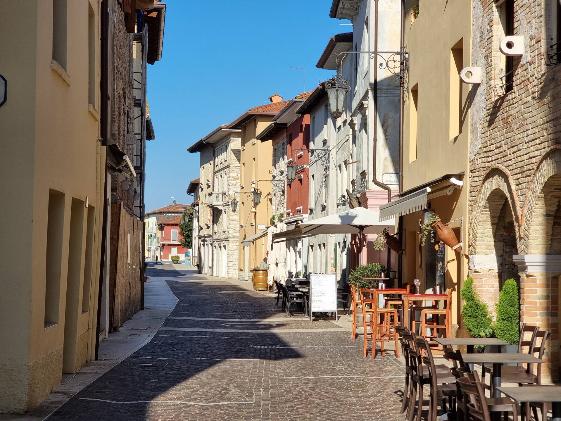
Photo 37 - the route continues northwards
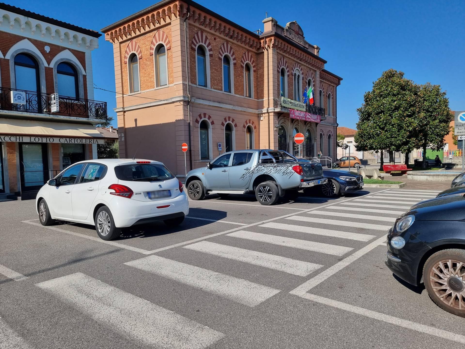
Photo 38 - Parking in front of city hall
1.8
/3
ENTRANCE
.jpg)
Ingresso
Entrance typology
TYPE:
MainACCESSIBLE:
YesTIPO:
PrincipaleHeight difference (> 2.5 cm)
PRESENT:
YesDISLEVEL:
-
TYPE:
RampUNIVOCAL CODE:
RA1RAMP:
WIDTH (CM):
250LENGTH (CM):
50PENDENZA:
6.99%CORRIMANO:
PRESENT:
NoSIDE KERB:
NoNON-SLIP FINISH:
NoYES:
COLOUR CONTRAST:
NoYES:
TACTILE-PLANTAR PATHS:
No
Threshold (< 2.5 cm)
PRESENT:
No/flushEntrance door
TYPE:
SlidingAUTOMATED OPENING:
NoNET DOOR CLEARANCE:
Single or sliding doorMEASURE (CM):
140DOOR AND BACK DOOR COPLANARITY (NOT ASSESSED HEIGHT DIFFERENCE UP TO 2.5 CM):
NoZERBINI/CARPETS:
PRESENTS:
YesTYPE:
Protruding doormatTYPE:
CompactCITOFONO/CAMPANELLO:
PRESENT:
YesHEIGHT (CM):
100LOCATION:
Right-hand side of the doorGlass doors: window decals to indicate their presence
PRESENTS:
NoATM COUNTER
.jpg)
Sportello bancomat
Atm typology
TYPE:
InsideTIPO:
InternoUser workstation
TYPE:
On private ground levelWheelchair approach
TYPE:
PossibleAverage device height
GROUND CLEARANCE (CM):
130Facilities
TYPE:
High readability screen, Anti-glare screen, Touch screen, Audio channel1.8
/3
ENTRANCE
.jpg)
Ingresso
Entrance typology
TYPE:
MainACCESSIBLE:
NoTIPO:
PrincipaleHeight difference (> 2.5 cm)
PRESENT:
YesDISLEVEL:
-
TYPE:
Short staircase/stepUNIVOCAL CODE:
SB1SHORT STAIRCASE/STEP (INFERIORE A UN PIANO):
WIDTH (CM):
80NUMBER OF STEPS:
1HEIGHT OF INDIVIDUAL RISER (CM):
10CORRIMANO:
PRESENT:
NoINTERMEDIATE LANDING:
NoYES:
TACTILE-PLANTAR PATHS:
No
Threshold (< 2.5 cm)
PRESENT:
No/LevelEntrance door
TYPE:
Single leafOPENING:
InsideAUTOMATED OPENING:
NoNET DOOR CLEARANCE:
Single or sliding doorMEASURE (CM):
80DOOR AND BACK DOOR COPLANARITY (NOT ASSESSED HEIGHT DIFFERENCE UP TO 2.5 CM):
NoZERBINI/CARPETS:
PRESENTS:
NoCITOFONO/CAMPANELLO:
PRESENT:
NoGlass doors: window decals to indicate their presence
PRESENTS:
NoCOMPARTMENT
.jpg)
Bancone
Compartment name
TYPE:
Generic, of the structureIDENTIFIER:
V1Door
ACCESS:
NoneDimensions
ROTATION DIAMETER 140 CM:
YesPREVAILING CLEAR WIDTH:
> 75 cmPaving
TYPE:
WoodColour contrast floors/walls
TYPE:
YesFLOOR COLOUR:
WoodWALL COLOUR:
White/StoneSignage
YES:
TACTILE-PLANTAR PATHS:
NoYES:
TOUCH MAP:
NoYES:
INFORMATION SIGNAGE:
NoFurniture
COUNTER:
-
HEIGHT:
UniqueGROUND CLEARANCE (CM):
140EMPTY UNDER:
No
TABLE:
-
TYPE OF SUPPORT:
Corner legsTYPE OF PLAN:
Rectangular/SquareWIDTH (CM):
60LENGTH (CM):
60GROUND CLEARANCE (CM):
75GROUND CLEARANCE (CM):
66TOP WITH ROUNDED EDGES:
No
SEDIA:
-
Schienale
FIXED TO THE GROUND:
No
OUTDOOR AREA
Destination of the area
AREA TYPOLOGY:
ConsumptionType
YES:
On public groundOTHER TYPOLOGY:
Pedestrian areaAccess to the area
TYPE:
From the main door already describedHeight difference (> 2.5 cm)
PRESENT:
NoPaving
TYPE:
Concrete/Asphalt or coplanar stoneDimensions
ROTATION DIAMETER 140 CM:
YesPREVAILING CLEAR WIDTH:
> 75 cmFurniture
TABLE:
-
TYPE OF SUPPORT:
Corner legsTYPE OF PLAN:
Rectangular/SquareWIDTH (CM):
45LENGTH (CM):
45GROUND CLEARANCE (CM):
92GROUND CLEARANCE (CM):
90TOP WITH ROUNDED EDGES:
No
SEDIA:
-
Schienale
FIXED TO THE GROUND:
No
General note
2.1
/3
ENTRANCE
.jpg)
Ingresso
Entrance typology
TYPE:
MainACCESSIBLE:
NoTIPO:
PrincipaleHeight difference (> 2.5 cm)
PRESENT:
YesDISLEVEL:
-
TYPE:
Short staircase/stepUNIVOCAL CODE:
SB1SHORT STAIRCASE/STEP (INFERIORE A UN PIANO):
WIDTH (CM):
90NUMBER OF STEPS:
1HEIGHT OF INDIVIDUAL RISER (CM):
12CORRIMANO:
PRESENT:
NoINTERMEDIATE LANDING:
NoYES:
TACTILE-PLANTAR PATHS:
No
Threshold (< 2.5 cm)
PRESENT:
No/LevelEntrance door
TYPE:
Single leafOPENING:
InsideAUTOMATED OPENING:
NoNET DOOR CLEARANCE:
Single or sliding doorMEASURE (CM):
90DOOR AND BACK DOOR COPLANARITY (NOT ASSESSED HEIGHT DIFFERENCE UP TO 2.5 CM):
NoZERBINI/CARPETS:
PRESENTS:
NoCITOFONO/CAMPANELLO:
PRESENT:
NoGlass doors: window decals to indicate their presence
PRESENTS:
NoGeneral note
COMPARTMENT
Compartment name
TYPE:
Generic, of the structureIDENTIFIER:
V1Door
ACCESS:
NoneDimensions
ROTATION DIAMETER 140 CM:
YesPREVAILING CLEAR WIDTH:
> 75 cmPaving
TYPE:
TilesColour contrast floors/walls
TYPE:
YesFLOOR COLOUR:
GreyWALL COLOUR:
WhiteSignage
YES:
TACTILE-PLANTAR PATHS:
NoYES:
TOUCH MAP:
NoYES:
INFORMATION SIGNAGE:
NoGeneral note
OUTDOOR AREA
.jpg)
Tavoli e sedie
Destination of the area
AREA TYPOLOGY:
ConsumptionType
YES:
On public groundAccess to the area
TYPE:
From the main door already describedHeight difference (> 2.5 cm)
PRESENT:
NoPaving
TYPE:
Concrete/Asphalt or coplanar stoneDimensions
ROTATION DIAMETER 140 CM:
YesPREVAILING CLEAR WIDTH:
> 75 cmFurniture
TABLE:
-
TYPE OF SUPPORT:
Centre pivotTYPE OF PLAN:
Rectangular/SquareWIDTH (CM):
70LENGTH (CM):
70GROUND CLEARANCE (CM):
72GROUND CLEARANCE (CM):
69TOP WITH ROUNDED EDGES:
No
SEDIA:
-
Schienale
FIXED TO THE GROUND:
No
2.1
/3
ENTRANCE
.jpg)
Ingresso
Entrance typology
TYPE:
MainACCESSIBLE:
NoTIPO:
PrincipaleHeight difference (> 2.5 cm)
PRESENT:
YesDISLEVEL:
-
TYPE:
Short staircase/stepUNIVOCAL CODE:
SB1SHORT STAIRCASE/STEP (INFERIORE A UN PIANO):
WIDTH (CM):
300NUMBER OF STEPS:
1HEIGHT OF INDIVIDUAL RISER (CM):
20CORRIMANO:
PRESENT:
NoINTERMEDIATE LANDING:
NoYES:
TACTILE-PLANTAR PATHS:
No
Threshold (< 2.5 cm)
PRESENT:
No/LevelEntrance door
TYPE:
Single leafOPENING:
OutdoorAUTOMATED OPENING:
NoNET DOOR CLEARANCE:
Single or sliding doorMEASURE (CM):
96DOOR AND BACK DOOR COPLANARITY (NOT ASSESSED HEIGHT DIFFERENCE UP TO 2.5 CM):
NoZERBINI/CARPETS:
PRESENTS:
YesTYPE:
Satin doormatTYPE:
CompactCITOFONO/CAMPANELLO:
PRESENT:
NoGlass doors: window decals to indicate their presence
PRESENTS:
NoCOMPARTMENT
.jpg)
Bancone
.jpg)
Tavolo e sedie
Compartment name
TYPE:
Consumption: barIDENTIFIER:
V1Door
ACCESS:
NoneDimensions
ROTATION DIAMETER 140 CM:
YesPREVAILING CLEAR WIDTH:
> 75 cmPaving
TYPE:
MoreOTHER TYPOLOGY:
StoneColour contrast floors/walls
TYPE:
YesFLOOR COLOUR:
GreyWALL COLOUR:
WhiteSignage
YES:
TACTILE-PLANTAR PATHS:
NoYES:
TOUCH MAP:
NoYES:
INFORMATION SIGNAGE:
NoFurniture
COUNTER:
-
HEIGHT:
UniqueGROUND CLEARANCE (CM):
130EMPTY UNDER:
No
TABLE:
-
TYPE OF SUPPORT:
Centre pivotTYPE OF PLAN:
Rectangular/SquareWIDTH (CM):
60LENGTH (CM):
80GROUND CLEARANCE (CM):
72GROUND CLEARANCE (CM):
70TOP WITH ROUNDED EDGES:
No
SEDIA:
-
Schienale
FIXED TO THE GROUND:
No
OUTDOOR AREA
.jpg)
Tavoli e sedie
Destination of the area
AREA TYPOLOGY:
ConsumptionType
YES:
On public groundAccess to the area
TYPE:
From external pathwayHeight difference (> 2.5 cm)
PRESENT:
NoPaving
TYPE:
Concrete/Asphalt or coplanar stoneDimensions
ROTATION DIAMETER 140 CM:
YesPREVAILING CLEAR WIDTH:
> 75 cmFurniture
TABLE:
-
TYPE OF SUPPORT:
Recessed legsTYPE OF PLAN:
Rectangular/SquareWIDTH (CM):
80LENGTH (CM):
100GROUND CLEARANCE (CM):
77GROUND CLEARANCE (CM):
72TOP WITH ROUNDED EDGES:
No
SEDIA:
-
Schienale
FIXED TO THE GROUND:
No
General note
2.0
/3
ENTRANCE
.jpg)
Ingresso
Entrance typology
TYPE:
MainACCESSIBLE:
YesTIPO:
PrincipaleHeight difference (> 2.5 cm)
PRESENT:
NoThreshold (< 2.5 cm)
PRESENT:
YesHEIGHT:
1Entrance door
TYPE:
Single leafOPENING:
InsideAUTOMATED OPENING:
NoNET DOOR CLEARANCE:
Single or sliding doorMEASURE (CM):
96DOOR AND BACK DOOR COPLANARITY (NOT ASSESSED HEIGHT DIFFERENCE UP TO 2.5 CM):
YesZERBINI/CARPETS:
PRESENTS:
YesTYPE:
Satin doormatTYPE:
CompactCITOFONO/CAMPANELLO:
PRESENT:
NoGlass doors: window decals to indicate their presence
PRESENTS:
NoCOMPARTMENT
.jpg)
Bancone
Compartment name
TYPE:
Generic, of the structureIDENTIFIER:
V1Door
ACCESS:
NoneDimensions
ROTATION DIAMETER 140 CM:
YesPREVAILING CLEAR WIDTH:
> 75 cmPaving
TYPE:
TilesColour contrast floors/walls
TYPE:
YesFLOOR COLOUR:
Grey/BrownWALL COLOUR:
Yellow/StoneSignage
PHOTO 1:
TACTILE-PLANTAR PATHS:
NoPHOTO 1:
TOUCH MAP:
NoPHOTO 1:
INFORMATION SIGNAGE:
NoFurniture
COUNTER:
-
HEIGHT:
UniqueGROUND CLEARANCE (CM):
120EMPTY UNDER:
No
WC
Present
PHOTO 1:
Present but completely inaccessibleOUTDOOR AREA
.jpg)
Tavoli e sedie
Destination of the area
AREA TYPOLOGY:
ConsumptionType
PHOTO 1:
On public groundAccess to the area
TYPE:
From the main door already describedHeight difference (> 2.5 cm)
PRESENT:
NoPaving
TYPE:
Concrete/Asphalt or coplanar stoneDimensions
ROTATION DIAMETER 140 CM:
YesPREVAILING CLEAR WIDTH:
> 75 cmFurniture
TABLE:
-
TYPE OF SUPPORT:
Corner legsTYPE OF PLAN:
Rectangular/SquareWIDTH (CM):
60LENGTH (CM):
80GROUND CLEARANCE (CM):
80GROUND CLEARANCE (CM):
65TOP WITH ROUNDED EDGES:
No
SEDIA:
-
Schienale, Braccioli
FIXED TO THE GROUND:
No -
Schienale
FIXED TO THE GROUND:
No
General note
2.5
/3
ENTRANCE
.jpg)
Ingresso
Entrance typology
TYPE:
MainACCESSIBLE:
YesTIPO:
PrincipaleHeight difference (> 2.5 cm)
PRESENT:
NoThreshold (< 2.5 cm)
PRESENT:
YesHEIGHT:
2.5Entrance door
TYPE:
Single leafOPENING:
InsideAUTOMATED OPENING:
NoNET DOOR CLEARANCE:
Single or sliding doorMEASURE (CM):
100DOOR AND BACK DOOR COPLANARITY (NOT ASSESSED HEIGHT DIFFERENCE UP TO 2.5 CM):
YesZERBINI/CARPETS:
PRESENTS:
NoCITOFONO/CAMPANELLO:
PRESENT:
NoGlass doors: window decals to indicate their presence
PRESENTS:
NoCOMPARTMENT
.jpg)
Bancone e tavoli
Compartment name
TYPE:
Generic, of the structureIDENTIFIER:
V1Door
ACCESS:
NoneDimensions
ROTATION DIAMETER 140 CM:
YesPREVAILING CLEAR WIDTH:
> 75 cmPaving
TYPE:
TilesColour contrast floors/walls
TYPE:
YesFLOOR COLOUR:
WoodWALL COLOUR:
GreenSignage
TACTILE-PLANTAR PATHS:
NoTOUCH MAP:
NoINFORMATION SIGNAGE:
NoFurniture
COUNTER:
-
HEIGHT:
UniqueGROUND CLEARANCE (CM):
120EMPTY UNDER:
No
TABLE:
-
TYPE OF SUPPORT:
Corner legsTYPE OF PLAN:
Round/OvalDIAMETER (CM):
160GROUND CLEARANCE (CM):
80GROUND CLEARANCE (CM):
75TOP WITH ROUNDED EDGES:
No
SEDIA:
-
Backrest
FIXED TO THE GROUND:
No -
Backrest
FIXED TO THE GROUND:
No
OUTDOOR AREA
.jpg)
Tavolo e sgabelli
Destination of the area
AREA TYPOLOGY:
ConsumptionType
Access to the area
TYPE:
From the main door already describedHeight difference (> 2.5 cm)
PRESENT:
NoPaving
TYPE:
Concrete/porphyry coplanar blocksDimensions
ROTATION DIAMETER 140 CM:
YesPREVAILING CLEAR WIDTH:
> 75 cmFurniture
TABLE:
-
TYPE OF SUPPORT:
Corner legsTYPE OF PLAN:
Rectangular/SquareWIDTH (CM):
70LENGTH (CM):
70GROUND CLEARANCE (CM):
100GROUND CLEARANCE (CM):
98TOP WITH ROUNDED EDGES:
No
SEDIA:
-
Backrest
FIXED TO THE GROUND:
No
3
/3
ENTRANCE
.jpg)
Ingresso
Entrance typology
TYPE:
MainACCESSIBLE:
YesTIPO:
PrincipaleHeight difference (> 2.5 cm)
PRESENT:
NoThreshold (< 2.5 cm)
PRESENT:
No/LevelEntrance door
TYPE:
With two doors or with two opening elementsOPENING:
InsideAUTOMATED OPENING:
NoNET DOOR CLEARANCE:
With two doors or with two opening elementsOVERALL BORE (CM):
160MAIN DOOR (CM):
80DOOR AND BACK DOOR COPLANARITY (NOT ASSESSED HEIGHT DIFFERENCE UP TO 2.5 CM):
YesZERBINI/CARPETS:
PRESENTS:
NoCITOFONO/CAMPANELLO:
PRESENT:
NoGlass doors: window decals to indicate their presence
PRESENTS:
NoGeneral note
COMPARTMENT
.jpg)
Sala
Compartment name
TYPE:
Generic, of the structureIDENTIFIER:
V1Door
ACCESS:
NoneDimensions
ROTATION DIAMETER 140 CM:
YesPREVAILING CLEAR WIDTH:
> 75 cmPaving
TYPE:
WoodColour contrast floors/walls
TYPE:
YesFLOOR COLOUR:
WoodWALL COLOUR:
WhiteSignage
TACTILE-PLANTAR PATHS:
NoTOUCH MAP:
NoINFORMATION SIGNAGE:
No2.8
/3
ENTRANCE
.jpg)
Ingresso
Entrance typology
TYPE:
MainACCESSIBLE:
YesTIPO:
PrincipaleHeight difference (> 2.5 cm)
PRESENT:
NoThreshold (< 2.5 cm)
PRESENT:
No/LevelEntrance door
TYPE:
Single leafOPENING:
InsideAUTOMATED OPENING:
NoNET DOOR CLEARANCE:
Single or sliding doorMEASURE (CM):
100DOOR AND BACK DOOR COPLANARITY (NOT ASSESSED HEIGHT DIFFERENCE UP TO 2.5 CM):
YesZERBINI/CARPETS:
PRESENTS:
NoINTERCOM/BELL:
PRESENT:
NoGlass doors: window decals to indicate their presence
PRESENTS:
NoCOMPARTMENT
Compartment name
TYPE:
Consumption: dining roomIDENTIFIER:
V1Door
ACCESS:
NoneDimensions
ROTATION DIAMETER 140 CM:
YesPREVAILING CLEAR WIDTH:
> 75 cmPaving
TYPE:
TilesColour contrast floors/walls
TYPE:
YesFLOOR COLOUR:
BrownWALL COLOUR:
WhiteSignage
TACTILE-PLANTAR PATHS:
NoTOUCH MAP:
NoINFORMATION SIGNAGE:
NoFurniture
TABLE:
-
TYPE OF SUPPORT:
Corner legsTYPE OF PLAN:
Rectangular/SquareWIDTH (CM):
140LENGTH (CM):
80GROUND CLEARANCE (CM):
80GROUND CLEARANCE (CM):
70TOP WITH ROUNDED EDGES:
No
SEDIA:
-
Schienale
FIXED TO THE GROUND:
No
Attri arredi
TYPE:
CounterHEIGHT:
UniqueGROUND CLEARANCE (CM):
90EMPTY UNDER:
NoGeneral note
OUTDOOR AREA
.jpg)
Tavoli e sedie
Destination of the area
AREA TYPOLOGY:
ConsumptionType
Access to the area
TYPE:
From external pathwayHeight difference (> 2.5 cm)
PRESENT:
NoPaving
TYPE:
Concrete/Asphalt or coplanar stoneDimensions
ROTATION DIAMETER 140 CM:
YesPREVAILING CLEAR WIDTH:
> 75 cmFurniture
TABLE:
-
TYPE OF SUPPORT:
Centre pivotTYPE OF PLAN:
Rectangular/SquareWIDTH (CM):
80LENGTH (CM):
80GROUND CLEARANCE (CM):
74GROUND CLEARANCE (CM):
70TOP WITH ROUNDED EDGES:
No -
TYPE OF SUPPORT:
Corner legsTYPE OF PLAN:
Rectangular/SquareWIDTH (CM):
70LENGTH (CM):
70GROUND CLEARANCE (CM):
100GROUND CLEARANCE (CM):
90TOP WITH ROUNDED EDGES:
No
SEDIA:
-
Backrest, Armrests
FIXED TO THE GROUND:
No -
NOTES:
StoolsFIXED TO THE GROUND:
No
General note
1.8
/3
ENTRANCE
.jpg)
Ingresso
Entrance typology
TYPE:
MainACCESSIBLE:
NoTIPO:
PrincipaleHeight difference (> 2.5 cm)
PRESENT:
YesDISLEVEL:
-
TYPE:
Short staircase/stepUNIVOCAL CODE:
SB1SHORT STAIRCASE/STEP (INFERIORE A UN PIANO):
WIDTH (CM):
120NUMBER OF STEPS:
1HEIGHT OF INDIVIDUAL RISER (CM):
12CORRIMANO:
PRESENT:
NoINTERMEDIATE LANDING:
NoTACTILE-PLANTAR PATHS:
No
Threshold (< 2.5 cm)
PRESENT:
No/LevelEntrance door
TYPE:
With two doors or with two opening elementsOPENING:
InsideAUTOMATED OPENING:
NoNET DOOR CLEARANCE:
With two doors or with two opening elementsOVERALL BORE (CM):
120MAIN DOOR (CM):
60DOOR AND BACK DOOR COPLANARITY (NOT ASSESSED HEIGHT DIFFERENCE UP TO 2.5 CM):
NoZERBINI/CARPETS:
PRESENTS:
NoINTERCOM/BELL:
PRESENT:
NoGlass doors: window decals to indicate their presence
PRESENTS:
NoCOMPARTMENT
.jpg)
Tavoli e panche
Compartment name
TYPE:
Generic, of the structureIDENTIFIER:
V1Door
ACCESS:
NoneDimensions
ROTATION DIAMETER 140 CM:
YesPREVAILING CLEAR WIDTH:
> 75 cmPaving
TYPE:
MoreOTHER TYPOLOGY:
Venetian sownColour contrast floors/walls
TYPE:
YesFLOOR COLOUR:
Grey/BrownWALL COLOUR:
White/WoodSignage
TACTILE-PLANTAR PATHS:
NoTOUCH MAP:
NoINFORMATION SIGNAGE:
NoFurniture
COUNTER:
-
HEIGHT:
UniqueGROUND CLEARANCE (CM):
110EMPTY UNDER:
No
TABLE:
-
TYPE OF SUPPORT:
Recessed legsTYPE OF PLAN:
Rectangular/SquareWIDTH (CM):
70LENGTH (CM):
150GROUND CLEARANCE (CM):
75GROUND CLEARANCE (CM):
72TOP WITH ROUNDED EDGES:
No
SEDIA:
-
Backrest
NOTES:
BenchFIXED TO THE GROUND:
No
WC
Present
OUTDOOR AREA
.jpg)
Tavoli e sedie
Destination of the area
AREA TYPOLOGY:
ConsumptionType
Access to the area
TYPE:
From the main door already describedHeight difference (> 2.5 cm)
PRESENT:
NoPaving
TYPE:
Concrete/Asphalt or coplanar stoneDimensions
ROTATION DIAMETER 140 CM:
YesPREVAILING CLEAR WIDTH:
> 75 cmFurniture
TABLE:
-
TYPE OF SUPPORT:
Centre pivotTYPE OF PLAN:
Rectangular/SquareWIDTH (CM):
80LENGTH (CM):
80GROUND CLEARANCE (CM):
72GROUND CLEARANCE (CM):
68TOP WITH ROUNDED EDGES:
No
SEDIA:
-
Backrest, Armrests
FIXED TO THE GROUND:
No
General note
0.5
/3
PARKING FOR PUBLIC USE
.jpg)
Stallo di parcheggio
Public car park features
TYPE:
Outdoor uncoveredSTALL:
-
NUMBER OF STALLS:
1TYPE:
in combWIDTH (CM):
250LENGTH (CM):
500SIGNAGE:
Horizontal, VerticalPAVING:
Rough concrete/porphyry blocks, cobblestones
Connection with the footpath
HEIGHT DIFFERENCE (> 2.5 CM):
PRESENT:
NoGeneral note
1.5
/3
PARKING FOR PUBLIC USE
_MOD.jpg)
Stallo di parcheggio
Public car park features
TYPE:
Outdoor uncoveredSTALL:
-
NUMBER OF STALLS:
1TYPE:
in combWIDTH (CM):
220LENGTH (CM):
520SIGNAGE:
Horizontal, VerticalPAVING:
Concrete/Asphalt or coplanar stone
Connection with the footpath
HEIGHT DIFFERENCE (> 2.5 CM):
PRESENT:
No2.0
/3
PARKING FOR PUBLIC USE
.jpg)
Stallo di parcheggio
Public car park features
TYPE:
Outdoor uncoveredSTALL:
-
NUMBER OF STALLS:
1TYPE:
in combWIDTH (CM):
320LENGTH (CM):
500SIGNAGE:
Horizontal, VerticalPAVING:
Rough concrete/porphyry blocks, cobblestones
Connection with the footpath
HEIGHT DIFFERENCE (> 2.5 CM):
PRESENT:
NoGeneral note
0.5
/3
PARKING FOR PUBLIC USE
.jpg)
Stallo di parcheggio
Public car park features
TYPE:
Outdoor uncoveredSTALL:
-
NUMBER OF STALLS:
1TYPE:
in combWIDTH (CM):
240LENGTH (CM):
520SIGNAGE:
Horizontal, VerticalPAVING:
Rough concrete/porphyry blocks, cobblestones
Connection with the footpath
HEIGHT DIFFERENCE (> 2.5 CM):
PRESENT:
No3
/3
PARKING FOR PUBLIC USE
.jpg)
Stallo di parcheggio
Public car park features
TYPE:
Outdoor uncoveredSTALL:
-
NUMBER OF STALLS:
1TYPE:
In lineWIDTH (CM):
340LENGTH (CM):
500SIGNAGE:
Horizontal, VerticalPAVING:
Concrete/Asphalt or coplanar stone
Connection with the footpath
HEIGHT DIFFERENCE (> 2.5 CM):
PRESENT:
No3
/3
ENTRANCE
.jpg)
Ingresso
Entrance typology
TYPE:
MainACCESSIBLE:
YesTIPO:
PrincipaleHeight difference (> 2.5 cm)
PRESENT:
NoThreshold (< 2.5 cm)
PRESENT:
YesHEIGHT:
2Entrance door
TYPE:
With two doors or with two opening elementsOPENING:
InsideAUTOMATED OPENING:
NoNET DOOR CLEARANCE:
With two doors or with two opening elementsOVERALL BORE (CM):
160MAIN DOOR (CM):
80DOOR AND BACK DOOR COPLANARITY (NOT ASSESSED HEIGHT DIFFERENCE UP TO 2.5 CM):
YesZERBINI/CARPETS:
PRESENTS:
NoCITOFONO/CAMPANELLO:
PRESENT:
NoGlass doors: window decals to indicate their presence
PRESENTS:
NoCOMPARTMENT
.jpg)
Sala
Compartment name
TYPE:
Generic, of the structureIDENTIFIER:
V1Door
ACCESS:
NoneDimensions
ROTATION DIAMETER 140 CM:
YesPREVAILING CLEAR WIDTH:
> 75 cmPaving
TYPE:
TilesColour contrast floors/walls
TYPE:
YesFLOOR COLOUR:
Dark greyWALL COLOUR:
WhiteSignage
TACTILE-PLANTAR PATHS:
NoTOUCH MAP:
NoINFORMATION SIGNAGE:
NoFurniture
CHAIRS FOR WAITING/RESTING:
-
PRESENT:
YesSchienale
OUTDOOR AREA
.jpg)
Piazza
Destination of the area
AREA TYPOLOGY:
EventsType
Access to the area
TYPE:
From external pathwayHeight difference (> 2.5 cm)
PRESENT:
NoPaving
TYPE:
Concrete/Asphalt or coplanar stoneDimensions
ROTATION DIAMETER 140 CM:
YesPREVAILING CLEAR WIDTH:
> 75 cm2.9
/3
ENTRANCE - PRINCIPALE
.jpg)
Ingresso
Entrance typology
TYPE:
MainACCESSIBLE:
NoTIPO:
PrincipaleHeight difference (> 2.5 cm)
PRESENT:
YesDISLEVEL:
-
TYPE:
Short staircase/stepUNIVOCAL CODE:
SB1SHORT STAIRCASE/STEP (INFERIORE A UN PIANO):
WIDTH (CM):
260NUMBER OF STEPS:
4HEIGHT OF INDIVIDUAL RISER (CM):
15CORRIMANO:
PRESENT:
YesTYPE:
Two sidesCOLOUR CONTRAST:
SìINTERMEDIATE LANDING:
NoTACTILE-PLANTAR PATHS:
No
Threshold (< 2.5 cm)
PRESENT:
No/LevelEntrance door
TYPE:
With two doors or with two opening elementsOPENING:
InsideAUTOMATED OPENING:
NoTYPE:
RectangularWIDTH (CM):
208LENGTH (CM):
208NET DOOR CLEARANCE:
With two doors or with two opening elementsOVERALL BORE (CM):
200MAIN DOOR (CM):
100DOOR AND BACK DOOR COPLANARITY (NOT ASSESSED HEIGHT DIFFERENCE UP TO 2.5 CM):
NoZERBINI/CARPETS:
PRESENTS:
YesTYPE:
Satin doormatTYPE:
CompactINTERCOM/BELL:
PRESENT:
NoGlass doors: window decals to indicate their presence
PRESENTS:
NoENTRANCE - SECONDARIO
.jpg)
Rampa
.jpg)
Porta
Entrance typology
TYPE:
SecondaryACCESSIBLE:
YesTIPO:
SecondarioLOCATION IN RELATION TO THE MAIN:
SideSECONDARY ENTRANCE INDICATION:
South sideHeight difference (> 2.5 cm)
PRESENT:
YesDISLEVEL:
-
TYPE:
RampUNIVOCAL CODE:
RA1RAMP:
WIDTH (CM):
125LENGTH (CM):
800PENDENZA:
8%CORRIMANO:
PRESENT:
YesSIDE KERB:
YesNON-SLIP FINISH:
NoCOLOUR CONTRAST:
NoTACTILE-PLANTAR PATHS:
No
Threshold (< 2.5 cm)
PRESENT:
No/LevelEntrance door
TYPE:
With two doors or with two opening elementsOPENING:
InsideAUTOMATED OPENING:
NoNET DOOR CLEARANCE:
With two doors or with two opening elementsOVERALL BORE (CM):
156MAIN DOOR (CM):
78DOOR AND BACK DOOR COPLANARITY (NOT ASSESSED HEIGHT DIFFERENCE UP TO 2.5 CM):
YesZERBINI/CARPETS:
PRESENTS:
NoINTERCOM/BELL:
PRESENT:
NoGlass doors: window decals to indicate their presence
PRESENTS:
NoCOMPARTMENT
.jpg)
Interno della chiesa
Compartment name
TYPE:
Generic, of the structureIDENTIFIER:
V1Door
ACCESS:
NoneDimensions
ROTATION DIAMETER 140 CM:
YesPREVAILING CLEAR WIDTH:
> 75 cmPaving
TYPE:
MoreOTHER TYPOLOGY:
Venetian sownColour contrast floors/walls
TYPE:
YesFLOOR COLOUR:
MixedWALL COLOUR:
YellowSignage
TACTILE-PLANTAR PATHS:
NoTOUCH MAP:
NoINFORMATION SIGNAGE:
NoGeneral note
2.2
/3
ENTRANCE
Entrance typology
TYPE:
MainACCESSIBLE:
NoTIPO:
PrincipaleHeight difference (> 2.5 cm)
PRESENT:
YesDISLEVEL:
-
TYPE:
Short staircase/stepUNIVOCAL CODE:
SB1SHORT STAIRCASE/STEP (LESS THAN ONE FLOOR):
WIDTH (CM):
100NUMBER OF STEPS:
1HEIGHT OF INDIVIDUAL RISER (CM):
9CORRIMANO:
PRESENT:
NoINTERMEDIATE LANDING:
NoTACTILE-PLANTAR PATHS:
No
Threshold (< 2.5 cm)
PRESENT:
No/LevelEntrance door
TYPE:
SlidingAUTOMATED OPENING:
YesTYPE:
RectangularNOTE EXTERNAL DOOR:
The outer door is glazed with glass and allows a glimpse of the chamber beyond it.NOTE INNER DOOR:
The inner door is sliding, glazed with glass and a wooden frame.NET DOOR CLEARANCE:
Single or sliding doorMEASURE (CM):
100DOOR AND BACK DOOR COPLANARITY (NOT ASSESSED HEIGHT DIFFERENCE UP TO 2.5 CM):
NoZERBINI/CARPETS:
PRESENTS:
YesTYPE:
Satin doormatTYPE:
CompactINTERCOM/BELL:
PRESENT:
NoGlass doors: window decals to indicate their presence
PRESENTS:
NoCOMPARTMENT
Compartment name
TYPE:
Generic, of the structureIDENTIFIER:
V1Door
ACCESS:
NoneDimensions
ROTATION DIAMETER 140 CM:
YesPREVAILING CLEAR WIDTH:
> 75 cmPaving
TYPE:
TilesColour contrast floors/walls
TYPE:
YesFLOOR COLOUR:
BeigeWALL COLOUR:
ClearSignage
TACTILE-PLANTAR PATHS:
NoTOUCH MAP:
NoINFORMATION SIGNAGE:
NoFurniture
COUNTER:
-
HEIGHT:
UniqueGROUND CLEARANCE (CM):
120EMPTY UNDER:
No
TABLE:
-
TYPE OF SUPPORT:
Corner legsTYPE OF PLAN:
Rectangular/SquareGROUND CLEARANCE (CM):
70GROUND CLEARANCE (CM):
69TOP WITH ROUNDED EDGES:
No
SEDIA:
-
Backrest
FIXED TO THE GROUND:
No
General note
OUTDOOR AREA
Destination of the area
AREA TYPOLOGY:
ConsumptionType
Access to the area
TYPE:
From the main door already describedHeight difference (> 2.5 cm)
PRESENT:
NoPaving
TYPE:
Concrete/Asphalt or coplanar stoneDimensions
ROTATION DIAMETER 140 CM:
YesPREVAILING CLEAR WIDTH:
> 75 cmFurniture
TABLE:
-
TYPE OF SUPPORT:
Corner legsTYPE OF PLAN:
Rectangular/SquareWIDTH (CM):
70LENGTH (CM):
120GROUND CLEARANCE (CM):
70GROUND CLEARANCE (CM):
69TOP WITH ROUNDED EDGES:
No
SEDIA:
-
Backrest, Armrest
FIXED TO THE GROUND:
No -
Backrest
FIXED TO THE GROUND:
No